-
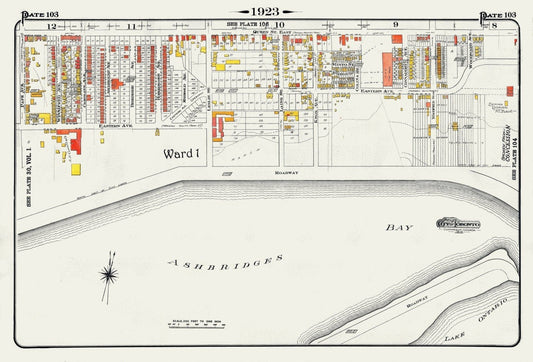
Plate 103, Toronto East, Waterfront, Ashbridges Bay, 1923, Map on heavy cotton canvas, 18x27in. approx.
Regular price $45.00 CADRegular price -
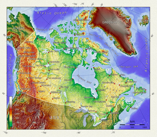
Topographical Map of Canada, on heavy cotton canvas, 20 x 25" approx.
Regular price $45.00 CADRegular price -
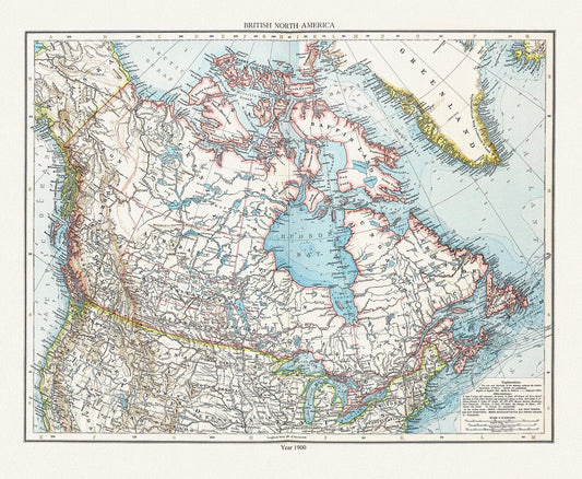
Andree et London Times, British North America, 1900 , map on heavy cotton canvas, 20 x 25" approx.
Regular price $45.00 CADRegular price -
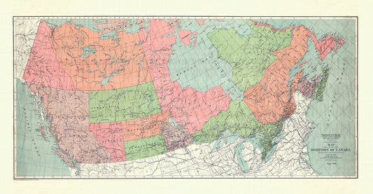
Map of the Dominion of Canada, 1900, on heavy cotton canvas, 20 x 25" approx.
Regular price $45.00 CADRegular price -
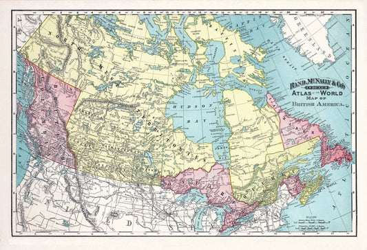
Rand, McNally & Co., British America (Canada), 1892, , map on heavy cotton canvas, 20 x 25" approx.
Regular price $45.00 CADRegular price -
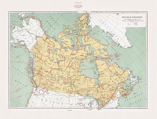
Canada, Routes of explorers, Chalifour (auth.), 1915, map on heavy cotton canvas, 20 x 25" approx.
Regular price $45.00 CADRegular price -
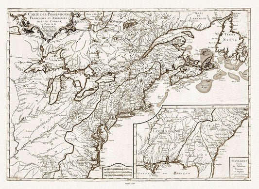
Longchamps et Thevenard, Carte des possessions françoises et angloises , et partie de la Louisiane, 1756 Ver. D, on canvas, 20x25"
Regular price $45.00 CADRegular price -
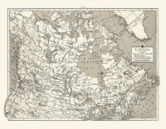
J.W. Clement Co., Canada, 1943 Ver. BWMWS70, map on heavy cotton canvas, 20 x 25" approx.
Regular price $45.00 CADRegular price -
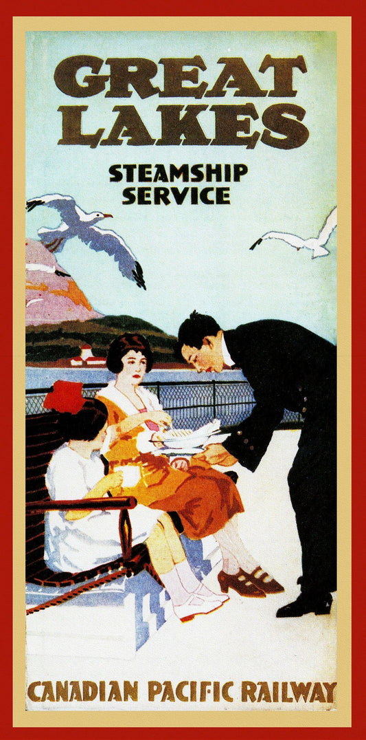
Great Lakes Steamship Service, Canadian Pacific Railway , map on heavy cotton canvas, 22x27" approx
Regular price $45.00 CADRegular price -
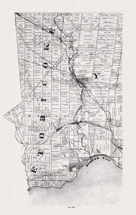
Tremaine's Map of Etobicoke, 1860, map on heavy cotton canvas, 22x27" approx.
Regular price $45.00 CADRegular price -
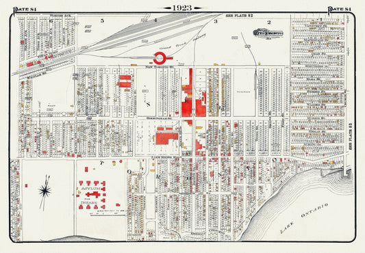
Plate 84, Toronto West, New Toronto, 1923, Map on heavy cotton canvas, 18x27in. approx.
Regular price $45.00 CADRegular price -
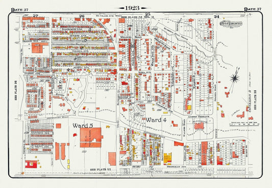
Plate 37, Toronto Central North West, Wychwood, Casa Loma, 1923, Map on heavy cotton canvas, 18x27in. approx.
Regular price $45.00 CADRegular price -
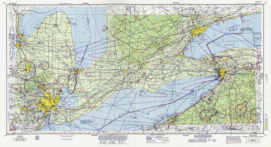
Aeronautical Chart, Ontario, South Western Section, 1970, map on heavy cotton canvas, 20 x 27" approx.
Regular price $45.00 CADRegular price -
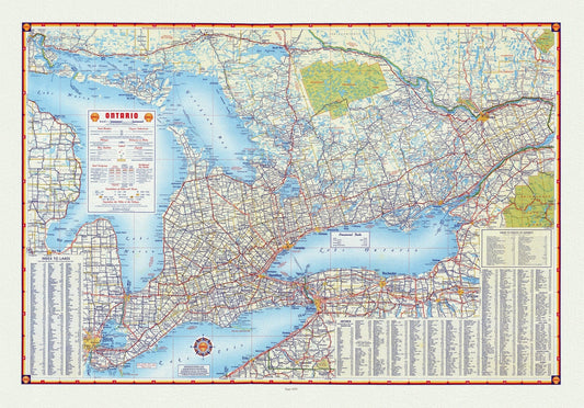
Shell Oil Company of Canada, Road Map of Ontario, 1955, map on heavy cotton canvas, 22x27" approx.
Regular price $45.00 CADRegular price -
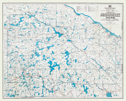
Map No. 47A showing the Algonquin Provincial Park in the District of Nipissing and the County of Haliburton, 1947, cotton canvas, 22x27"
Regular price $45.00 CADRegular price -
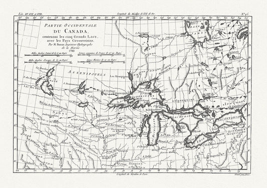
Raynall et Bonne, Partie Occidentale Du Canada, 1780, map on heavy cotton canvas, 50 x 70cm, 20 x 27" approx.
Regular price $45.00 CADRegular price -
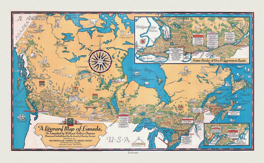
Canada, A Literary Map, 1936 , vintage map reprinted on durable cotton canvas, 50 x 70 cm, 20 x 25" approx.
Regular price $45.00 CADRegular price -
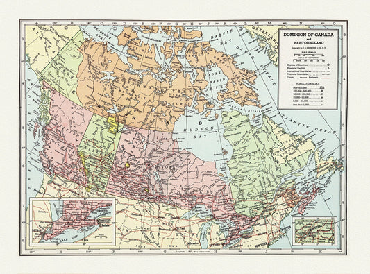
Dominion of Canada and Newfoundland-1948, Hammond auth., vintage map reprinted on durable cotton canvas, 50 x 70 cm, 20 x 25" approx.
Regular price $45.00 CADRegular price -
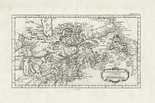
La Nouvelle France où Canada, ,Bellin, 1764 Ver. II, vintage map reprinted on durable cotton canvas, 50 x 70 cm, 20 x 25" approx.
Regular price $45.00 CADRegular price -
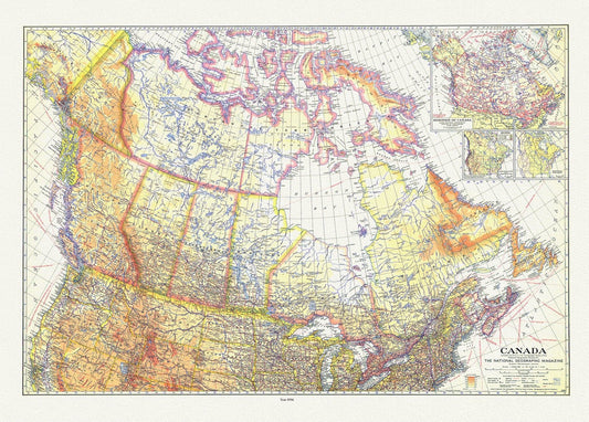
Canada , National Geographic, 1936, vintage map reprinted on durable cotton canvas, 50 x 70 cm or 20x25" approx.
Regular price $45.00 CADRegular price -
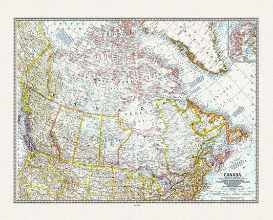
Canada, National Geographic, 1961 , vintage map reprinted on durable cotton canvas, 50 x 70 cm or 20x25" approx.
Regular price $45.00 CADRegular price -
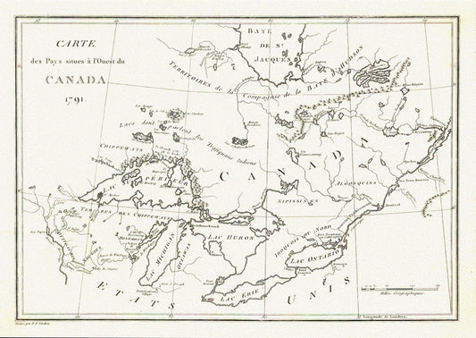
Carte des Pays situes a l'Ouest du Canada, Long auth.,1791, travel poster on durable cotton canvas, 50 x 70 cm, 20 x 25" approx.
Regular price $45.00 CADRegular price -
Plate 57, Toronto West, High Park West, South Kingsway & Swansea, 1923, Map on heavy cotton canvas, 18x27in. approx.
Regular price $45.00 CADRegular price -
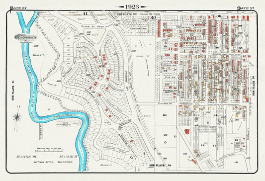
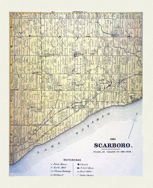
Scarboro, York County Atlas,1884
Regular price $45.00 CADRegular price