-
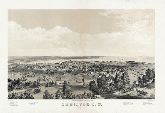
Hamilton, Ontario, Canada West, 1859, map on heavy cotton canvas, 20 x 25" approx.
Regular price $45.00 CADRegular price -
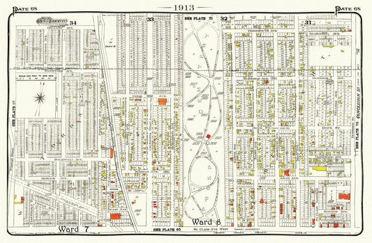
Plate 68, Toronto West, St.Clair, Prospect Cemetery, 1913, map on heavy cotton canvas, 20 x 30" or 50 x 75cm. approx.
Regular price $45.00 CADRegular price -
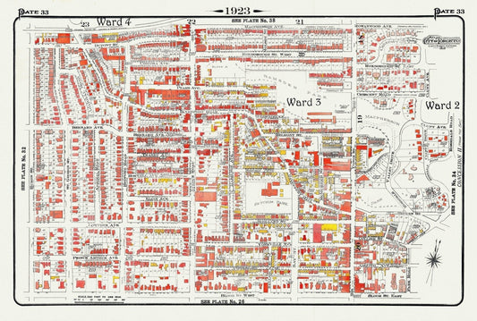
Plate 33, Toronto Uptown, Yorkville, & The Annex, 1923, Map on heavy cotton canvas, 18x27in. approx.
Regular price $45.00 CADRegular price -
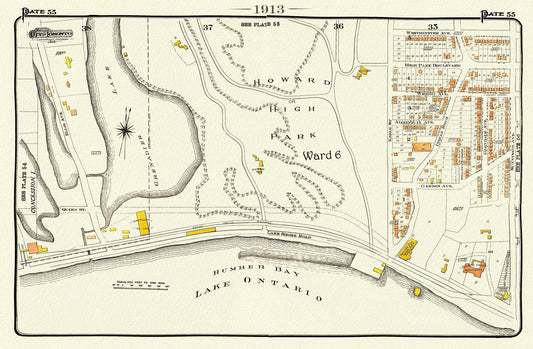
Plate 55 Toronto West, High Park South, 1913, map on heavy cotton canvas, 20 x 30" approx.
Regular price $45.00 CADRegular price -
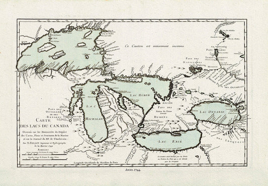
Bellin, Carte des lacs du Canada, 1744 Ver. III, map on heavy cotton canvas, 22x27" approx.
Regular price $45.00 CADRegular price -
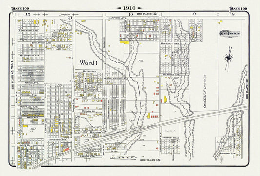
Plate 109, Toronto East, Leslieville North, Monarch Park, 1910 , map on heavy cotton canvas, 20 x 30" approx.
Regular price $45.00 CADRegular price -
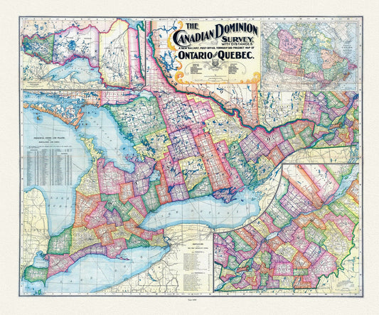
Canadian Dominion Survey, A New Railway, Post-Office, Township and Precinct Map Of Ontario and Quebec, 1899, on heavy cotton canvas, 22x27"
Regular price $45.00 CADRegular price -
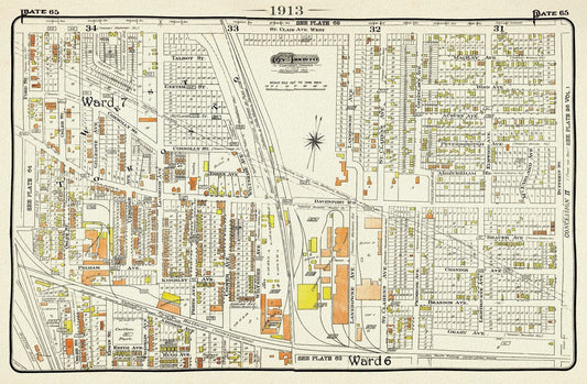
Plate 65, Toronto West, The Junction Triangle North, 1913, map on heavy cotton canvas, 20 x 30" or 50 x 75cm. approx.
Regular price $45.00 CADRegular price -
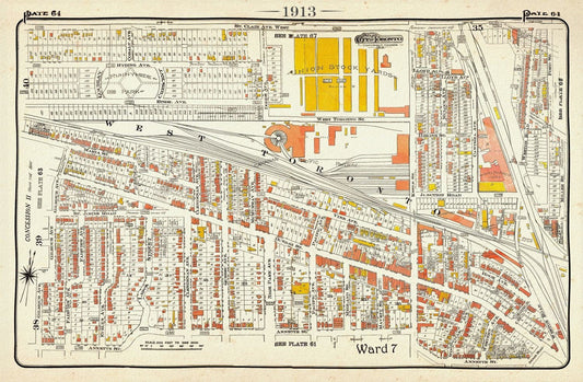
Plate 64, Toronto West, The Junction and Stockyards, 1913, map on heavy cotton canvas, 20 x 30" or 50 x 75cm. approx.
Regular price $45.00 CADRegular price -
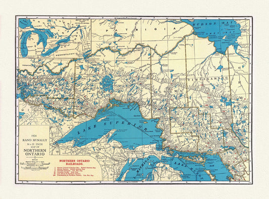
Rand McNally & Company, Commercial Atlas, Northern Ontario, 1924 , map on heavy cotton canvas, 22x27" approx.
Regular price $45.00 CADRegular price -
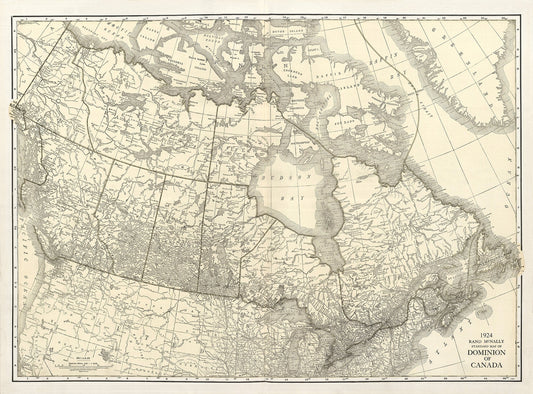
Rand McNally & Company, Commercial Atlas, Canada, 1924 Ver. I , map on heavy cotton canvas, 20 x 25" approx.
Regular price $45.00 CADRegular price -
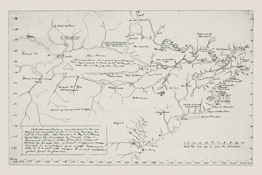
Carte de la Nouvelle France, Champlain (1632) et Thoreau (1850), map on heavy cotton canvas, 50 x 70 cm, 20 x 25" approx.
Regular price $45.00 CADRegular price -
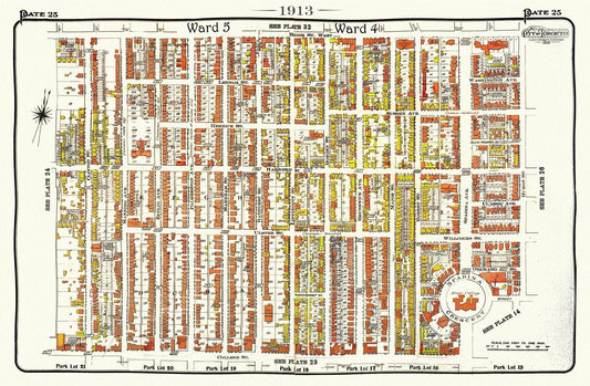
Plate 25, Toronto Central West, Annex South, 1913, map on heavy cotton canvas, 20 x 30" approx.
Regular price $45.00 CADRegular price -
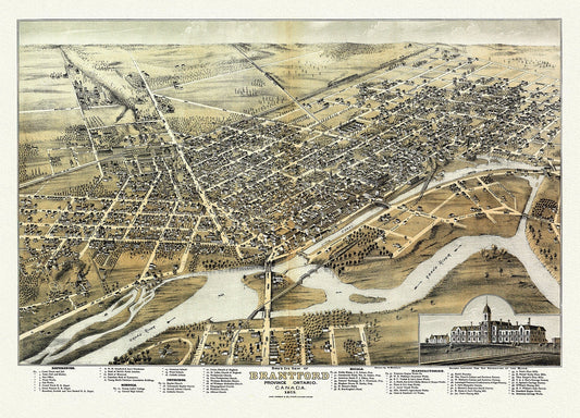
Bird's eye view of Brantford, Province of Ontario, Canada, 1875, map on heavy cotton canvas, 22x27" approx.
Regular price $45.00 CADRegular price -
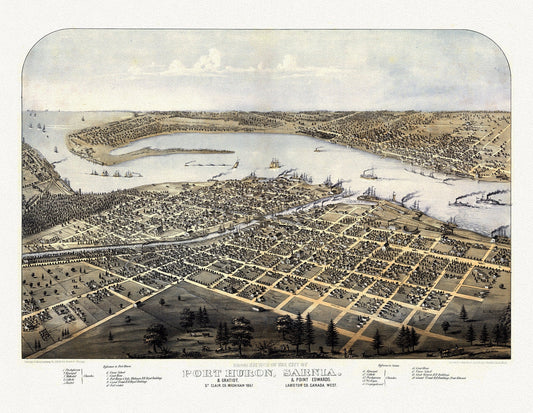
View of the City of Port Huron, Sarnia & Gratiot, Michigan, Point Edwards, Lambton Co., Canada West, 1867, canvas, 22x27"
Regular price $45.00 CADRegular price -
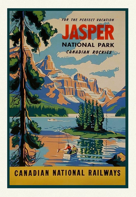
Jasper National Park, Canadian National Railways, Travel Poster on heavy cotton canvas, 22x27" approx.
Regular price $45.00 CADRegular price -
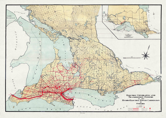
The Electric Generating and Transmission Systems of the Hydro, Electric Power Commission of Ontario, 1914 , map on canvas, 22x27" approx.
Regular price $45.00 CADRegular price -
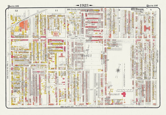
Plate 106, Toronto East, Leslieville and North, 1923, Map on heavy cotton canvas, 18x27in. approx.
Regular price $45.00 CADRegular price -
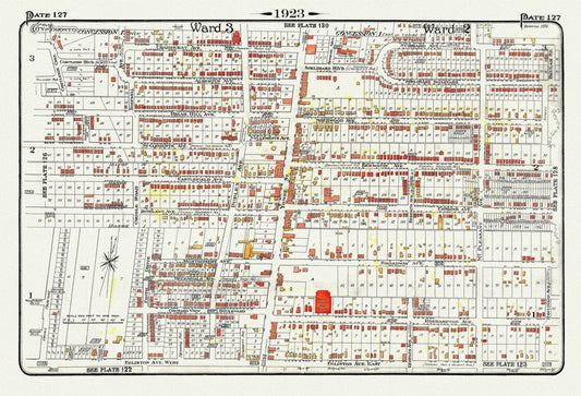
Plate 127, Toronto Uptown, Yonge St. North of Eglinton, 1923, Map on heavy cotton canvas, 18x27in. approx.
Regular price $45.00 CADRegular price -
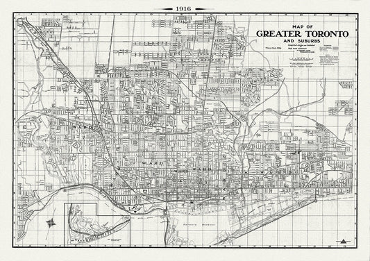
Map of Greater Toronto & Suburbs, 1916 , map on heavy cotton canvas, 22x27" approx.
Regular price $45.00 CADRegular price -
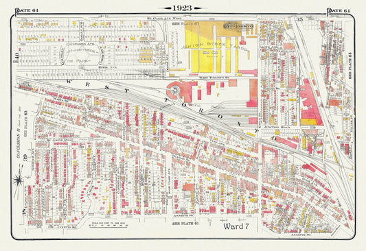
Plate 64, Toronto West, The Junction & Stockyards, 1923, Map on heavy cotton canvas, 18x27in. approx.
Regular price $45.00 CADRegular price -
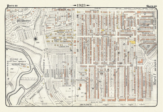
Plate 60, Toronto West, Bloor West Village, 1923, Map on heavy cotton canvas, 18x27in. approx.
Regular price $45.00 CADRegular price -
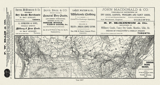
Map of the Canadian Pacific Railway, and its connections, 1887 , map on heavy cotton canvas, 50 x 70cm, 20 x 25" approx.
Regular price $45.00 CADRegular price -
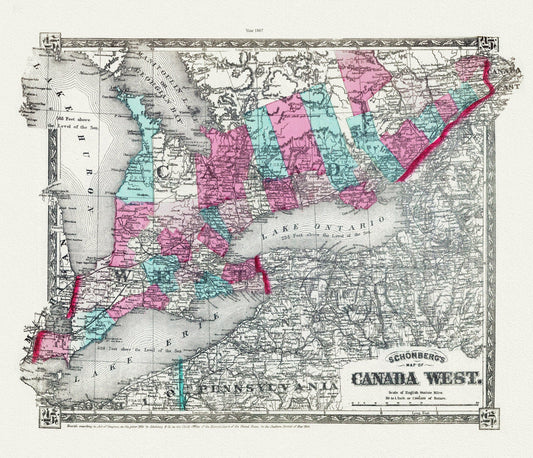
Schonberg's Map of Canada West, 1867 , map on heavy cotton canvas, 22x27" approx.
Regular price $45.00 CADRegular price