-
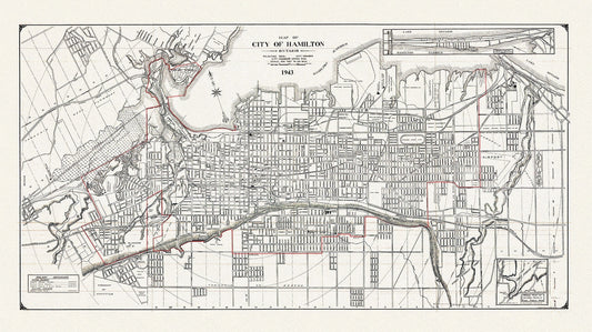
Map of the City of Hamilton, Ontario, 1943, on heavy cotton canvas, 22x27" approx.
Regular price $45.00 CADRegular price -
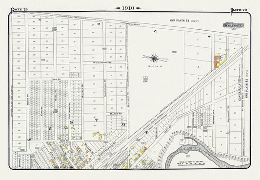
Plate 79, Toronto North West, Weston, 1910 , map on heavy cotton canvas, 20 x 30" approx.
Regular price $45.00 CADRegular price -
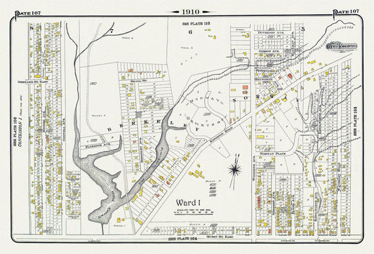
Plate 107, Toronto East, Leslieville, Norway & Beach, 1910 , map on heavy cotton canvas, 20 x 30" approx.
Regular price $45.00 CADRegular price -
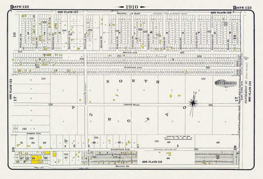
Plate 123, Toronto North, Davisville, 1910 , map on heavy cotton canvas, 20 x 30" approx.
Regular price $45.00 CADRegular price -
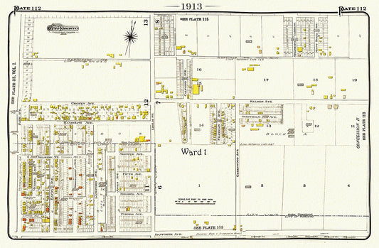
Toronto, 1913-112-East-Danforth-Leslie North, map on heavy cotton canvas, 50 x 70cm, 20 x 25" approx.
Regular price $45.00 CADRegular price -
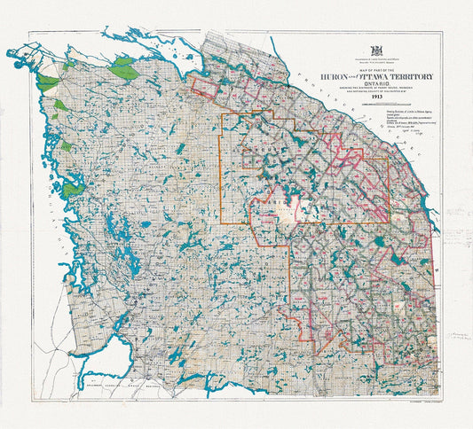
Algonquin Park Area, Part of the Huron and Ottawa Territories, 1913 , map on heavy cotton canvas, 45 x 65 cm, 18 x 24" approx.
Regular price $45.00 CADRegular price -
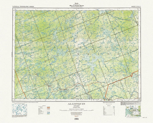
Historic Algonquin Park Map, National Topographic Series, Algonquin, 1951 , map on heavy cotton canvas, 45 x 65 cm, 18 x 24" approx.
Regular price $45.00 CADRegular price -
Peterborough County, Township Map. 1875, map on heavy cotton canvas, 50 x 70cm, 20 x 27" approx.
Regular price $40.00 CADRegular price -
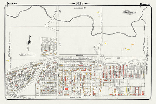
Plate 66, Toronto West, Junction North, Runnymede & Black Creek, 1923, Map on heavy cotton canvas, 18x27in. approx.
Regular price $40.00 CADRegular price -
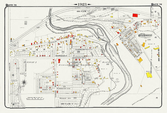
Plate 76, Toronto West, Etobicoke, Lambton Mills & Kingsway, 1923, Map on heavy cotton canvas, 18x27in. approx.
Regular price $45.00 CADRegular price -
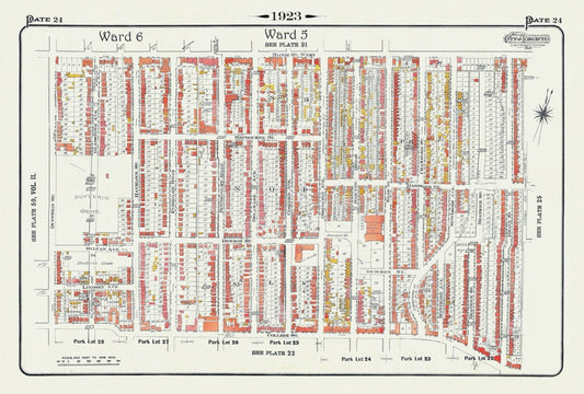
Plate 24, Toronto West, Dufferin Grove, BloorCourt , South of Bloor, St., 1923, Map on heavy cotton canvas, 18x27in. approx.
Regular price $45.00 CADRegular price -
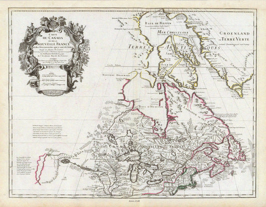
Delisle, Le Canada, 1708, map on durable cotton canvas, 50 x 70 cm, 20 x 25" approx.
Regular price $45.00 CADRegular price -
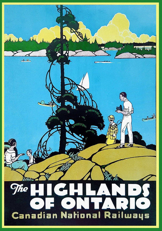
Highlands of Ontario, Travel Poster, Canadian National Railways, on heavy cotton canvas, 22x27" approx.
Regular price $45.00 CADRegular price -
Northern Ontario Road Map, 1955, map on heavy cotton canvas, 50 x 70 cm (20x25") approx.
Regular price $45.00 CADRegular price -
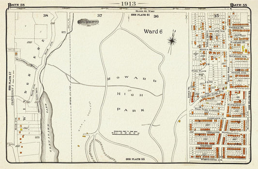
Plate 58, Toronto West, High Park, 1913, map on heavy cotton canvas, 20 x 30" approx.
Regular price $45.00 CADRegular price -
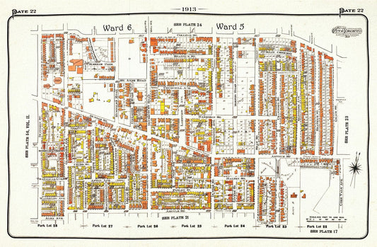
Plate 22, Toronto West, Parkdale, Brockton Village, 1913, map on heavy cotton canvas, 20 x 30" approx.
Regular price $45.00 CADRegular price -
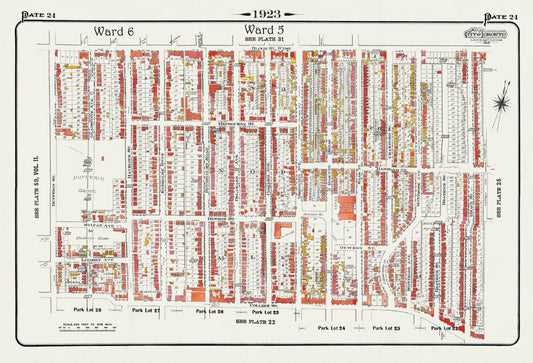
Plate 24, Toronto West, Bloorcourt, Dufferin Grove & Brockton, 1923, Map on heavy cotton canvas, 18x27in. approx.
Regular price $45.00 CADRegular price -
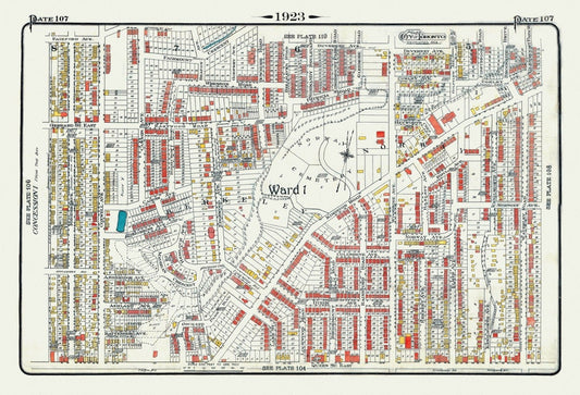
Plate 107, Toronto East, Leslieville, Norway & Beach, 1923, Map on heavy cotton canvas, 18x27in. approx.
Regular price $45.00 CADRegular price -
Plate 118, Toronto Uptown, Upper Canada College, Mount Pleasant, 1923, Map on heavy cotton canvas, 18x27in. approx.
Regular price $45.00 CADRegular price -
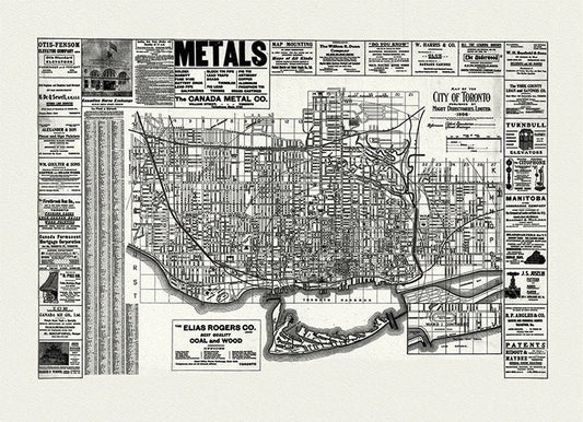
City of Toronto, 1906 Ver. W, map on heavy cotton canvas, 22x27" approx.
Regular price $45.00 CADRegular price -
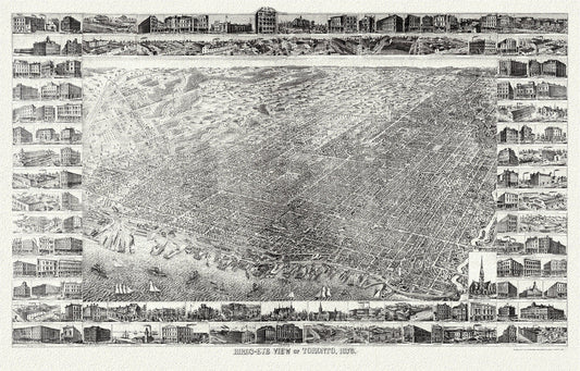
Gross, A Bird's eye view of Toronto, 1876, map on heavy cotton canvas, 22x27" approx.
Regular price $45.00 CADRegular price -
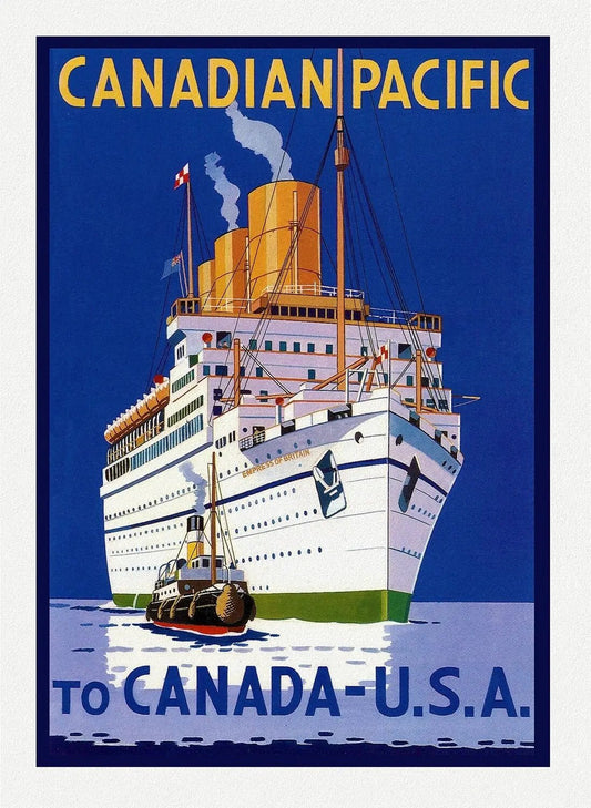
Travel Poster, Canadian Pacific to the U.S.A. on heavy cotton canvas, 22x27" approx.
Regular price $45.00 CADRegular price -
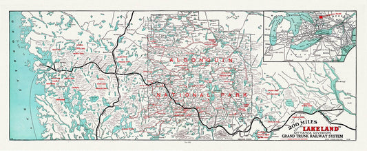
Algonquin-Haliburton: Grand Trunk Railway, Historic Algonquin Park Map, 1906, map on heavy cotton canvas, 22x27" approx.
Regular price $45.00 CADRegular price -
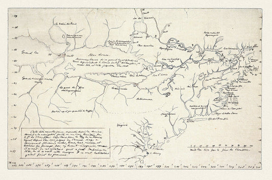
Champlain (1574-1635) et Thoreau-Carte de la Nouvelle France, 1632, map on heavy cotton canvas, 22x27" approx.
Regular price $45.00 CADRegular price