-
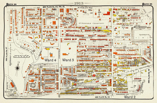

Plate 38, Toronto Uptown West, Forest Hill South, 1913, map on heavy cotton canvas, 20 x 30" approx.
Regular price $45.00 CADRegular price -
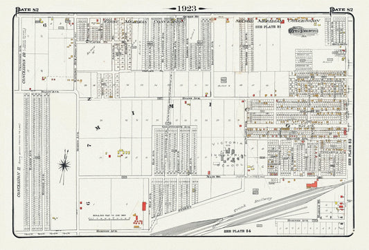
Plate 82, Toronto West, Mimico, 1923, Map on heavy cotton canvas, 18x27in. approx.
Regular price $45.00 CADRegular price -
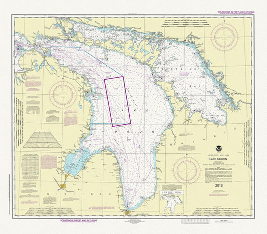
Chart of Lake Huron, 2016, map on heavy cotton canvas, 24 x 27" approx.
Regular price $45.00 CADRegular price -
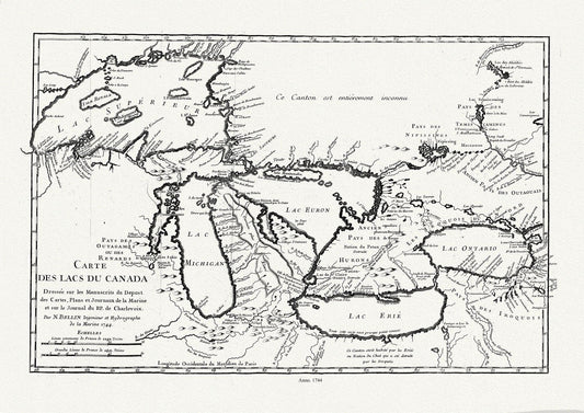
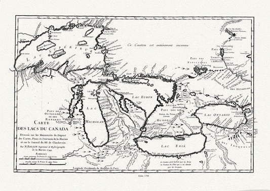
Bellin, Carte des lacs du Canada, Dressée sur les manuscrits du depost des cartes,1744, map on heavy cotton canvas, 50x70cm approx.
Regular price $45.00 CADRegular price -
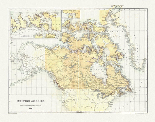
British America, 1856, map on heavy cotton canvas, 50 x 70 cm, 20 x 25" approx.
Regular price $45.00 CADRegular price -
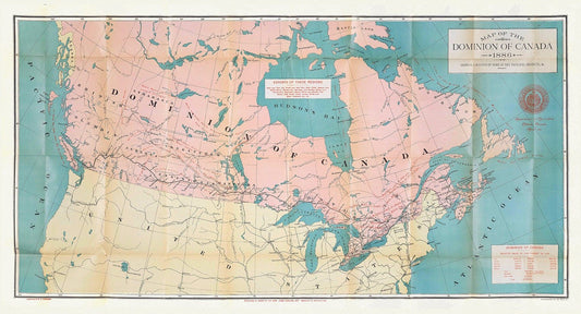
Canada, its history, productions and natural resources, prepared under the direction of Honourable John Carling, 1886, map on canvas, 20x25"
Regular price $45.00 CADRegular price -
Canada, Hall auth., 1829, map on heavy cotton canvas, 50 x 70 cm, 20 x 25" approx.
Regular price $45.00 CADRegular price -
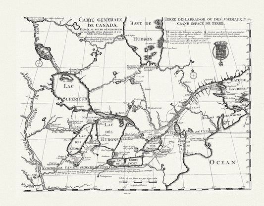
Carte generale de Canada, Lahotan auth., 1706, map on heavy cotton canvas, 50 x 70 cm, 20 x 25" approx.
Regular price $45.00 CADRegular price -
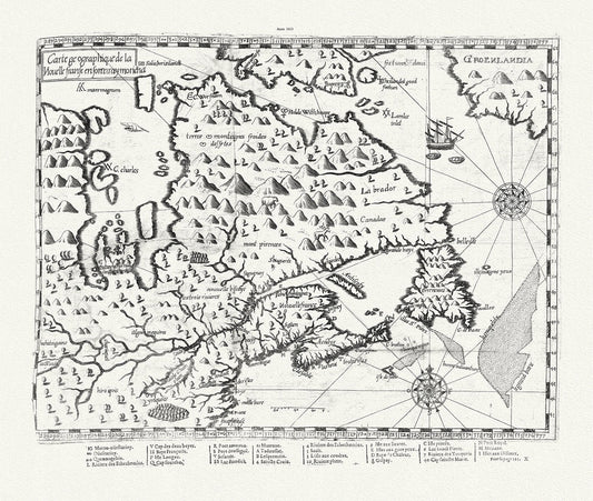
Carte geographique de la Nouelle franse en son vray moricha, Champlain auth., 1613, map on heavy cotton canvas, 50 x 70 cm, 20 x 25" approx.
Regular price $45.00 CADRegular price -
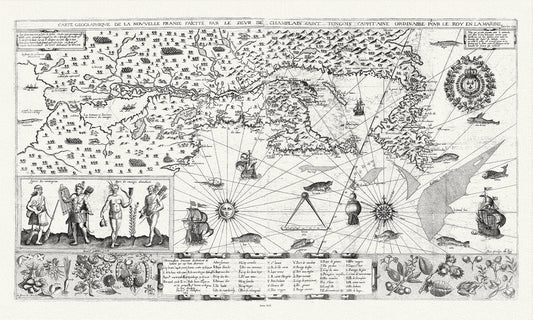
Carte geographiqve de la Nouvelle France, St Tongois cappitaine ordinaire pour le roy , Champlain.auth., 1612,,canvas, 20 x 25" approx.
Regular price $45.00 CADRegular price -
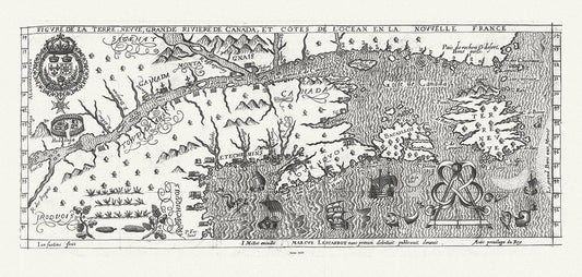
Figure de la Terre Neuve, le grande riviere de Canada, et côtes de l'ocean en la Nouvelle France, Les Carbot auth.,1609, 20 x 25" approx.
Regular price $45.00 CADRegular price -
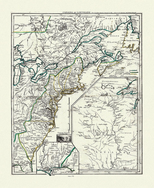
LaRouge, Canada et Louisiana, 1793, map on heavy cotton canvas, 50 x 70 cm, 20 x 25" approx.
Regular price $45.00 CADRegular price -
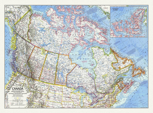
Canada, National Geographic, 1972, map on heavy cotton canvas, 50 x 70 cm, 21 x 25" approx.
Regular price $45.00 CADRegular price -
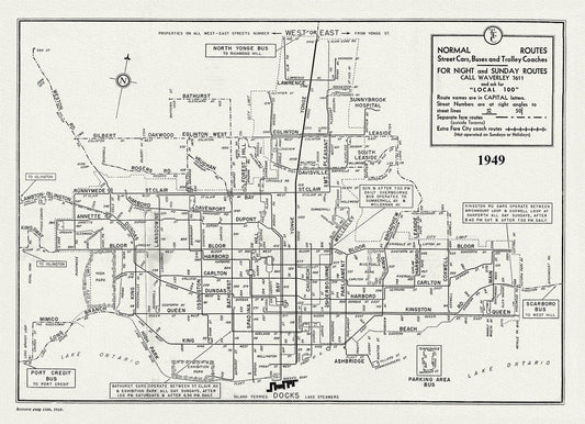
Toronto Bus Routes, 1949 , map on heavy cotton canvas, 22x27" approx.
Regular price $45.00 CADRegular price -
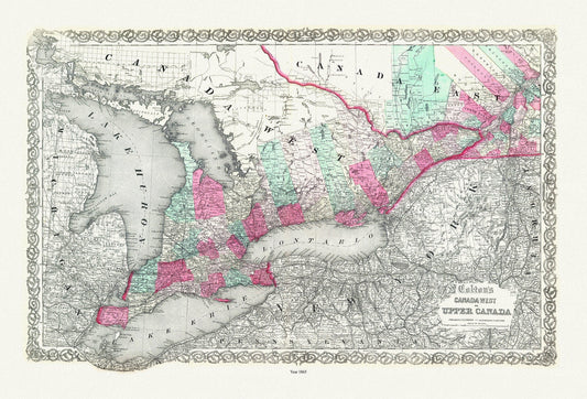
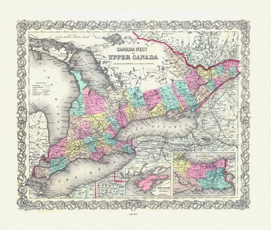
Ontario: Canada West or Upper Canada, Colton auth., 1865 , map on heavy cotton canvas, 50 x 70 cm, 20 x 25" approx.
Regular price $45.00 CADRegular price -
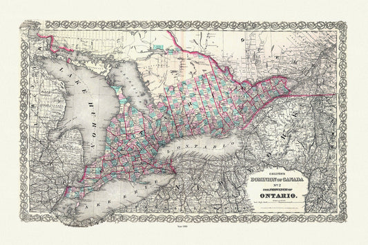
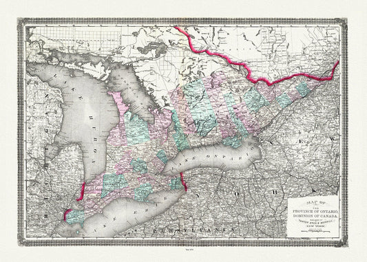
Colton, The Dominion of Canada No. 2., The Province of Ontario, Colton, 1880, map on heavy cotton canvas, 50 x 70 cm, 20 x 25" approx.
Regular price $45.00 CADRegular price -
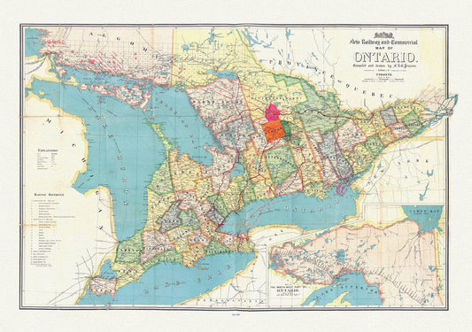
Penson, A New Railway and Commercial Map of Ontario,1887 Ver. II , map on heavy cotton canvas, 50 x 70 cm, 20 x 25" approx.
Regular price $45.00 CADRegular price -
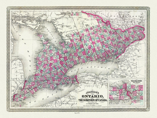
Ontario of the Dominion of Canada, Johnson auth., 1874 , map on heavy cotton canvas, 50 x 70 cm, 20 x 25" approx.
Regular price $45.00 CADRegular price -
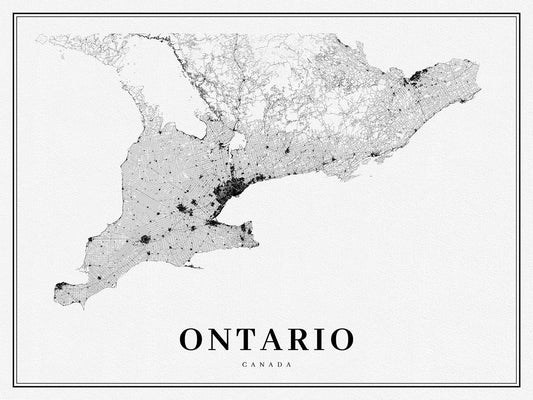
Southern Ontario, A Modern Map, on heavy cotton canvas, 50 x 70 cm, 20 x 25" approx.
Regular price $45.00 CADRegular price -
Ontario, Canada, Taintor Brothers & Merrill auth., 1874
Regular price $45.00 CADRegular price -
EOntario: Upper Canada. 1857
Regular price $45.00 CADRegular price -
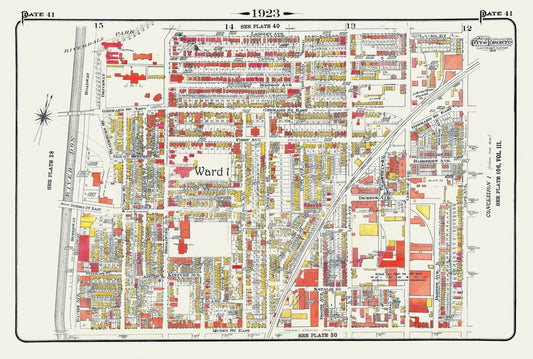
Plate 41, Toronto East, Riverdale & Leslieville, 1923, Map on heavy cotton canvas, 18x27in. approx.
Regular price $45.00 CADRegular price -
Plate 110, Toronto East, Danforth and Woodbine South, 1910 , map on heavy cotton canvas, 20 x 30" approx.
Regular price $45.00 CADRegular price -
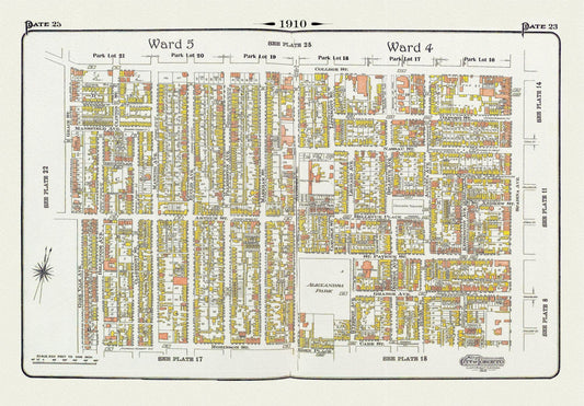
Plate 23, Toronto Downtown West, Kensington, & Annex South, 1910, map on heavy cotton canvas, 20 x 30" approx.
Regular price $45.00 CADRegular price