-
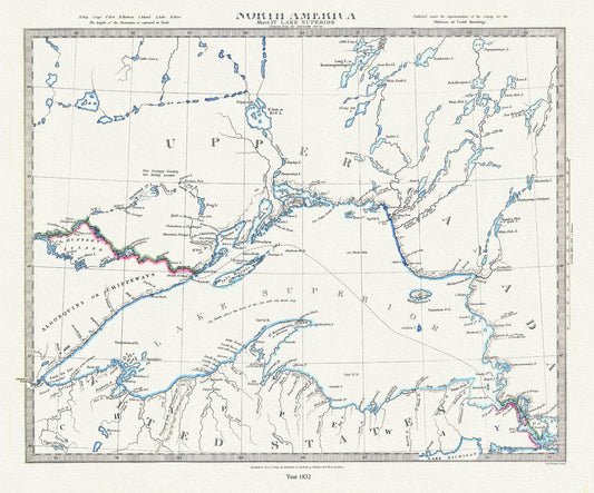
Lake Superior, reduced from the Admiralty Survey, 1832 , map on durable cotton canvas, 50 x 70 cm, 20 x 25" approx.
Regular price $45.00 CADRegular price -
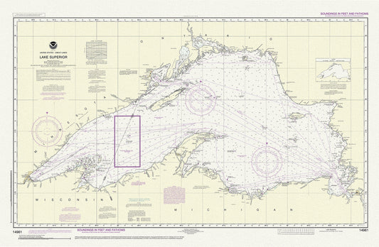
Lake Superior, 14961, 1983
Regular price $45.00 CADRegular price -
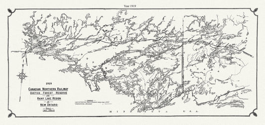
Canadian Northern Railway Quetico forest reserve and Rainy Lake region of New Ontario, 1919 , map on canvas, 50 x 70 cm, 20 x 25" approx.
Regular price $45.00 CADRegular price -
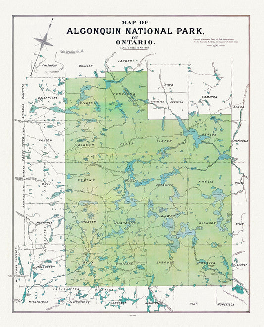
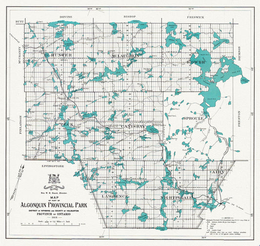
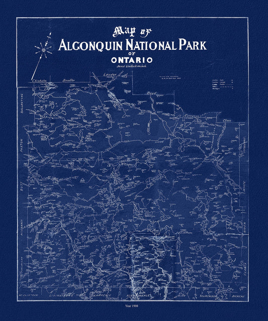
Historic Algonquin Park Map, Algonquin Park Commission, 1893, map on heavy cotton canvas, 20x27" approx.
Regular price $45.00 CADRegular price -
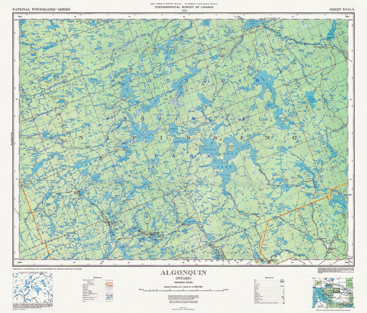
Historic Algonquin Park Map, National Topographic Series, 1934
Regular price $45.00 CADRegular price -
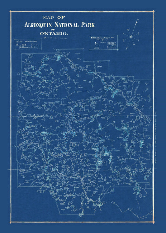
Historic Algonquin Park Map, auth. Arthur Brown, 1925 Cyanotype , map on heavy cotton canvas, 20x27" approx.
Regular price $45.00 CADRegular price -
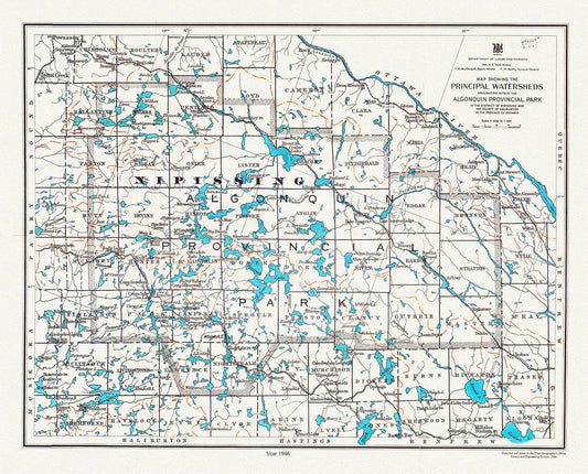
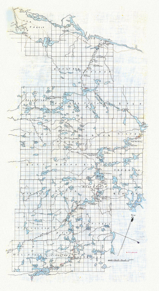
Algonquin Provincial Park, Principal Watersheds, 1946 , map on heavy cotton canvas, 45 x 65 cm, 18 x 24" approx.
Regular price $45.00 CADRegular price -
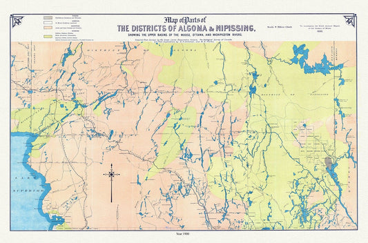
Algoma and Nipissing Districts, a geological map, 1900 , map on heavy cotton canvas, 45 x 65 cm, 18 x 24" approx.
Regular price $45.00 CADRegular price -
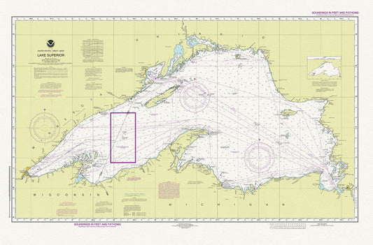
Nautical Chart of Lake Superior, 2016, map on heavy cotton canvas, 50 x 70cm, 20 x 25" approx.
Regular price $50.00 CADRegular price -
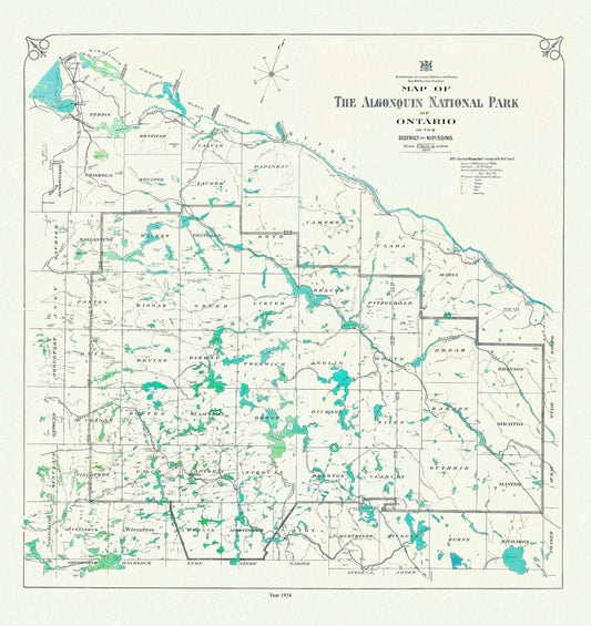
Historic Algonquin Park Map, 1914, map on heavy cotton canvas, 20x27" approx
Regular price $45.00 CADRegular price -
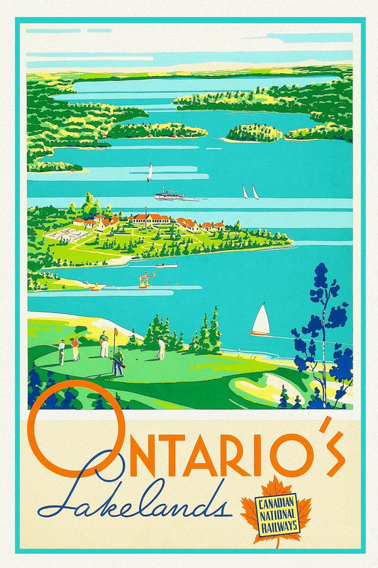
Ontario's Lakelands, Canadian National Railways , travel poster on heavy cotton canvas, 20x25" approx.
Regular price $45.00 CADRegular price -
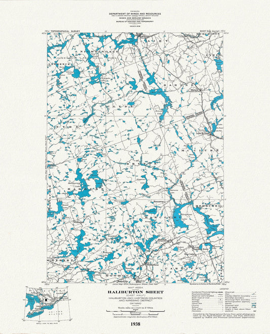
Historic Algonquin Park Map, Haliburton East, National Topographic Series, 1938, map on heavy cotton canvas, 22x27" approx.
Regular price $45.00 CADRegular price -
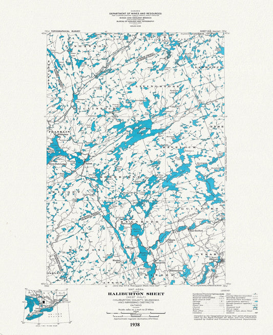
Historic Algonquin Park Map Haliburton West, National Topographic Series, 1938, map on heavy cotton canvas, 20x27" approx.
Regular price $45.00 CADRegular price -
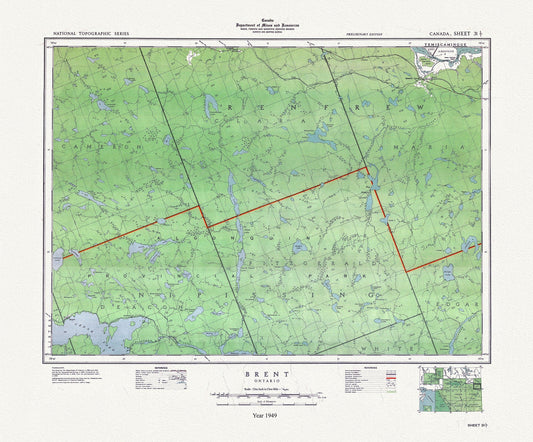
Historic Algonquin Park Map, Brent, National Topographic Series, 1949 , map on heavy cotton canvas, 20x27" approx.
Regular price $45.00 CADRegular price -
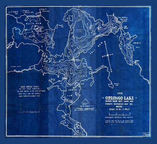
Historic Algonquin Park Map, Depth Map, Opeongo Lake, 1958 Cyanotype , map on heavy cotton canvas, 20x27" approx
Regular price $45.00 CADRegular price -
Historic Algonquin Provincial Park Map, 1914, map on heavy cotton canvas, 20x27" approx.
Regular price $45.00 CADRegular price -
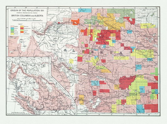
British Columbia and Alberta, Canada Department of the Interior et Chalifour-Origin of the population,1915 , map on cotton canvas, 20x27"
Regular price $45.00 CADRegular price -
Historic Algonquin Park Map, Dr. Bell auth., 1908 Ver. Cyanotype , map on heavy cotton canvas, 45 x 65 cm, 18 x 24" approx.
Regular price $45.00 CADRegular price -
Historic Algonquin Park Map (Hand drawn), Kawagama to North Bay via Algonquin, c. 1916 , map on heavy cotton canvas, 20 x 25" approx.
Regular price $45.00 CADRegular price -
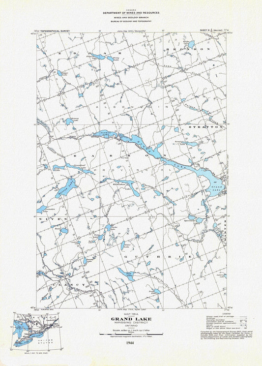
Historic Algonquin Park Map, Grand Lake, National Topographic Series, 1944, map on heavy cotton canvas, 20 x 25" approx.
Regular price $45.00 CADRegular price -
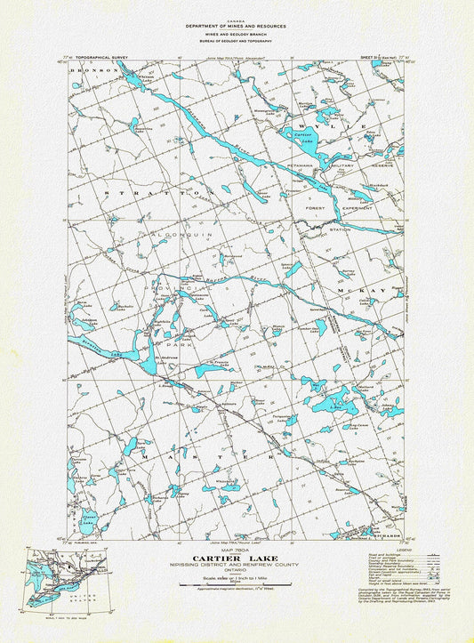
Historic Algonquin Park Map, Cartier Lake, National Topographic Series, 1944 , map on heavy cotton canvas, 20 x 25" approx.
Regular price $45.00 CADRegular price -
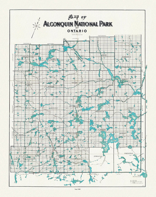
Historic Algonquin Park Map, Copp Clark Co., 1900, map on heavy cotton canvas, 20 x 25" approx.
Regular price $45.00 CADRegular price -
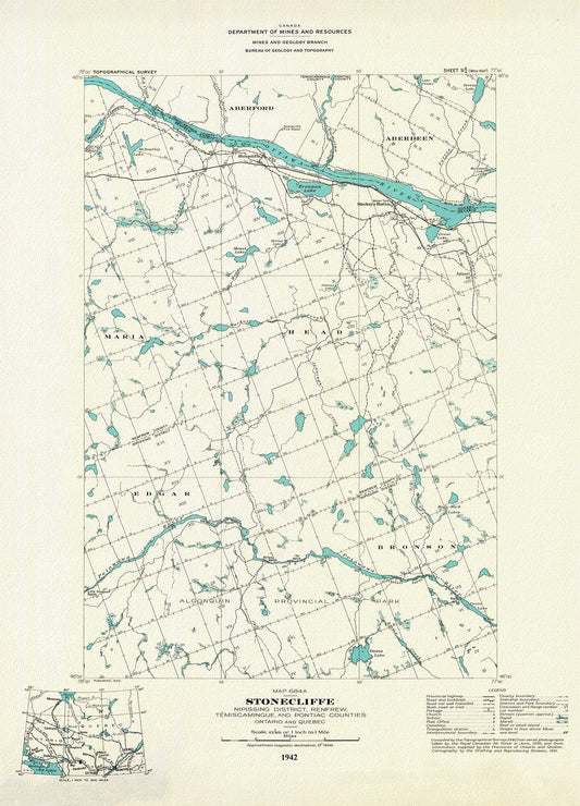
Historic Algonquin Park Map, Stonecliffe ,National Topographic Series, 1942, map on heavy cotton canvas, 20 x 25" approx.
Regular price $45.00 CADRegular price -
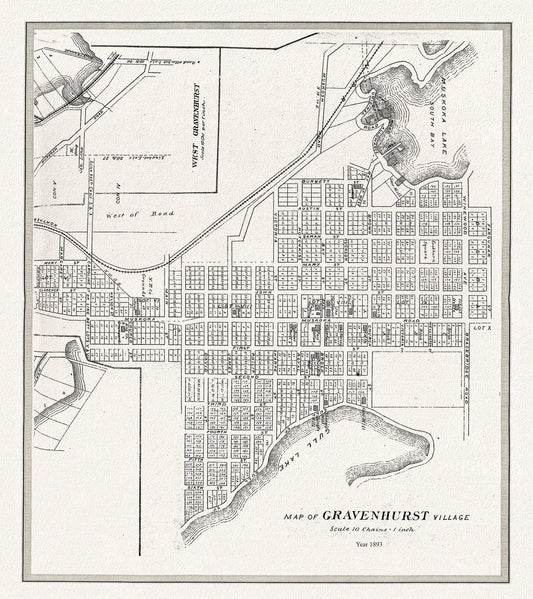
Gravenhurst Village, Muskoka, 1893,map on heavy cotton canvas, 22x27" approx.
Regular price $45.00 CADRegular price