-
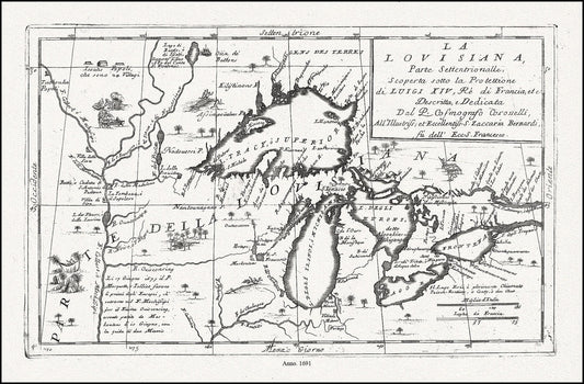
Coronelli, La Louisiana, Parte Settentrionalle, Scoperta sotto Protettione di Luigi XIV, Re di Francia, 1691, cotton canvas, 22x27" approx.
Regular price $45.00 CADRegular price -
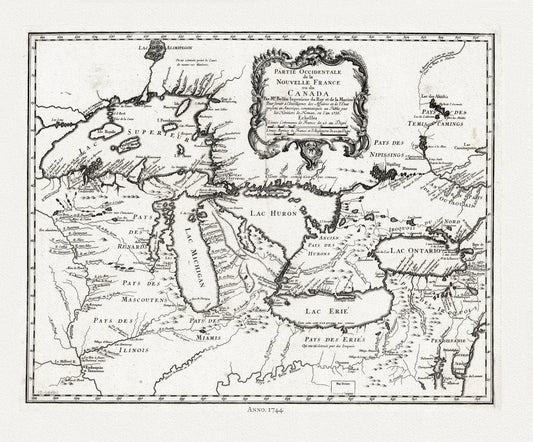
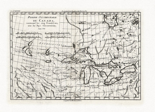
Bellin, Partie occidentale de la Nouvelle France ou du Canada, 1744 , map on heavy cotton canvas, 22x27" approx.
Regular price $45.00 CADRegular price -
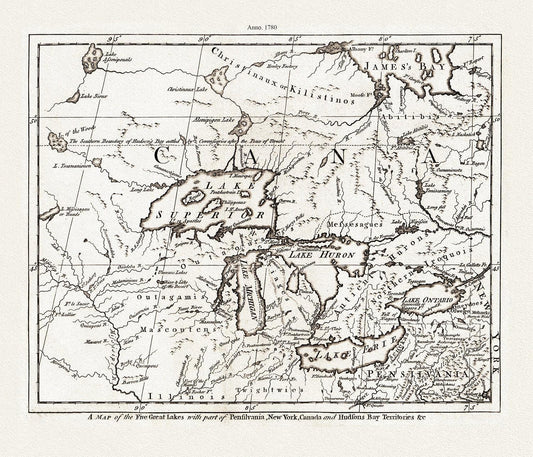
A Map of the Five Great Lakes with part of Pensilvania, New York, Canada, and Hudsons Bay Territories &c., 1780, on cotton canvas, 22x27"
Regular price $45.00 CADRegular price -
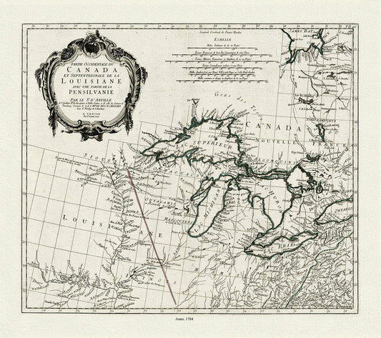
Anville et al., Partie occidentale du Canada et septentrionale de la Louisiane avec une partie de la Pensilvanie, 1784 , on canvas 22x27"
Regular price $45.00 CADRegular price -
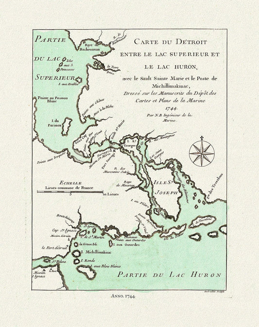
Bellin, Carte du Detroit entre le Lac Superieur et Huron, avec le Sault Ste. Marie, 1744, map on heavy cotton canvas, 22x27" approx.
Regular price $45.00 CADRegular price -
Bonne, Partie Occidentale du Canada, contenant les Cinq Grands Lacs, avec les pays circonvoisins, 1780, map on cotton canvas, 22x27" approx.
Regular price $45.00 CADRegular price -
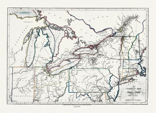
Conrad et Lewis, A correct map of the seat of war, 1812, map on heavy cotton canvas, 22x27" approx.
Regular price $45.00 CADRegular price -
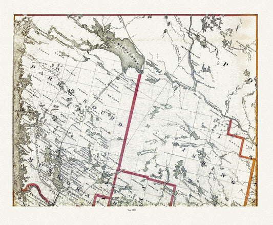
Muskoka-Haliburton, Parry Sound-Nipissing, 1893 , map on heavy cotton canvas, 20 x 25" approx.
Regular price $45.00 CADRegular price -


Muskoka-Haliburton, Plan of Bracebridge Village, 1893 , map on heavy cotton canvas, 20 x 25" approx.
Regular price $45.00 CADRegular price -
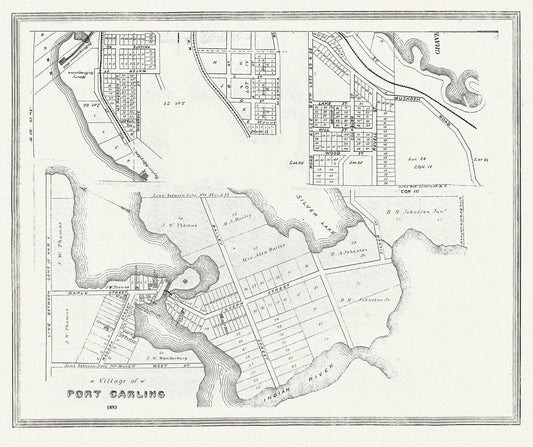
Muskoka-Haliburton, Port Carling, 1893 , map on heavy cotton canvas, 20 x 25" approx.
Regular price $45.00 CADRegular price -
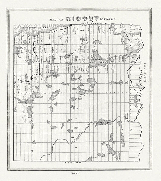
Muskoka-Haliburton, Ridout Township,1893
Regular price $45.00 CADRegular price -
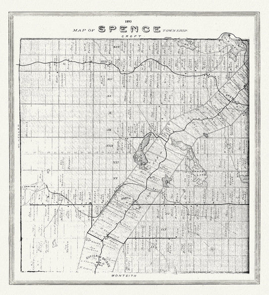
Muskoka-Haliburton, Spence Township, 1893, map on heavy cotton canvas, 20 x 25" approx.
Regular price $45.00 CADRegular price -
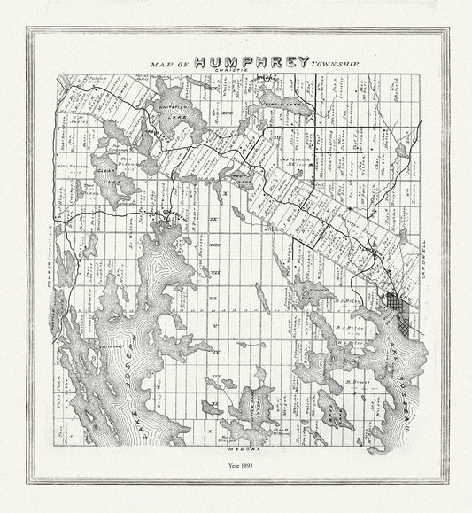
Muskoka-Haliburton, Humphrey Township, 1893 , map on heavy cotton canvas, 20 x 25" approx.
Regular price $45.00 CADRegular price -
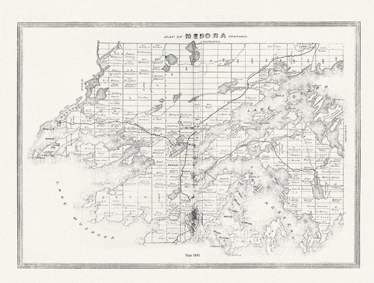
Muskoka-Haliburton, Medora Township, 1893, map on heavy cotton canvas, 20 x 25" approx.
Regular price $45.00 CADRegular price -
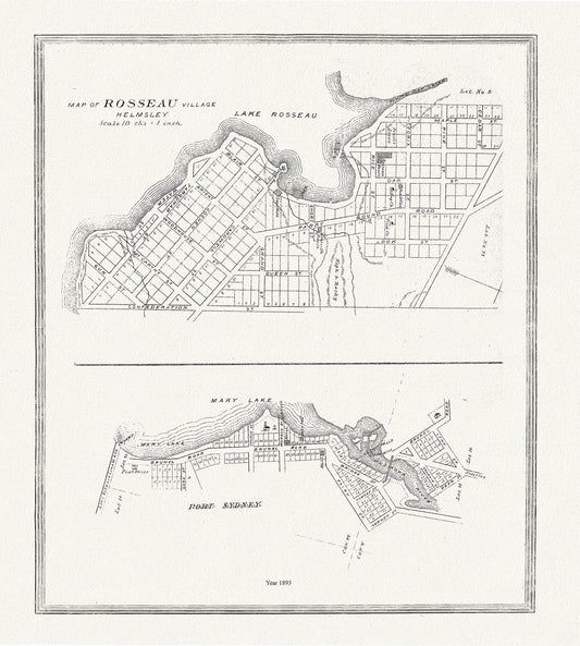
Muskoka-Haliburton, Rosseau Village & Port Sydney, 1893, map on heavy cotton canvas, 20 x 25" approx.
Regular price $45.00 CADRegular price -
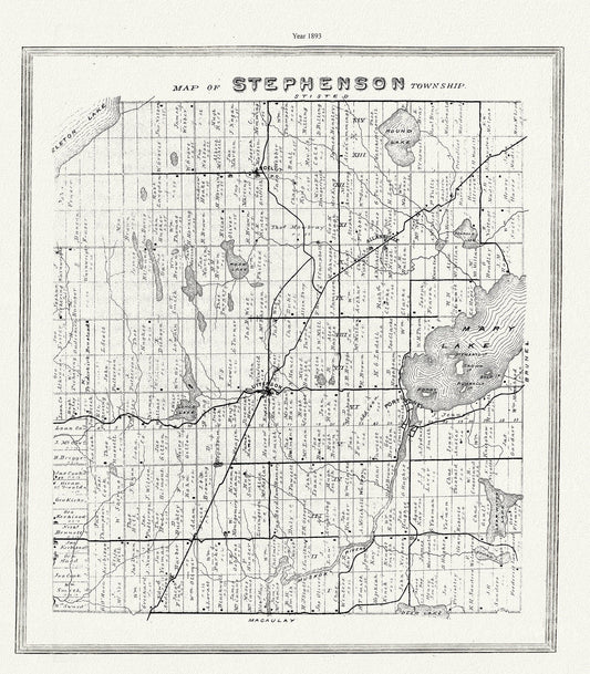
Muskoka-Haliburton, Stephenson Township, 1893 , map on heavy cotton canvas, 20 x 25" approx.
Regular price $45.00 CADRegular price -
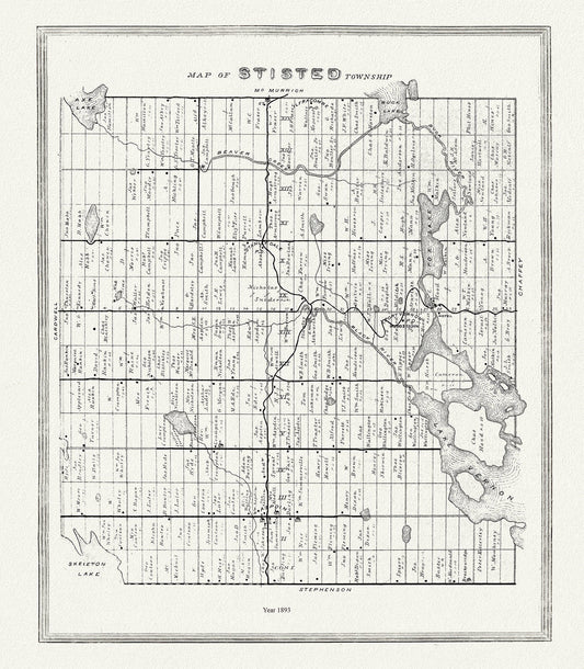
Muskoka-Haliburton, Stisted Township, 1893 , map on heavy cotton canvas, 20 x 25" approx.
Regular price $45.00 CADRegular price -
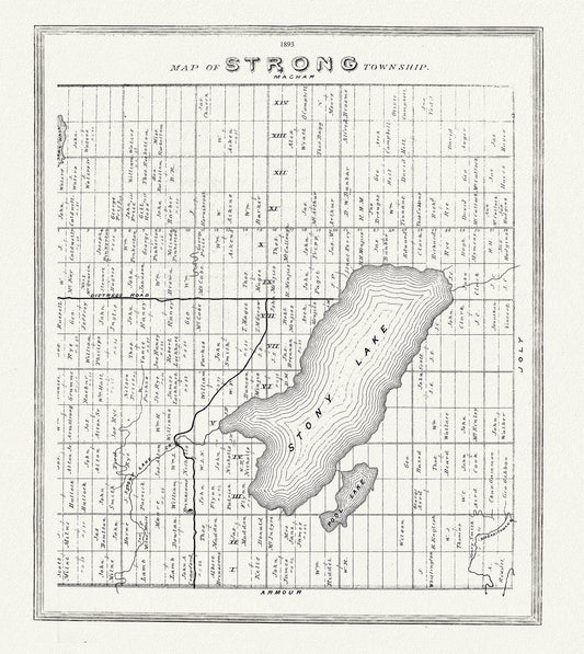
Muskoka-Haliburton, Strong Township, 1893, map on heavy cotton canvas, 20 x 25" approx.
Regular price $45.00 CADRegular price -
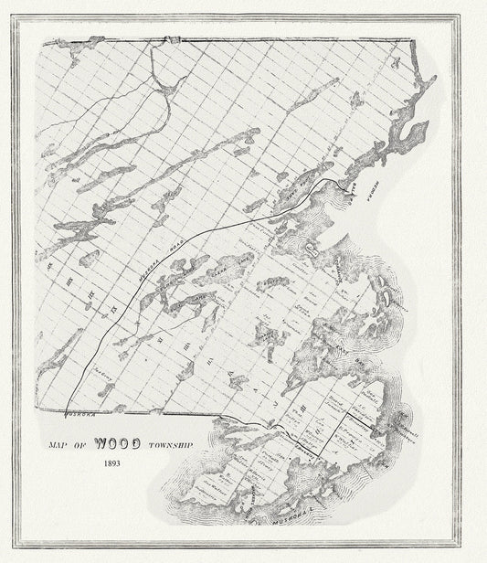
Muskoka-Haliburton, Wood Township, 1893 , map on heavy cotton canvas, 20 x 25" approx.
Regular price $45.00 CADRegular price -
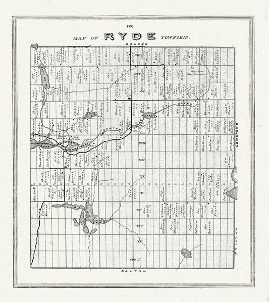
Muskoka-Haliburton, Ryde Township, 1893, map on heavy cotton canvas, 20 x 25" approx.
Regular price $45.00 CADRegular price -
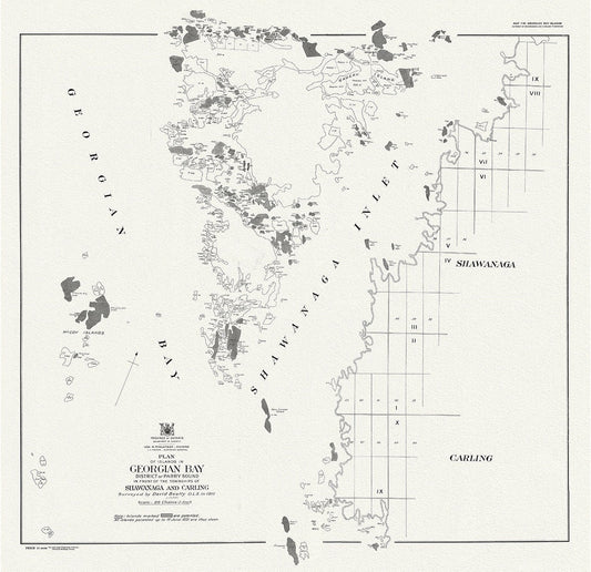
Plan of islands in Georgian Bay district of Parry Sound, in front of the townships of Shawanaga and Carling, 1931
Regular price $45.00 CADRegular price -
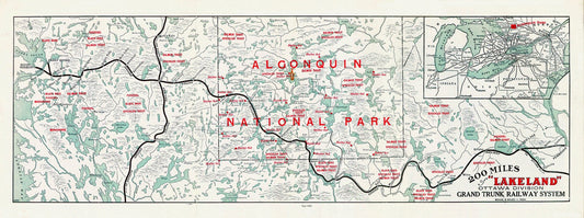
Algonquin: Grand Trunk Railway, Historic Algonquin Park Map, 1905, map on heavy cotton canvas, 22x27" approx.
Regular price $45.00 CADRegular price -
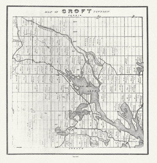
Muskoka-Haliburton, Croft Township, 1893 , map on heavy cotton canvas, 20 x 25" approx.
Regular price $45.00 CADRegular price -
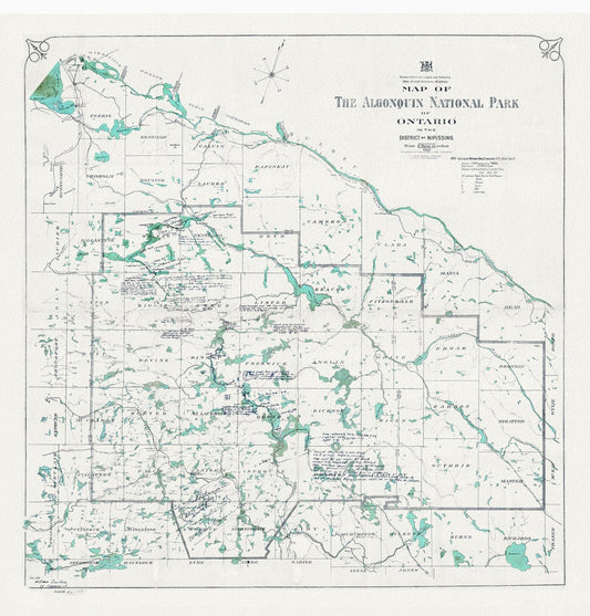
Historic Algonquin Park Map, Lands and Forrests, 1921, map on heavy cotton canvas, 20 x 25" approx.
Regular price $45.00 CADRegular price