-
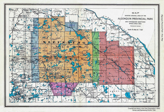
1946 Map of Algonquin Park, Showing Subsequent Additions since 1893, map on heavy cotton canvas, 22x27" approx.
Regular price $45.00 CADRegular price -
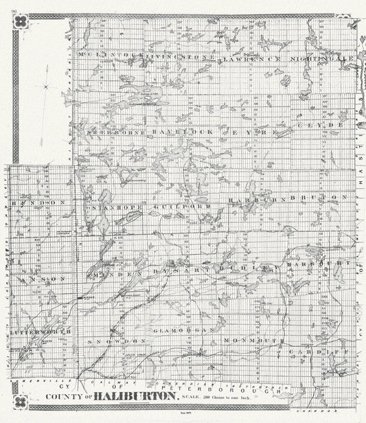
Historic Algonquin Park Map, Haliburton County, 1879, map on heavy cotton canvas, 20 x 25" approx.
Regular price $50.00 CADRegular price -
Muskoka-Haliburton, Draper Township, 1893, map on heavy cotton canvas, 20 x 25" approx.
Regular price $45.00 CADRegular price -
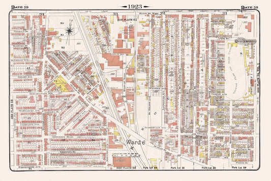
Plate 59, Toronto West, High Park East Side & Brockton, South of Bloor St., 1923, Map on heavy cotton canvas, 18x27in. approx.
Regular price $45.00 CADRegular price -
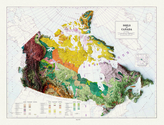
Soils of Canada, 1915 , map on heavy cotton canvas, 20 x 25" approx.
Regular price $45.00 CADRegular price -
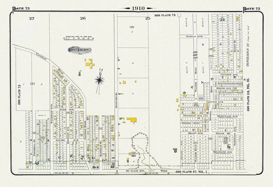
Plate 73, Toronto Uptown West, Wychwood North, 1910, map on heavy cotton canvas, 20 x 30" approx.
Regular price $45.00 CADRegular price -
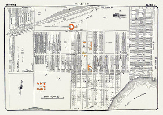
Plate 84, Toronto West, New Toronto, 1910, map on heavy cotton canvas, 20 x 30" approx.
Regular price $45.00 CADRegular price -
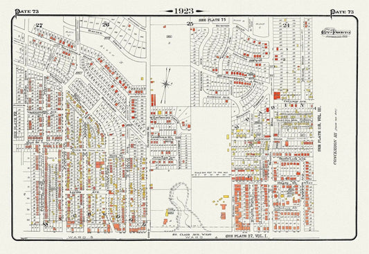
Plate 73, Toronto Uptown West, Wychwood North, 1923, Map on heavy cotton canvas, 18x27in. approx.
Regular price $45.00 CADRegular price -
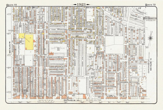
Plate 72, Toronto, North West, Wychwood, 1923, Map on heavy cotton canvas, 18x27in. approx.
Regular price $45.00 CADRegular price -
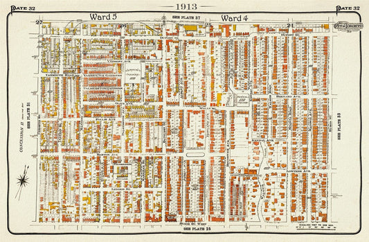
Plate 32, Toronto Uptown West, Seaton Village, Annex, 1913, map on heavy cotton canvas, 20 x 30" approx.
Regular price $45.00 CADRegular price -
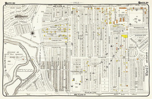
Plate 60, Toronto West, High Park, Bloor West Village North, 1913, map on heavy cotton canvas, 20 x 30" or 50 x 75cm. approx.
Regular price $45.00 CADRegular price -
Road map of Haliburton and surrounding districts, Ontario 1935, on heavy cotton canvas, 22x27" approx.
Regular price $45.00 CADRegular price -
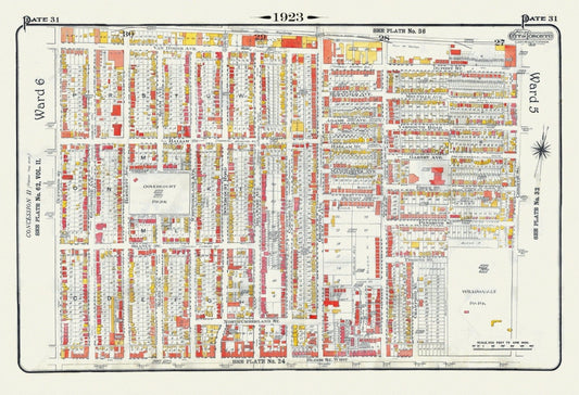
Plate 31, Toronto West, Bloorcourt, Dovercourt, 1923, Map on heavy cotton canvas, 18x27in. approx.
Regular price $45.00 CADRegular price -
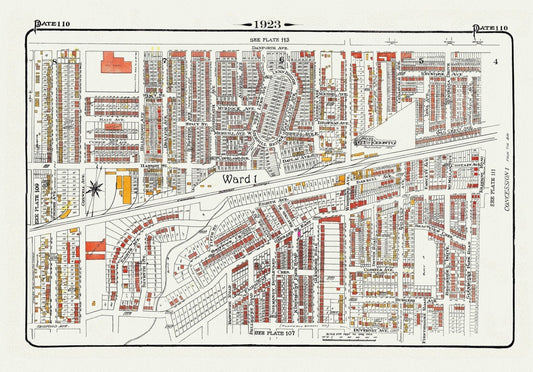
Plate 110, Toronto East, Danforth and Woodbine South, 1923, Map on heavy cotton canvas, 18x27in. approx.
Regular price $45.00 CADRegular price -
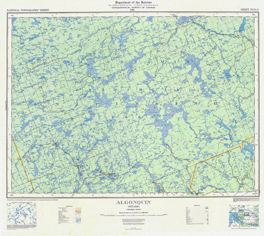
Topographical Map of Algonquin, 1934 , map on heavy cotton canvas, 22x27" approx.
Regular price $45.00 CADRegular price -
Muskoka-Haliburton, Watt Township, 1893 , map on heavy cotton canvas, 20 x 25" approx.
Regular price $45.00 CADRegular price -
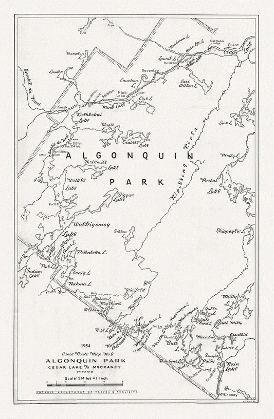
Canoe Route Map No. 9, Algonquin Park, 1954 , map on heavy cotton canvas, 22x27" approx.
Regular price $45.00 CADRegular price -
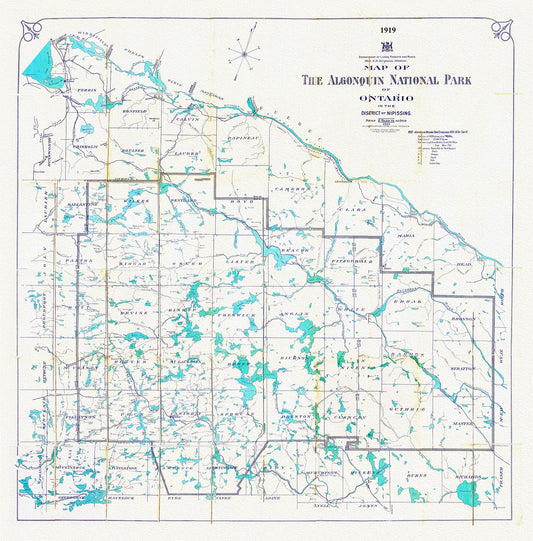
Historic Algonquin Park Map, Lands, Forests, Mines, 1919, map on heavy cotton canvas, 20 x 25" approx.
Regular price $45.00 CADRegular price -
Muskoka & Parry Sound District, 1893 , map on heavy cotton canvas, 20 x 25" approx.
Regular price $45.00 CADRegular price -
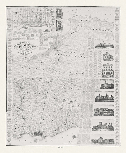
York County: Tremaine's Map of the County of York, Canada West, 1860, map on heavy cotton canvas, 22x27" approx.
Regular price $45.00 CADRegular price -
Map of the Lakehead, Northwestern Ontario Region, 1959, map on heavy cotton canvas, 50 x 70cm, 20 x 25" approx.
Regular price $45.00 CADRegular price -
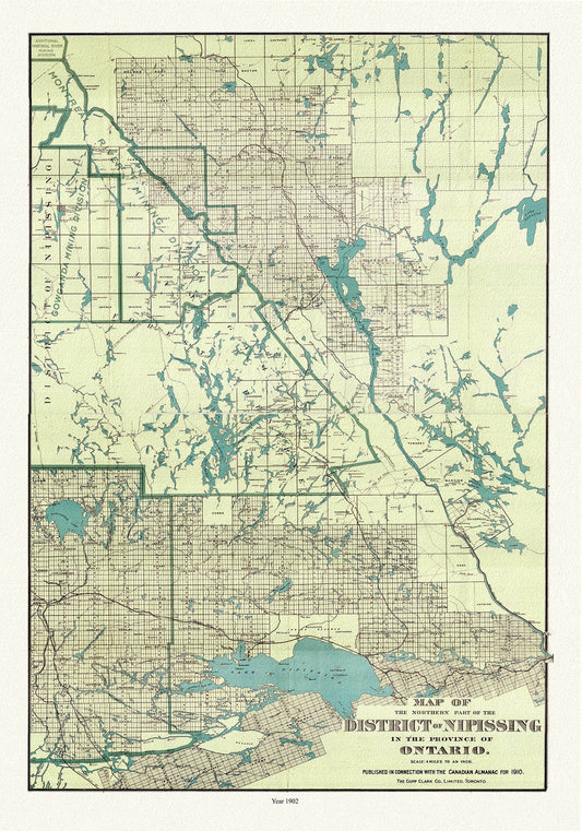
Map of the northern part of the District of Nipissing in the province of Ontario, 1902 Ver. II , map on canvas, 50 x 70cm, 20 x 25" approx.
Regular price $45.00 CADRegular price -
Mineral district, Northern Ontario, South Sheet, 1911, map on heavy cotton canvas, 50 x 70cm, 20 x 25" approx.
Regular price $45.00 CADRegular price -
Plate 56, Toronto West, High Park East, Parkdale & Brockton, 1923, Map on heavy cotton canvas, 18x27in. approx.
Regular price $45.00 CADRegular price