-
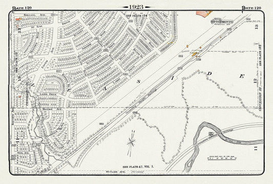
Plate 120, Toronto Uptown East, Leaside Station Junction, 1923, Map on heavy cotton canvas, 18x27in. approx.
Regular price $45.00 CADRegular price -
Plate 56, Toronto West, High Park East, Parkdale & Brockton, 1910 , map on heavy cotton canvas, 20 x 30" approx.
Regular price $45.00 CADRegular price -
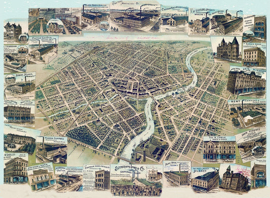
Bird's eye view of Chatham, Ontario, 1870, map on heavy cotton canvas, 22x27" approx.
Regular price $45.00 CADRegular price -
Canada, Department of Interior, Hamilton, 1915, map on heavy cotton canvas, 22x27" approx.
Regular price $45.00 CADRegular price -
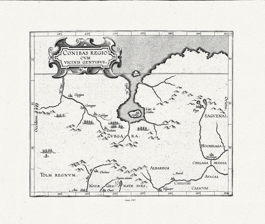
Wytfliet, Corneille, Conibas regio cum vicinis gentibus, (Central Canada), 1597, map on heavy cotton canvas, 22x27" approx.
Regular price $45.00 CADRegular price -
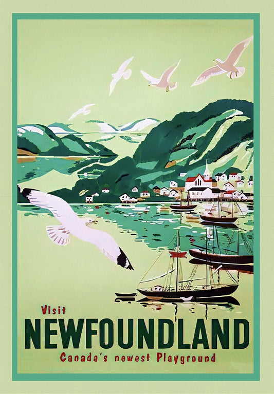
Visit Newfoundland Canada, 1965, Travel Poster on heavy cotton canvas, 22x27" approx.
Regular price $45.00 CADRegular price -
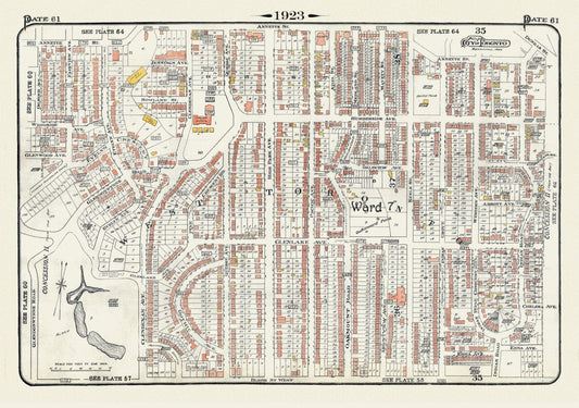
Plate 61, Toronto West, High Park North, 1923, Map on heavy cotton canvas, 18x27in. approx.
Regular price $45.00 CADRegular price -
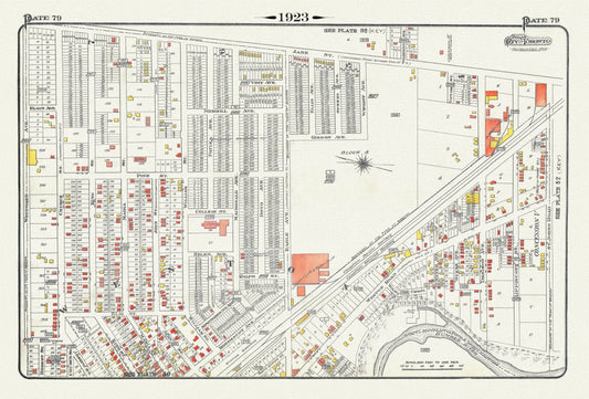
Plate 79, Toronto North West, Weston, 1923, Map on heavy cotton canvas, 18x27in. approx.
Regular price $45.00 CADRegular price -
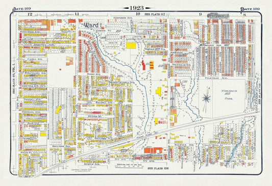
Plate 109, Toronto East, Leslieville North, Monarch Park, 1923, Map on heavy cotton canvas, 18x27in. approx.
Regular price $45.00 CADRegular price -
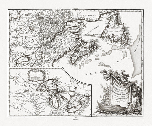
Bellin, La Nouvelle France où Canada, 1764 Ver. 2 , map on heavy cotton canvas, 50 x 70cm, 20 x 25" approx.
Regular price $45.00 CADRegular price -
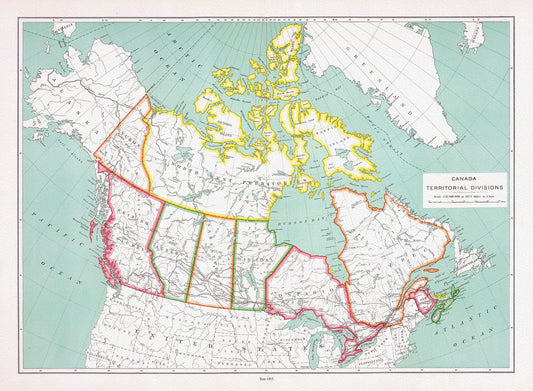
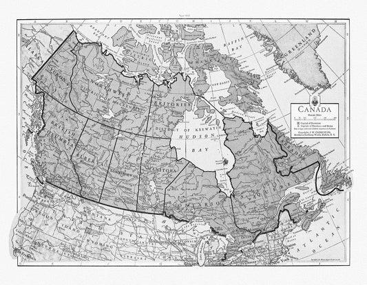
Canada territorial divisions, 1915, map on heavy cotton canvas, 22x27" approx
Regular price $45.00 CADRegular price -
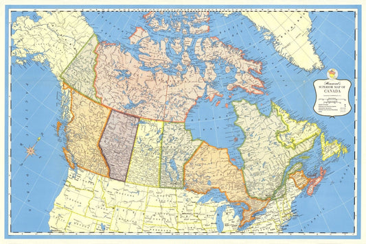
Hammond's Superior Map of Canada, 1957 , map on heavy cotton canvas, 22x27" approx.
Regular price $45.00 CADRegular price -
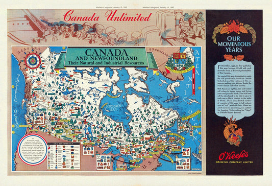
Canada and Newfoundland, Their natural and industrial resources, MacLean's Magazine, 1945, map on heavy cotton canvas, 22x27" approx.
Regular price $45.00 CADRegular price -
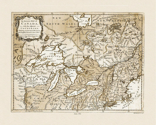
Canada, with the adjacent countries exhibiting the seat of war between the English & French in those parts, 1761 Ver. S, canvas-22x27"
Regular price $45.00 CADRegular price -
J.W. Clement Co., Canada, 1943 Ver. BW, map on heavy cotton canvas, 22x27" approx.
Regular price $45.00 CADRegular price -
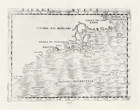
Ptolemy, Gastaldi et Mattioli, Tierra Nueva, 1548 , map on heavy cotton canvas, 22x27" approx.
Regular price $45.00 CADRegular price -
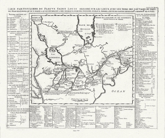
Henri Chatelain, Le Canada, 1719, map on heavy cotton canvas, 22x27" approx.
Regular price $45.00 CADRegular price -
Vaugondy (Robert de, Gilles, 1688-1766), Nouvelle France ou le Canada, 1755 , map on heavy cotton canvas, 22x27" approx.
Regular price $45.00 CADRegular price -
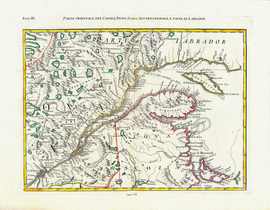
Mitchell, Rayanal et Zatta,Parte Orientale del Canada, Nuova Scozia Settentrionale, e Parte di Labrador, 1778, on canvas, 22x27"
Regular price $45.00 CADRegular price -
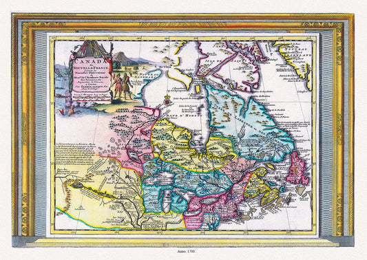
Aa, Canada ou Nouvelle France Suivant les Nouvelles Observations, 1700, map on heavy cotton canvas, 20 x 25" approx.
Regular price $45.00 CADRegular price -
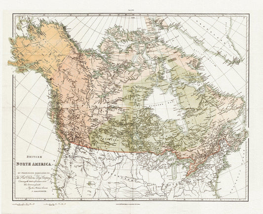
Arrowsmith, British North America by permission of The Hudsons Bay Company, 1854 , map on heavy cotton canvas, 20 x 25" approx.
Regular price $45.00 CADRegular price -
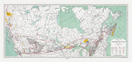
Canada. Department of Interior et Chalifour, Map Mineral map of the Dominion of Canada, 1915 , map on heavy cotton canvas, 20 x 25" approx.
Regular price $45.00 CADRegular price -
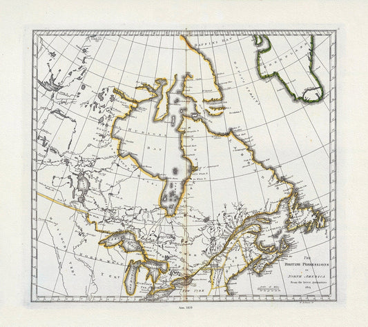
Carey, British Possessions in North America, 1818, map on heavy cotton canvas, 20 x 25" approx.
Regular price $45.00 CADRegular price -
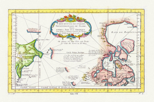
Carte reduite des parties septentrionales du globe, situees entre l'Asie et l'Amerique ,1758 , map on heavy cotton canvas, 20 x 25" approx.
Regular price $45.00 CADRegular price