-
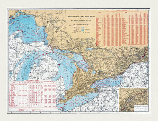
Department of the Interior, Canals, Lighthouses and sailing routes on St. Lawrence River & Great Lakes, 1915, cotton canvas, 22x27" approx.
Regular price $45.00 CADRegular price -
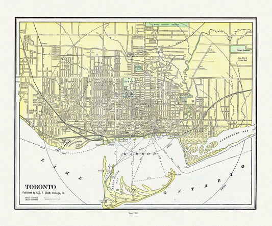
Toronto: Cram et Murray, 1901 , map on heavy cotton canvas, 22x27" approx.
Regular price $45.00 CADRegular price -
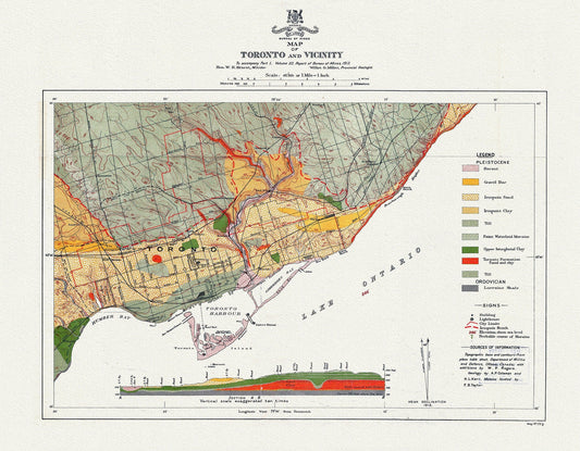
Map of Toronto and Vicinity To accompany part 1, Volume 22, Report of Bureau of Mines, 1913, map on heavy cotton canvas, 22x27" approx.
Regular price $45.00 CADRegular price -
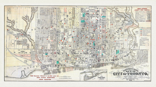
Toronto, Areas Exempt from Real Estate Taxation, 1878, map on heavy cotton canvas, 22x27" approx.
Regular price $45.00 CADRegular price -
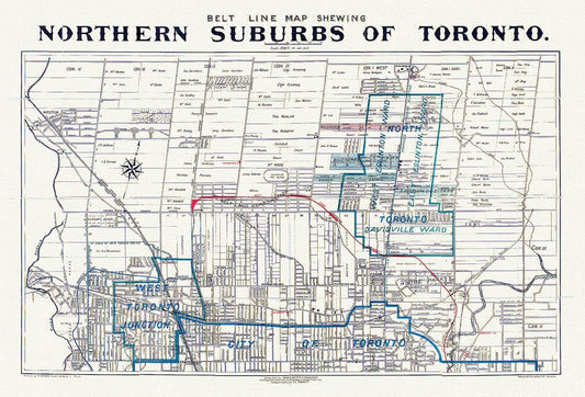
Toronto: Unwin Foster & Proudfoot, Beltline Map of Toronto, 1890
Regular price $45.00 CADRegular price -
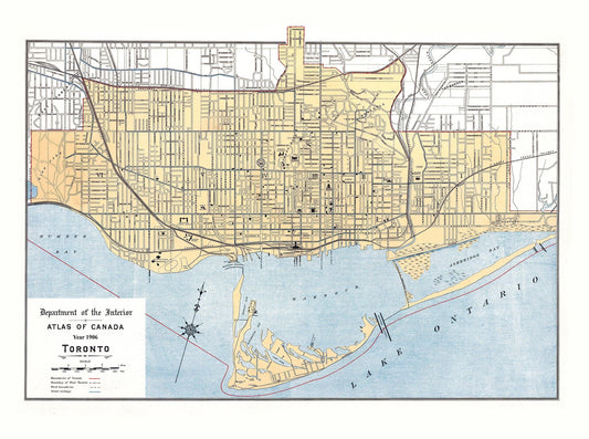
Toronto: White et Canada Department of Interior, Toronto, 1906
Regular price $45.00 CADRegular price -
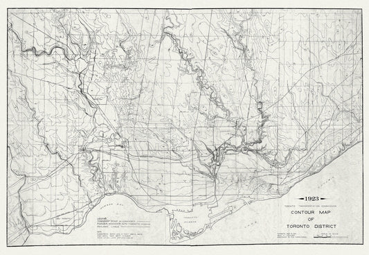
Toronto: Contour Map , 1923 , map on heavy cotton canvas, 22x27" approx.
Regular price $45.00 CADRegular price -
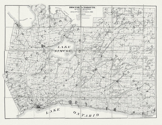
Toronto: Diocese of Toronto, 1883 , map on heavy cotton canvas, 22x27" approx.
Regular price $45.00 CADRegular price -
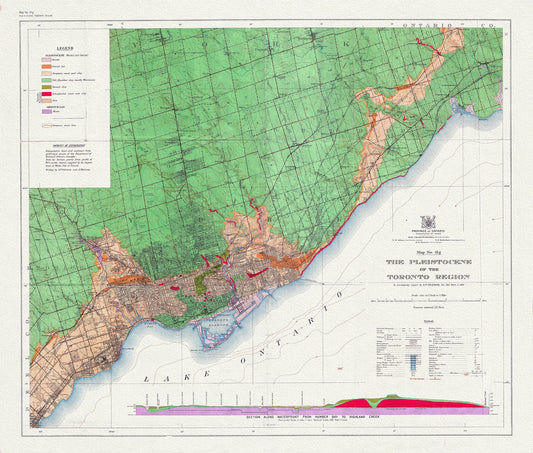
Toronto: Map of the Pleistocene of the Toronto Region, 1932 , map on heavy cotton canvas, 22x27" approx.
Regular price $45.00 CADRegular price -
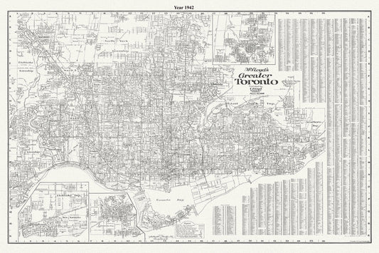
Lloyd's Map of Greater Toronto, 1942, Lloyd's Map, , map on durable cotton canvas, 50 x 70 cm, 20 x 25" approx.
Regular price $45.00 CADRegular price -
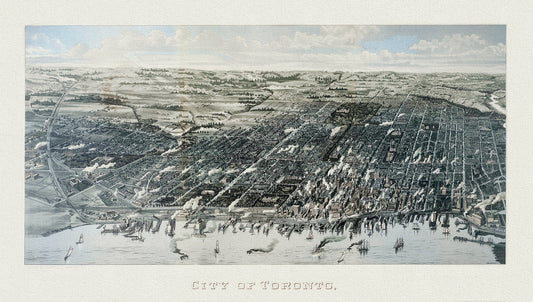
Wesbroom, View of Toronto, 1886, map on heavy cotton canvas, 22x27" approx.
Regular price $45.00 CADRegular price -
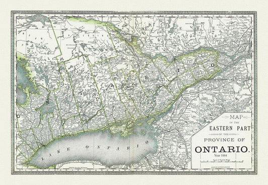
H.H. Hardesty & Co., Map of Ontario, No. 2, Eastern Part, 1884, map on heavy cotton canvas, 22x27" approx
Regular price $45.00 CADRegular price -
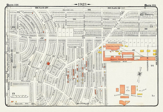
Plate 124, Toronto North, Leaside, 1923, Map on heavy cotton canvas, 18x27in. approx.
Regular price $45.00 CADRegular price -
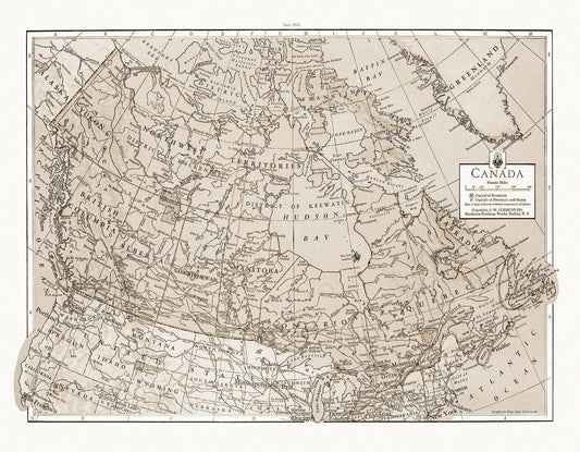
J.W. Clement Co., Canada, 1943 Ver. S, map on heavy cotton canvas, 20 x 25" approx.
Regular price $45.00 CADRegular price -
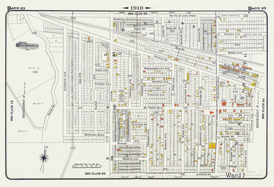
Plate 63, Toronto West, Junction & Stockyards, 1910 , map on heavy cotton canvas, 20 x 30" approx.
Regular price $45.00 CADRegular price -
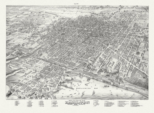
Bird's eye view of the City of Hamilton, Ontario, 1876 , map on durable cotton canvas, 50 x 70 cm, 20 x 25" approx.
Regular price $45.00 CADRegular price -
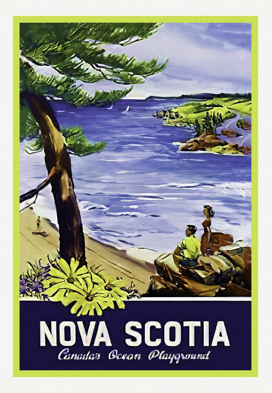
Nova Scotia, Canada's Ocean Playground, 1965, Travel Poster on heavy cotton canvas, 22x27" approx.
Regular price $45.00 CADRegular price -
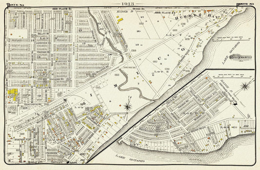
Plate 83, Toronto West, South Etobicoke South, Mimico, 1913, map on heavy cotton canvas, 20 x 30" or 50 x 75cm. approx.
Regular price $45.00 CADRegular price -
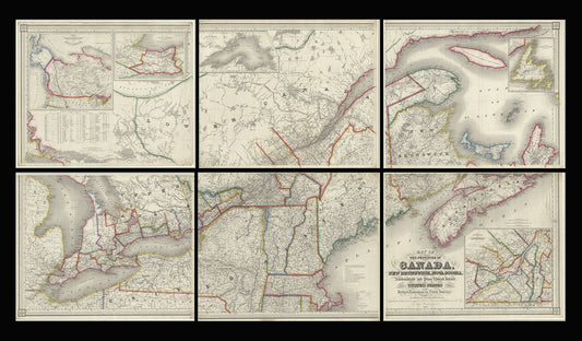
Map of the provinces of Canada, New Brunswick, Nova Scotia, Newfoundland and Prince Edward Island, a set of 6 highly detailed maps on canvas
Regular price $300.00 CADRegular price -
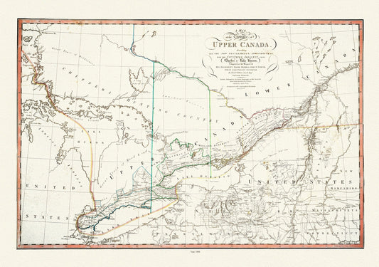
Smyth, The Province of Upper Canada describing all the new settlements, townships, 1800 , map on heavy cotton canvas, 22x27" approx.
Regular price $45.00 CADRegular price -
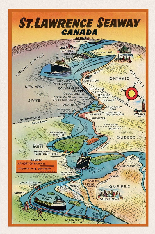
St. Lawrence Seaway Canada , map on durable cotton canvas, 50 x 70 cm, 20 x 25" approx.
Regular price $45.00 CADRegular price -
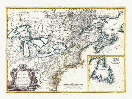
Vaugondy, Carte du Canada et des Etats Unis de l'Amérique Septentrionale, 1778 , map on heavy cotton canvas, 22x27" approx.
Regular price $45.00 CADRegular price -
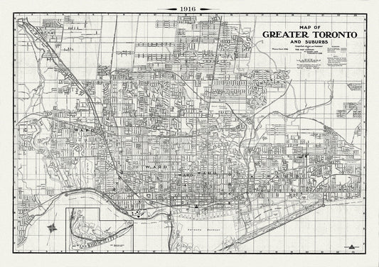
Toronto: Map of Greater Toronto & Suburbs, 1916 , map on heavy cotton canvas, 22x27" approx.
Regular price $45.00 CADRegular price -
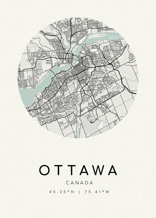
Ottawa, A Modern Map, Ver. II, on heavy cotton canvas, 45 x 65 cm, 18 x 24" approx
Regular price $45.00 CADRegular price