-
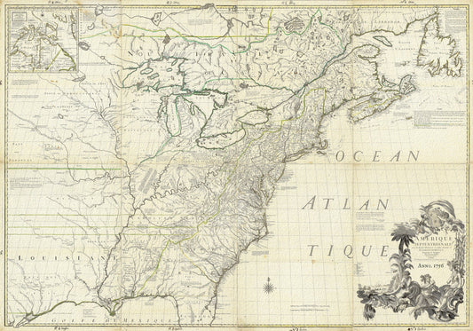
North America, 1756, Carey auth., map on durable cotton canvas, 50 x 70 cm, 20 x 25" approx.
Regular price $45.00 CADRegular price -
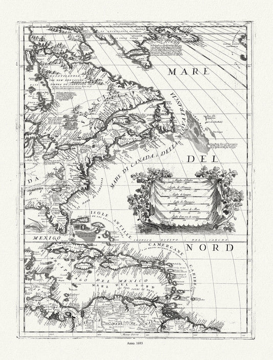
Coronelli (Vicenzo 1650-1718), America Settentrionale (parte orientale)), 1693, map on durable cotton canvas, 50 x 70 cm, 20 x 25" approx.
Regular price $45.00 CADRegular price -
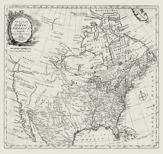
Carver, A new map of North America, from the latest discoveries, 1778, map on durable cotton canvas, 50 x 70 cm, 20 x 25" approx.
Regular price $45.00 CADRegular price -
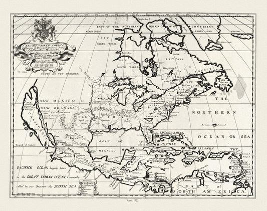
A new map of North America shewing its principal divisions.,1722, map on durable cotton canvas, 50 x 70 cm, 20 x 25" approx.
Regular price $45.00 CADRegular price -
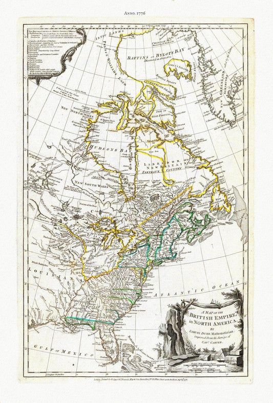
A Map of The British Empire in North America, 1776, Jefferys auth., map on durable cotton canvas, 50 x 70 cm, 20 x 25" approx.
Regular price $45.00 CADRegular price -
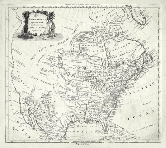
North America, Conder auth., 1774, map on durable cotton canvas, 50 x 70 cm, 20 x 25" approx.
Regular price $45.00 CADRegular price -
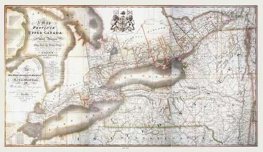
Map of the province of Upper Canada and the adjacent territories in North America, 1826 , map on heavy cotton canvas, 22x27" approx.
Regular price $45.00 CADRegular price -
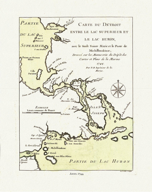
Bellin, Carte du Detroit entre le Lac Superieur et Huron, avec le Sault Ste. Marie, 1744, map on heavy cotton canvas, 50x70cm approx.
Regular price $45.00 CADRegular price -
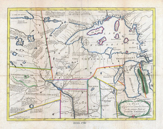
Carver, Interior, North America, 1781, map on heavy cotton canvas, 50x70cm (20 x 25") approx.
Regular price $45.00 CADRegular price -
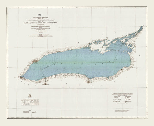
International boundary between the U.S. and Canada through the St. Lawrence River and Great Lakes, 1951 , map on canvas, 50x70cm approx.
Regular price $45.00 CADRegular price -
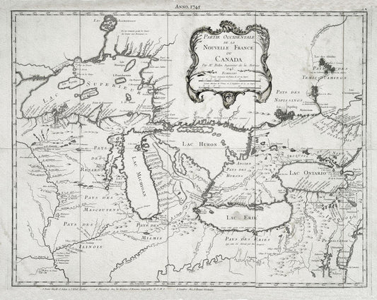
Jacques Nicolas Bellin, Le Canada, 1745, map on heavy cotton canvas, 50x70cm (20 x 25") approx.
Regular price $45.00 CADRegular price -
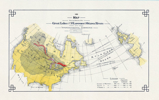
Great Lakes St. Lawrence, Ottawa Rivers and InterContinental Commerce, 1880, map on heavy cotton canvas, 50x70cm (20 x 25") approx.
Regular price $45.00 CADRegular price -
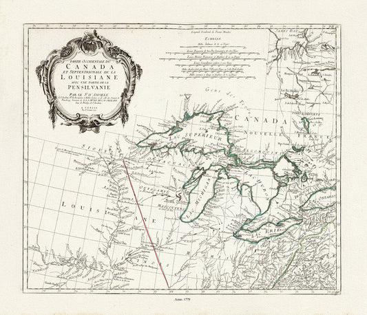
apres Vaugondy, Partie Occidentale du Canada et Septentrionale de la Louisiane, 1779, map on heavy cotton canvas, 50x70cm (20 x 25") approx.
Regular price $45.00 CADRegular price -
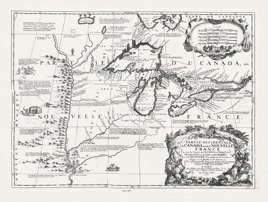
Partie occidentale du Canada ou de la Nouvelle France ou sont les Nations des Ilinois, avec la Louisiane, Coronelli, 1688, canvas 20 x 25"
Regular price $45.00 CADRegular price -
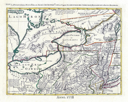
Zatta, Upper Canada, 1778, map on heavy cotton canvas, 50x70cm (20 x 25") approx.
Regular price $45.00 CADRegular price -
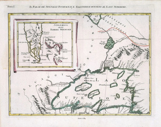
Zatta, Il Paese de' Selvaggi Outauacesi, e Kilistinesi Intorno al Lago Superiore, 1784 , map on heavy cotton canvas, 50x70cm approx.
Regular price $45.00 CADRegular price -
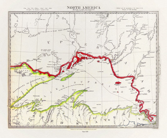
Society for the Diffusion of Useful Knowledge, North America, Lake Superior, 1838, map on heavy cotton canvas, 50 x 70cm, 20 x 27" approx.
Regular price $45.00 CADRegular price -
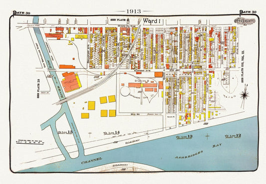
Plate 30, Toronto Waterfront East, Leslieville South, 1913, map on heavy cotton canvas, 20 x 30" approx.
Regular price $45.00 CADRegular price -
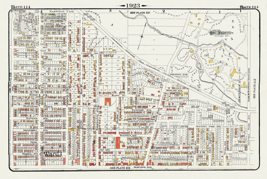
Plate 114, Toronto East, Danforth, Dentonia, Dawes Road, 1923, Map on heavy cotton canvas, 18x27in. approx.
Regular price $45.00 CADRegular price -
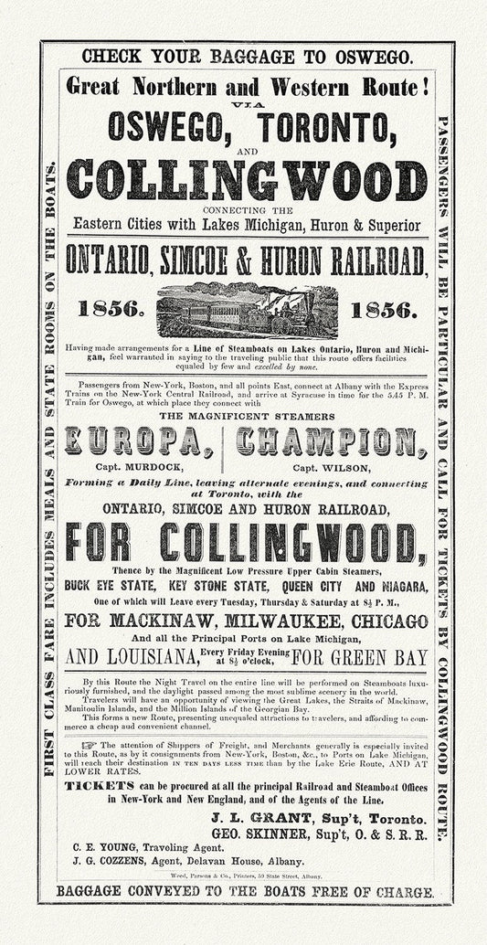
Railways to Collingwood, 1856, map on durable cotton canvas, 16x29" approx.
Regular price $45.00 CADRegular price -
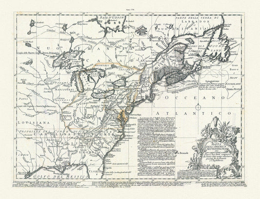
Mappa dell' America Settentrionale et i paesi e che hanno dato motivo alla guerra presente fra la Francia e l'Inghilterra, 1758, Bellin,
Regular price $45.00 CADRegular price -
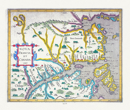
Nova Francia et Canada, 1597, , map on heavy cotton canvas, 50 x 70cm, 20 x 27" approx.
Regular price $45.00 CADRegular price -
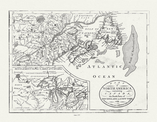
Part of North America,containing Canada, the north parts of New England and New York, with Nova Scotia and Newfoundland,1777, canvas, 20x25"
Regular price $45.00 CADRegular price -
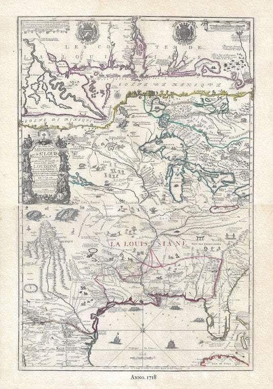
Louisiana & Great Lakes, 1718, de Fer auth. , map on heavy cotton canvas, 50 x 70cm, 20 x 27" approx.
Regular price $45.00 CADRegular price