-
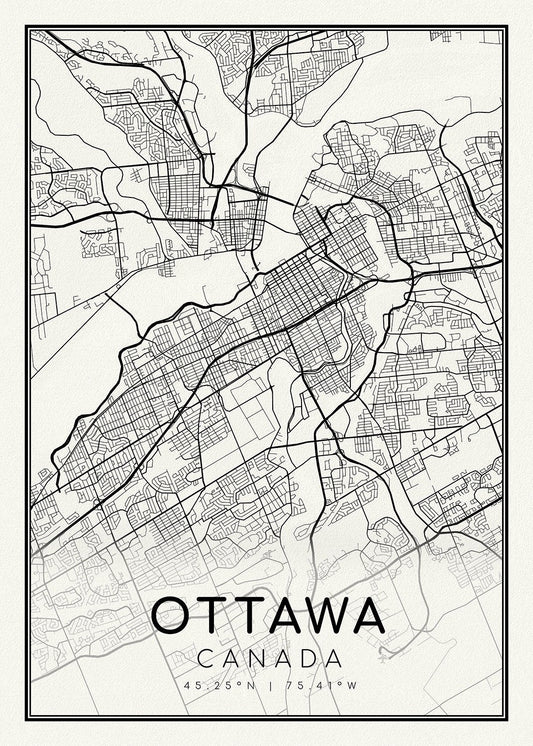
Ottawa, A Modern Map, on heavy cotton canvas, 45 x 65 cm, 18 x 24" approx.
Regular price $45.00 CADRegular price -
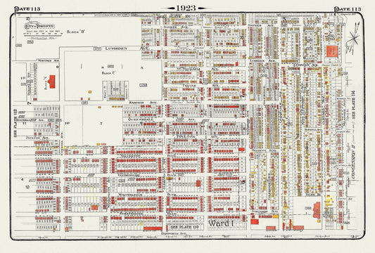
Plate 113, Toronto East York, Woodbine Ave. North of Danforth, 1923, Map on heavy cotton canvas, 18x27in. approx.
Regular price $45.00 CADRegular price -
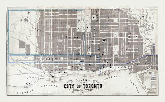
Toronto: Fleming, Plan of the City of Toronto, Canada West, 1857 , map on heavy cotton canvas, 22x27" approx.
Regular price $45.00 CADRegular price -
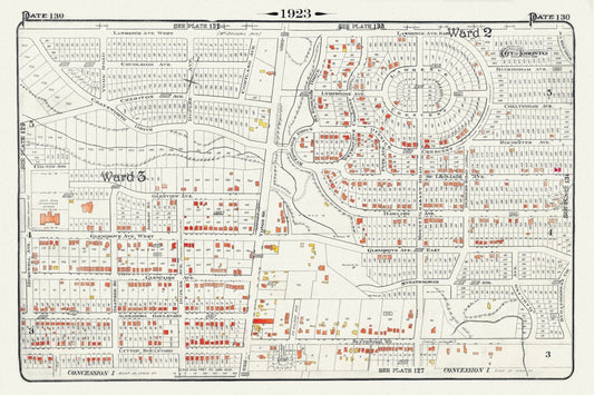
Plate 130, Toronto North, Lawrence Park , North of Blythewood, 1923, Map on heavy cotton canvas, 18x27in. approx.
Regular price $45.00 CADRegular price -
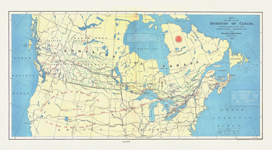
Dominion of Canada, shewing principal products, also railway & water routes, 1878, Smith auth. map on canvas, 50 x 70 cm, 20 x 25" approx.
Regular price $45.00 CADRegular price -
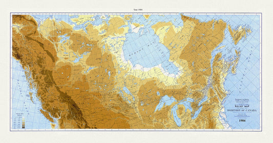
Relief map of the Dominion of Canada, 1904, White auth., map on durable cotton canvas, 50 x 70 cm, 20 x 25" approx.
Regular price $45.00 CADRegular price -
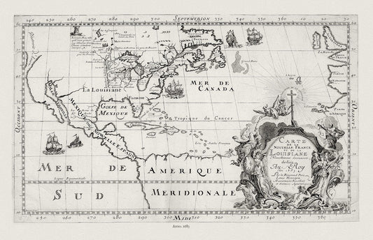
New France, 1683, Hennepin auth., map on durable cotton canvas, 50 x 70 cm, 20 x 25" approx.
Regular price $45.00 CADRegular price -
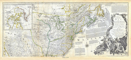
Jeffreys, North America, North East, 1776, map on durable cotton canvas, 21 x 33" approx.
Regular price $45.00 CADRegular price -
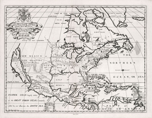
A New Map of North America, 1700, Wells auth., map on durable cotton canvas, 50 x 70 cm, 20 x 25" approx.
Regular price $45.00 CADRegular price -
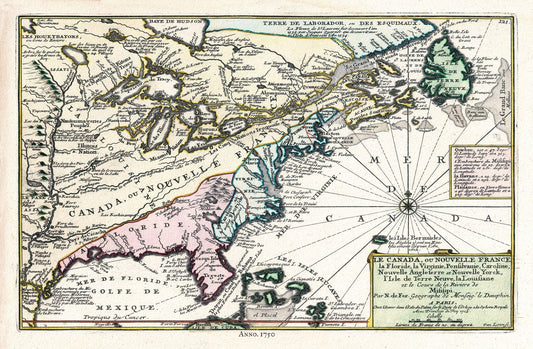
Canada, 1705, Fer auth., map on durable cotton canvas, 50 x 70 cm, 20 x 25" approx.
Regular price $45.00 CADRegular price -
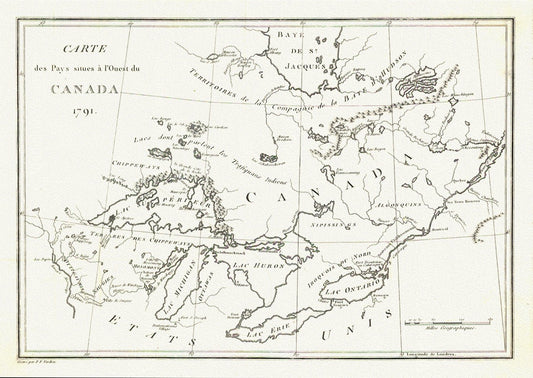
Carte des Pays situes a l'Ouest du Canada, Stephen H. Long auth.,1791, map on durable cotton canvas, 50 x 70 cm, 20 x 25" approx.
Regular price $45.00 CADRegular price -
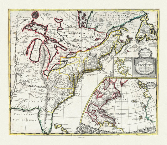
John Senex, New Map of the English Empire in America, 1721, map on durable cotton canvas, 50 x 70 cm, 20 x 25" approx.
Regular price $45.00 CADRegular price -
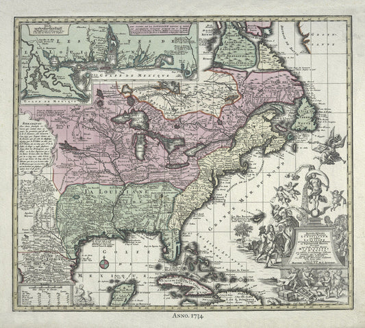
British North America, 1734 Rein auth., map on durable cotton canvas, 50 x 70 cm, 20 x 25" approx.
Regular price $45.00 CADRegular price -
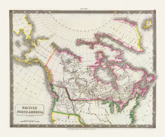
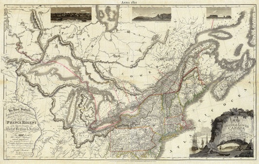
Canada, Hall auth., 1829
Regular price $45.00 CADRegular price -
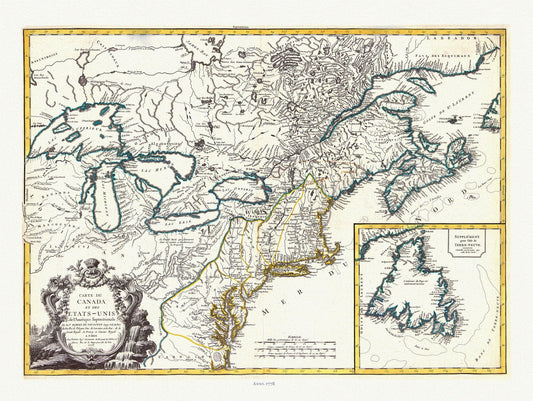
Carte du Canada et des Etats Unis de l'Amérique Septentrionale, 1778, Vaugondy auth, map on durable canvas, 50 x 70 cm, 20 x 25" approx.
Regular price $45.00 CADRegular price -
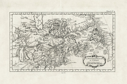
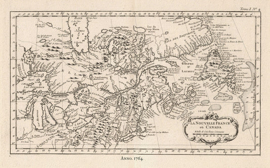
E La Nouvelle France où Canada,Bellin,1764 Ver. I,II, map on durable cotton canvas, 50 x 70 cm, 20 x 25" approx.
Regular price $45.00 CADRegular price -
Bouchette, Map Of The Provinces Of Canada, 1846, map on durable cotton canvas, 50 x 70 cm, 20 x 25" approx.
Regular price $45.00 CADRegular price -
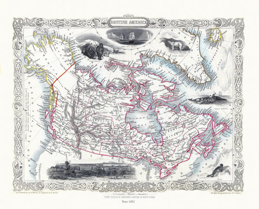
E British America, Tallis, 1851 Ver. II
Regular price $45.00 CADRegular price -
Arbuckle's Illustrated Atlas, Canada, 1890, map on durable cotton canvas, 50 x 70 cm, 20 x 25" approx.
Regular price $45.00 CADRegular price -
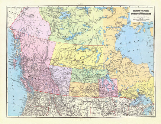
British Columbia, North West Territory, 1901, Stanford auth., map on durable cotton canvas, 50 x 70 cm, 20 x 25" approx.
Regular price $45.00 CADRegular price -
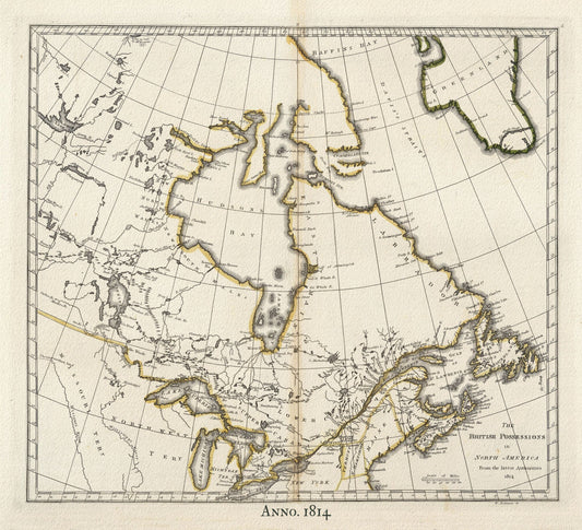
British North America,1814 Carey auth., map on durable cotton canvas, 50 x 70 cm, 20 x 25" approx.
Regular price $45.00 CADRegular price -
Canada, 1815, Bouchette auth., map on durable cotton canvas, 50 x 70 cm, 20 x 25" approx.
Regular price $45.00 CADRegular price -
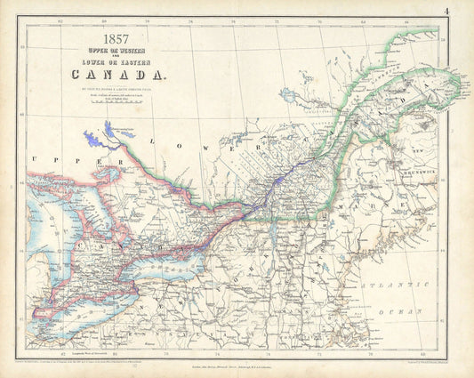
Canada ,Central,1857, Johnston auth., map on durable cotton canvas, 50 x 70 cm, 20 x 25" approx.
Regular price $45.00 CADRegular price -
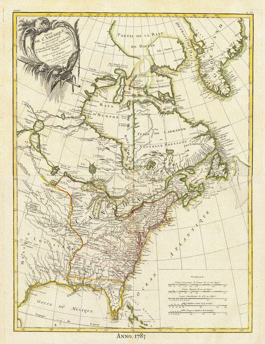
North America, 1783 Bonne auth., map on durable cotton canvas, 50 x 70 cm, 20 x 25" approx.
Regular price $45.00 CADRegular price