-
Map from the Pacific Ocean across the Rocky Mountain zone to accompany report on the exploratory survey.CPR.1874, 20x25" approx.
Regular price $45.00 CADRegular price -
Map of the central section of British Columbia shewing the county served by the Grand Trunk Pacific Railway, 1911, 20 x 25" approx.
Regular price $45.00 CADRegular price -
Map of the south-western part of British Columbia, Vernon, 1892, map on durable cotton canvas, 50 x 70 cm, 20 x 25" approx.
Regular price $45.00 CADRegular price -
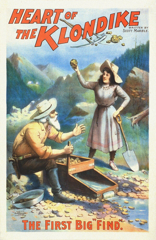
The Heart of the Klondike, The First Big Find, A Book, vintage print on canvas, 50 x 70 cm, 20 x 25" approx.
Regular price $45.00 CADRegular price -
Klondike Game Co., Going to Klondyke, 1897, vintage print on canvas, 50 x 70 cm, 20 x 25" approx.
Regular price $45.00 CADRegular price -


North America polar regions Baffin Bay to E Lincoln Sea, showing the most recent discoveries, 20x25"
Regular price $45.00 CADRegular price -
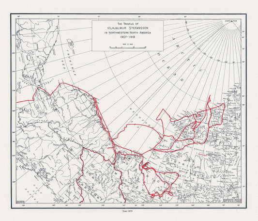
E The travels of Vilhjalmur Stefansson, 1859 , map on durable cotton canvas, 50 x 70 cm, 20 x 25" approx.
Regular price $45.00 CADRegular price -
Klondike gold region, Yukon district, Dominion of Canada by the Klondyke Parent Pioneer Corporation, 1898,' 50 x 70 cm, 20 x 25" approx.
Regular price $45.00 CADRegular price -
Map of Alaska, Yukon Territory and British Columbia showing connections of the White Pass and Yukon route, 1904 , 20 x 25" approx.
Regular price $45.00 CADRegular price -
Map of White Pass & Yukon Route and connections, 1915 , map on durable cotton canvas, 50 x 70 cm, 20 x 25" approx.
Regular price $45.00 CADRegular price -
Map of Yukon District with the adjacent northern part of British Columbia, 1903, map on durable cotton canvas, 50 x 70 cm, 20 x 25" approx.
Regular price $45.00 CADRegular price -
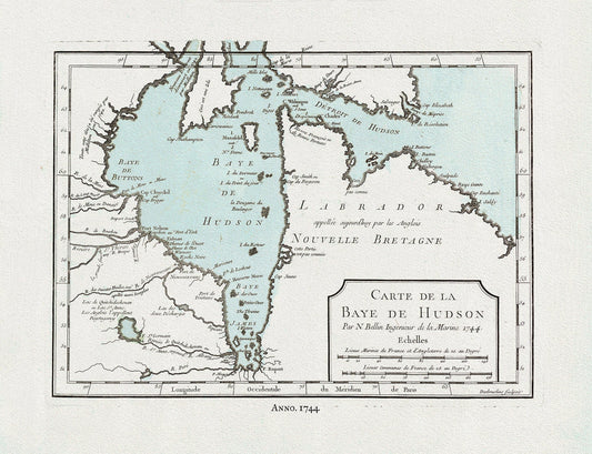
Bellin, Carte de la Bye de Hudson, 1744 Ver. II, map on heavy cotton canvas, 22x27" approx.
Regular price $45.00 CADRegular price -
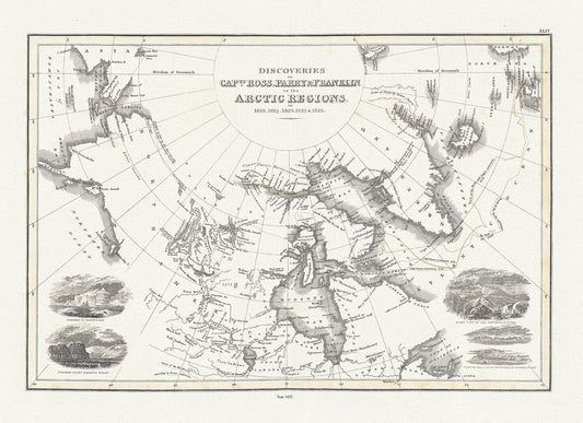
Discoveries of Capts. Ross, Parry and Franklin in the Arctic Regions, in 1818, 1819, 1820, 1821 & 1822, Wyld auth.,1823, 20x25" approx
Regular price $45.00 CADRegular price -
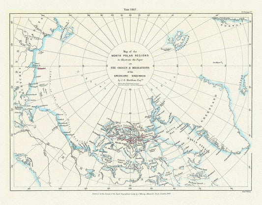
A Map of the north polar regions to illustrate the paper on the origin & migrations of the Greenland Esquimaux,1865
Regular price $45.00 CADRegular price -
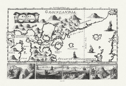
Greenland and Canada, Le Peyrere auth., 1679 , map on durable cotton canvas, 50 x 70 cm, 20 x 25" approx.
Regular price $45.00 CADRegular price -
Mackenzie's Track, between latitudes 40 and 70 north, and longitudes 45 and 180 west, 1793 , map on canvas, 50 x 70 cm, 20 x 25" approx.
Regular price $45.00 CADRegular price -
New Northwest Exploration, in Portions of Alberta and Saskatchewan, 1909 , map on durable cotton canvas, 50 x 70 cm, 20 x 25" approx.
Regular price $45.00 CADRegular price -
Recent discoveries in the Arctic Regions, 1833 Aspin auth. , map on durable cotton canvas, 50 x 70 cm, 20 x 25" approx.
Regular price $45.00 CADRegular price -
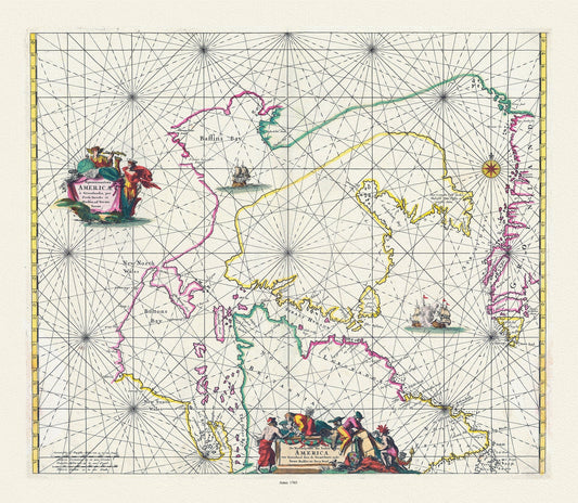
Septemtrionaliora Americae a Groenlandia, Freta Davidis et Hudson, Groenland door de Straet Davis ende Straet Hudson tot Terra Neuf, 1765
Regular price $45.00 CADRegular price -
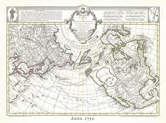
The Northern Hemisphere, 1750, Buache, , map on heavy cotton canvas, 50 x 70cm, 20 x 25" approx.
Regular price $45.00 CADRegular price -
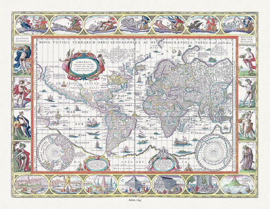
Nova totius terrarum orbis geographica ac hydrographica tabula, 1643, Blaeu authore,bright or dull versions, map, 20x25" approx.
Regular price $45.00 CADRegular price -
North Pole, with the countries hitherto discovered situated near or adjacent to it as well as some others more remote.1747, canvas 20x25"
Regular price $45.00 CADRegular price -
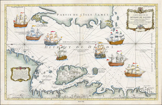
Detroit de Davids (Davis Strait), 1764. Bellin auth.
Regular price $45.00 CADRegular price -
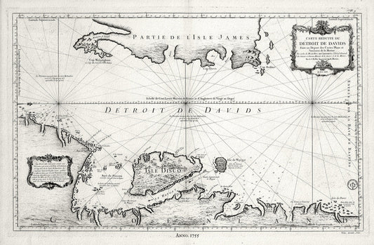
Davis Strait, 1755, Bellin auth., map on heavy cotton canvas, 50 x 70cm, 20 x 25" approx.
Regular price $45.00 CADRegular price