-
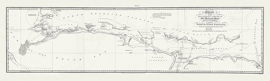
Chart of the Discoveries & Route of his Majesty's Ships Hecla and Griper in search of a North West Passage, 1821 20x66"
Regular price $75.00 CADRegular price -
Nouvelle carte des parties, oul'on a cherche le passage de nord-ouest dans les anneees 1746 et 1747, Ellis auth 20x50" approx.
Regular price $70.00 CADRegular price -
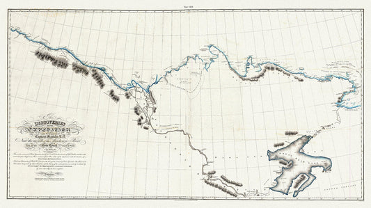
Discoveries of the expedition under the command of Captain Franklin R.N. near the mouth of the Mackenzie River, 1828 map, 20 x 36" approx.
Regular price $45.00 CADRegular price -
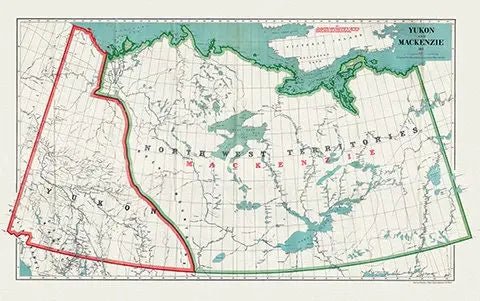
Yukon and Mackenzie, 1911, Map on heavy canvas, 22x27" approx.
Regular price $45.00 CADRegular price -
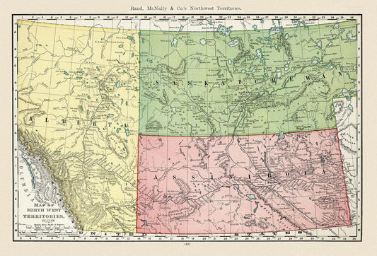
The North West Territories, 1892, Map on heavy cotton canvas, 22x27" approx.
Regular price $45.00 CADRegular price -
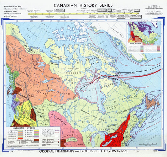
Map of Canadian History & Exploration, 1965, on heavy cotton canvas, 22x27" approx.
Regular price $45.00 CADRegular price -
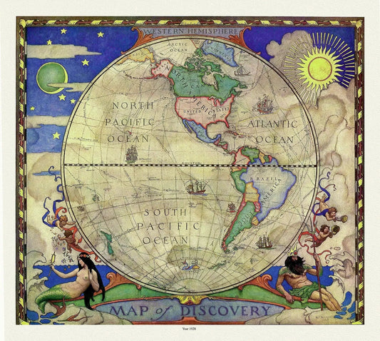
Western Hemisphere, A Map of Discovery, Wyeth auth., 1928, map on heavy cotton canvas, 50 x 70 cm, 20 x 25" approx.
Regular price $45.00 CADRegular price -
Northern Alberta land districts comprising agencies of Peace River, Grande Prairie, Edmonton showing homestead entry, 1919, canvas, 22x27"
Regular price $45.00 CADRegular price -
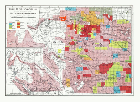
Department of the Interior, Origin of the Population for 1911 British Columbia and Alberta, issued 1915 ,heavy cotton canvas, 22x27" approx.
Regular price $45.00 CADRegular price -
Northern Alberta, map showing disposition of lands, 1918 South Sheet, map on heavy cotton canvas, 22x27" approx.
Regular price $45.00 CADRegular price -
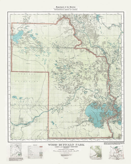
Wood Buffalo Park, Alberta and Northwest Territories, 1931 , map on heavy cotton canvas, 22x27" approx.
Regular price $45.00 CADRegular price -
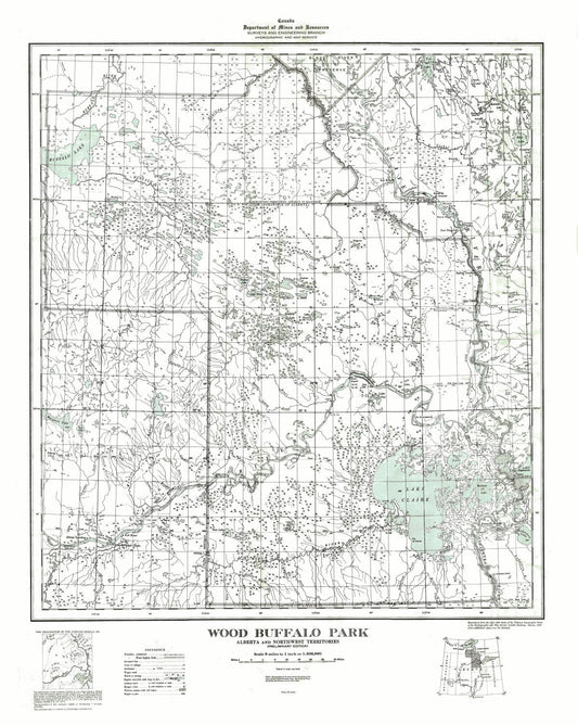
Wood Buffalo Park, Alberta and Northwest Territories, 1947
Regular price $45.00 CADRegular price -
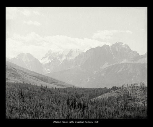
Ottertail Range, Canada, In The Canadian Rockies, 1900, vintage photograph reprinted on durable cotton canvas, 50 x 70 cm, 20 x 25" approx.
Regular price $45.00 CADRegular price -
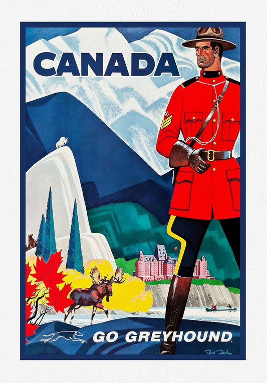
Canada, Go Greyhound , travel poster on heavy cotton canvas, 20x25" approx.
Regular price $45.00 CADRegular price -
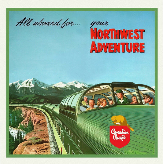
Northwest Adventure, Canadian Pacific, travel poster on heavy cotton canvas, 50 x 70 cm, 20 x 22" approx.
Regular price $45.00 CADRegular price -
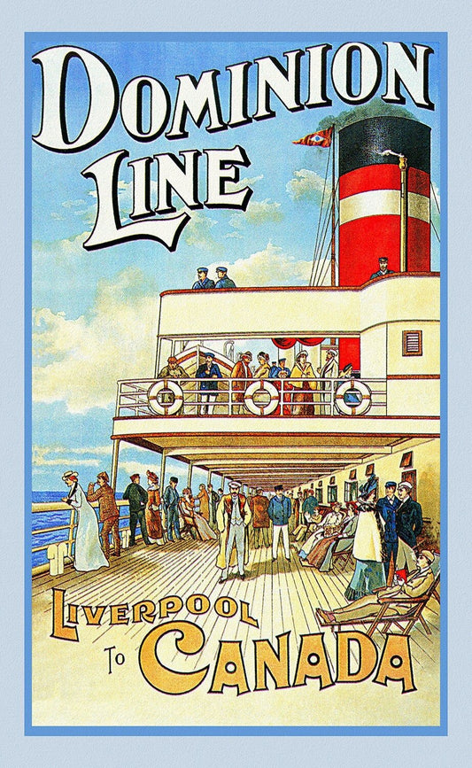
Liverpool to Canada, Dominion Line , vintage travel poster on heavy cotton canvas, 50 x 70 cm, 20 x 25" approx.
Regular price $45.00 CADRegular price -
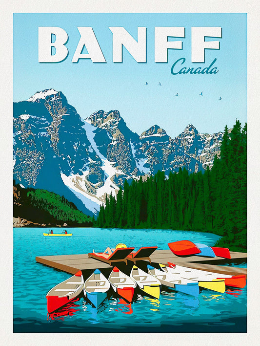
Banff, Canada, travel poster on heavy cotton canvas, 22x27" approx.
Regular price $45.00 CADRegular price -
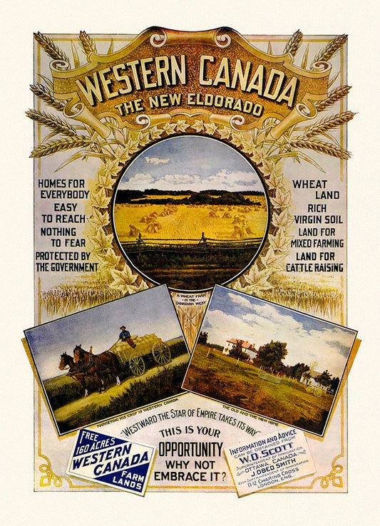
Western Canada, The New Eldorado, vintage poster on heavy cotton canvas, 22x27" approx.
Regular price $45.00 CADRegular price -
Northern Alberta, Map showing wooded and prairie tracts, etc.,by J.B. Tyrrell, 1884 , map on heavy cotton canvas, 20x27" approx.
Regular price $45.00 CADRegular price -
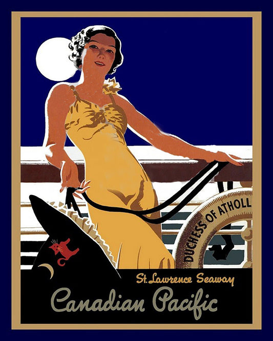
Canadian Pacific, St. Lawrence Seaway, travel poster on heavy cotton canvas, 22x27" approx.
Regular price $45.00 CADRegular price -
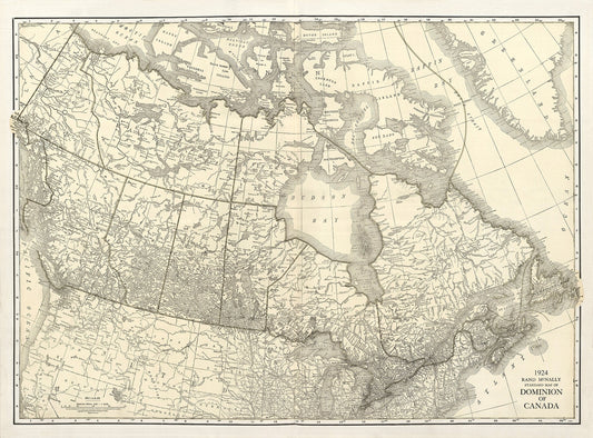
Rand McNally & Company, Commercial Atlas, Canada, 1924 Ver. I , map on heavy cotton canvas, 20 x 25" approx.
Regular price $45.00 CADRegular price -
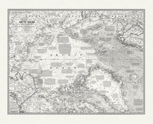
Arctic Ocean, National Geographic, 1971, map on heavy cotton canvas, 50 x 70 cm, 20 x 25" approx.
Regular price $45.00 CADRegular price -
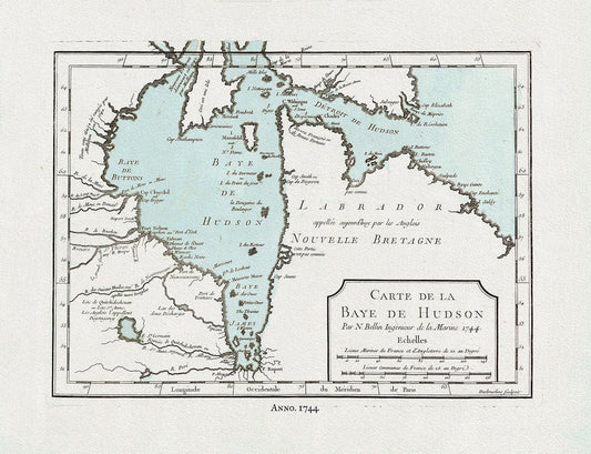
Bellin, Carte de la Bye de Hudson, 1744 Ver. II, map on heavy cotton canvas, 50 x 70 cm, 20 x 25" approx.
Regular price $45.00 CADRegular price -
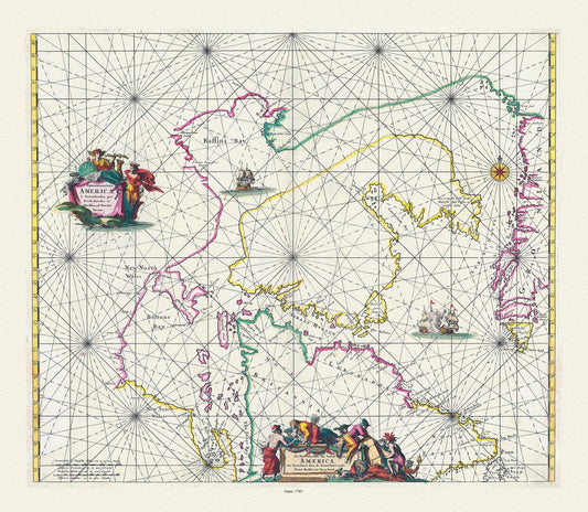
Septemtrionaliora Americae a Groenlandia, per Davidis et Hudson, Witt auth., 1765, map on heavy cotton canvas, 50 x 70 cm, 20 x 25" approx.
Regular price $45.00 CADRegular price