-
Map of Newfoundland, Canada, Author Coronelli, 1692, on Heavy clear coated natural cotton canvas, 20x24" approx.
Regular price $40.00 CADRegular price -
Map of part of Keewatin shewing Dominion land surveys, 1876 [south Kenora district], map on durable canvas, 50 x 70 cm, 20 x 25" approx.
Regular price $45.00 CADRegular price -
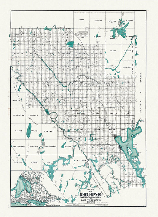
Map of part of the District of Nipissing showing Agricultural lands on Lake Temiskaming Ontario, 1907, map on canvas, 20 x 25" approx.
Regular price $45.00 CADRegular price -
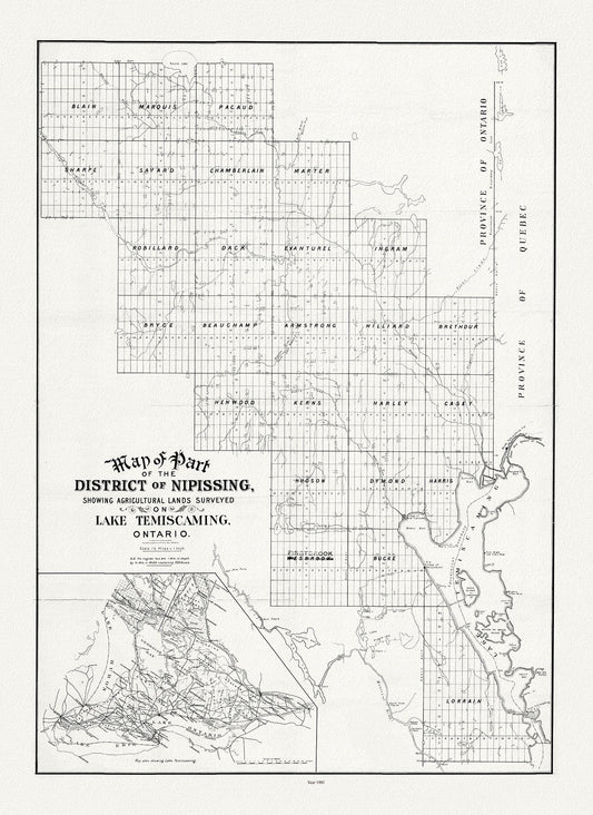
Map of part of the district of Nipissing showing agricultural lands surveyed on Lake Temiscaming, Ontario, 1901
Regular price $45.00 CADRegular price -
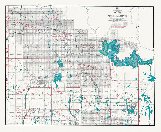
Map of part of the District of Timiskaming showing Lake Abitibi and along the line of the National Transcontinental Railway, 1917, 22x27"
Regular price $45.00 CADRegular price -
Map of portion of Southern Interior of British Columbia ,the explorations in 1877, Dawson, , map on heavy cotton canvas, 20 x 25" approx.
Regular price $45.00 CADRegular price -


Map of Prince Edward County, Ontario, 1923, map on heavy cotton canvas, 45 x 65 cm, 18 x 24" approx.
Regular price $45.00 CADRegular price -
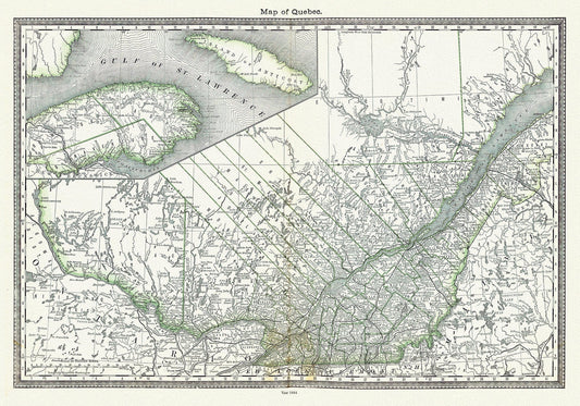
Map of Quebec, 1884, Hardesty & Co. auth. , map on durable cotton canvas, 50 x 70 cm, 20 x 25" approx.
Regular price $45.00 CADRegular price -
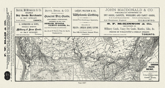
Map of the Canadian Pacific Railway, and its connections, 1887 , map on heavy cotton canvas, 50 x 70cm, 20 x 25" approx.
Regular price $45.00 CADRegular price -
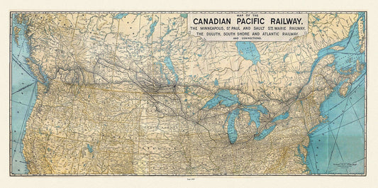
Map of the Canadian Pacific Railway, the Minneapolis, St. Paul and Sault Ste. Marie, Railway, Duluth, South Shore et c., 1907, 22x27" canvas
Regular price $45.00 CADRegular price -
Map of the central section of British Columbia shewing the county served by the Grand Trunk Pacific Railway, 1911, 20 x 25" approx.
Regular price $45.00 CADRegular price -
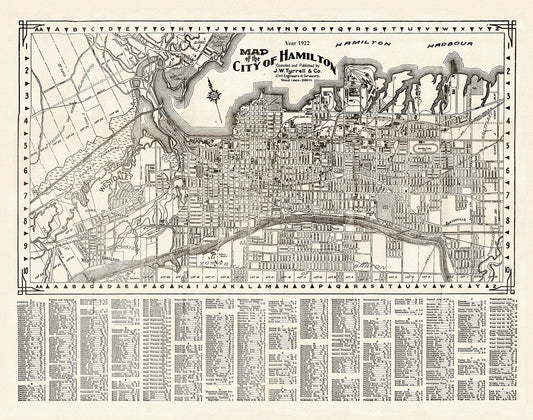
Map of the City of Hamilton, 1922, on heavy cotton canvas, 22x27" approx.
Regular price $45.00 CADRegular price -
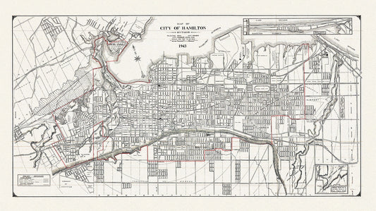
Map of the City of Hamilton, Ontario, 1943, on heavy cotton canvas, 22x27" approx.
Regular price $45.00 CADRegular price -
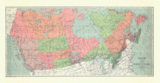
Map of the Dominion of Canada, 1900, on heavy cotton canvas, 20 x 25" approx.
Regular price $45.00 CADRegular price -
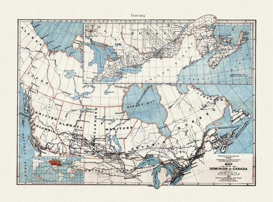
Map of the Dominion of Canada, 1914 , map on heavy cotton canvas, 20 x 25" approx.
Regular price $45.00 CADRegular price -
Map of the Dominion of Canada, showing Indian reserves, 1891,, vintage map reprinted on durable cotton canvas, 16 x 30" approx.
Regular price $45.00 CADRegular price -
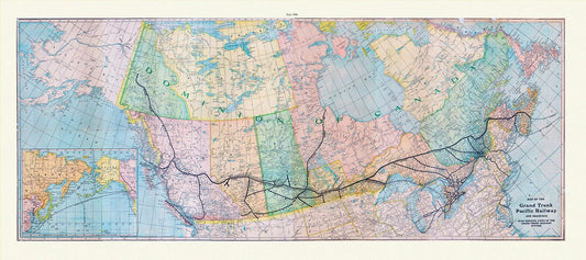
Map of the Grand Trunk Pacific Railway and branches, also showing lines of the Grand Trunk Railway System, 1906, on heavy canvas, 22x27"
Regular price $45.00 CADRegular price -
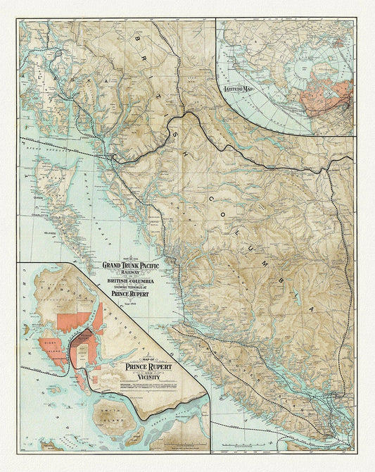
Map Of The Grand Trunk Pacific Railway In British Columbia, 1910, map on heavy cotton canvas, 20 x 30" or 50 x 75cm. approx.
Regular price $45.00 CADRegular price -
Map Of The Grand Trunk Pacific Railway In British Columbia, 1910, Map on heavy cotton canvas, 22x27" approx.
Regular price $45.00 CADRegular price -
Map of the Grand Trunk Pacific Railway, also showing lines of the Grand Trunk Railway System, 1906 Western Section, 22x27" cotton canvas
Regular price $45.00 CADRegular price -
Map of the Lakehead, Northwestern Ontario Region, 1959, map on heavy cotton canvas, 50 x 70cm, 20 x 25" approx.
Regular price $45.00 CADRegular price -
Map of the north polar regions to illustrate the origin & migrations of the Greenland Esquimaux, 1865 ,on heavy cotton canvas, 22x27"
Regular price $45.00 CADRegular price -
Map of the North Shore Indian Reservations of Lake Huron, 1927 , map on durable cotton canvas, 50 x 70 cm or 20x25" approx.
Regular price $45.00 CADRegular price -
Map of the North Simcoe Railway, Ontario, 1890, map on durable cotton canvas, 50 x 70 cm or 20x25" approx.
Regular price $45.00 CADRegular price


![Map of part of Keewatin shewing Dominion land surveys, 1876 [south Kenora district], map on durable canvas, 50 x 70 cm, 20 x 25" approx. - The Map Chest](http://themapchest.ca/cdn/shop/products/map-of-part-of-keewatin-shewing-dominion-land-surveys-1876-south-kenora-district-map-on-durable-canvas-50-x-70-cm-20-x-25-approx-5878013.jpg?v=1759947537&width=533)