-
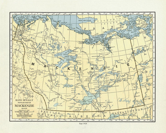
Mackenzie, 1924, Map on heavy cotton canvas, 22x27" approx.
Regular price $45.00 CADRegular price -
Mackenzie, 1924, Rand McNally & Company, Commercial Atlas, , map on durable cotton canvas, 50 x 70 cm, 20 x 25" approx.
Regular price $45.00 CADRegular price -
Mackinlay's map of the Province of Nova Scotia, including the island of Cape Breton, 1890
Regular price $45.00 CADRegular price -
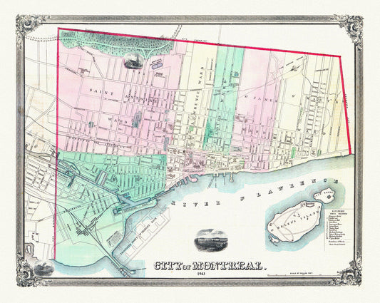
Magnus, City of Montreal, 1863, map on heavy cotton canvas, 20x27" approx.
Regular price $45.00 CADRegular price -
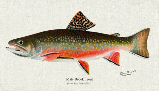
Male brook trout (Salvelinus Fontinalis), 1931, Denton auth., fishing print reprinted on durable cotton canvas, 50 x 70 cm, 20 x 25" approx.
Regular price $45.00 CADRegular price -
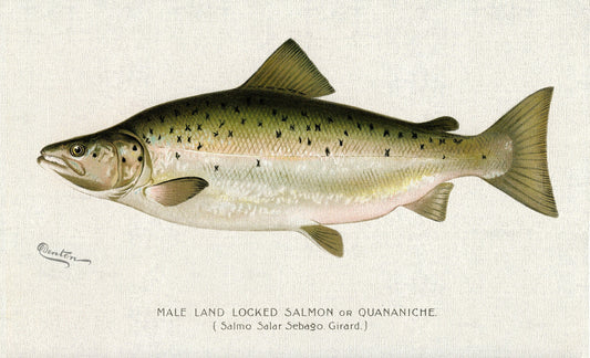
Male Land Locked Salmon or Quananiche ( Salmo Salar Sebaqo Girard)., 1913, Denton auth. , print on canvas, 50 x 70 cm, 20 x 25" approx.
Regular price $45.00 CADRegular price -
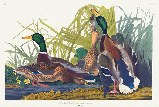
Mallard duck. Anas Boschas, plate 221, 1836 Audobon auth. , vintage wildlife print on durable cotton canvas, 50 x 70 cm, 20 x 25" approx.
Regular price $45.00 CADRegular price -
Manitoba and Saskatchewan, Department of Interior, Origin of the population, 1911 , map on durable canvas, 50 x 70 cm, 20 x 25" approx.
Regular price $45.00 CADRegular price -
Manitoba Official Highway Map, 1941 , map on heavy cotton canvas, 22x27" approx.
Regular price $45.00 CADRegular price -
Manitoba shewing provincial government lands for sale, 1907 , map on durable cotton canvas, 50 x 70 cm, 20 x 25" approx.
Regular price $45.00 CADRegular price -
Manitoba, 1889, Cram auth., map on durable cotton canvas, 50 x 70 cm, 20 x 25" approx.
Regular price $45.00 CADRegular price -
Manitoba, 1901, Cram auth.,, map on durable cotton canvas, 50 x 70 cm, 20 x 25" approx.
Regular price $45.00 CADRegular price -
Manitoba, 1903, map on durable cotton canvas, 50 x 70 cm, 20 x 25" approx.
Regular price $45.00 CADRegular price -
Manitoba, 1904, Stanford auth.,, map on durable cotton canvas, 50 x 70 cm, 20 x 25" approx.
Regular price $45.00 CADRegular price -
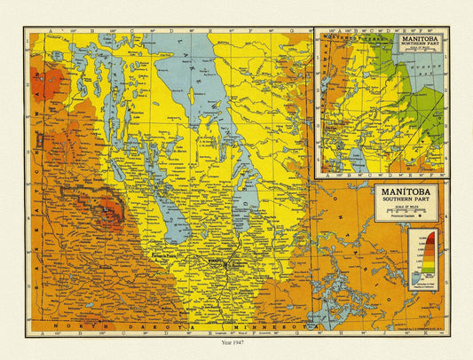
Manitoba, 1947 , map on heavy cotton canvas, 22x27" approx.
Regular price $45.00 CADRegular price -
Manitoba, Auto road map, 1926, map on durable cotton canvas, 50 x 70 cm, 20 x 25" approx.
Regular price $45.00 CADRegular price -
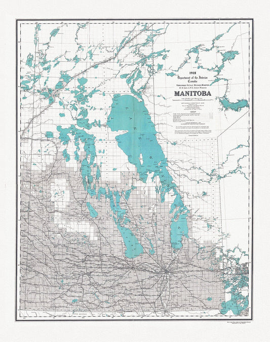
Manitoba, map showing disposition of lands, 1918 , map on heavy cotton canvas, 22x27" approx.
Regular price $45.00 CADRegular price -
Manitoba, Rand, McNally & Co., 1890, map on durable cotton canvas, 50 x 70 cm, 20 x 25" approx.
Regular price $45.00 CADRegular price -
Map from the Pacific Ocean across the Rocky Mountain zone to accompany report on the exploratory survey.CPR.1874, 20x25" approx.
Regular price $45.00 CADRegular price -
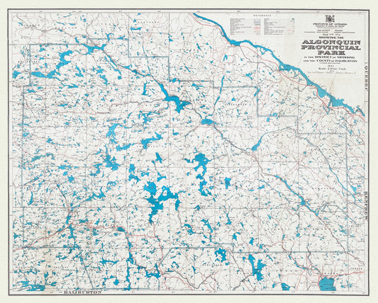
Map No. 47A showing the Algonquin Provincial Park in the District of Nipissing and the County of Haliburton, 1947, cotton canvas, 22x27"
Regular price $45.00 CADRegular price -
Map of South Western Part of the North West Territories shewing grazing country adjacent to the Rocky Mountains,1881, canvas, 20 x 25"
Regular price $45.00 CADRegular price -
Map of a Large Country Newly Discovered in the Northern America Situated between New Mexico And the Frozen Sea, Hennepin,1698
Regular price $45.00 CADRegular price -
Map of a Large Country Newly Discovered in the Northern America Situated between New Mexico And the Frozen Sea, Hennepin,1698, 20 25" approx
Regular price $45.00 CADRegular price -
Map of Alaska, Yukon Territory and British Columbia showing connections of the White Pass and Yukon route, 1904 , 20 x 25" approx.
Regular price $45.00 CADRegular price