-
Map of Ameliasburgh Township, in Prince Edward County, 1880, map on heavy cotton canvas, 45 x 65 cm, 18 x 24" approx.
Regular price $45.00 CADRegular price -
Map of America showing MacKenzie's Route from Montreal to Ft. Chepewyan in 1793, map on durable cotton canvas, 50 x 70 cm, 20 x 25" approx.
Regular price $45.00 CADRegular price -
Map of British Columbia and part of Western Canada,, Canadian Pacific Railways, 1890, map on cotton canvas, 50 x 70cm, 20 x 25" approx.
Regular price $45.00 CADRegular price -
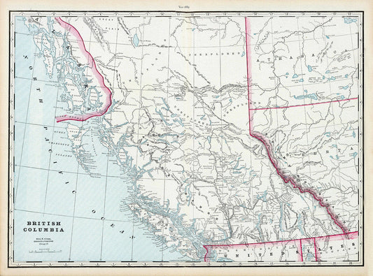
Map of British Columbia,1899, on heavy canvas, 22x27' approx.
Regular price $45.00 CADRegular price -
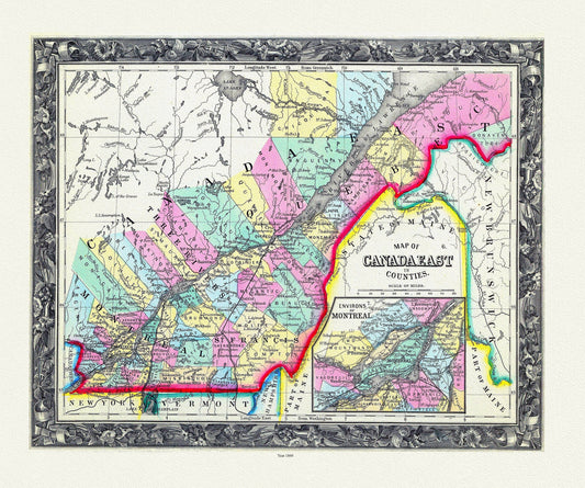
Map Of Canada East, In Counties, 1860 , map on durable cotton canvas, 50 x 70 cm, 20 x 25" approx.
Regular price $45.00 CADRegular price -
Map Of Canada West, In Counties, 1860
Regular price $45.00 CADRegular price -
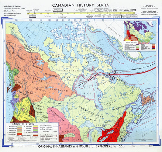
Map of Canadian History & Exploration, 1965, on heavy cotton canvas, 22x27" approx.
Regular price $45.00 CADRegular price -
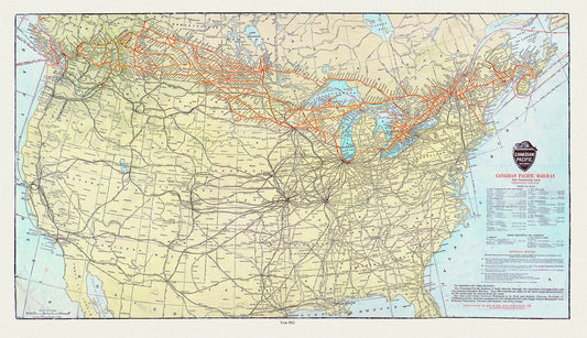
Map of Canadian Pacific Railway and Connecting Lines, 1912, on heavy cotton canvas, 20x27" approx.
Regular price $45.00 CADRegular price -
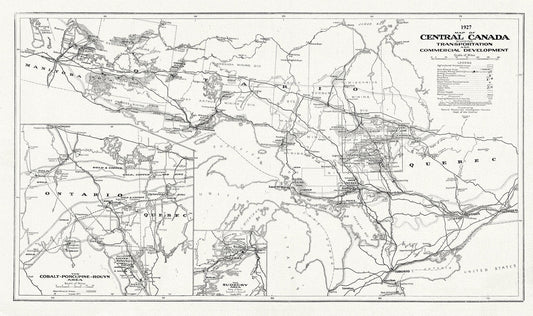
Map of Central Canada Showing Transportation and Commercial Development, 1927, map on durable cotton canvas, 50 x 70 cm, 20 x 25" approx.
Regular price $45.00 CADRegular price -
Map of Central Canada Showing Transportation and Commercial Development, 1927, map on heavy cotton canvas, 50 x 70cm, 20 x 25" approx.
Regular price $45.00 CADRegular price -
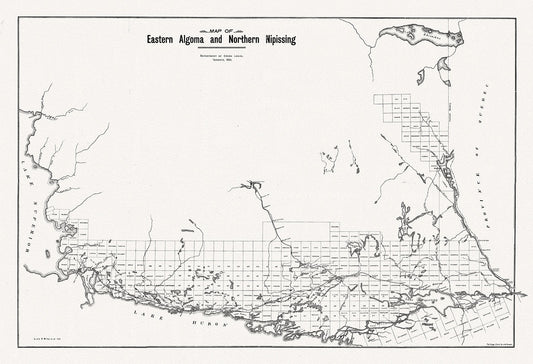
Map of Eastern Algoma and Northern Nipissing, 1901 , map on heavy cotton canvas, 50 x 70cm, 20 x 25" approx.
Regular price $45.00 CADRegular price -
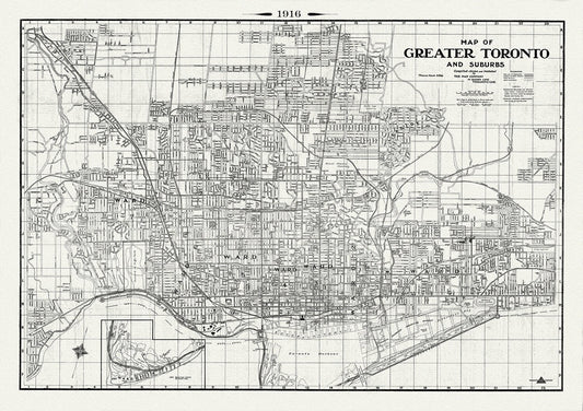
Map of Greater Toronto & Suburbs, 1916 , map on heavy cotton canvas, 22x27" approx.
Regular price $45.00 CADRegular price -
Map of Hastings County, Ontario, 1880 , map on heavy cotton canvas, 45 x 65 cm, 18 x 24" approx.
Regular price $45.00 CADRegular price -
Map of Manitoba Canada, 1917, map on heavy cotton canvas, 22x27" approx.
Regular price $45.00 CADRegular price -
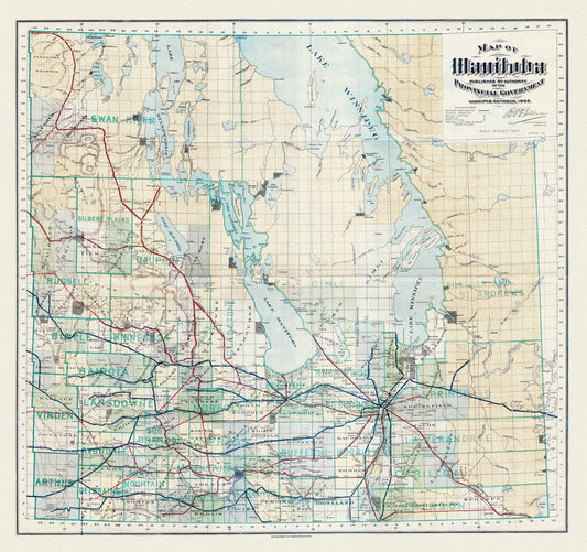
Map of Manitoba published by the authority of the Provincial Government, 1903, map on heavy cotton canvas, 22x27" approx.
Regular price $45.00 CADRegular price -
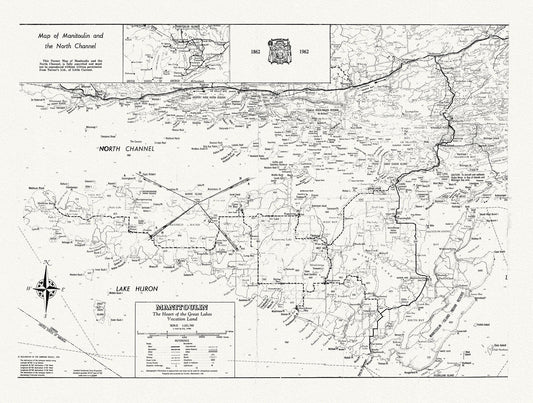
Map of Manitoulin and the North Channel 1862 to 1962, map on heavy cotton canvas, 22x27" approx.
Regular price $45.00 CADRegular price -
Map of Marysburgh Township, Prince Edward County, 1880 , map on heavy cotton canvas, 45 x 65 cm, 18 x 24" approx.
Regular price $45.00 CADRegular price -
Map of new discoveries in the Arctic,1777, Vaugondy auth. map on durable cotton canvas, 50 x 70 cm, 20 x 25" approx.
Regular price $45.00 CADRegular price -
Map of New England According to the Latest Observation, 1720, Neal auth., map on durable cotton canvas, 50 x 70 cm, 20 x 25" approx.
Regular price $45.00 CADRegular price -
Map of New Westminster District, 1905 , map on heavy cotton canvas, 45 x 65 cm, 18 x 24" approx.
Regular price $45.00 CADRegular price -
Map of Newfoundland in British America, McGregor auth., 1832
Regular price $45.00 CADRegular price -
Map of Newfoundland in British America, McGregor auth., 1832, map on heavy cotton canvas, 45 x 65 cm, 18 x 24" approx.
Regular price $45.00 CADRegular price -
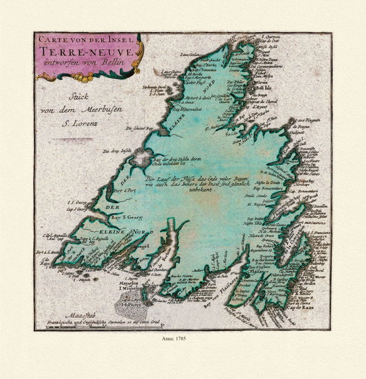
Map of Newfoundland, Canada, 1785, Authors Bellin et Raspe, on Heavy durable cotton canvas, approx. 20 x 24"
Regular price $45.00 CADRegular price -
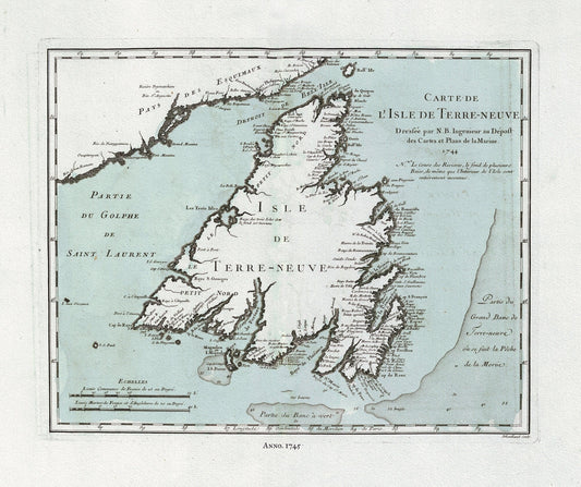
Map of Newfoundland, Canada, Author Bellin, Jacques Nicolas, 1703-1772, on heavy cotton canvas, approx. 20x24"
Regular price $40.00 CADRegular price