-
Map on heavy cotton canvas, Yukon, 1924, 27x22" approx.
Regular price $40.00 CADRegular price -
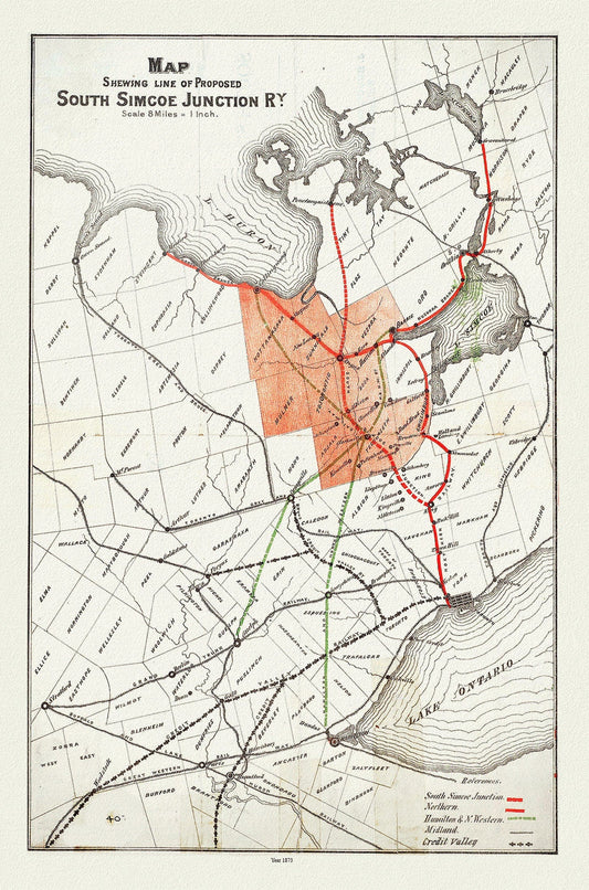
Map shewing line of proposed South Simcoe Junction Railway, Ontario, 1873, map on durable cotton canvas, 50 x 70 cm or 20x25" approx.
Regular price $45.00 CADRegular price -
Map shewing portion of the west coast of Vancouver Island, G. B. Martin ,auth., 1897 , map on heavy cotton canvas, 20 x 25" approx.
Regular price $45.00 CADRegular price -
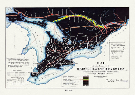
Map shewing the route of the Montreal, Ottawa and Georgian Bay Canal, also subsidiary routes, 1898, on canvas, 50 x 70 cm, 20 x 25" approx.
Regular price $45.00 CADRegular price -
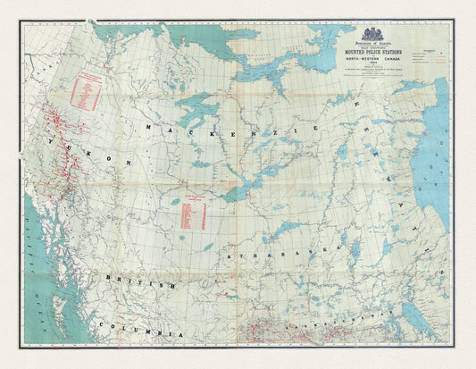
Map showing Mounted Police stations in North-Western Canada, 1904, map on heavy cotton canvas, 22x27" approx.
Regular price $45.00 CADRegular price -
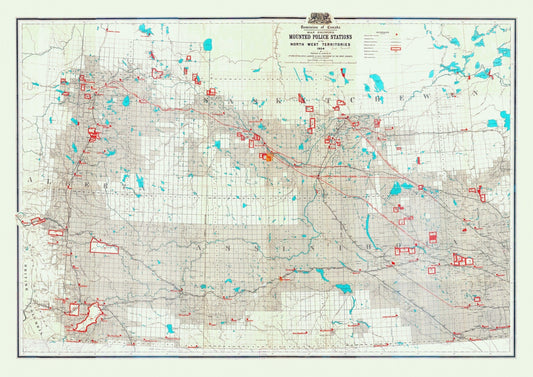
Map showing mounted police stations in the North West Territories, 1904, map on heavy cotton canvas, 22x27" approx.
Regular price $45.00 CADRegular price -
Map Showing Routes From San Francisco To Alaska And The Klondike, Alaska Exploration Company, 1898
Regular price $45.00 CADRegular price -
Map showing the most direct commercial route from the Atlantic, 1836 Ver. II, Price auth., on canvas, 50 x 70 cm, 20 x 25" approx.
Regular price $45.00 CADRegular price -
Map showing the route of the Chicago and Canada Southern Railway and its connecting lines, Colton auth., 1872 on canvas, 20 x 25" approx
Regular price $45.00 CADRegular price -
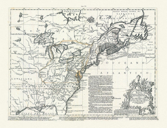
Mappa dell' America Settentrionale et i paesi e che hanno dato motivo alla guerra presente fra la Francia e l'Inghilterra, 1758, Bellin,
Regular price $45.00 CADRegular price -
Mari Archipelaghi polari artici dalla Baia d'Hudson all' America Russa, 1858, Marmocchi auth. map on cotton canvas, 20 x 25" approx
Regular price $45.00 CADRegular price -
Mariette et Sanson, Amérique septentrionale, 1650 , map on heavy cotton canvas, 22x27" approx
Regular price $45.00 CADRegular price -
Mariette, Carte de l'Amerique, 1646, map on durable cotton canvas, 50 x 70 cm, 20 x 25" approx.
Regular price $45.00 CADRegular price -
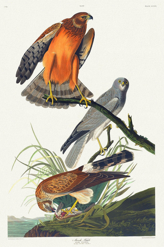
Marsh hawk.Falco cyaneus. Male adult, 1. Female adult, 2. Young male, 3. c.1 v.4 plate 356, 1836 Audobon auth.
Regular price $45.00 CADRegular price -
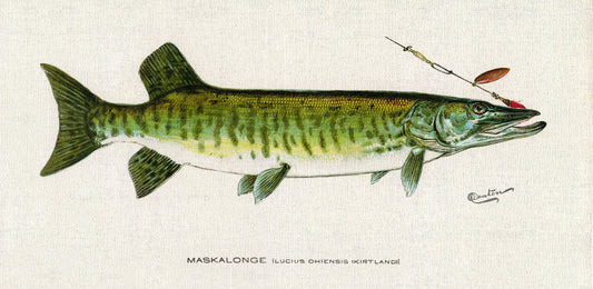
Maskalonge (Lucius Ohiensis; Kirtland), 1913, Denton auth., fishing print reprinted on durable cotton canvas, 50 x 70 cm, 20 x 25" approx.
Regular price $45.00 CADRegular price -
Master et Elias, An Animated Map of Nova Scotia, 1929
Regular price $45.00 CADRegular price -
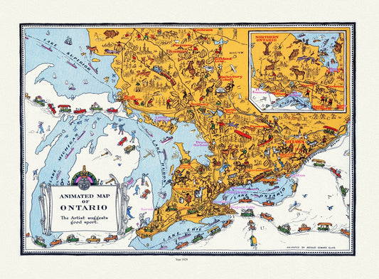
Master et Elias, An Animated Map of Ontario, 1929 , map on heavy cotton canvas, 22x27" approx.
Regular price $45.00 CADRegular price -
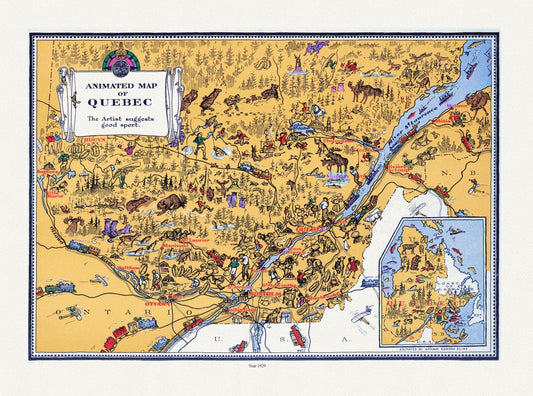
Master et Elias, An Animated Map of Quebec, 1929, map on durable cotton canvas, 50 x 70 cm, 20 x 25" approx.
Regular price $45.00 CADRegular price -
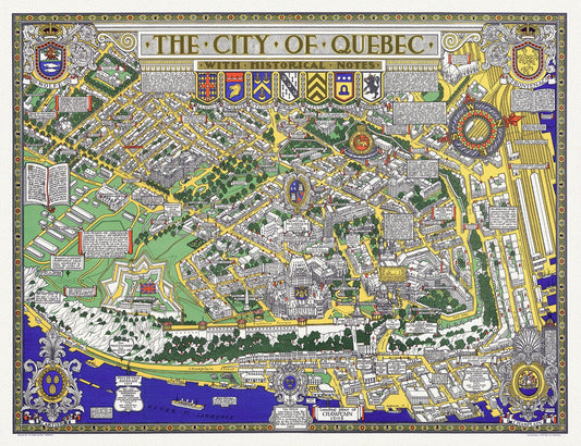
Maw, City of Quebec with Historical Notes, 1932, map on heavy cotton canvas, 20x27" approx.
Regular price $45.00 CADRegular price -
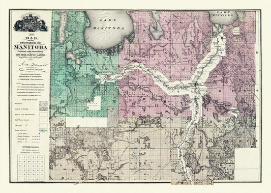
Meacham et Allan, Province of Manitoba, 1880, map on heavy cotton canvas, 22x27" approx.
Regular price $45.00 CADRegular price -
Mediterranean: Empire: Alexander the Great: Expedition of Alexander the Great, 1565, Ortelius (Abraham, 1527-1598) DESAT
Regular price $45.00 CADRegular price -
Mediterranean: Empire: Alexander the Great: Imperium Alexandri Magni,1778, Zatta, Zuiliani, Novelli et Pitteri auths.
Regular price $45.00 CADRegular price -
Mediterranean: Empire: Alexander the Great: Smith et Kingdoms of the successors of Alexander after the battle of Magnesia (190 B.C.),1874, Muller auth.
Regular price $45.00 CADRegular price -
Mediterranean: Empire: Alexander the Great: Alexandri Magni Imperium et Expeditio, 1731, Delisle, (Guillaume de,1675-1726) auth.
Regular price $75.00 CADRegular price