-
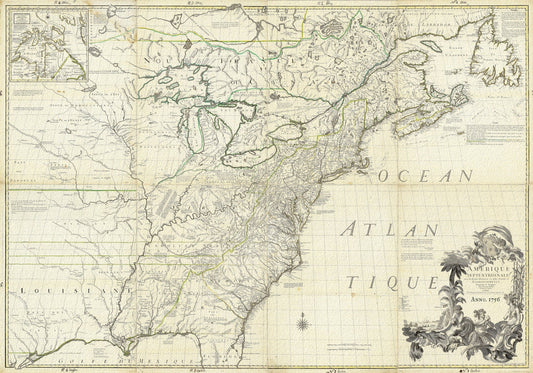
North America, 1756, Carey auth., map on durable cotton canvas, 50 x 70 cm, 20 x 25" approx.
Regular price $45.00 CADRegular price -
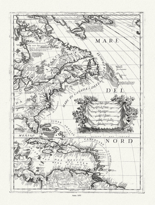
Coronelli (Vicenzo 1650-1718), America Settentrionale (parte orientale)), 1693, map on durable cotton canvas, 50 x 70 cm, 20 x 25" approx.
Regular price $45.00 CADRegular price -
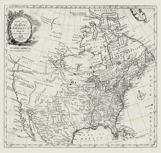
Carver, A new map of North America, from the latest discoveries, 1778, map on durable cotton canvas, 50 x 70 cm, 20 x 25" approx.
Regular price $45.00 CADRegular price -
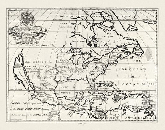
A new map of North America shewing its principal divisions.,1722, map on durable cotton canvas, 50 x 70 cm, 20 x 25" approx.
Regular price $45.00 CADRegular price -
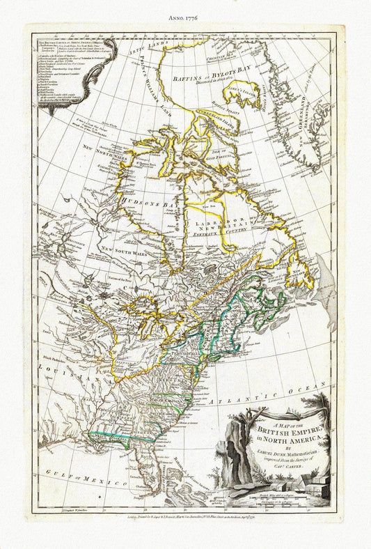
A Map of The British Empire in North America, 1776, Jefferys auth., map on durable cotton canvas, 50 x 70 cm, 20 x 25" approx.
Regular price $45.00 CADRegular price -
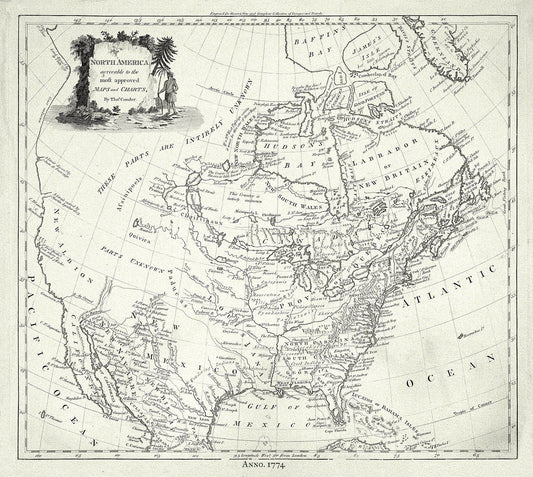
North America, Conder auth., 1774, map on durable cotton canvas, 50 x 70 cm, 20 x 25" approx.
Regular price $45.00 CADRegular price -
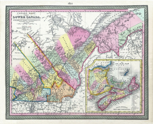
Lower Canada, 1855, Mitchell auth., map on heavy cotton canvas, 50 x 70cm, 20 x 25" approx.
Regular price $45.00 CADRegular price -
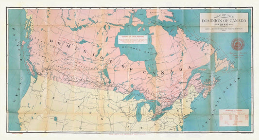
Canada, its history, productions and natural resources, 1886, map on heavy cotton canvas, 16x36" approx.
Regular price $50.00 CADRegular price -
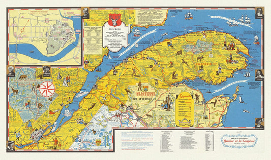
Quebec: Carte de vacanes, Quebec et la Gaspesie Holiday guide, 1959, map on heavy cotton canvas, 22x27" approx.
Regular price $45.00 CADRegular price -
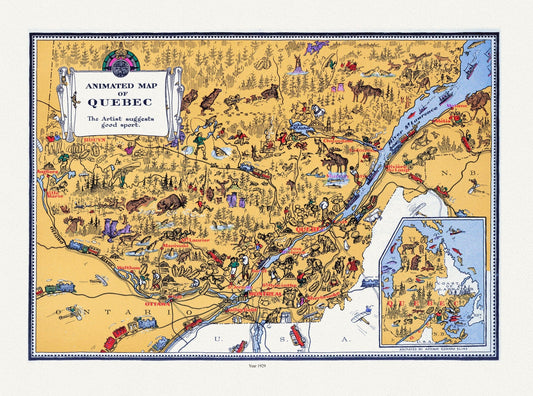
An Animated Map of Quebec, 1929, On heavy durable cotton canvas, 22x27" approx.
Regular price $45.00 CADRegular price -
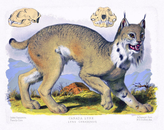
Canada Lynx ( Lynx Canadensis ), 1890, Vintage Poster Print on heavy canvas, 22x27" approx.
Regular price $45.00 CADRegular price -
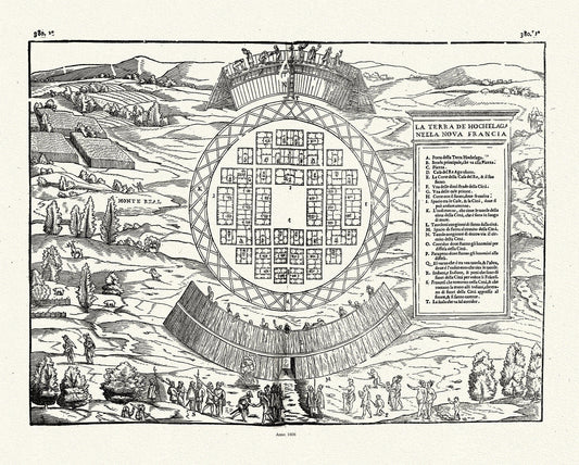
Rasmusio, Hochelaga,1606
Regular price $45.00 CADRegular price -
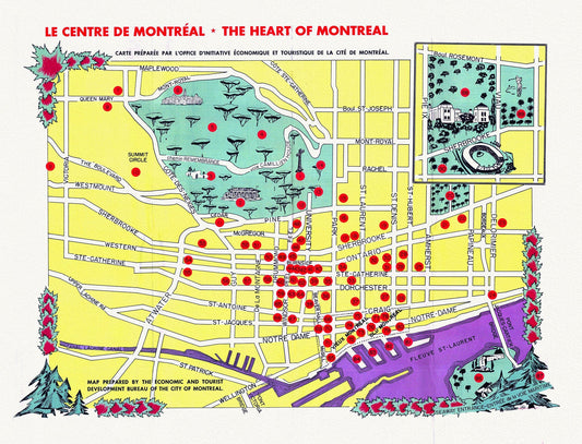
Le Centre de Montréal, The Heart of Montreal, 1960, map on heavy cotton canvas, 20x27" approx.
Regular price $45.00 CADRegular price -
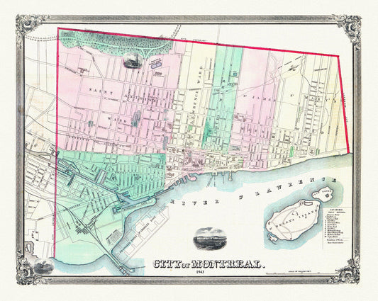
Magnus, City of Montreal, 1863, map on heavy cotton canvas, 20x27" approx.
Regular price $45.00 CADRegular price -
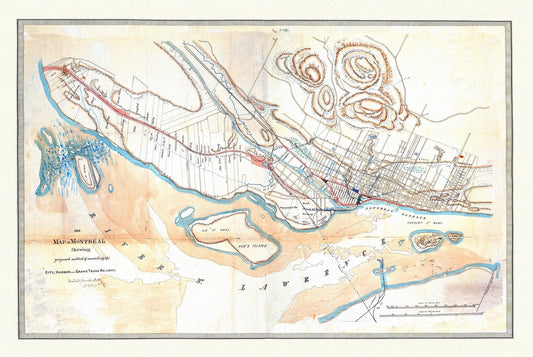
Sketch Map of Montreal and the proposed connection of the Grand Trunk Railway, 1860 , map on heavy cotton canvas, 20x27" approx.
Regular price $45.00 CADRegular price -
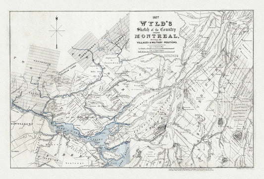

Wyld, A Sketch Map of the Country Around Montreal, 1837, , map on heavy cotton canvas, 20x27" approx
Regular price $45.00 CADRegular price -
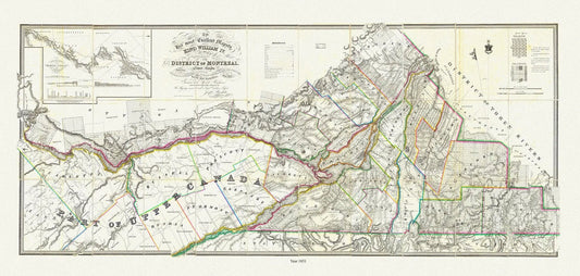
Wyld, Map of the District Of Montreal, Lower Canada, 1831 , map on heavy cotton canvas, 20x27" approx.
Regular price $45.00 CADRegular price -
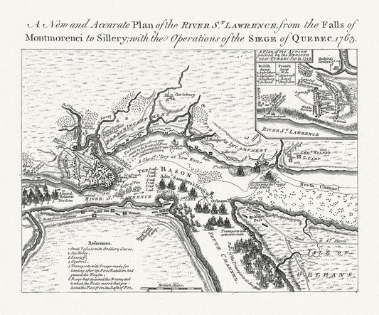
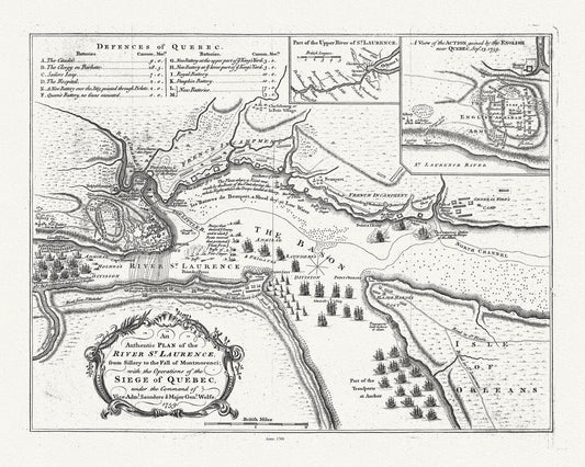
Plan of the river St. Laurence, the falls of Montmorency to Sillery., with the siege of Quebec, 1763, map on cotton canvas, 20x27" approx
Regular price $45.00 CADRegular price -
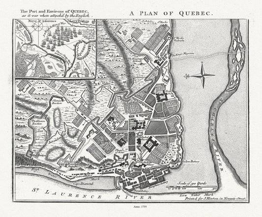
A Plan of Quebec the port and environs of Quebec, as it was when attack'd by the English, 1759, map on heavy cotton canvas, 20x27" approx.
Regular price $45.00 CADRegular price -
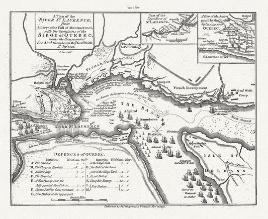
A plan of the River St. Laurence, from Sillery to Montmerenci Falls with the operations of the Siege of Quebec, 1759-1780,canvas, 22x27"
Regular price $45.00 CADRegular price -
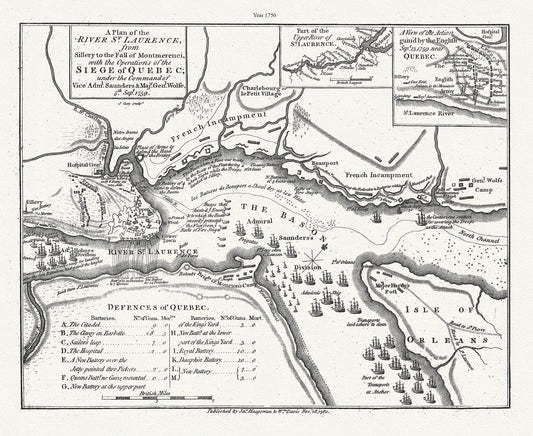
Plan of the River St. Laurence, from Sillery Montmorenci Falls etc...., 1760, map on heavy cotton canvas, 20x27" approx.
Regular price $45.00 CADRegular price -
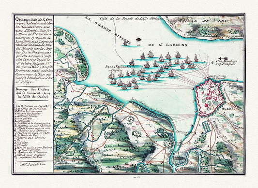
Qubbec, ville de l'Amerique septentrionale dans la Nouvelle France, 1755, map on heavy cotton canvas, 20x27" approx.
Regular price $45.00 CADRegular price -
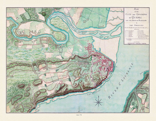
Plan of the city and environs of Quebec, with its siege and blockade by the Americans from 1775-1776,, map on cotton canvas, 20x27" approx.
Regular price $45.00 CADRegular price -
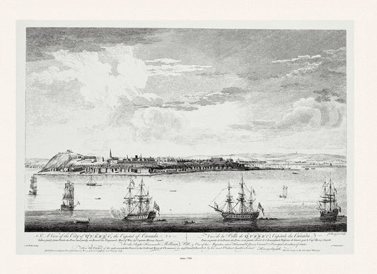
Pitt, Vue de la ville du Québec, capitale du Canada, 1760, map on heavy cotton canvas, 20x27" approx.
Regular price $45.00 CADRegular price