-
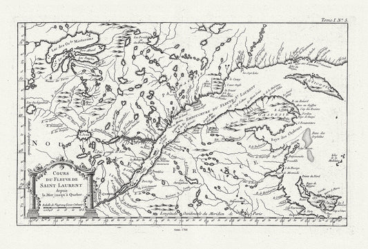
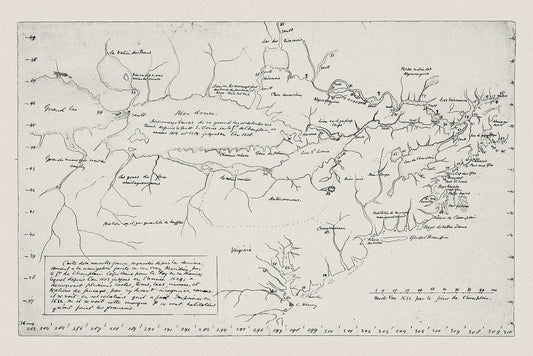
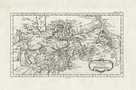
Quebec: Bellin, Cours du Fleuve de Saint Laurent, Depuis la Mer Jusque a Quebec, 1764, map on heavy cotton canvas, 22x27" approx.
Regular price $45.00 CADRegular price -
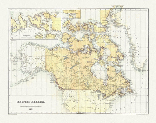
British America, 1856, map on heavy cotton canvas, 50 x 70 cm, 20 x 25" approx.
Regular price $45.00 CADRegular price -
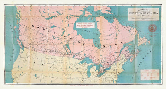
Canada, its history, productions and natural resources, prepared under the direction of Honourable John Carling, 1886, map on canvas, 20x25"
Regular price $45.00 CADRegular price -
Canada, Hall auth., 1829, map on heavy cotton canvas, 50 x 70 cm, 20 x 25" approx.
Regular price $45.00 CADRegular price -
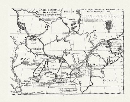
Carte generale de Canada, Lahotan auth., 1706, map on heavy cotton canvas, 50 x 70 cm, 20 x 25" approx.
Regular price $45.00 CADRegular price -
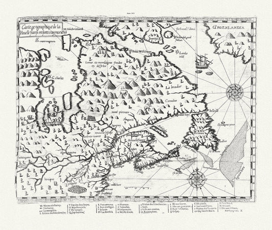
Carte geographique de la Nouelle franse en son vray moricha, Champlain auth., 1613, map on heavy cotton canvas, 50 x 70 cm, 20 x 25" approx.
Regular price $45.00 CADRegular price -
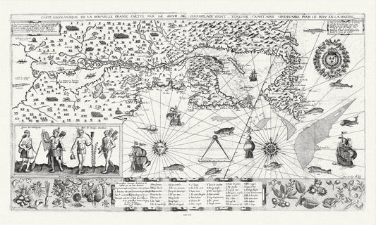
Carte geographiqve de la Nouvelle France, St Tongois cappitaine ordinaire pour le roy , Champlain.auth., 1612,,canvas, 20 x 25" approx.
Regular price $45.00 CADRegular price -
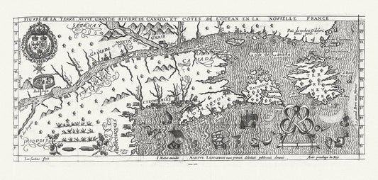
Figure de la Terre Neuve, le grande riviere de Canada, et côtes de l'ocean en la Nouvelle France, Les Carbot auth.,1609, 20 x 25" approx.
Regular price $45.00 CADRegular price -
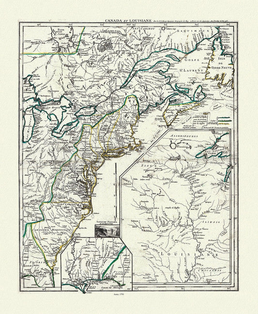
LaRouge, Canada et Louisiana, 1793, map on heavy cotton canvas, 50 x 70 cm, 20 x 25" approx.
Regular price $45.00 CADRegular price -
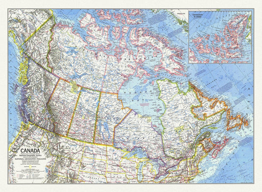
Canada, National Geographic, 1972, map on heavy cotton canvas, 50 x 70 cm, 21 x 25" approx.
Regular price $45.00 CADRegular price -
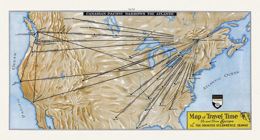
Map of Travel Time To and From Europe Via the Shorter St. Lawrence Seaway, 1938 Ver. 1 , map on cotton canvas, 50 x 70 cm, 20 x 25" approx.
Regular price $45.00 CADRegular price -
Carte de la Nouvelle France, Champlain (1632) et Thoreau (1850), map on heavy cotton canvas, 50 x 70 cm, 20 x 25" approx.
Regular price $45.00 CADRegular price -
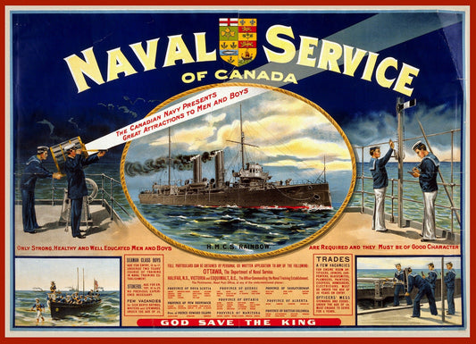
Naval service of Canada. Only strong, healthy and well educated men and boys are required, 1915, on heavy cotton canvas, 22x27in. approx.
Regular price $45.00 CADRegular price -
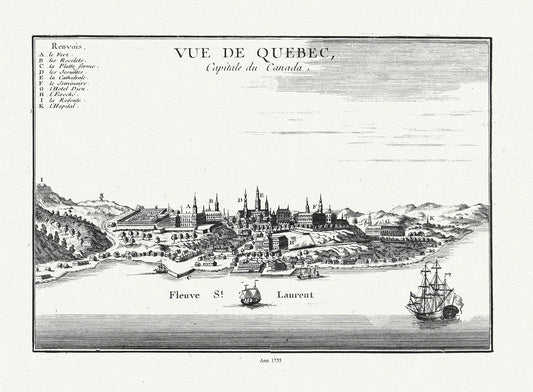
Le Rouge, Vue de Quebec, Capitale du Canada, 1755, on heavy cotton canvas, 20 x 25" approx.
Regular price $45.00 CADRegular price -
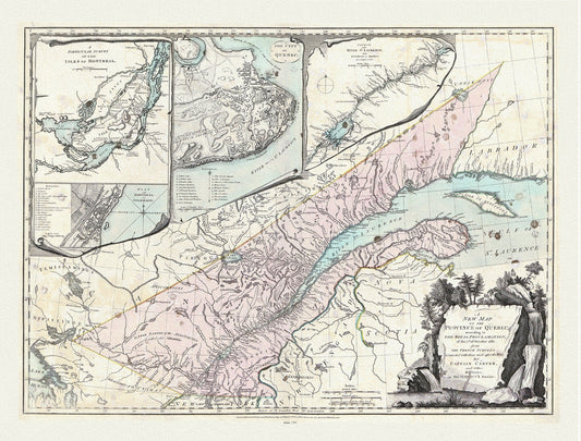
Quebec: Sayer et Carver, A new map of the Province of Quebec, according to the 1763 Royal Proclamation, 1776, cotton canvas, 22x27" approx.
Regular price $45.00 CADRegular price -
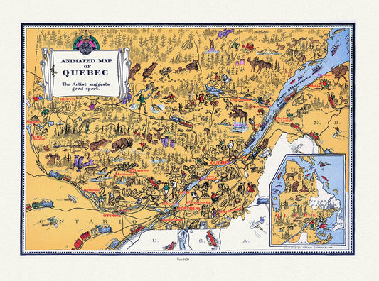
Quebec: Master et Elias, An Animated Map of Quebec, 1929 , map on heavy cotton canvas, 22x27" approx.
Regular price $45.00 CADRegular price -
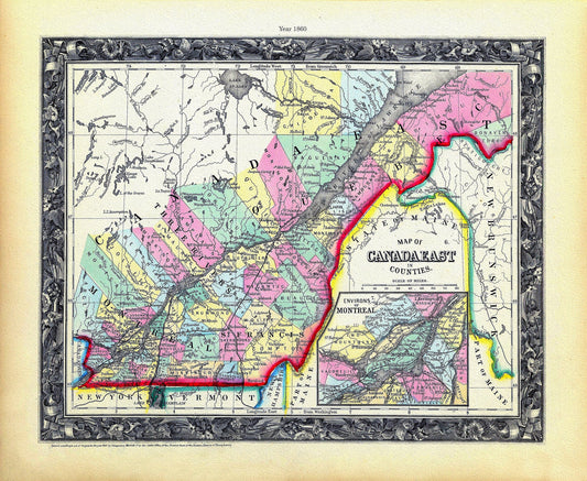
Quebec: Mitchell, Map Of Canada East In Counties, 1860 , map on heavy cotton canvas, 22x27" approx.
Regular price $45.00 CADRegular price -
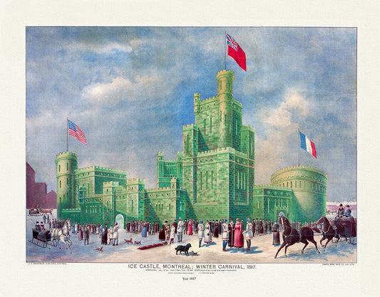
Montreal Winter Carnival, 1887 , vintage print reprinted on durable cotton canvas, 50 x 70 cm or 20x25" approx
Regular price $45.00 CADRegular price -
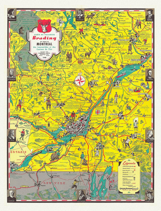
Montreal, Carte des Vacances des regions, 1948, map on durable cotton canvas, 50 x 70 cm, 20 x 25" approx.
Regular price $45.00 CADRegular price -
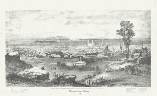
Montreal, Lower Canada, 1855, Whitfield auth., vintage print reprinted on durable cotton canvas, 50 x 70 cm, 20 x 25" approx.
Regular price $45.00 CADRegular price -
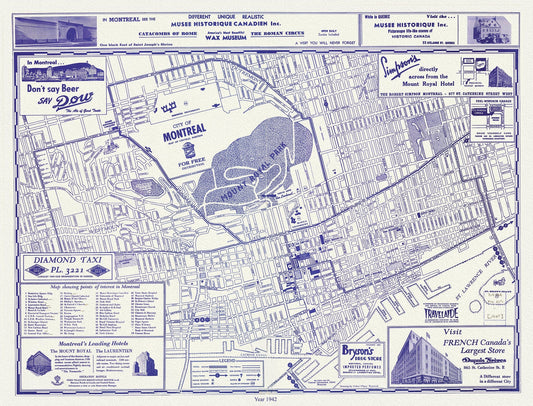
Montreal, a base Map, 1942 reprinted on durable cotton canvas, 50 x 70 cm, 20 x 25" approx.
Regular price $45.00 CADRegular price -
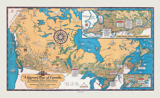
Canada, A Literary Map, 1936 , vintage map reprinted on durable cotton canvas, 50 x 70 cm, 20 x 25" approx.
Regular price $45.00 CADRegular price -
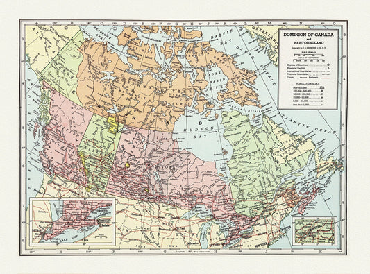
Dominion of Canada and Newfoundland-1948, Hammond auth., vintage map reprinted on durable cotton canvas, 50 x 70 cm, 20 x 25" approx.
Regular price $45.00 CADRegular price -
La Nouvelle France où Canada, ,Bellin, 1764 Ver. II, vintage map reprinted on durable cotton canvas, 50 x 70 cm, 20 x 25" approx.
Regular price $45.00 CADRegular price