-
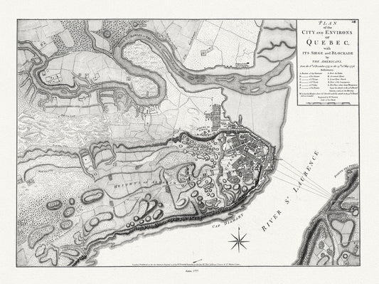
Plan of the city and environs of Quebec with its siege and blockade by the Americans, from 1775 to 1776 Ver. I, 22x27" canvas
Regular price $45.00 CADRegular price -
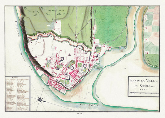
Plan de la ville de Québec, 1750 , map on heavy cotton canvas, 20 x 25" approx.
Regular price $45.00 CADRegular price -
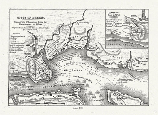
Smith, Siege of Quebec Plan of the St. Lawrence from the Montmorenci to Sillery, 1849 , map on heavy cotton canvas, 20 x 25" approx.
Regular price $45.00 CADRegular price -
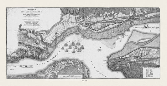
Jefferys, A correct plan of the environs of Quebec, and of the battle fought on the 13th September, 1759, Map on canvas 20x25"
Regular price $45.00 CADRegular price -
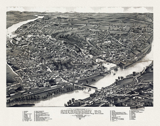
Quebec: Bird's eye view of Sherbrooke, P.Q., 1881 , map on heavy cotton canvas, 22x27" approx.
Regular price $45.00 CADRegular price -
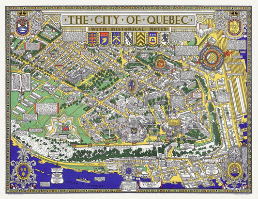
Maw, City of Quebec with Historical Notes, 1932, map on heavy cotton canvas, 20x27" approx.
Regular price $45.00 CADRegular price -
Men of the empire! Rally round the flag and join the army to-day, your country needs you, 1915, on heavy cotton canvas, 22x27in. approx.
Regular price $45.00 CADRegular price -
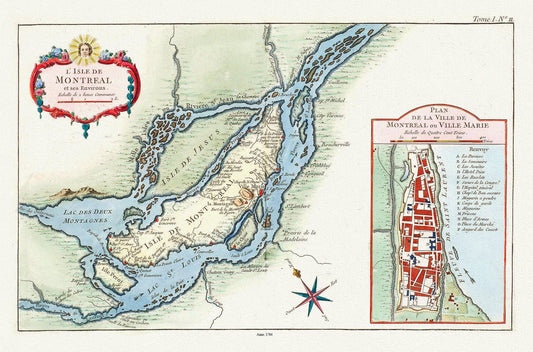
Bellin (Jacques Nicolas, 1703-1772), L'Isle de Montreal, et ses environs, 1764 Ver. C, map on heavy cotton canvas, 20x27" approx.
Regular price $45.00 CADRegular price