-
Map of the United States, Territory of Oregon, west of the Rocky Mountains, connected with fur trade, 1838, canvas map 20x25"
Regular price $45.00 CADRegular price -
Lower Fraser Valley, Topping auth., 1910, map on heavy cotton canvas, 50 x 70cm, 20 x 25" approx.
Regular price $45.00 CADRegular price -
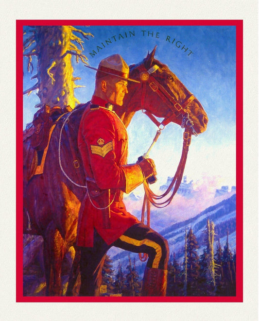
RCMP, Maintain The Right, Ver. VIII, poster on heavy cotton canvas, 50 x 70 cm, 20 x 25" approx.
Regular price $45.00 CADRegular price -
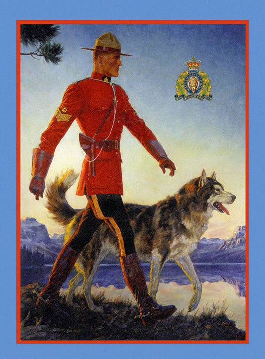
RCMP, Maintain the Right! Ver. II, vintage poster on heavy cotton canvas, 50 x 70 cm, 20 x 25" approx.
Regular price $45.00 CADRegular price -
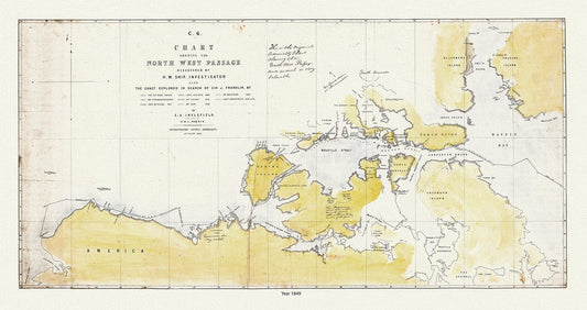
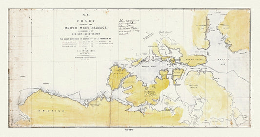
A Chart Shewing the North West Passage discovered by H.M. Ship Investigator the coast explored in search of Franklin, 1848 & 41 Ver. II
Regular price $45.00 CADRegular price -
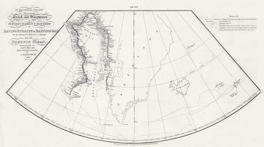
A General Chart Shewing the Track and Discoveries of H.M. Ships Isabella & Alexander to Davis's Straits and Baffin's Bay.Ross.1819
Regular price $45.00 CADRegular price -
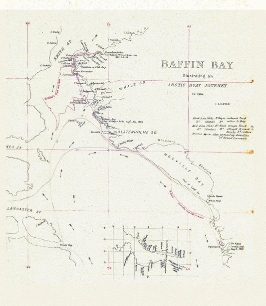
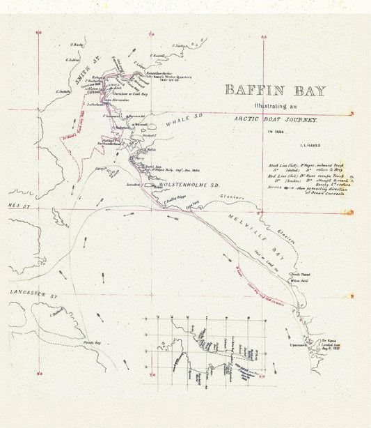
An Arctic Boat Journey around Baffin Bay Journey, A Manuscript, Kane et Hayes, 1855, 20 x 25" approx.
Regular price $45.00 CADRegular price -
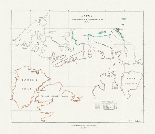
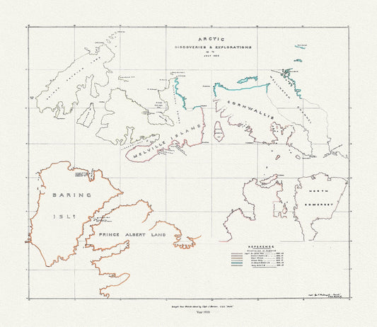
Arctic discoveries and explorations up to July 1853, (1910), map on durable cotton canvas, 50 x 70 cm or 20x25" approx.
Regular price $45.00 CADRegular price -
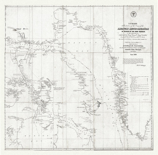
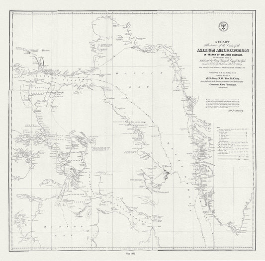
Arctic Expedition in Search of Sir John Franklin, 1850 Ver.2, map on durable cotton canvas, 50 x 70 cm, 20 x 25" approx.
Regular price $45.00 CADRegular price -
Arctic discoveries and explorations up to July 1853, (1910)
Regular price $45.00 CADRegular price -
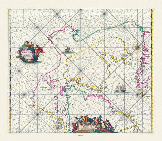
Carte particulière de l'Amerique septentrionale ou sont compris le destroit de Davids, le destroit de Hudson, Mortier auth.,1700, 20x25"
Regular price $45.00 CADRegular price -
Keulen, Johannes van, 1654-1715. Pas-Kaart, vande zee-kusten van Terra Nova, 1695, , 50 x 70 cm or 20x25" approx.
Regular price $45.00 CADRegular price -
Map of new discoveries in the Arctic,1777, Vaugondy auth. map on durable cotton canvas, 50 x 70 cm, 20 x 25" approx.
Regular price $45.00 CADRegular price -


Northern America, Arrowsmith auth., 1855, map on durable cotton canvas, 50 x 70 cm, 20 x 25" approx.
Regular price $45.00 CADRegular price -
Northwest Territories ,Settlements and Trading Posts, 1952, map on durable cotton canvas, 50 x 70 cm, 20 x 25" approx.
Regular price $45.00 CADRegular price -
Peter Pond, fur trader & explorer, 1785, map on durable cotton canvas, 50 x 70 cm, 20 x 25" approx.
Regular price $45.00 CADRegular price -
Routes of explorers, (1534-1870), map on durable cotton canvas, 50 x 70 cm, 20 x 25" approx.
Regular price $45.00 CADRegular price -
The Franklin Expedition, 1850, map on durable cotton canvas, 50 x 70 cm, 20 x 25" approx.
Regular price $45.00 CADRegular price -
North America polar regions Baffin Bay to Lincoln Sea, showing the most recent discoveries and British Arctic Expedition in 1875-6.,1885
Regular price $45.00 CADRegular price -
Septemtrionaliora Americae a Groenlandia, per Freta Davidis et Hudson van Groenland door de Straet Davis ende Straet Hudson, 1765
Regular price $45.00 CADRegular price -
Chart Shewing the North West Passage discovered by H.M. Ship Investigator also the search of Franklin by Sir Jas. Ross, 1848 & 49
Regular price $45.00 CADRegular price -
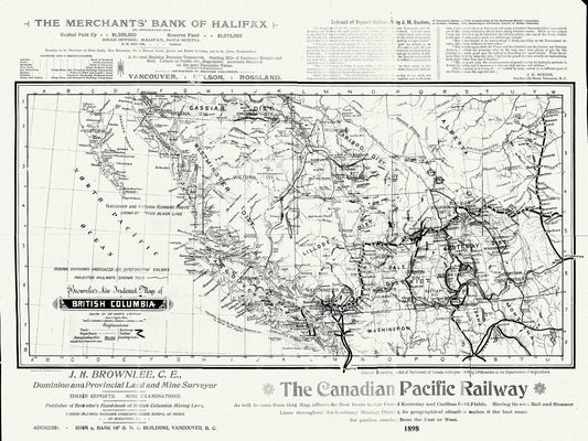
British Columbia, Brownlee auth., 1898, map on durable cotton canvas, 50 x 70 cm, 20 x 25" approx.
Regular price $45.00 CADRegular price -
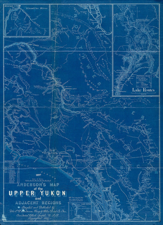
Anderson's map of the Upper Yukon and adjacent regions, 1897, Cyanotype map on durable cotton canvas, 50 x 70 cm, 20 x 25" approx.
Regular price $45.00 CADRegular price -
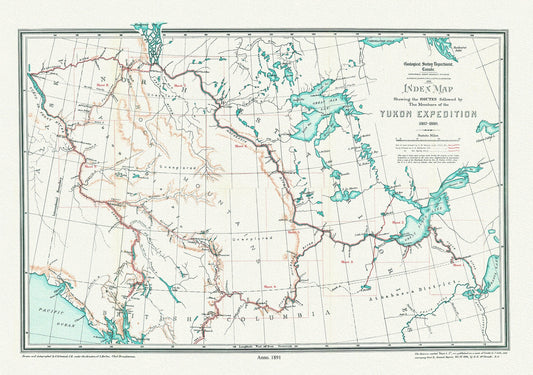
Index Map Shewing the Routes Followed by the Members of the Yukon Expedition, 1887-1888,(1891), map on canvas, 50 x 70 cm, 20 x 25" approx.
Regular price $45.00 CADRegular price