-
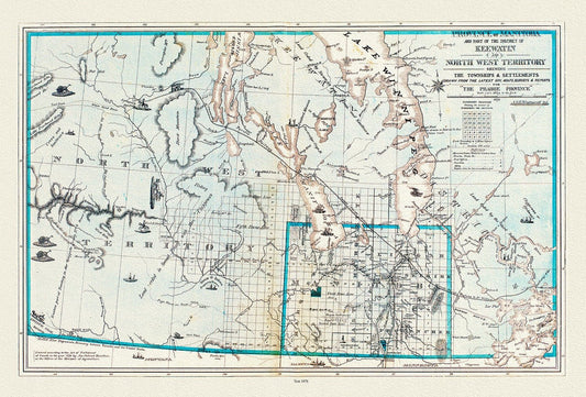
Province of Manitoba District of Keewatin, 1878, , map on heavy cotton canvas, 22x27" approx.
Regular price $45.00 CADRegular price -
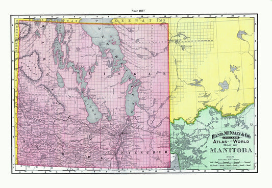
Rand McNally and Company, Manitoba, 1897 , map on heavy cotton canvas, 22x27" approx.
Regular price $45.00 CADRegular price -
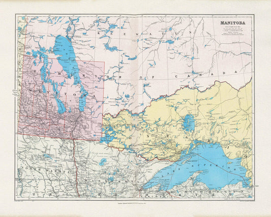
Stanford, Manitoba, 1904 , map on heavy cotton canvas, 22x27" approx.
Regular price $45.00 CADRegular price -
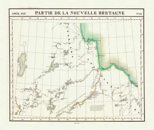
Vandermaelen, Partie, Nouvelle Bretagne (Manitoba), 1827 , map on heavy cotton canvas, 22x27" approx.
Regular price $45.00 CADRegular price -
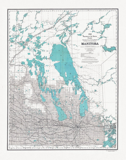
Manitoba, map showing disposition of lands, 1918 , map on heavy cotton canvas, 22x27" approx.
Regular price $45.00 CADRegular price -
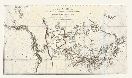
Mackenzie's Track from Montreal to Fort Chipewyan, 1793, map on heavy cotton canvas, 22x27" approx.
Regular price $45.00 CADRegular price -
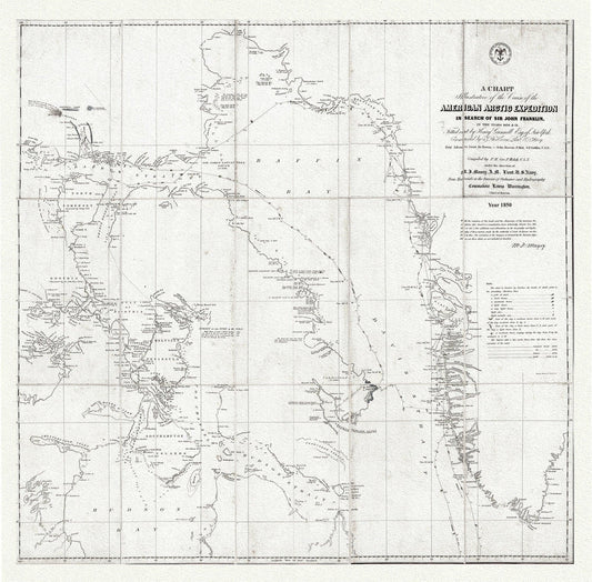
Arctic Expedition in Search of Sir John Franklin, 1850 Ver.2 , map on heavy cotton canvas, 22x27" approx.
Regular price $45.00 CADRegular price -
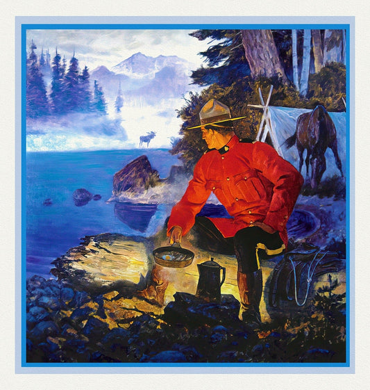
RCMP, Maintain The Right, Ver. XII, poster on heavy cotton canvas, 50 x 70 cm, 20 x 25" approx.
Regular price $45.00 CADRegular price -
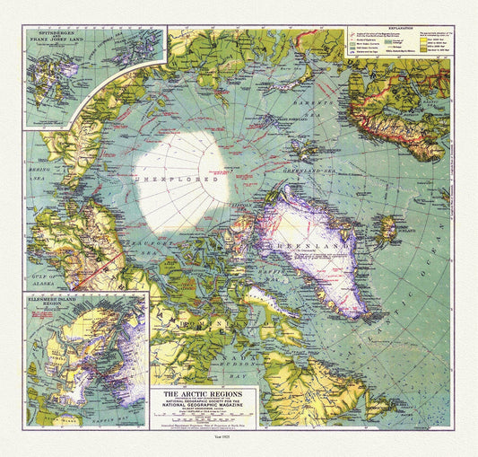
Arctic Regions, National Geographic, 1925, map on heavy cotton canvas, 50 x 70 cm, 20 x 25" approx.
Regular price $45.00 CADRegular price -
Manitoba Official Highway Map, 1941 , map on heavy cotton canvas, 22x27" approx.
Regular price $45.00 CADRegular price -
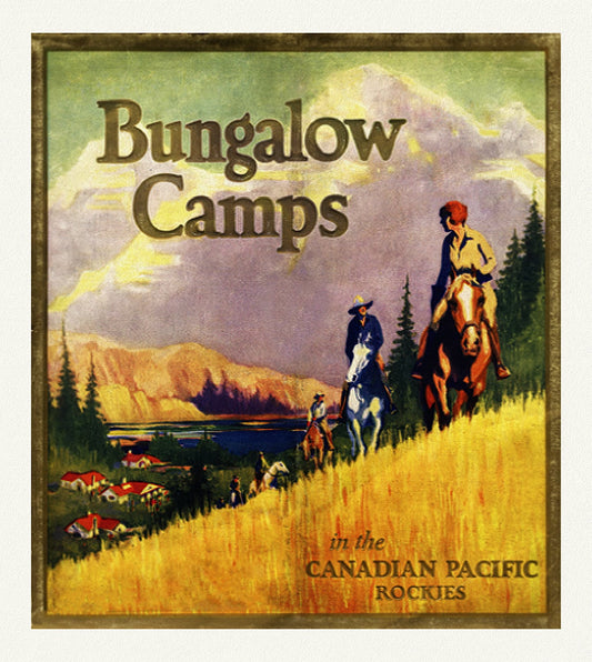
Bungalow Camps in The Canadian Rockies , reprinted vintage poster on heavy cotton canvas, 50 x 70 cm, 20 x 25" approx.
Regular price $45.00 CADRegular price -
Part of the coast of N.W. America , with tracks of His Majesty's sloop Discovery and armed tender Chatham, 1798, canvas map, 20x25" approx.
Regular price $45.00 CADRegular price -
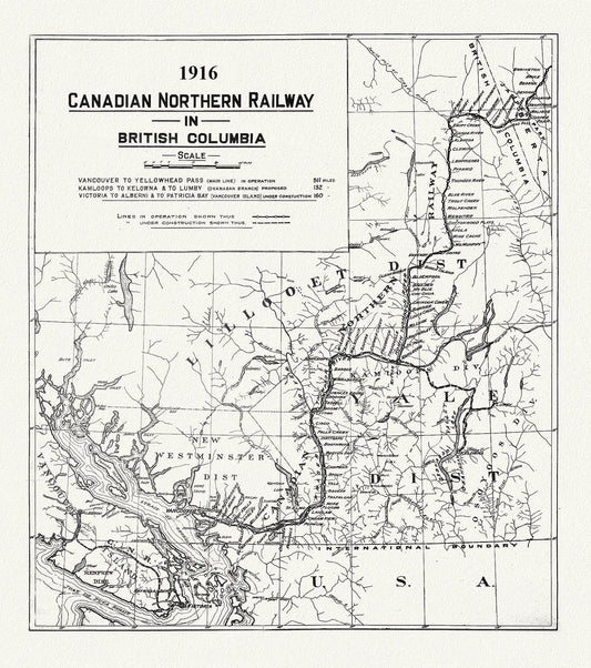
Canadian Northern Railway in British Columbia, 1916 , map on heavy cotton canvas, 50 x 70cm, 20 x 25" approx.
Regular price $45.00 CADRegular price -
Map of British Columbia and part of Western Canada,, Canadian Pacific Railways, 1890, map on cotton canvas, 50 x 70cm, 20 x 25" approx.
Regular price $45.00 CADRegular price -
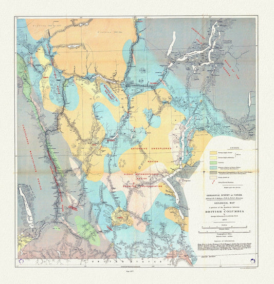
Geological map of a portion of the Southern Interior of British Columbia, George Dawson ,1877, map on cotton canvas, 20 x 25" approx.
Regular price $45.00 CADRegular price -
Prince Rupert Harbour, 1909 Ver. II, map on heavy cotton canvas, 50 x 70cm, 20 x 25" approx.
Regular price $45.00 CADRegular price -
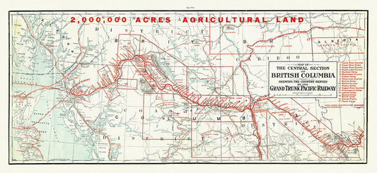
Central section of British Columbia shewing the county served by the Grand Trunk Pacific Railway, 1911 , map on canvas, 20 x 30", approx.
Regular price $45.00 CADRegular price -
Map Of The Grand Trunk Pacific Railway In British Columbia, 1910, map on heavy cotton canvas, 20 x 30" or 50 x 75cm. approx.
Regular price $45.00 CADRegular price -
Map shewing portion of the west coast of Vancouver Island, G. B. Martin ,auth., 1897 , map on heavy cotton canvas, 20 x 25" approx.
Regular price $45.00 CADRegular price -
Northwest Coast Lands, Territorial Claims, Paulin et Wright auths., 1790 - 1846, map on heavy cotton canvas, 50 x 70cm, 20 x 25" approx.
Regular price $45.00 CADRegular price -
Portions of New Westminster District and Vancouver Island, 1912 , map on heavy cotton canvas, 50 x 70cm, 20 x 25" approx.
Regular price $45.00 CADRegular price -
Southern British Columbia, A Modern Map, Ver. I, map on heavy cotton canvas, 50 x 70cm, 20 x 25" approx.
Regular price $45.00 CADRegular price -
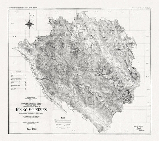
Topographical map of part of the main range of the Rocky Mountains adjacent to the Canadian Pacific Railway, 1903, Canvas 20 x 25" approx.
Regular price $45.00 CADRegular price -
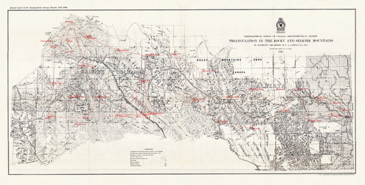
Triangulation in the Rocky and Selkirk Mountains, 1907, map on heavy cotton canvas, 50 x 70cm, 20 x 25" approx.
Regular price $45.00 CADRegular price