-
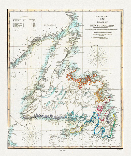
A Hand Map of the Island of Newfoundland, Findlay auth.,1859 , map on heavy cotton canvas, 45 x 65 cm, 18 x 24" approx.
Regular price $45.00 CADRegular price -
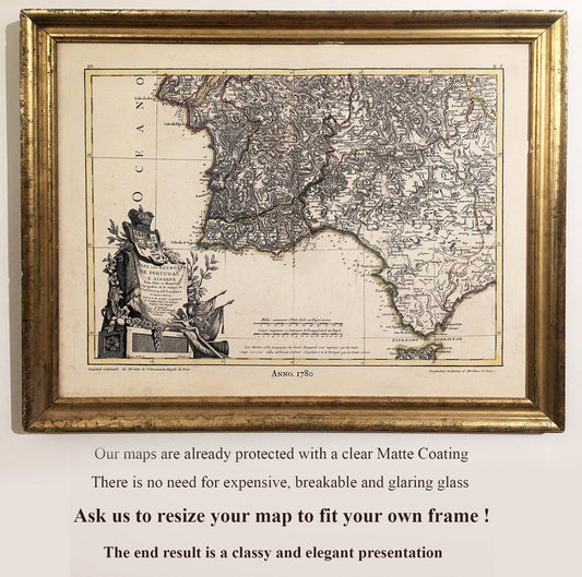
All Our Maps have a Matte Transparent Clear Protective Coating. Often there is No Need for Heavy, Fragile Glaring Glass
Regular price $45.00 CADRegular price -
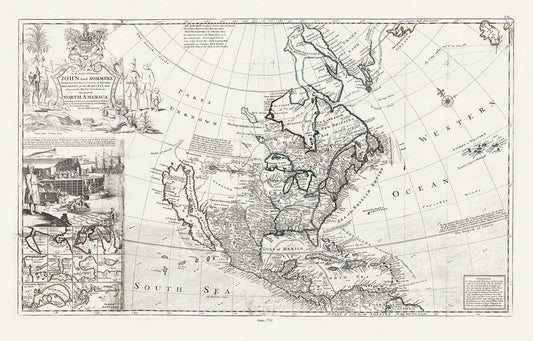
Bowles, Moll et Virtue, This map of North America, according to ye newest and most exact observations, 1712 , map on heavy canvas, 22x27"
Regular price $45.00 CADRegular price -
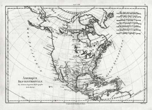
Bonne, Amérique septentrionale, 1788 , map on heavy cotton canvas, 22x27" approx.
Regular price $45.00 CADRegular price -
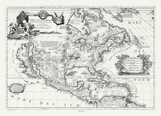
Coronelli (Vicenzo 1650-1718), America Settentrionale, 1693, map on heavy cotton canvas, 22x27" approx.
Regular price $45.00 CADRegular price -
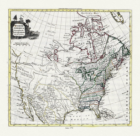
Guthrie et Kitchin, North America, 1774 , map on heavy cotton canvas, 22x27" approx.
Regular price $45.00 CADRegular price -
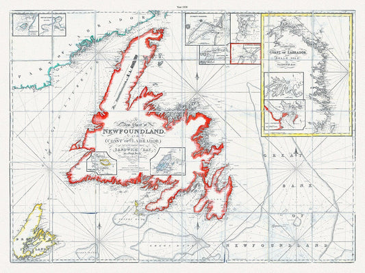
A new chart of Newfoundland, and coast of Labrador extending to Sandwich Bay, Blachford ,1838 , cotton canvas, 45 x 65 cm, 18 x 24" approx.
Regular price $45.00 CADRegular price -
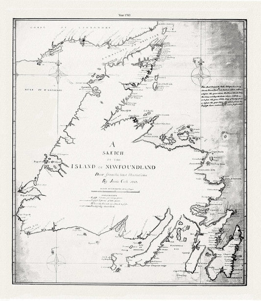
A sketch of the island of Newfoundland.Cook. 1763 , map on heavy cotton canvas, 45 x 65 cm, 18 x 24" approx.
Regular price $45.00 CADRegular price -
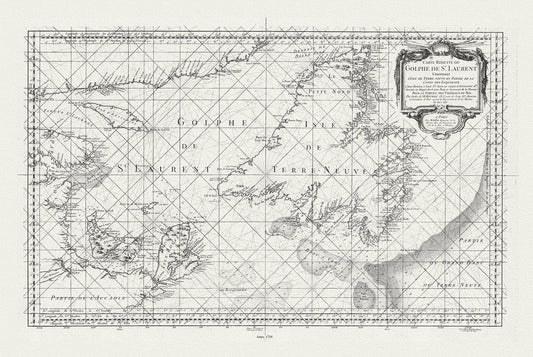
E Bellin, Carte reduite du Golphe de St. Laurent, 1754
Regular price $45.00 CADRegular price -
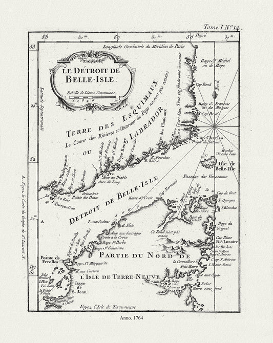
E Bellin, Le Detroit de Belle-Isle, 1764 , map on heavy cotton canvas, 45 x 65 cm, 18 x 24" approx.
Regular price $45.00 CADRegular price -
Coronelli, Map of Newfoundland,1692 Ver. III , map on heavy cotton canvas, 45 x 65 cm, 18 x 24" approx.
Regular price $45.00 CADRegular price -
Newfoundland, A Modern Map on heavy cotton canvas, 45 x 65 cm, 18 x 24" approx.
Regular price $45.00 CADRegular price -
Labrador, Hubbard auth., 1908
Regular price $45.00 CADRegular price -
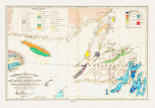
Geological map of Canada and Newfoundland, 1875 , map on heavy cotton canvas, 45 x 65 cm, 18 x 24" approx.
Regular price $45.00 CADRegular price -
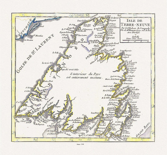

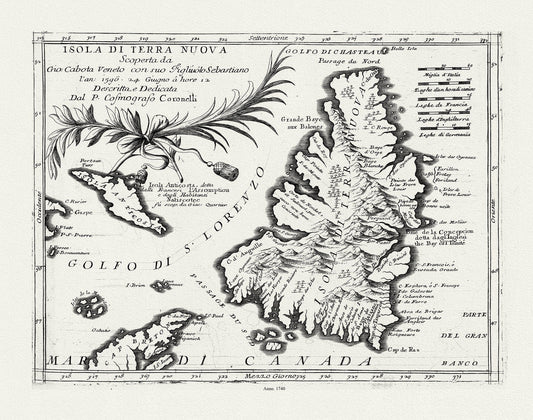
Isle de Terre-neuve, Vaugondy auth., 1749 , map on heavy cotton canvas, 45 x 65 cm, 18 x 24" approx.
Regular price $45.00 CADRegular price -
Labrador Peninsula, NW Sheet, 1896 , map on heavy cotton canvas, 45 x 65 cm, 18 x 24" approx.
Regular price $45.00 CADRegular price -
Labrador Peninsula, SE Sheet, 1896, map on heavy cotton canvas, 45 x 65 cm, 18 x 24" approx.
Regular price $45.00 CADRegular price -
Labrador Peninsula, SW Sheet, 1896 , map on heavy cotton canvas, 45 x 65 cm, 18 x 24" approx.
Regular price $45.00 CADRegular price -
Map of Newfoundland in British America, McGregor auth., 1832, map on heavy cotton canvas, 45 x 65 cm, 18 x 24" approx.
Regular price $45.00 CADRegular price -
Newfoundland, A handrawn Map showing position of shipwrecks around the coast, R.White auth., 1904, on canvas, 45 x 65 cm, 18 x 24" approx.
Regular price $45.00 CADRegular price -
Newfoundland, A Sportman's Paradise, 1960, a travel poster on heavy cotton canvas, 45 x 65 cm, 18 x 24" approx.
Regular price $45.00 CADRegular price -
Lotter, Carte de la nouvelle république de lʾAmérique ou les treize Provinces Unies, 1778 , map on heavy cotton canvas, 22x27" approx.
Regular price $45.00 CADRegular price -
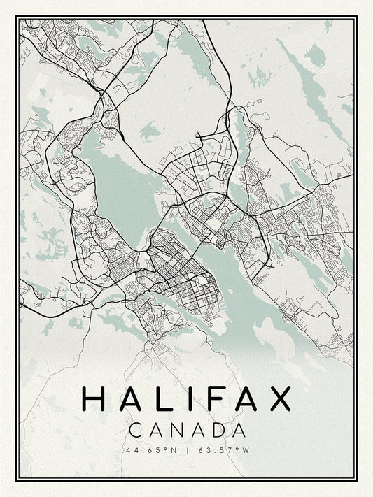
Halifax, Nova Scotia, A Modern Map, on heavy cotton canvas, 45 x 65 cm, 18 x 24" approx.
Regular price $45.00 CADRegular price -
North and South America ,1658, Walton auth.
Regular price $45.00 CADRegular price