-
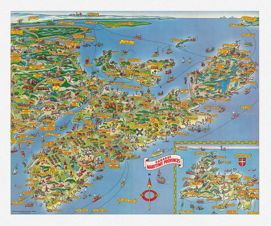
Bloodgood, A Pic-Tour Map of Canada's Maritime Provinces, 1953
Regular price $45.00 CADRegular price -
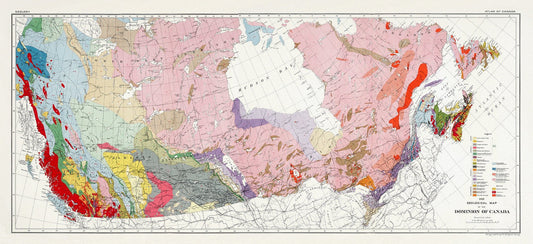
Composite Geological Map of the Dominion of Canada, Issued 1915, on heavy cotton canvas, 22x27" approx.
Regular price $45.00 CADRegular price -
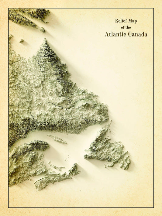
Relief Map of Atlantic Canada, 1924 Ver. IV , map on heavy cotton canvas, 50 x 70 cm, 20 x 25" approx.
Regular price $45.00 CADRegular price -
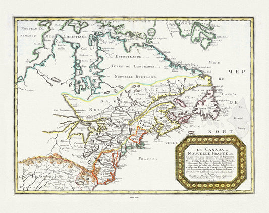
Nouvelle France, qui de diverses Relations des Anglois, Danois. Vers le Midy les Costes de Virginie, Nouvlle Suede, Nouveau Pays Bas, 1656,
Regular price $45.00 CADRegular price -
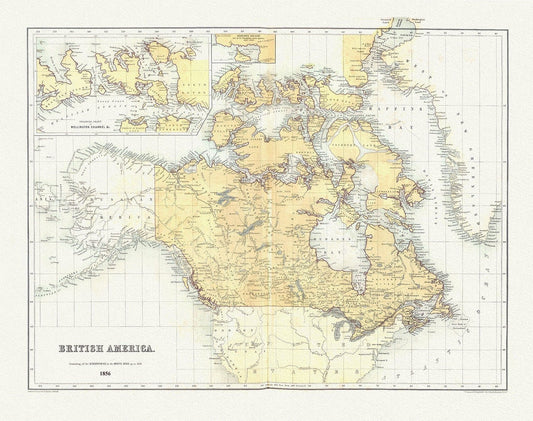
British America, 1856, map on heavy cotton canvas, 50 x 70 cm, 20 x 25" approx.
Regular price $45.00 CADRegular price -
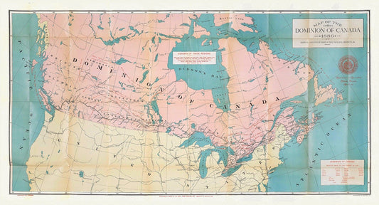
Canada, its history, productions and natural resources, prepared under the direction of Honourable John Carling, 1886, map on canvas, 20x25"
Regular price $45.00 CADRegular price -
Canada, Hall auth., 1829, map on heavy cotton canvas, 50 x 70 cm, 20 x 25" approx.
Regular price $45.00 CADRegular price -
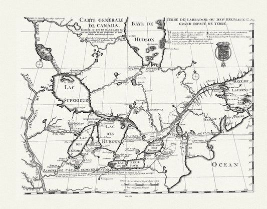
Carte generale de Canada, Lahotan auth., 1706, map on heavy cotton canvas, 50 x 70 cm, 20 x 25" approx.
Regular price $45.00 CADRegular price -
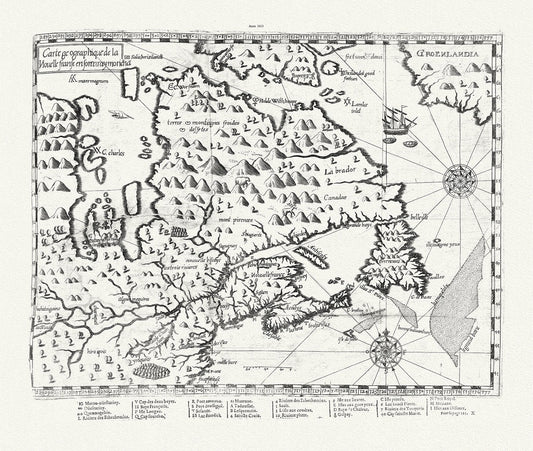
Carte geographique de la Nouelle franse en son vray moricha, Champlain auth., 1613, map on heavy cotton canvas, 50 x 70 cm, 20 x 25" approx.
Regular price $45.00 CADRegular price -
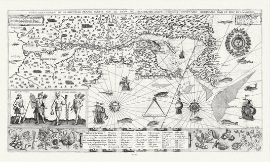
Carte geographiqve de la Nouvelle France, St Tongois cappitaine ordinaire pour le roy , Champlain.auth., 1612,,canvas, 20 x 25" approx.
Regular price $45.00 CADRegular price -
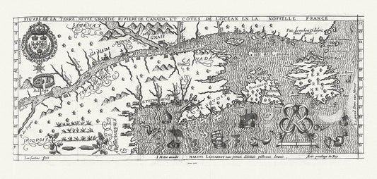
Figure de la Terre Neuve, le grande riviere de Canada, et côtes de l'ocean en la Nouvelle France, Les Carbot auth.,1609, 20 x 25" approx.
Regular price $45.00 CADRegular price -
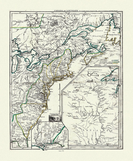
LaRouge, Canada et Louisiana, 1793, map on heavy cotton canvas, 50 x 70 cm, 20 x 25" approx.
Regular price $45.00 CADRegular price -
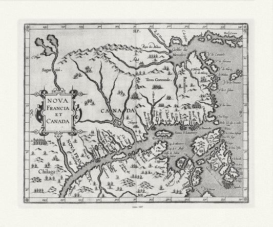
Wytfliet, Corneille, Nova Francia et Canada, 1607 , map on heavy cotton canvas, 22x27" approx.
Regular price $45.00 CADRegular price -
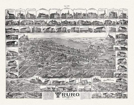
Truro, Nova Scotia, A Birdseye View, 1889 , vintage print on canvas, 50 x 70 cm, 20 x 25" approx.
Regular price $45.00 CADRegular price -
Lunenburg, Nova Scotia, A Bird's Eye View, 1890 , map on durable cotton canvas, 50 x 70 cm, 20 x 25" approx.
Regular price $45.00 CADRegular price -
Moncton, New Brunswick, A Birds's Eye View, 1888, map on durable cotton canvas, 50 x 70 cm, 20 x 25" approx.
Regular price $45.00 CADRegular price -
St. Stephen, New Brunswick and Calais, Maine, A Birdseye View, 1889, map on durable cotton canvas, 50 x 70 cm, 20 x 25" approx.
Regular price $45.00 CADRegular price -
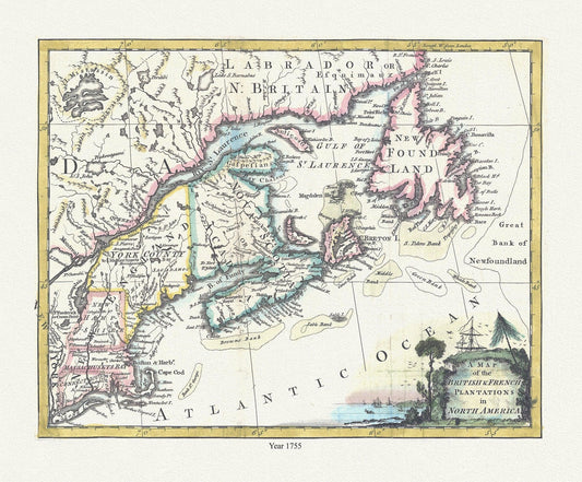
A map of the British & French plantations in North America, 1755, map on durable cotton canvas, 50 x 70 cm, 20 x 25" approx.
Regular price $45.00 CADRegular price -
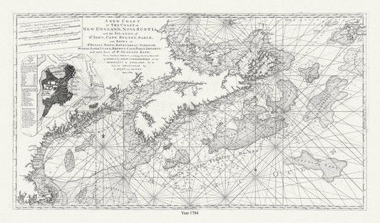
Chart of the coast of New England, Nova Scotia, and the islands of St. John, Cape Breton, Sable, banks St. Peters, 1784, Keulen auth.
Regular price $27.00 CADRegular price -
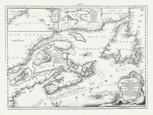
A new chart of the coast of New England, Nova Scotia, New France or Canada, with the islands of Newfoundland., Cape Breton, .Jefferys, 1746
Regular price $45.00 CADRegular price -
L'Acadie ,1769 Vaugondy auth., map on durable cotton canvas, 50 x 70 cm, 20 x 25" approx.
Regular price $45.00 CADRegular price -
Map of the province of Nova Scotia including Cape Breton Prince Edwards Island and part of New Brunswick, Toler, 1819, 20 x 25" approx.
Regular price $45.00 CADRegular price -
Morse, Jedidiah, A New Map of Nova Scotia, New Brunswick and Cape Breton, 1794, map on durable cotton canvas, 50 x 70 cm, 20 x 25" approx.
Regular price $45.00 CADRegular price -
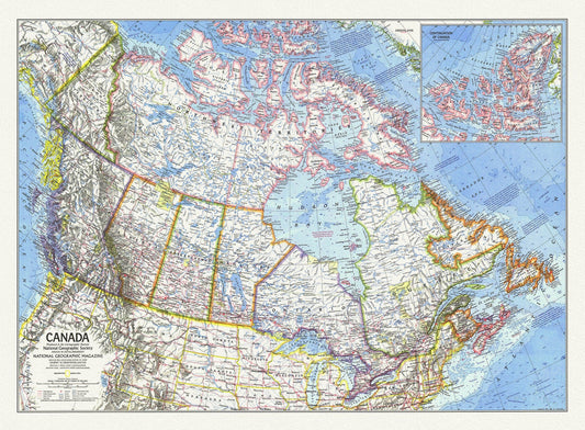
Canada, National Geographic, 1972, map on heavy cotton canvas, 50 x 70 cm, 21 x 25" approx.
Regular price $45.00 CADRegular price