-
North America, 1747, Bowen auth. , map on heavy cotton canvas, 50 x 70cm, 20 x 27" approx.
Regular price $45.00 CADRegular price -
North America II, 1783, Bonne auth., map on heavy cotton canvas, 50 x 70cm, 20 x 27" approx.
Regular price $45.00 CADRegular price -
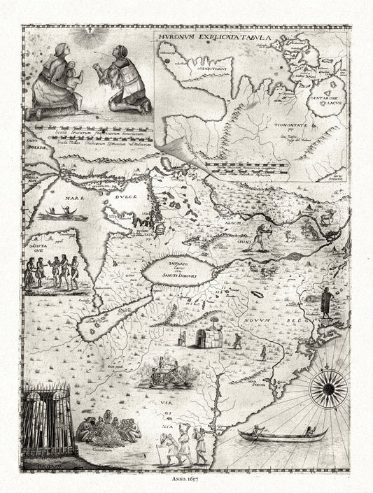
Bressani, Novae Franciae accurata delineatio , 1657 Ver. II , map on heavy cotton canvas, 50 x 70cm, 20 x 27" approx.
Regular price $45.00 CADRegular price -
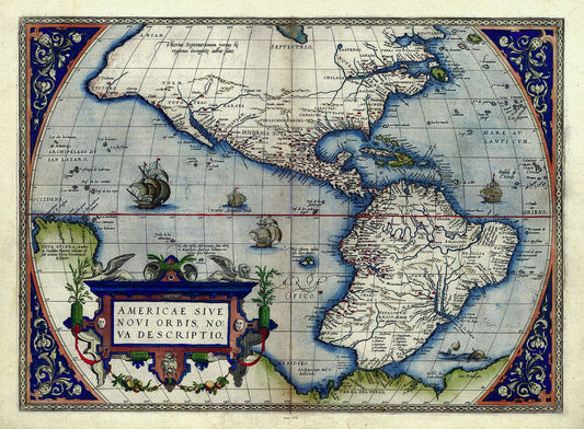
Abraham Ortelius, Theatrum Orbis Terrarum-Americae sive novi orbis, nova descriptio, Anno. 1570 Ver. III, 50 x 70 cm, 20 x 25" approx.
Regular price $45.00 CADRegular price -
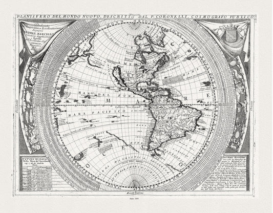
E Coronelli, Planisfero del Mondo Nuovo, 1693, map on durable cotton canvas, 50 x 70 cm, 20 x 25" approx.
Regular price $45.00 CADRegular price -
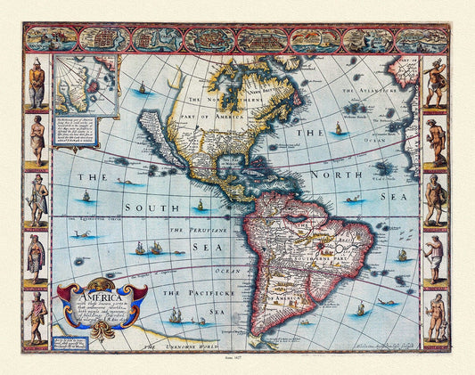
Goos-America with those known parts in that unknowne worlde both people, 1627, map on durable cotton canvas, 50 x 70 cm, 20 x 25" approx.
Regular price $45.00 CADRegular price -
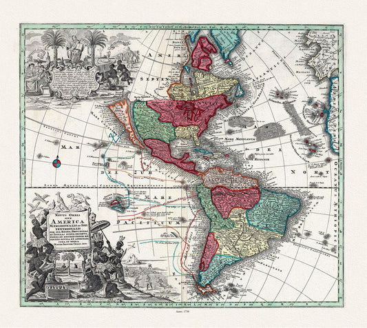
Seutter, Novis Orbis sive America, 1730, map on durable cotton canvas, 50 x 70 cm, 20 x 25" approx.
Regular price $45.00 CADRegular price -
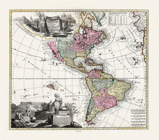
Visscher, Americae tam Septentrionalis Quam Meridionalis in Mappa Geographica Deliniatio, 1740 Ver. I, map , 50 x 70 cm, 20 x 25" approx.
Regular price $45.00 CADRegular price -
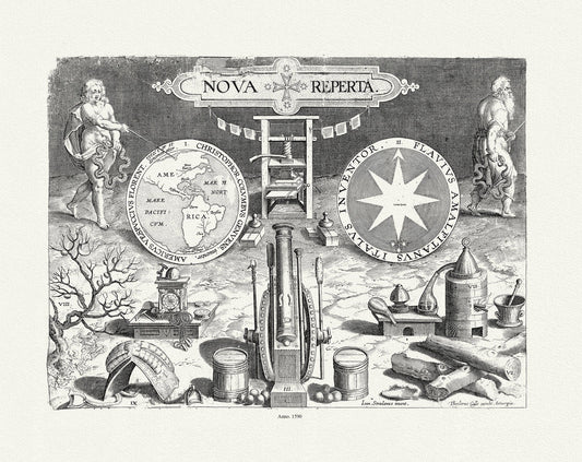
Galle et Straet, Map of Western Hemisphere, 1590, map on durable cotton canvas, 50 x 70 cm, 20 x 25" approx.
Regular price $45.00 CADRegular price -
Mariette, Carte de l'Amerique, 1646, map on durable cotton canvas, 50 x 70 cm, 20 x 25" approx.
Regular price $45.00 CADRegular price -
Ogilby et Montanus, Novissima et Accuratissima Totius Americae Descriptio, 1671, map on durable cotton canvas, 50 x 70 cm, 20 x 25" approx.
Regular price $45.00 CADRegular price -
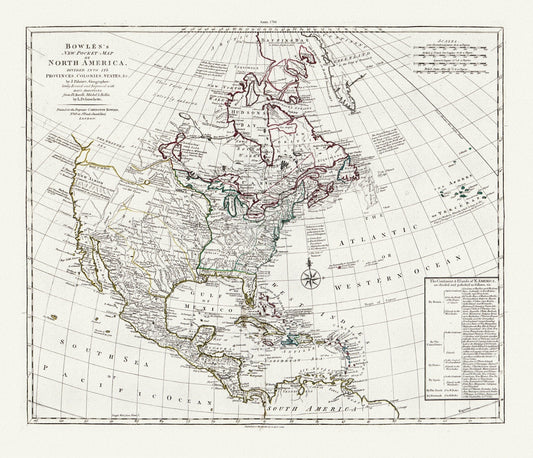
Bowles's new pocket map of North America, divided into it's provinces, colonies, states, &c.,1784 Ver.2 , on cotton canvas, 20 x 25" approx.
Regular price $45.00 CADRegular price -
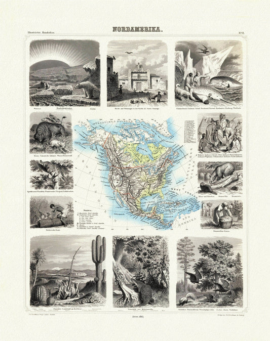
Brockhaus, Nordamerica, 1863, map on heavy cotton canvas, 20 x 25" approx
Regular price $45.00 CADRegular price -
Liechtenstern et Hartl, Nord America, 1805, map on heavy cotton canvas, 20 x 25" approx.
Regular price $45.00 CADRegular price -
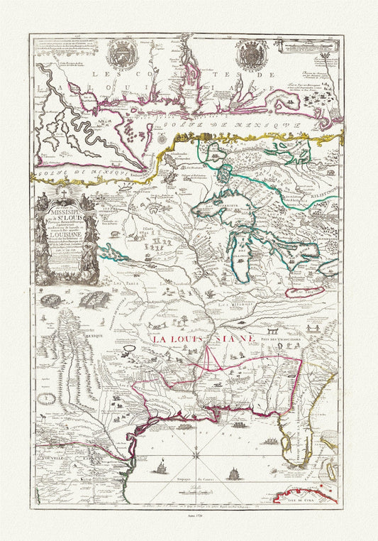
Fer, Composite Le cours de Missisipi, ou de St. Louis, Partie meridionale de la Riviere de Missisipi, 1720, on cotton canvas, 20 x 25"
Regular price $45.00 CADRegular price -
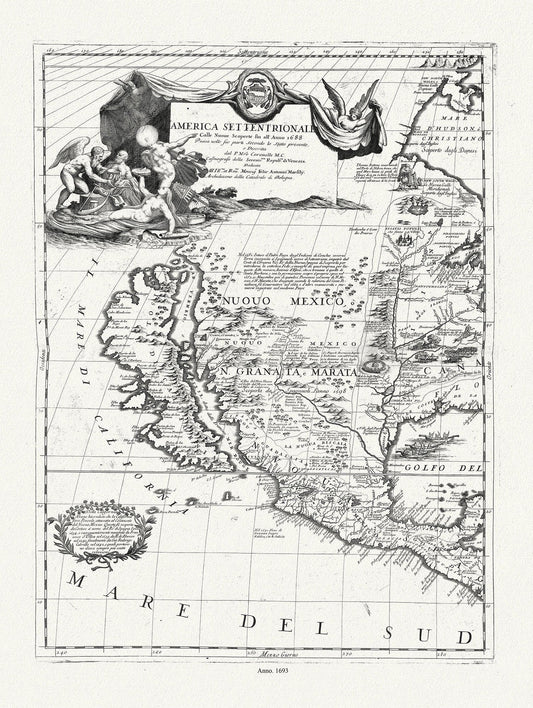
Coronelli (Vicenzo 1650-1718)-America Settentrionale (parte occidentale), 1693, map on heavy cotton canvas, 20 x 25" approx.
Regular price $45.00 CADRegular price -
Map of a Large Country Newly Discovered in the Northern America Situated between New Mexico And the Frozen Sea, Hennepin,1698, 20 25" approx
Regular price $45.00 CADRegular price -
Map of New England According to the Latest Observation, 1720, Neal auth., map on durable cotton canvas, 50 x 70 cm, 20 x 25" approx.
Regular price $45.00 CADRegular price -
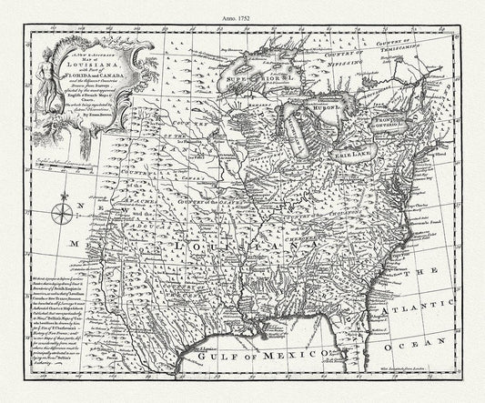
A new & accurate map of Louisiana, with part of Florida and Canada, and the adjacent countries, 1752, Bowen auth. canvas, 20 x 25" approx.
Regular price $45.00 CADRegular price -
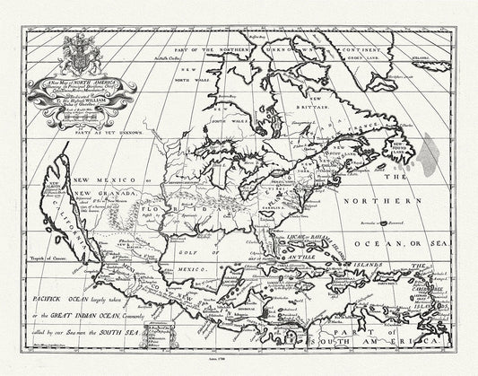
A New Map of North America, Wells auth., 1700, map on durable cotton canvas, 50 x 70 cm, 20 x 25" approx.
Regular price $45.00 CADRegular price -
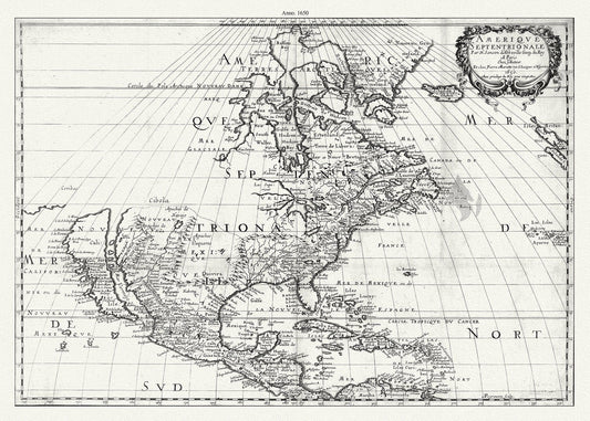
Amérique septentrionale, 1650, Marriette auth. , map on durable cotton canvas, 50 x 70 cm, 20 x 25" approx.
Regular price $45.00 CADRegular price -
l'Amerique Septle. pour servir a l'intelligence de la guerre entre les Anglois et les insurgents,1777, Beaurain auth. canvas 20 x 25"
Regular price $45.00 CADRegular price -
L'Amérique septentrionale, 1757, Covens et Mortier auths., map on durable cotton canvas, 50 x 70 cm, 20 x 25" approx.
Regular price $45.00 CADRegular price -
L'Amerique Septentrionale, ou la Partie Septentrionale des Indes Occidentales, 1689, Nolin auth. , map on canvas, 20 x 25" approx.
Regular price $45.00 CADRegular price