-
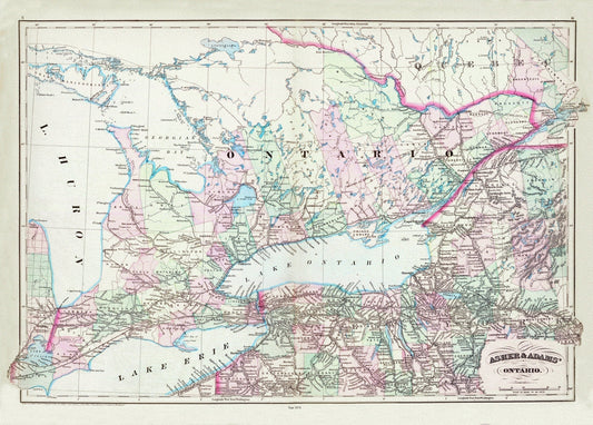
Asher & Adams, Ontario, 1872 , map on heavy cotton canvas, 22x27" approx.
Regular price $45.00 CADRegular price -
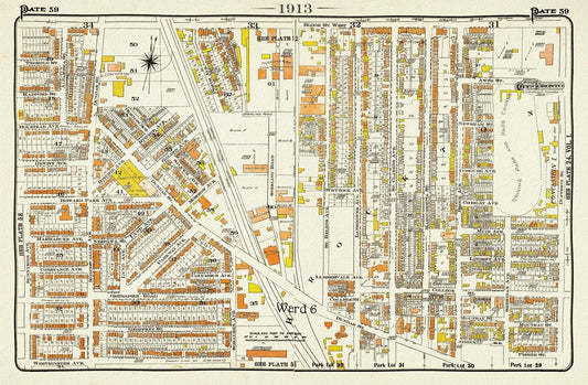
Plate 59, TorontoWest, Roncesvalles, Brockton North, 1913, map on heavy cotton canvas, 20 x 30" or 50 x 75cm. approx.
Regular price $45.00 CADRegular price -
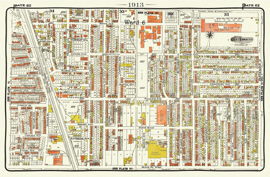
Plate 62, Toronto West, The Junction Triangle, 1913, map on heavy cotton canvas, 20 x 30" or 50 x 75cm. approx.
Regular price $45.00 CADRegular price -
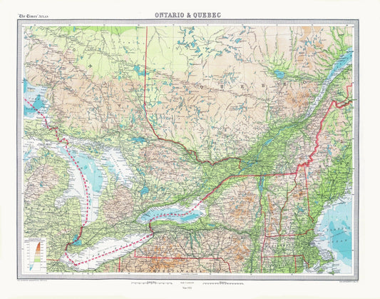
Bartholomew, Ontario & Quebec, 1922 , map on heavy cotton canvas, 22x27" approx.
Regular price $45.00 CADRegular price -
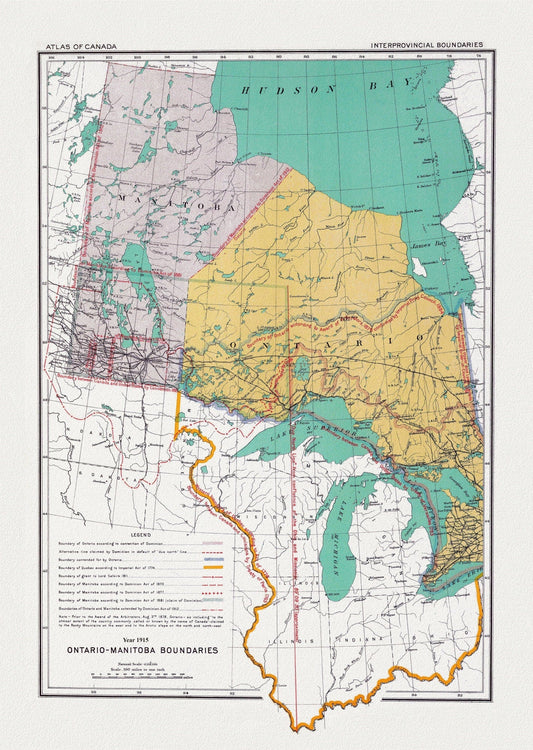
Canada Department of the Interior et Chalifour, Ontario & Manitoba boundary, 1915, map on heavy cotton canvas, 22x27" approx.
Regular price $45.00 CADRegular price -
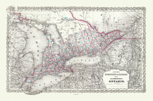
Colton, The Dominion of Canada No. 2., The Province of Ontario, 1880 , map on heavy cotton canvas, 22x27" approx.
Regular price $45.00 CADRegular price -
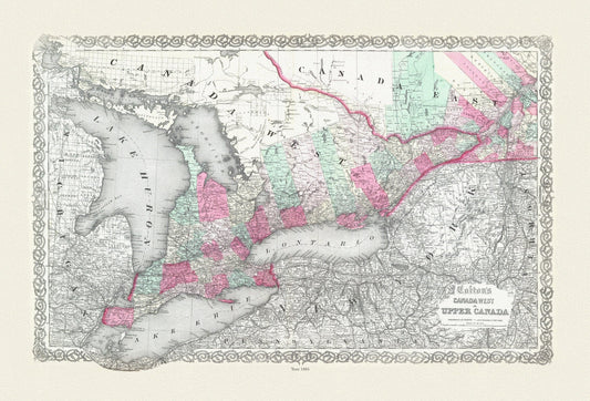
Colton, Canada West or Upper Canada, 1865, map on heavy cotton canvas, 22x27" approx.
Regular price $45.00 CADRegular price -
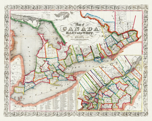
Ensign, Bridgman & Fanning, A Map of Canada East And West, 1855, map on heavy cotton canvas, 22x27" approx.
Regular price $45.00 CADRegular price -
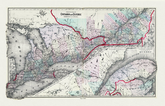
Gray, Ontario and Quebec, 1884, map on heavy cotton canvas, 22x27" approx.
Regular price $45.00 CADRegular price -
H.H. Hardesty & Co., Map of Ontario, No. 1, Western Half, 1884 , map on heavy cotton canvas, 22x27" approx.
Regular price $45.00 CADRegular price -
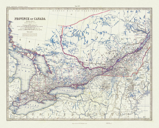
Johnson, Canada West, 1871, map on heavy cotton canvas, 22x27" approx.
Regular price $45.00 CADRegular price -
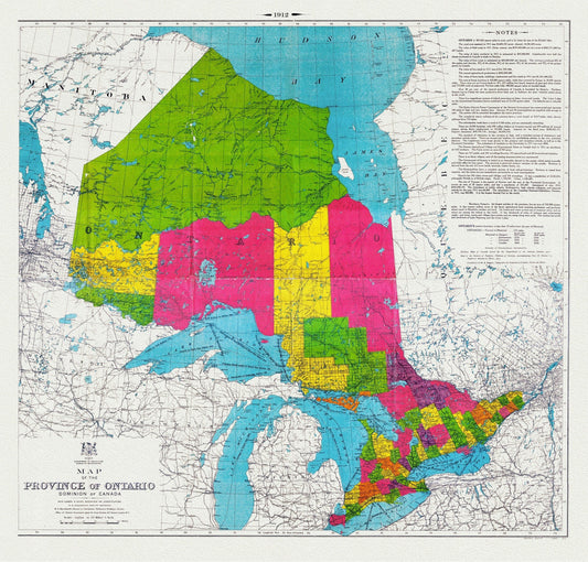

Map of the Province of Ontario, Dominion of Canada, 1912, map on heavy cotton canvas, 22x27" approx.
Regular price $45.00 CADRegular price -
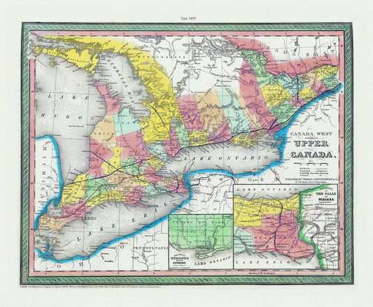
Mitchell, Canada West, (Formerly Upper Canada), 1855, map on heavy cotton canvas, 22x27" approx.
Regular price $45.00 CADRegular price -
Mitchell, Map Of Canada West In Counties, 1860, map on heavy cotton canvas, 22x27" approx.
Regular price $45.00 CADRegular price -
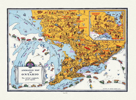
Master et Elias, An Animated Map of Ontario, 1929 , map on heavy cotton canvas, 22x27" approx.
Regular price $45.00 CADRegular price -
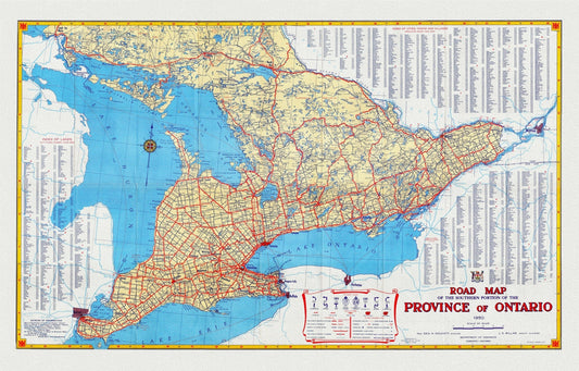
Official Road Map of Ontario, 1950, map on heavy cotton canvas, 22x27" approx.
Regular price $45.00 CADRegular price -
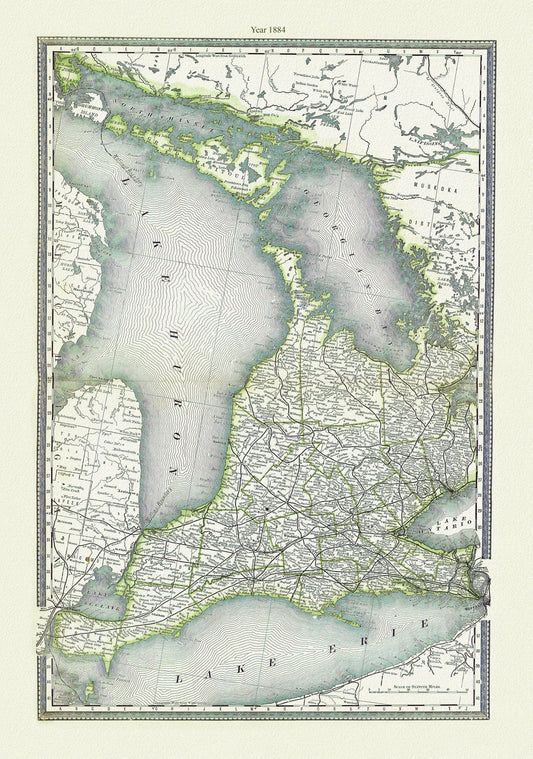
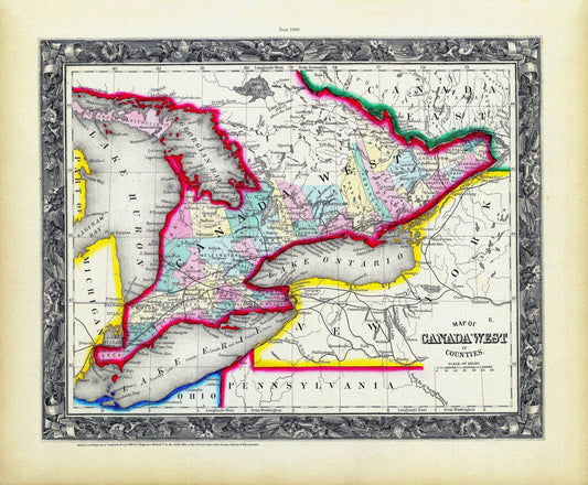
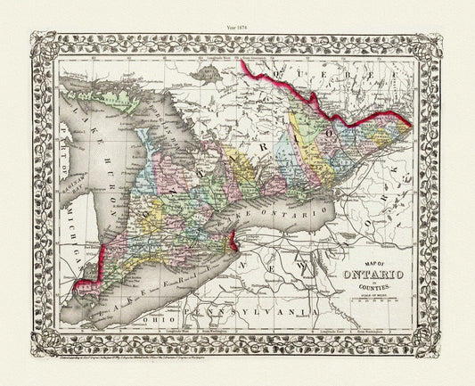
Mitchell, Map of Ontario in Counties, 1874, map on heavy cotton canvas, 22x27" approx.
Regular price $45.00 CADRegular price -
Rand, McNally & Co., Map of Western Ontario, 1878, map on heavy cotton canvas, 22x27" approx.
Regular price $45.00 CADRegular price -
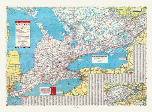
Road Map of Southern Ontario, 1955 , map on heavy cotton canvas, 22x27" approx.
Regular price $45.00 CADRegular price -
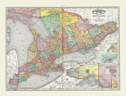
Rand, McNally & Co., Province of Ontario, 1892, map on heavy cotton canvas, 22x27" approx.
Regular price $45.00 CADRegular price -
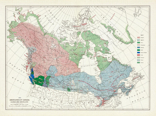
Aborigines of Canada, Alaska and Greenland, issued 1915, Map on heavy cotton canvas, 22x27" approx.
Regular price $45.00 CADRegular price -
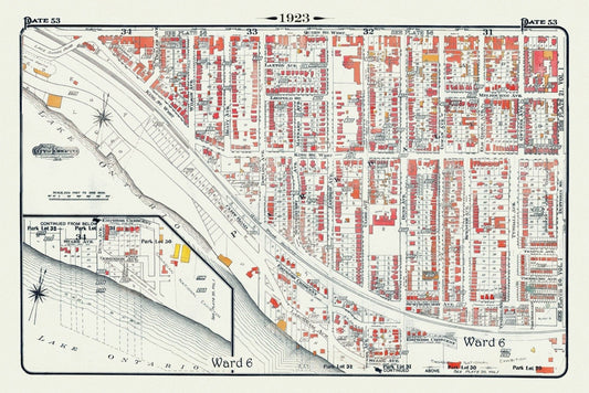
Plate 53, Toronto West, Parkdale South & West, 1923, Map on heavy cotton canvas, 18x27in. approx.
Regular price $40.00 CADRegular price -
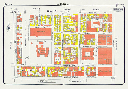
Plate 9, Toronto Downtown, City Hall, St. John's Ward, 1910 , map on heavy cotton canvas, 20 x 30" approx.
Regular price $45.00 CADRegular price -
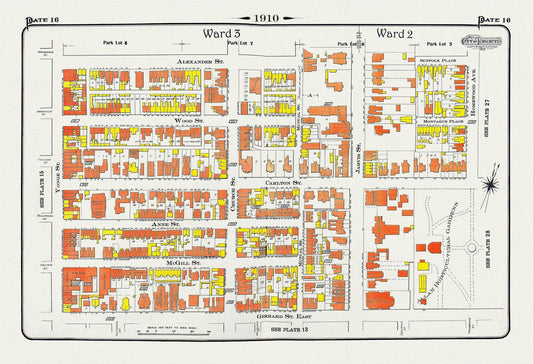
Plate 16, Toronto Downtown East, Allan Gardens, 1910 , map on heavy cotton canvas, 20 x 30" approx.
Regular price $45.00 CADRegular price