-
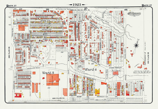
Plate 37, Toronto Central North West, Wychwood, Casa Loma, 1923, Map on heavy cotton canvas, 18x27in. approx.
Regular price $45.00 CADRegular price -
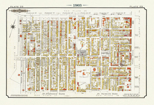
Plate 23, Toronto West, Kensington Market & Little Italy, 1903, map on heavy cotton canvas, 20 x 30" or 50 x 75cm. approx.
Regular price $45.00 CADRegular price -
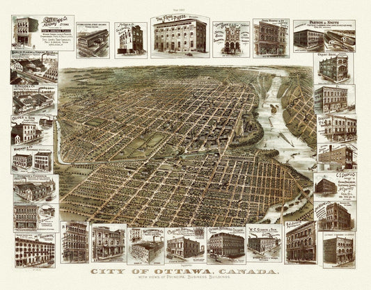
Birdseye View of the City of Ottawa, 1895, on heavy cotton canvas, approx. 22x27"
Regular price $45.00 CADRegular price -
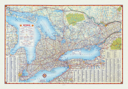
Shell Oil Company of Canada, Road Map of Ontario, 1955, map on heavy cotton canvas, 22x27" approx.
Regular price $45.00 CADRegular price -
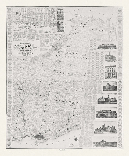
York County: Tremaine's Map of the County of York, Canada West, 1860, map on heavy cotton canvas, 22x27" approx.
Regular price $45.00 CADRegular price -
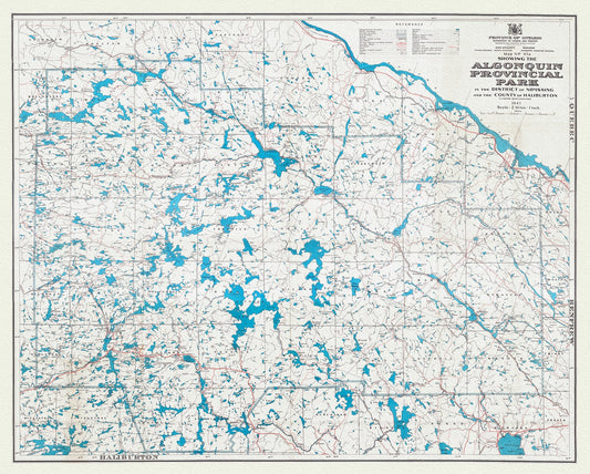
Map No. 47A showing the Algonquin Provincial Park in the District of Nipissing and the County of Haliburton, 1947, cotton canvas, 22x27"
Regular price $45.00 CADRegular price -
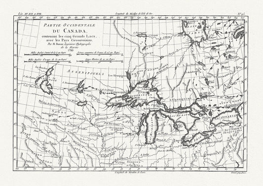
Raynall et Bonne, Partie Occidentale Du Canada, 1780, map on heavy cotton canvas, 50 x 70cm, 20 x 27" approx.
Regular price $45.00 CADRegular price -
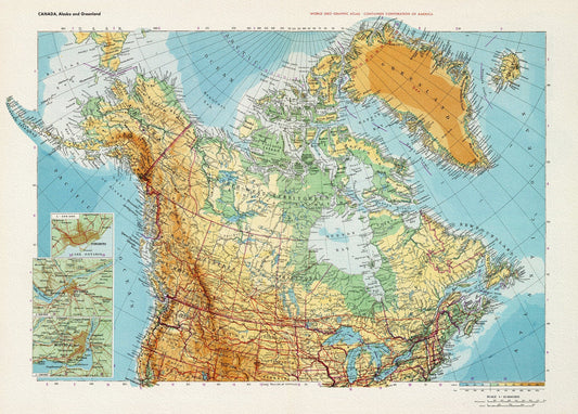
Canada. Alaska. Greenland, 1953,map on heavy cotton canvas, 22x27" approx.
Regular price $45.00 CADRegular price -
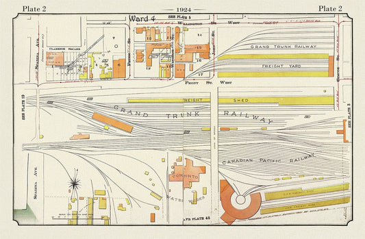
Plate 02, Toronto Downtown, Railway Lands, 1924, map on heavy cotton canvas, 20 x 30" or 50 x 75cm. approx.
Regular price $45.00 CADRegular price -
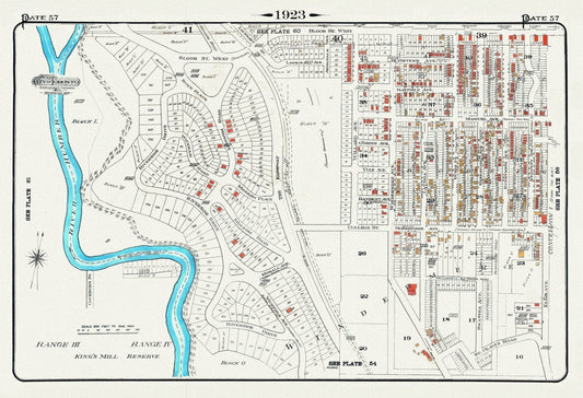
Plate 57, Toronto West, High Park West, South Kingsway & Swansea, 1923, Map on heavy cotton canvas, 18x27in. approx.
Regular price $45.00 CADRegular price -
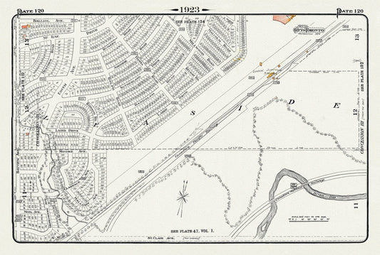
Plate 120, Toronto Uptown East, Leaside Station Junction, 1923, Map on heavy cotton canvas, 18x27in. approx.
Regular price $45.00 CADRegular price -
Plate 56, Toronto West, High Park East, Parkdale & Brockton, 1910 , map on heavy cotton canvas, 20 x 30" approx.
Regular price $45.00 CADRegular price -
Plate 56, Toronto West, High Park East, Parkdale & Brockton, 1923, Map on heavy cotton canvas, 18x27in. approx.
Regular price $45.00 CADRegular price -
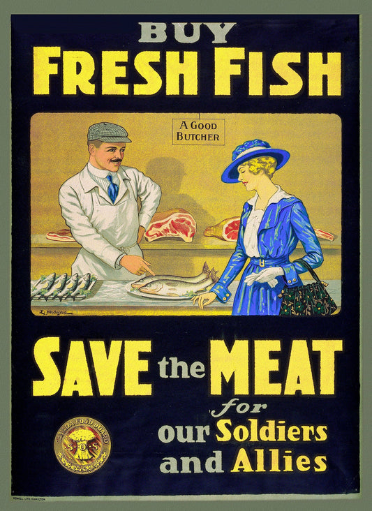
Canada WW I Poster, Buy Fresh Fish, save the meat for our soldiers and allies, 1914, on heavy canvas, 22x27" approx.
Regular price $45.00 CADRegular price -
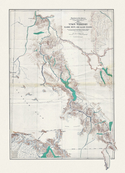
Yukon Territory, 1905, Map on heavy cotton canvas, 27x22" approx.
Regular price $45.00 CADRegular price -
Canada, Department of Interior, Hamilton, 1915, map on heavy cotton canvas, 22x27" approx.
Regular price $45.00 CADRegular price -
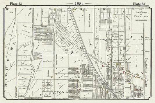
Plate 33, Toronto West, High Park to Brockton, Roncesvalles, 1884, map on heavy cotton canvas, 20 x 30" approx.
Regular price $45.00 CADRegular price -
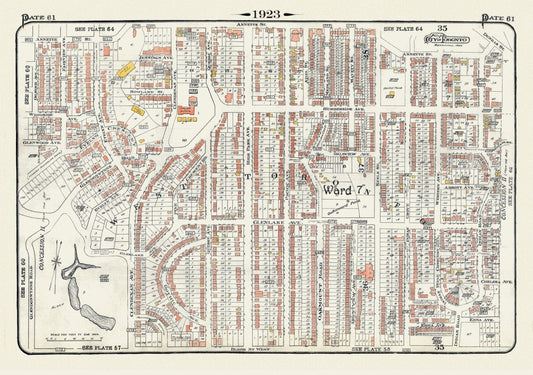
Plate 61, Toronto West, High Park North, 1923, Map on heavy cotton canvas, 18x27in. approx.
Regular price $45.00 CADRegular price -
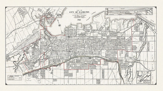
Map of the City of Hamilton, Ontario, 1943, on heavy cotton canvas, 22x27" approx.
Regular price $45.00 CADRegular price -
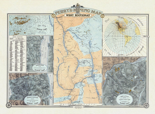
Perry's Mining Map of the Southern District of West Kootenay, 1893, Map on heavy cotton canvas, 22x27" approx.
Regular price $45.00 CADRegular price -
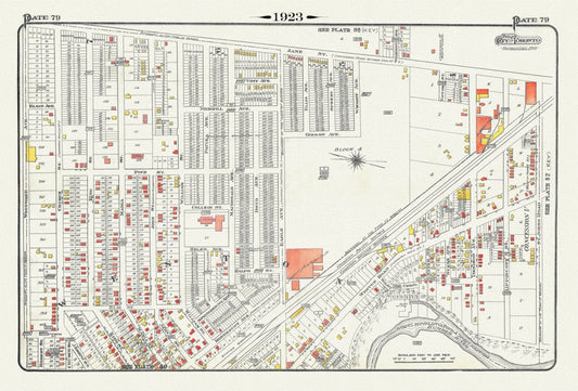
Plate 79, Toronto North West, Weston, 1923, Map on heavy cotton canvas, 18x27in. approx.
Regular price $45.00 CADRegular price -
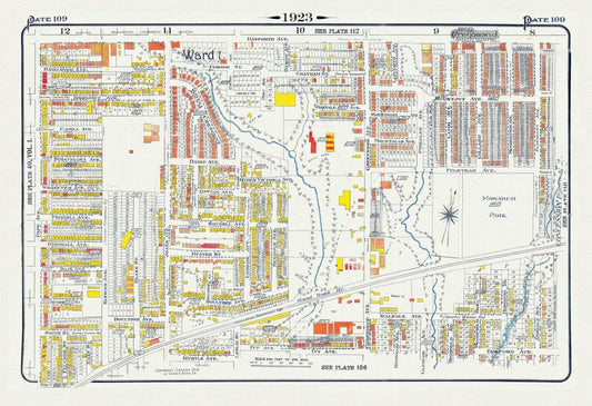
Plate 109, Toronto East, Leslieville North, Monarch Park, 1923, Map on heavy cotton canvas, 18x27in. approx.
Regular price $45.00 CADRegular price -
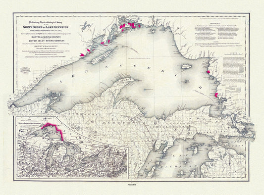
Colton, Preliminary map to a geological survey of the north shore of Lake Superior, Ontario, 1871 ,map on cotton canvas, 20 x 25" approx.
Regular price $45.00 CADRegular price -
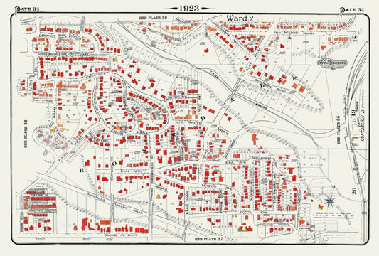
Plate 34, Toronto Uptown, Rosedale, 1923, Map on heavy cotton canvas, 18x27in. approx.
Regular price $45.00 CADRegular price