-
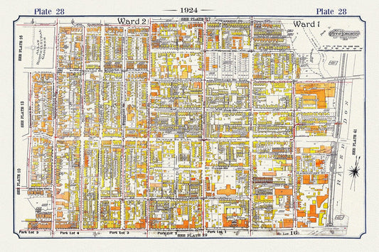
Plate 07, Toronto Downtown East, Cabbagetown, 1924, map on heavy cotton canvas, 20 x 30" or 50 x 75cm. approx.
Regular price $45.00 CADRegular price -
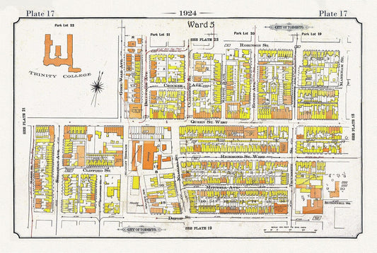
Plate 17, Toronto West, Parkdale-Trintity, 1924, map on heavy cotton canvas, 20 x 30" or 50 x 75cm. approx.
Regular price $45.00 CADRegular price -
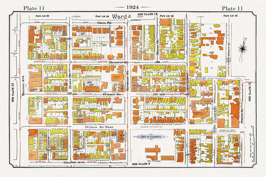
Plate 11, Toronto Downtown West, Art Gallery of Ontario, 1924, map on heavy cotton canvas, 20 x 30" or 50 x 75cm. approx.
Regular price $45.00 CADRegular price -
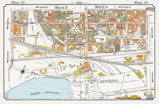
Plate 19, Toronto Downtown Harbour Lands West to Bathurst St., 1924, map on heavy cotton canvas, 20 x 30" or 50 x 75cm. approx.
Regular price $45.00 CADRegular price -
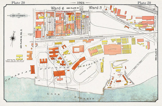
Plate 20, Toronto Downtown Harbour Lands West to Canadian National Exhibition Grounds, 1924, map on heavy cotton canvas, 20 x 30" approx.
Regular price $45.00 CADRegular price -
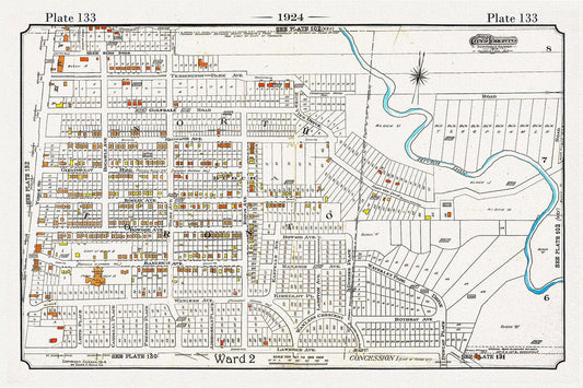
Plate 133, Toronto Uptown, Lawrence Park, 1924, map on heavy cotton canvas, 20 x 30" or 50 x 75cm. approx.
Regular price $45.00 CADRegular price -
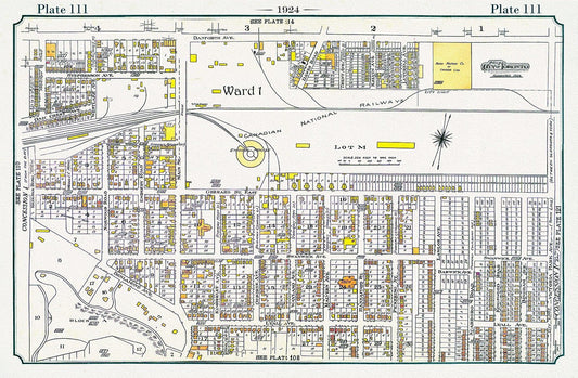
Plate 111, Toronto East, The Danforth, Main to Victoria Park, 1924, map on heavy cotton canvas, 20 x 30" or 50 x 75cm. approx.
Regular price $45.00 CADRegular price -
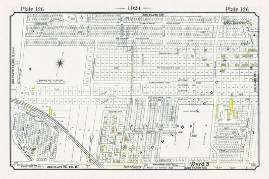
Plate 126, Toronto North and West, Old Hunt Club at Bathurst, 1924, map on heavy cotton canvas, 20 x 30" or 50 x 75cm. approx.
Regular price $45.00 CADRegular price -
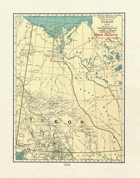
Yukon, 1924, Map on heavy cotton canvas, 27x22" approx.
Regular price $45.00 CADRegular price -
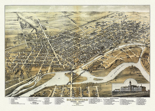
Bird's eye view of Brantford, Province of Ontario, Canada, 1875, map on heavy cotton canvas, 22x27" approx.
Regular price $45.00 CADRegular price -
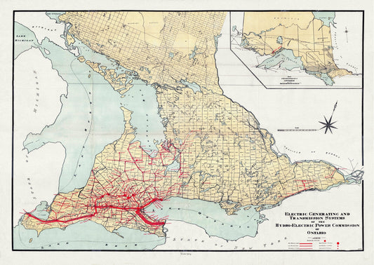
The Electric Generating and Transmission Systems of the Hydro, Electric Power Commission of Ontario, 1914 , map on canvas, 22x27" approx.
Regular price $45.00 CADRegular price -
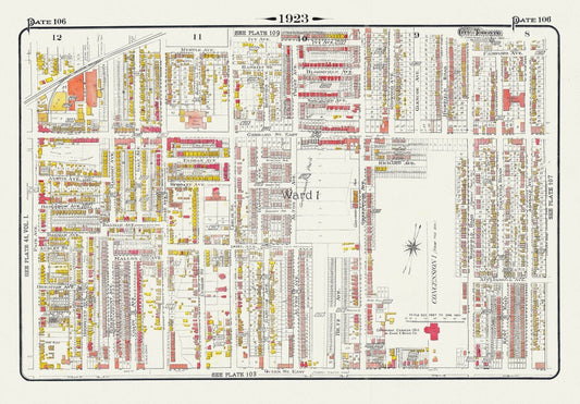
Plate 106, Toronto East, Leslieville and North, 1923, Map on heavy cotton canvas, 18x27in. approx.
Regular price $45.00 CADRegular price -
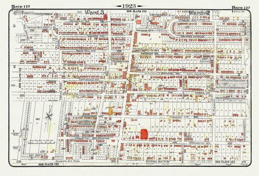
Plate 127, Toronto Uptown, Yonge St. North of Eglinton, 1923, Map on heavy cotton canvas, 18x27in. approx.
Regular price $45.00 CADRegular price -
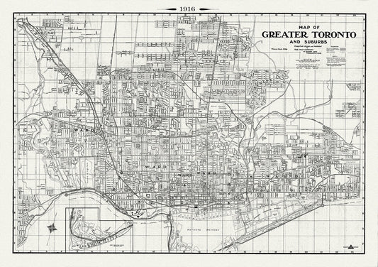
Map of Greater Toronto & Suburbs, 1916 , map on heavy cotton canvas, 22x27" approx.
Regular price $45.00 CADRegular price -
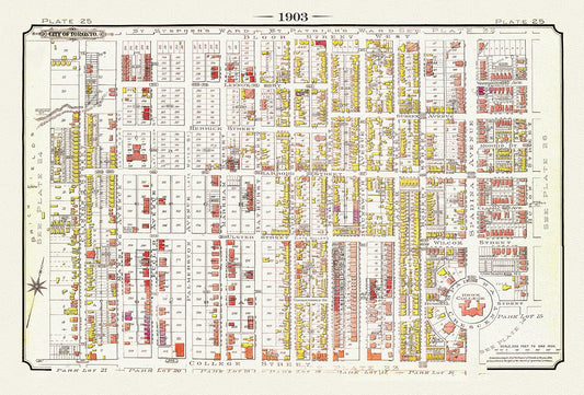
Plate 25, Toronto Downtown West, Annex South, Knox College, 1903 , map on heavy cotton canvas, 20 x 30", 50 x 76cm, approx.
Regular price $45.00 CADRegular price -
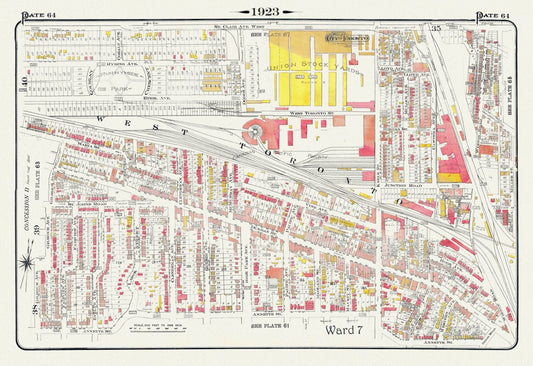
Plate 64, Toronto West, The Junction & Stockyards, 1923, Map on heavy cotton canvas, 18x27in. approx.
Regular price $45.00 CADRegular price -
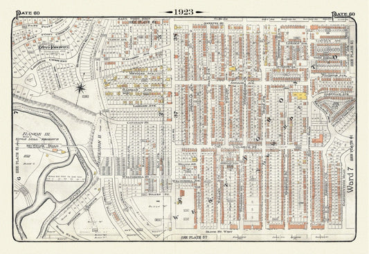
Plate 60, Toronto West, Bloor West Village, 1923, Map on heavy cotton canvas, 18x27in. approx.
Regular price $45.00 CADRegular price -
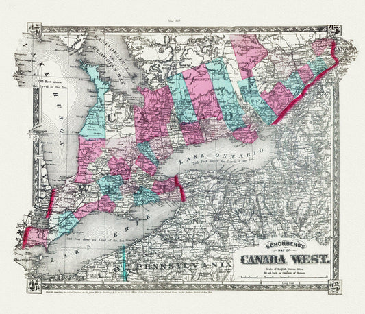
Schonberg's Map of Canada West, 1867 , map on heavy cotton canvas, 22x27" approx.
Regular price $45.00 CADRegular price -
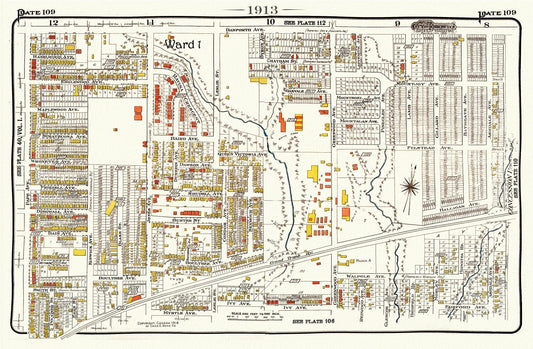
Plate 109, Toronto East, Riverdale East, Leslievile, 1913, map on heavy cotton canvas, 20 x 30" or 50 x 75cm. approx.
Regular price $45.00 CADRegular price -
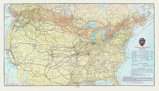
Map of Canadian Pacific Railway and Connecting Lines, 1912, on heavy cotton canvas, 20x27" approx.
Regular price $45.00 CADRegular price -
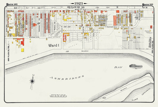
Plate 103, Toronto East, Waterfront, Ashbridges Bay, 1923, Map on heavy cotton canvas, 18x27in. approx.
Regular price $45.00 CADRegular price -
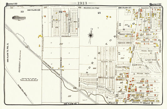
Plate 122, Toronto North, Forest Hill, Uptown, 1913, map on heavy cotton canvas, 20 x 30" or 50 x 75cm. approx.
Regular price $45.00 CADRegular price -
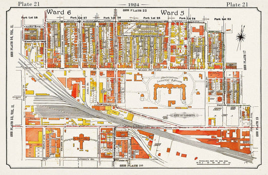
Plate 21, Toronto West, Parkdale, Gladstone Hotel, Asylum, 1924, map on heavy cotton canvas, 20 x 30" or 50 x 75cm. approx.
Regular price $45.00 CADRegular price -
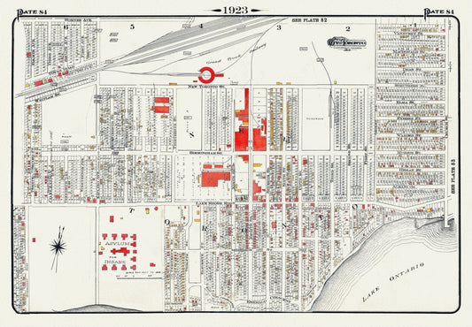
Plate 84, Toronto West, New Toronto, 1923, Map on heavy cotton canvas, 18x27in. approx.
Regular price $45.00 CADRegular price