-
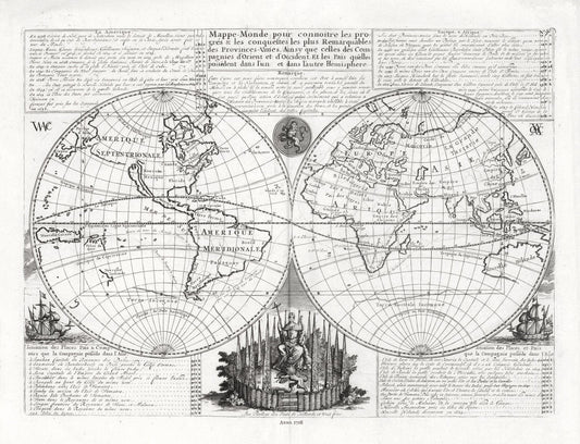
Henri Chatelain-Tome I. No. 46. Mappe-monde, 1718, Map on heavy cotton canvas, 22x27in. approx.
Regular price $45.00 CADRegular price -
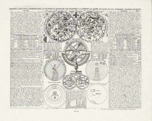
Henri Chatelaine, Tom I. No. 1. Premiere Carte Pour L'Introduction A L'Histoire Du Monde, 1718, canvas 22x27" approx.
Regular price $45.00 CADRegular price -
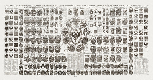
Heraldic Crests of the Roman Empire, Carte Heraldique Representant Les Armes De L' Empereur, 1720, on heavy cotton canvas, 18x43" approx.
Regular price $80.00 CADRegular price -
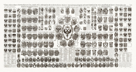
Heraldic Crests of the Roman Empire, Carte Heraldique Representant Les Armes De L' Empereur, 1720, on heavy cotton canvas, 22x27" approx.
Regular price $45.00 CADRegular price -
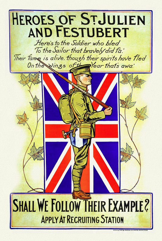
Heroes of St. Julien and Festubert, Shall We Follow Their Example, 1914
Regular price $45.00 CADRegular price -
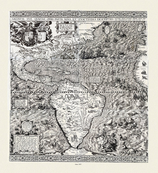
Hieronymous Cock, Americae sive qvartae orbis partis nova et exactissima descriptio, 1652 ,Map on heavy cotton canvas, 22x27in. approx.
Regular price $45.00 CADRegular price -
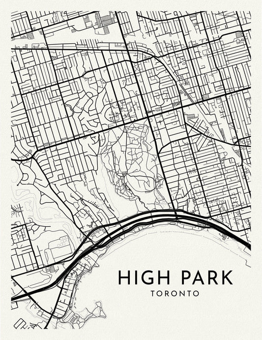
High Park, A Modern Map Ver. II, on durable cotton canvas, 50 x 70 cm, 20 x 25" approx.
Regular price $45.00 CADRegular price -
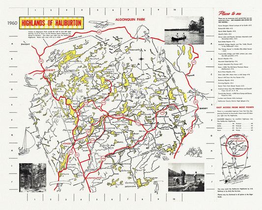
Highlands of Haliburton, Ontario, 1960, map on heavy cotton canvas, 1960
Regular price $45.00 CADRegular price -
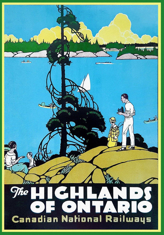
Highlands of Ontario, Travel Poster, Canadian National Railways, on heavy cotton canvas, 22x27" approx.
Regular price $45.00 CADRegular price -
Highways Map of Prairie Provinces and Adjacent States, 1930, map on heavy cotton canvas, 22x27" approx.
Regular price $45.00 CADRegular price -
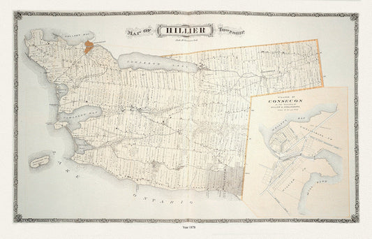
Hillier Township, Ont., 1878 , map on durable cotton canvas, 50 x 70 cm, 20 x 25" approx.
Regular price $45.00 CADRegular price -
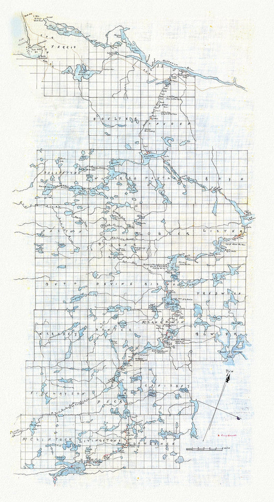
Historic Algonquin Park Map (Hand drawn), Kawagama to North Bay via Algonquin, c. 1916 , map on heavy cotton canvas, 20 x 25" approx.
Regular price $45.00 CADRegular price -
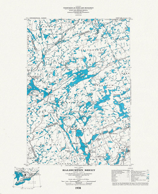
Historic Algonquin Park Map Haliburton West, National Topographic Series, 1938, map on heavy cotton canvas, 20x27" approx.
Regular price $45.00 CADRegular price -
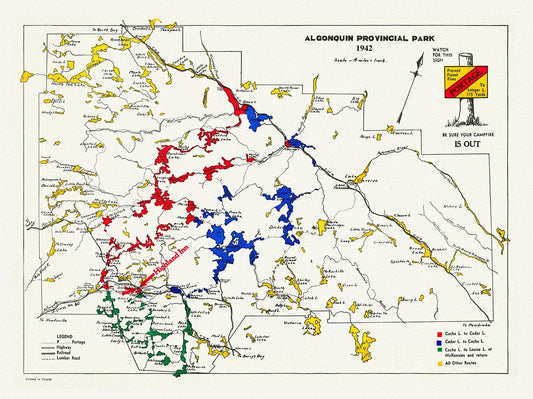
Historic Algonquin Park Map , Highland Inn, 1942, map on heavy cotton canvas, 20 x 25" approx.
Regular price $45.00 CADRegular price -
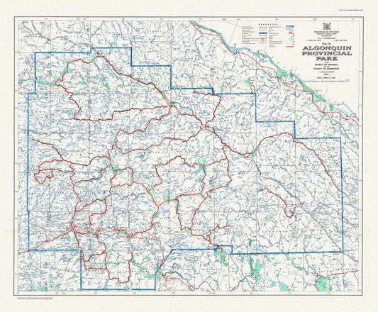
Historic Algonquin Park Map 47A, 1960 , map on heavy cotton canvas, 20 x 25" approx.
Regular price $50.00 CADRegular price -
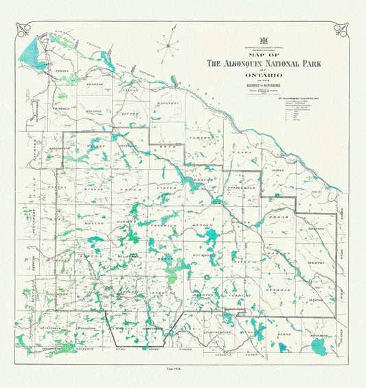
Historic Algonquin Park Map, 1914, map on heavy cotton canvas, 20x27" approx
Regular price $45.00 CADRegular price -
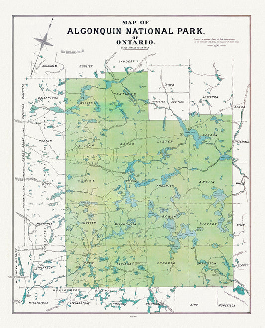
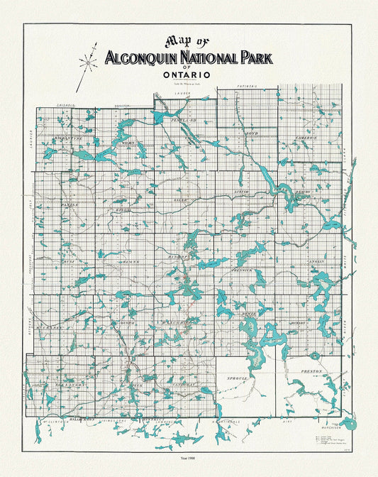
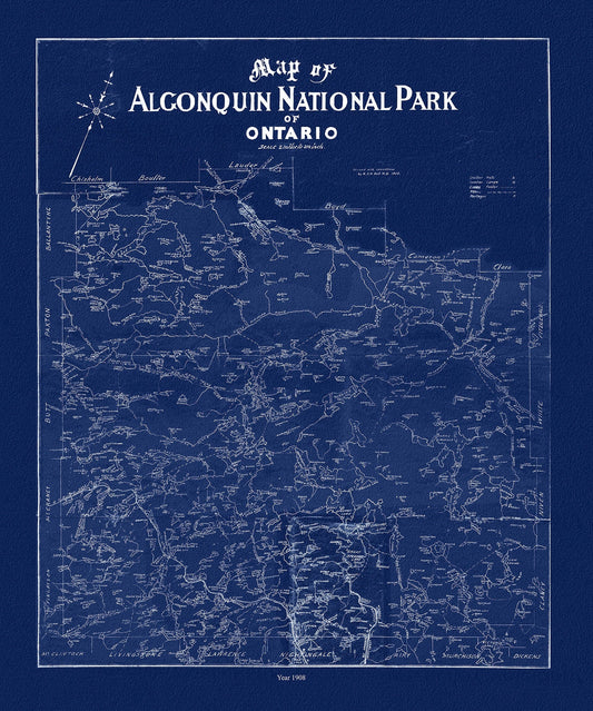
Historic Algonquin Park Map, Algonquin Park Commission, 1893, map on heavy cotton canvas, 20x27" approx.
Regular price $45.00 CADRegular price -
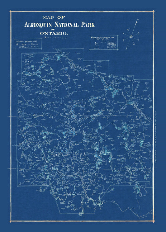
Historic Algonquin Park Map, auth. Arthur Brown, 1925 Cyanotype , map on heavy cotton canvas, 20x27" approx.
Regular price $45.00 CADRegular price -
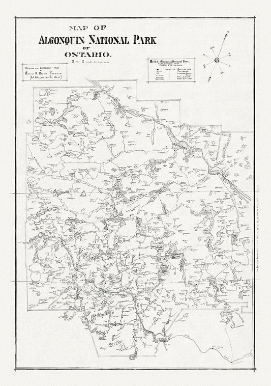
Historic Algonquin Park Map, auth. Arthur Brown, 1925, map on heavy cotton canvas, 20x29"
Regular price $45.00 CADRegular price -
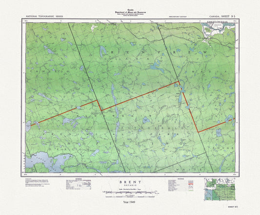
Historic Algonquin Park Map, Brent, National Topographic Series, 1949 , map on heavy cotton canvas, 20x27" approx.
Regular price $45.00 CADRegular price -
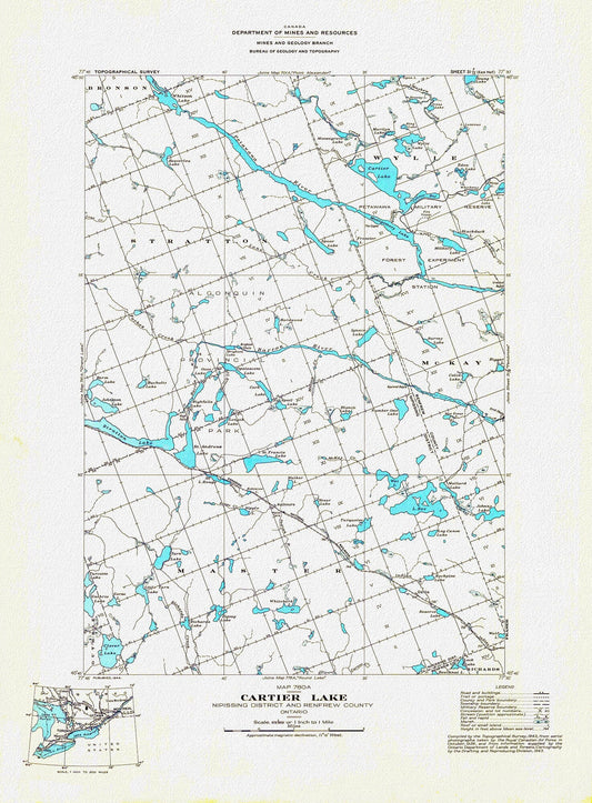
Historic Algonquin Park Map, Cartier Lake, National Topographic Series, 1944 , map on heavy cotton canvas, 20 x 25" approx.
Regular price $45.00 CADRegular price -
Historic Algonquin Park Map, Copp Clark Co., 1900, map on heavy cotton canvas, 20 x 25" approx.
Regular price $45.00 CADRegular price -
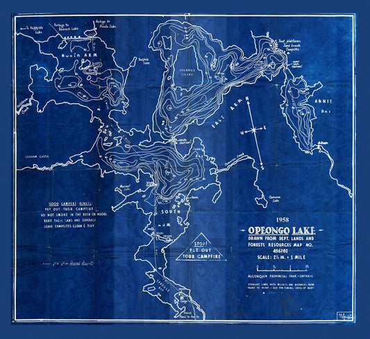
Historic Algonquin Park Map, Depth Map, Opeongo Lake, 1958 Cyanotype , map on heavy cotton canvas, 20x27" approx
Regular price $45.00 CADRegular price -
Historic Algonquin Park Map, Dr. Bell auth., 1908 Ver. Cyanotype , map on heavy cotton canvas, 45 x 65 cm, 18 x 24" approx.
Regular price $45.00 CADRegular price