-
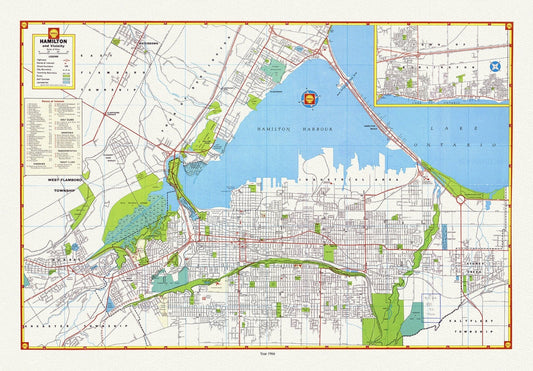
Hamilton and surrounding area, showing waterways, streets, railways, and an index, 1966, map on heavy cotton canvas, 20 x 25" approx.
Regular price $45.00 CADRegular price -
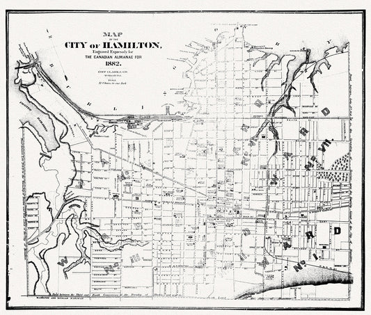
Hamilton, Ontario, 1882, map on heavy cotton canvas, 50 x 70cm, 20 x 25" approx.
Regular price $45.00 CADRegular price -
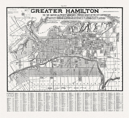
Hamilton, Ontario, 1913, map on heavy cotton canvas, 50 x 70 cm, 20 x 25" approx.
Regular price $45.00 CADRegular price -
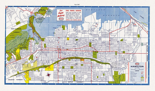
Hamilton, Ontario, 1963, map on heavy cotton canvas, 50 x 70 cm, 20 x 25" approx.
Regular price $45.00 CADRegular price -
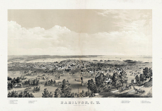
Hamilton, Ontario, Canada West, 1859 , map on heavy cotton canvas, 50 x 70 cm, 20 x 25" approx.
Regular price $45.00 CADRegular price -
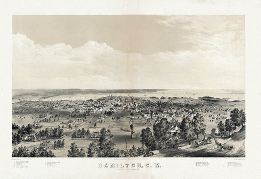
Hamilton, Ontario, Canada West, 1859, map on heavy cotton canvas, 20 x 25" approx.
Regular price $45.00 CADRegular price -
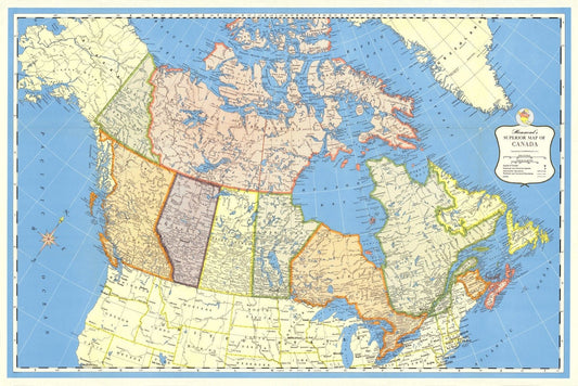
Hammond's Superior Map of Canada, 1957 , map on heavy cotton canvas, 22x27" approx.
Regular price $45.00 CADRegular price -
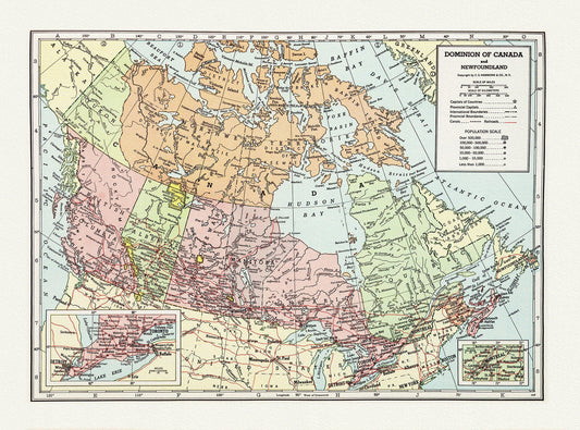
Hammond, Dominion of Canada and Newfoundland,1948 , map on heavy cotton canvas, 20 x 25" approx.
Regular price $45.00 CADRegular price -
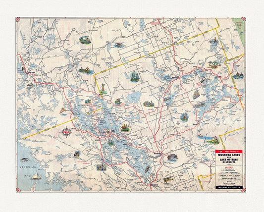
Happy motoring in Muskoka Lakes and Lake of Bays Districts, Ontario, 1949
Regular price $45.00 CADRegular price -
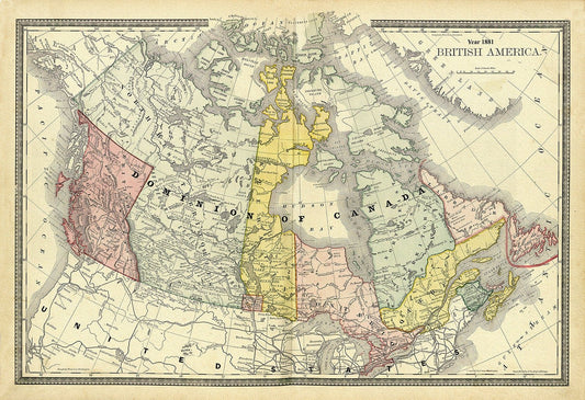
Hardesty, British America, Dominion of Canada, 1881
Regular price $45.00 CADRegular price -
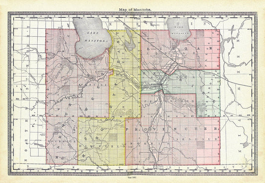
Hardesty, Map of Manitoba, 1881, map on heavy cotton canvas, 22x27" approx.
Regular price $45.00 CADRegular price -
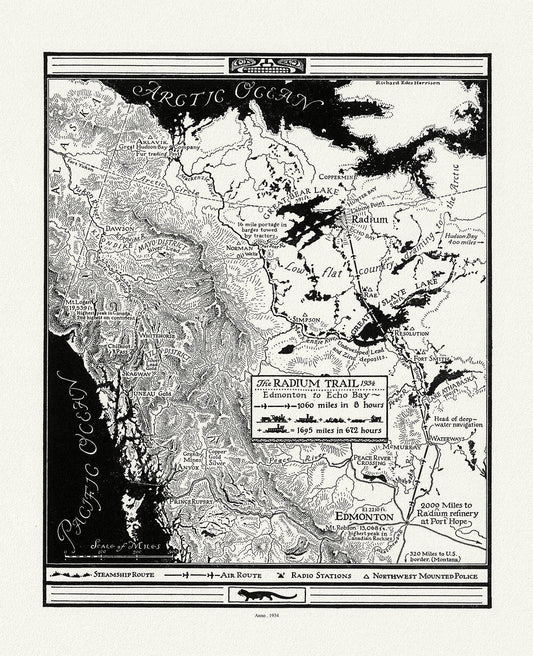
Harrison, The Radium Trail, 1934 , map on heavy cotton canvas, 22x27" approx.
Regular price $45.00 CADRegular price -
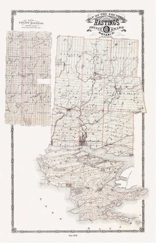
Hastings and Prince Edward Counties, Ontario, 1879, map on heavy cotton canvas, 45 x 65 cm, 18 x 24" approx.
Regular price $45.00 CADRegular price -
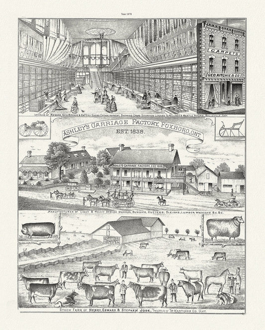
Hastings County, Businesses, 1878 Ver. II , vintage print on canvas, 50 x 70 cm, 20 x 25" approx.
Regular price $45.00 CADRegular price -
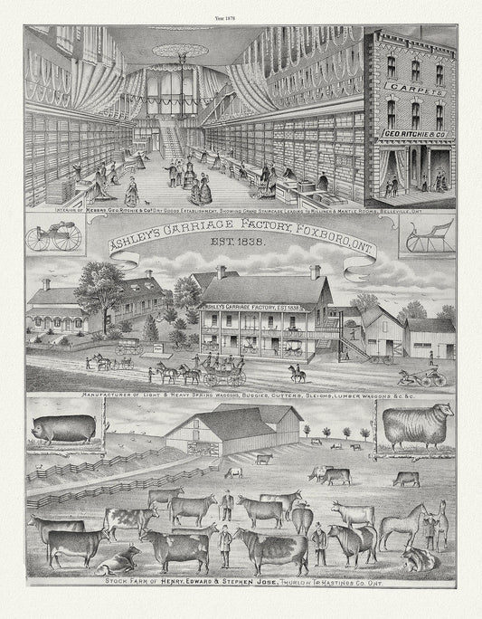
Hastings County, Businesses, 1878, map on heavy cotton canvas, 45 x 65 cm, 18 x 24" approx.
Regular price $45.00 CADRegular price -
Have you been saving a Vintage Picture Frame in Your Garage?
Regular price $45.00 CADRegular price -
He Carried the Flag To Victory!, vintage war poster reprinted on heavy cotton canvas, 50 x 70 cm, 20 x 25" approx.
Regular price $45.00 CADRegular price -
Hennepin, Amplissima regionis Mississipi, Francisc Riviere Mississippi in America septentrionali, 1687, map on heavy cotton canvas, 22x27"
Regular price $45.00 CADRegular price -
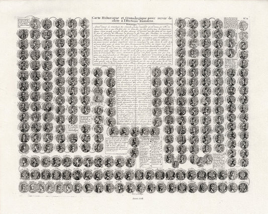
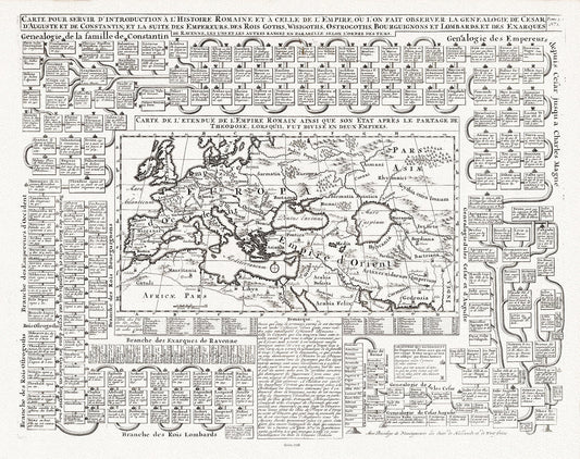
Henri Chatelain, Carte Historique et Cronologique pour servir de suite a l'Histoire Romaine, 1718, cotton canvas, 22x27" approx.
Regular price $45.00 CADRegular price -
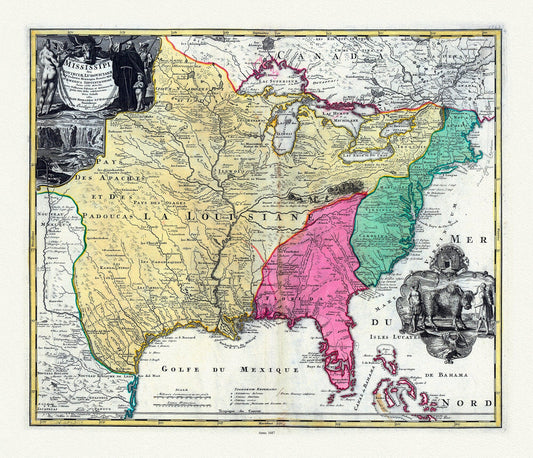
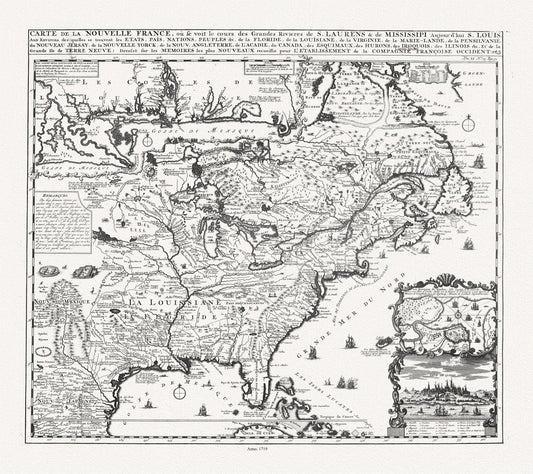
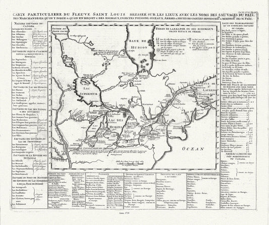
Henri Chatelain, Carte de la Nouvelle France, ou se voit le cours des grandes rivieres de S. Laurens & de Mississipi, 1719 ,canvas, 22x27"
Regular price $45.00 CADRegular price -
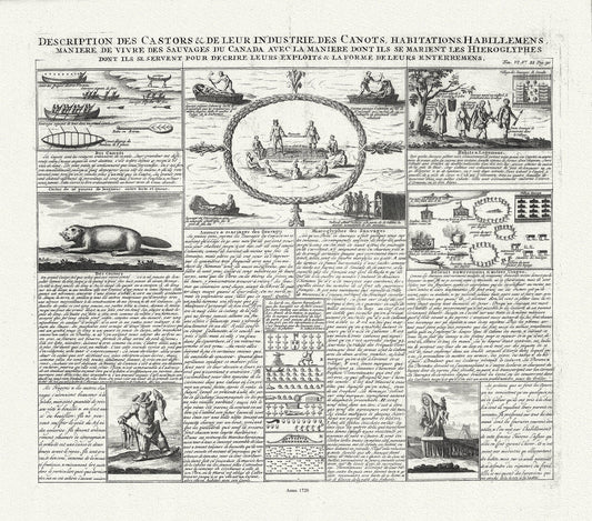
Henri Chatelain, Description des Castors & de Leur Industrie de Canots Habitations Habillemens, 1720, canvas 22x25"
Regular price $45.00 CADRegular price -
Henri Chatelain, Le Canada, 1719, map on heavy cotton canvas, 22x27" approx.
Regular price $45.00 CADRegular price -
Henri Chatelain, Tome I. Carte de l'etendue de l'Empire Romain, 1718, map on heavy cotton canvas, 22x27" approx.
Regular price $45.00 CADRegular price -
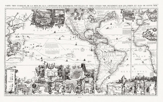
Henri Chatelain, Tome VI. No. 30. Page 117. Carte tres Curieuse de la Mer du Sud. North and South sheets, 1719
Regular price $45.00 CADRegular price