-
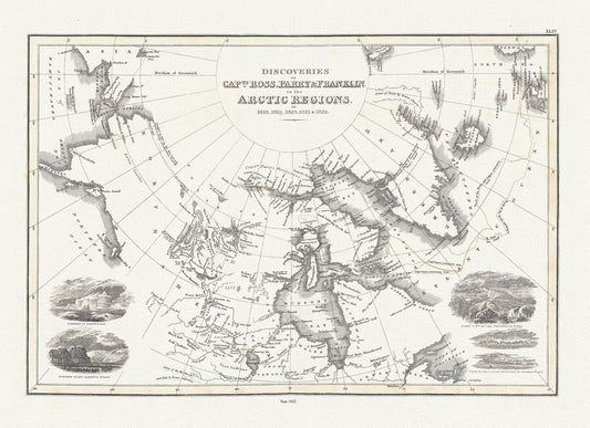
Discoveries of Capts. Ross, Parry and Franklin in the Arctic Regions, in 1818, 1819, 1820, 1821 & 1822, Wyld auth.,1823, 20x25" approx
Regular price $45.00 CADRegular price -
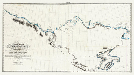
Discoveries of the expedition under the command of Captain Franklin R.N. near the mouth of the Mackenzie River, 1828 map, 20 x 36" approx.
Regular price $45.00 CADRegular price -
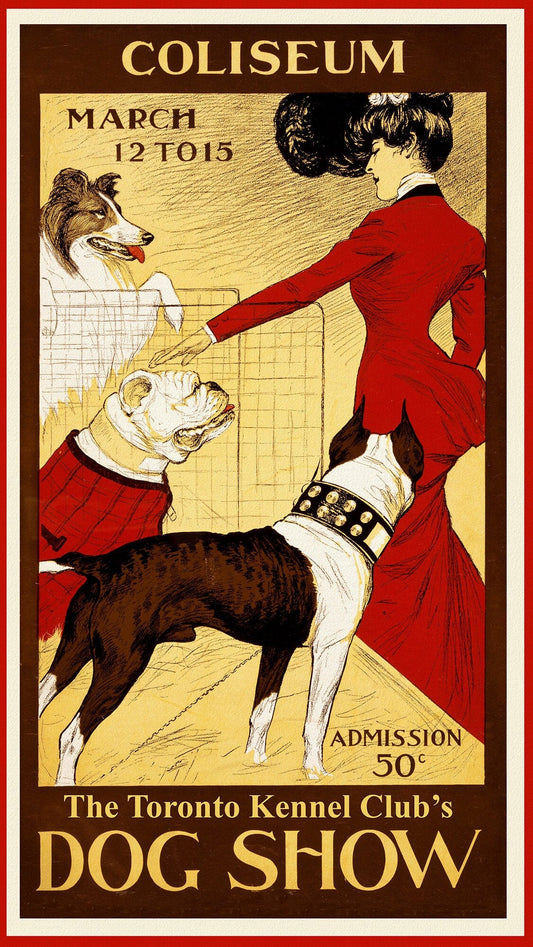
Dog Show, Toronto Kennel Club, 1902, vintage print on canvas, 50 x 70 cm, 20 x 25" approx.
Regular price $45.00 CADRegular price -
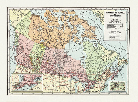
Dominion of Canada and Newfoundland-1948, Hammond auth., vintage map reprinted on durable cotton canvas, 50 x 70 cm, 20 x 25" approx.
Regular price $45.00 CADRegular price -
Dominion of Canada around the Bay of Fundy, 1880
Regular price $45.00 CADRegular price -
Dominion of Canada around the Bay of Fundy, 1880 Ver.BWI
Regular price $0.00 CADRegular price -
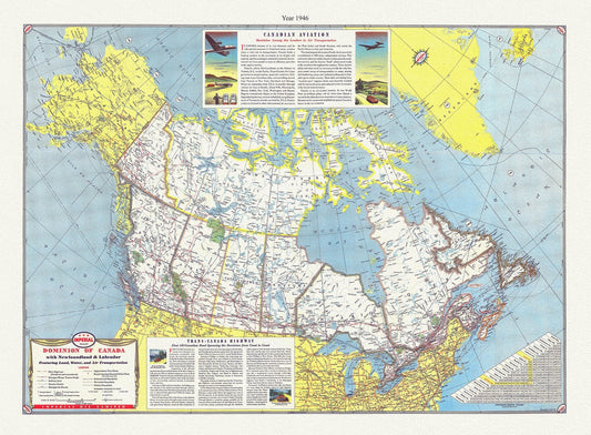
Dominion of Canada with Newfoundland & Labrador featuring land, water, and air transportation,1946, Turner auth., 50 x 70 cm approx
Regular price $45.00 CADRegular price -
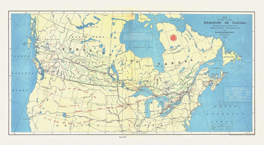
Dominion of Canada, shewing principal products, also railway & water routes, 1878, Smith auth. map on canvas, 50 x 70 cm, 20 x 25" approx.
Regular price $45.00 CADRegular price -
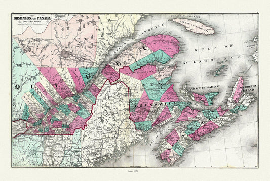
Dominion of Canada. Eastern Sheet. 1878, map on heavy cotton canvas, 50x70cm (20 x 25") approx.
Regular price $45.00 CADRegular price -
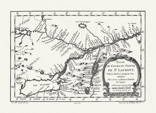
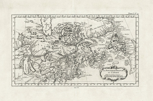
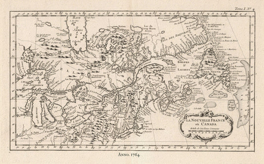
Du Cours du Fleuve de St. Laurent, 1764, Bellin auth., map on heavy cotton canvas, 50x70cm (20 x 25") approx.
Regular price $45.00 CADRegular price -
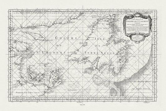
E Bellin, Carte reduite du Golphe de St. Laurent, 1754
Regular price $45.00 CADRegular price -
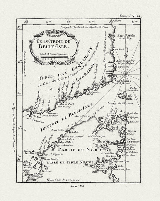
E Bellin, Le Detroit de Belle-Isle, 1764 , map on heavy cotton canvas, 45 x 65 cm, 18 x 24" approx.
Regular price $45.00 CADRegular price -
E Bring Us Victory!, vintage war poster on durable cotton canvas, 50 x 70 cm, 20 x 25" approx.
Regular price $45.00 CADRegular price -
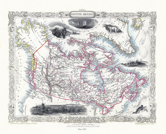
E British America, Tallis, 1851 Ver. II
Regular price $45.00 CADRegular price -
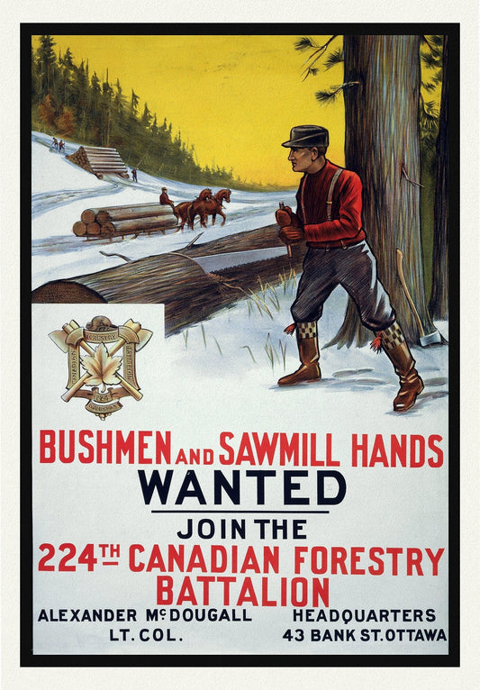
E Bushmen and Sawmill Hands Wanted. Join the 224th Canadian Forestry Battalion, war poster on durable canvas, 50 x 70 cm, 20 x 25" approx.
Regular price $45.00 CADRegular price -
E Canada WW I Poster, Notre Response Production Maximum
Regular price $45.00 CADRegular price -
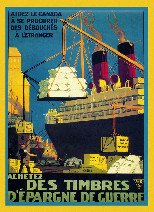
E Canada WW I,Poster, Achetez les Timbres, 1915
Regular price $45.00 CADRegular price -
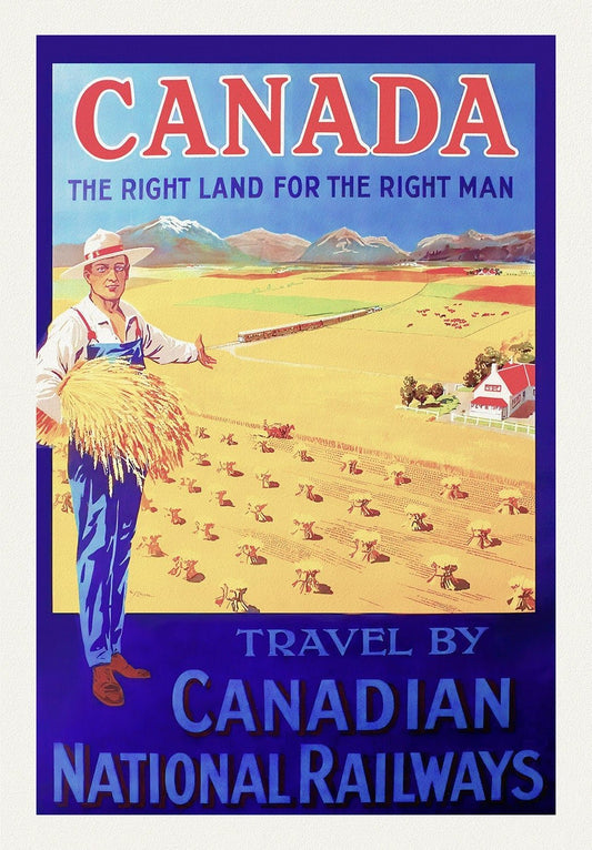
E Canada, The Right Land, CNR Ver. III , vintage travel poster reprinted on heavy cotton canvas, 50 x 70 cm, 20 x 25" approx.
Regular price $45.00 CADRegular price -
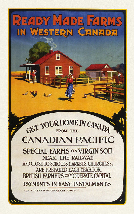
E Canadian Pacific, Ready Made Farms in Western Canada, 1920, travel poster on heavy cotton canvas, 50 x 70 cm, 20 x 25" approx.
Regular price $45.00 CADRegular price -
E Canadian Pacific, Visit Canada Ver. II , travel poster on heavy cotton canvas, 45 x 65 cm, 18 x 24" approx.
Regular price $45.00 CADRegular price -
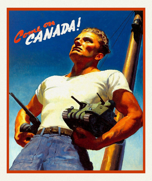

E Come on Canada! Ver. II, vintage war poster on durable cotton canvas, 50 x 70 cm, 20 x 25" approx.
Regular price $45.00 CADRegular price -
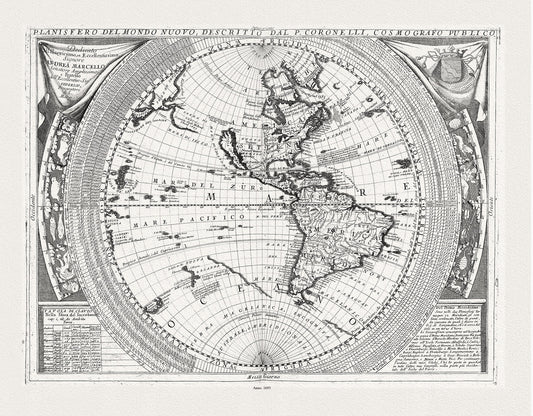
E Coronelli, Planisfero del Mondo Nuovo, 1693, map on durable cotton canvas, 50 x 70 cm, 20 x 25" approx.
Regular price $45.00 CADRegular price -
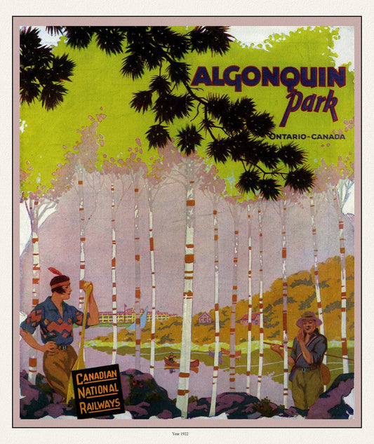
E Historic Algonquin Park, CN Rail Brouchure Cover, 1922 , map on durable cotton canvas, 50 x 70 cm, 20 x 25" approx.
Regular price $45.00 CADRegular price -
E La Nouvelle France où Canada,Bellin,1764 Ver. I,II, map on durable cotton canvas, 50 x 70 cm, 20 x 25" approx.
Regular price $45.00 CADRegular price