-
Come on Canada!, Lick Them Over there! , vintage war poster on heavy cotton canvas, 50 x 70 cm, 20 x 25" approx.
Regular price $45.00 CADRegular price -
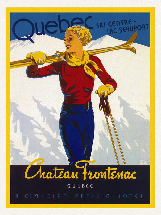
Come to Old Quebec, Chateau Frontenac, travel poster on heavy cotton canvas, 45 x 65 cm, 18 x 24" approx.
Regular price $45.00 CADRegular price -
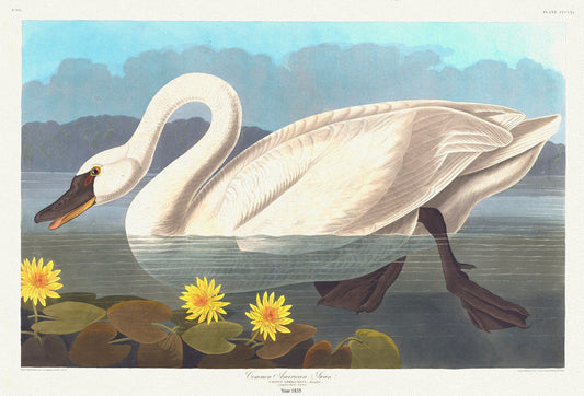
Common North American swan. Cygnus americanus, Sharplefs. Nymphea flava , 1836 Audobon auth. on canvas, 50 x 70 cm, 20 x 25" approx.
Regular price $45.00 CADRegular price -
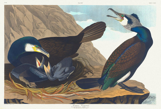
Common cormorant.Phalacrocorax carbo, Dumont. plate 266, 1836 Audobon auth. , vintage print on canvas, 50 x 70 cm, 20 x 25" approx.
Regular price $45.00 CADRegular price -
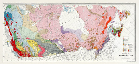
Composite Geological Map of the Dominion of Canada, Issued 1915, on heavy cotton canvas, 22x27" approx.
Regular price $45.00 CADRegular price -
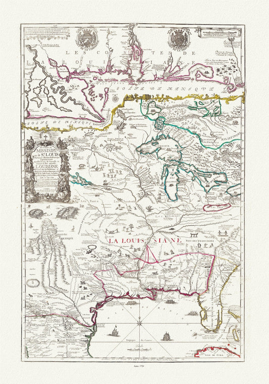
Composite Le cours de Missisipi, ou de St. Louis (with) Partie meridionale de la Riviere de Missisipi.,1720, on heavy canvas,22x27" approx.
Regular price $45.00 CADRegular price -
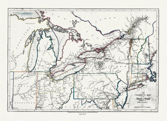
Conrad et Lewis, A correct map of the seat of war, 1812, map on heavy cotton canvas, 22x27" approx.
Regular price $45.00 CADRegular price -
Cook et Lane, Plan des cotes de Terre-Neuve VII, 1784
Regular price $45.00 CADRegular price -
Cook, L'Isle de Terre-Neuve, 1778
Regular price $45.00 CADRegular price -
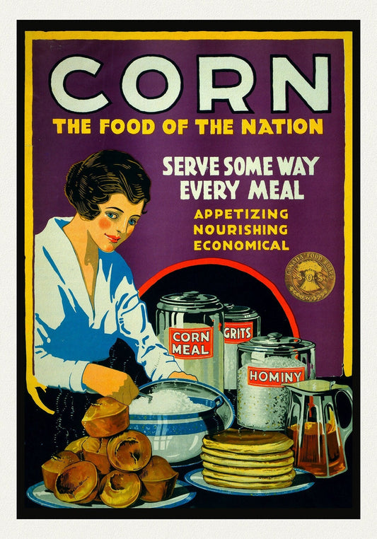
Corn. The Food of the Nation. Canada Food Board
Regular price $45.00 CADRegular price -
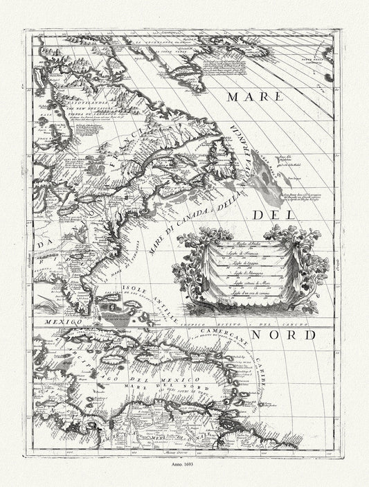
Coronelli (Vicenzo 1650-1718), America Settentrionale (parte orientale)), 1693, map on durable cotton canvas, 50 x 70 cm, 20 x 25" approx.
Regular price $45.00 CADRegular price -
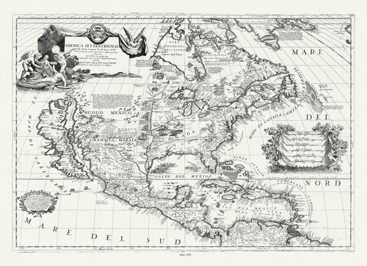
Coronelli (Vicenzo 1650-1718), America Settentrionale, 1693, map on heavy cotton canvas, 22x27" approx.
Regular price $45.00 CADRegular price -
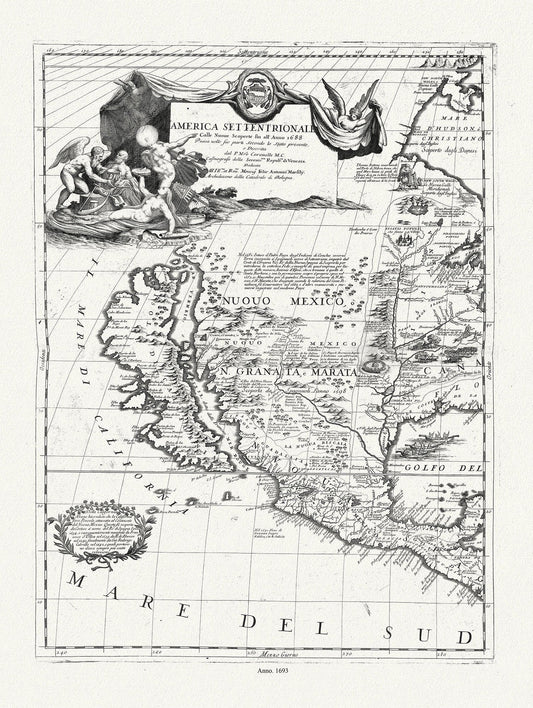
Coronelli (Vicenzo 1650-1718)-America Settentrionale (parte occidentale), 1693, map on heavy cotton canvas, 20 x 25" approx.
Regular price $45.00 CADRegular price -
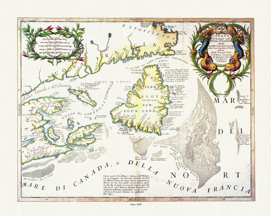
Coronelli, Canada Orientale Nell' America Settentrionale, 1690
Regular price $45.00 CADRegular price -
Coronelli, Canada Orientale Nell' America Settentrionale, 1690, map on heavy cotton canvas, 22x27" approx.
Regular price $45.00 CADRegular price -
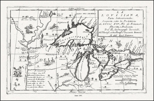
Coronelli, La Louisiana, Parte Settentrionalle, Scoperta sotto Protettione di Luigi XIV, Re di Francia, 1691, cotton canvas, 22x27" approx.
Regular price $45.00 CADRegular price -
Coronelli, Map of Newfoundland,1692 Ver. II
Regular price $45.00 CADRegular price -
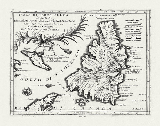
Coronelli, Map of Newfoundland,1692 Ver. III
Regular price $45.00 CADRegular price -
Coronelli, Map of Newfoundland,1692 Ver. III , map on heavy cotton canvas, 45 x 65 cm, 18 x 24" approx.
Regular price $45.00 CADRegular price -
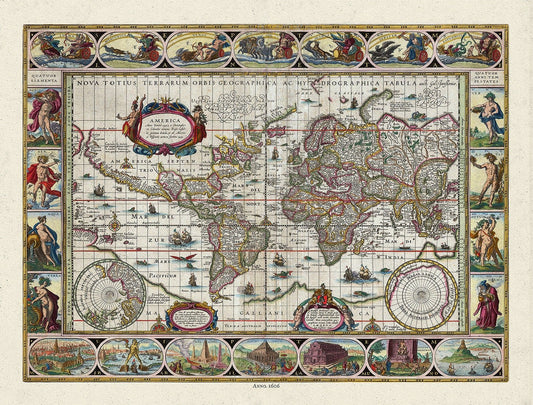
Coronelli, Nova Totius Terrarum Orbis Geographica, 1606 Ver. D ,Map on heavy cotton canvas, 22x27in. approx.
Regular price $45.00 CADRegular price -
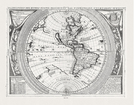
Coronelli, Planisfero del Mondo Nuovo, 1693 ,Map on heavy cotton canvas, 22x27in
Regular price $45.00 CADRegular price -
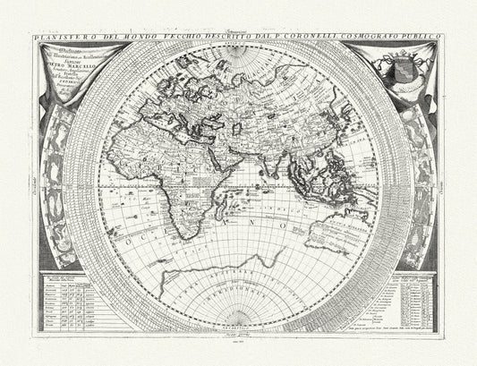
Coronelli, Planisfero del Mondo Vecchio, 1693, Map on heavy cotton canvas, 22x27in. approx.
Regular price $45.00 CADRegular price -
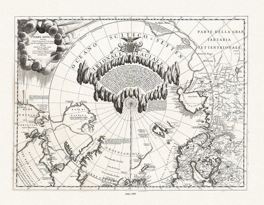
Coronelli, Terre Artiche, 1690, Map printed on to heavy cotton canvas, 22x27in. approx.
Regular price $45.00 CADRegular price -
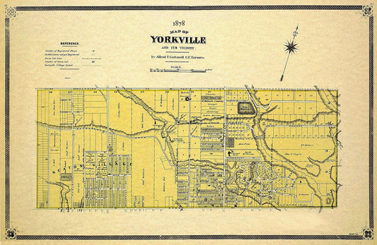
Cotterell, Yorkville, County of York, 1878 Ver.II, map on heavy cotton canvas, 22x27" approx.
Regular price $45.00 CADRegular price