-
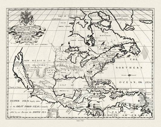
A New Map of North America shewing its principal divisions, chief cities, townes, rivers, mountains etc.,1722,on heavy canvas, 22x27" approx
Regular price $45.00 CADRegular price -
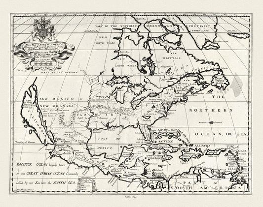
A new map of North America shewing its principal divisions.,1722, map on durable cotton canvas, 50 x 70 cm, 20 x 25" approx.
Regular price $45.00 CADRegular price -
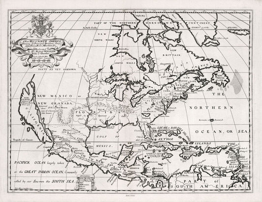
A New Map of North America, 1700, Wells auth., map on durable cotton canvas, 50 x 70 cm, 20 x 25" approx.
Regular price $45.00 CADRegular price -
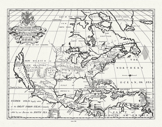
A New Map of North America, Wells auth., 1700, map on durable cotton canvas, 50 x 70 cm, 20 x 25" approx.
Regular price $45.00 CADRegular price -
A New Map of Nova Scotia and Cape Breton Island with the adjacent parts of New England and Canada, 1786, Cook
Regular price $45.00 CADRegular price -
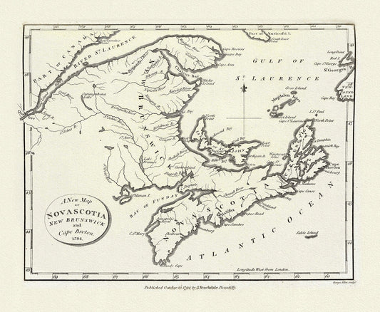
A New Map of Nova Scotia, New Brunswick and Cape Breton, 1794, on heavy cotton canvas, approx. 18x27"
Regular price $45.00 CADRegular price -
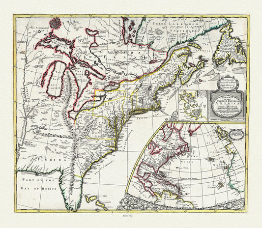
A New Map of the English Empire in America, 1721, on heavy cotton canvas, 22x27" approx.
Regular price $45.00 CADRegular price -
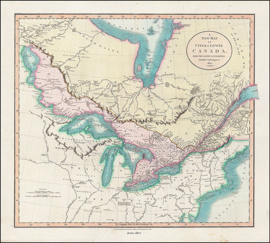
A New Map of Upper & Lower Canada, From the Latest Authorities, 1807, John Cary auth., cotton canvas, 50 x 70 cm, 20 x 25" approx.
Regular price $45.00 CADRegular price -
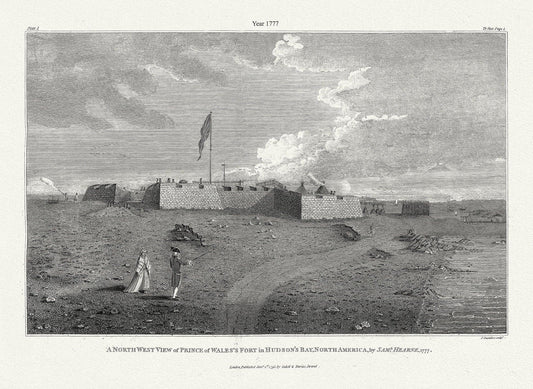
A north west view of Prince of Wales's Fort in Hudson's Bay, North America, Saml. Hearne auth., 1777, .50 x 70 cm, 20 x 25" approx.
Regular price $45.00 CADRegular price -
A Pic-Tour Map of Canada's Maritime Provinces,1953
Regular price $45.00 CADRegular price -
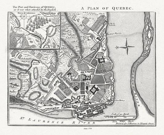
A Plan of Quebec the port and environs of Quebec, as it was when attack'd by the English, 1759, map on heavy cotton canvas, 20x27" approx.
Regular price $45.00 CADRegular price -
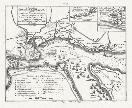
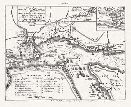
A plan of the River St. Laurence, from Sillery to Montmerenci Falls with the operations of the Siege of Quebec, 1759-1780,canvas, 22x27"
Regular price $45.00 CADRegular price -
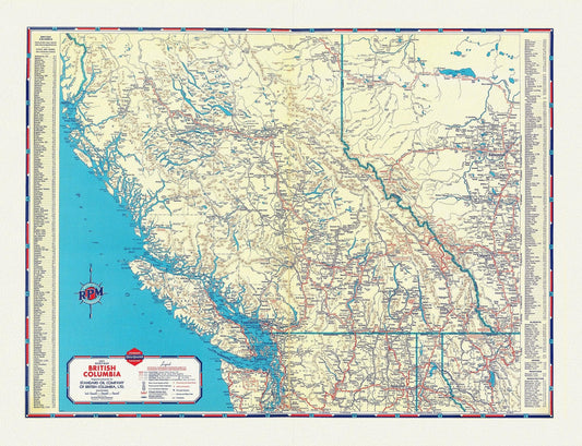
A Road Map of British Columbia, 1937
Regular price $45.00 CADRegular price -
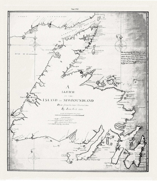
A sketch of the island of Newfoundland.Cook. 1763 , map on heavy cotton canvas, 45 x 65 cm, 18 x 24" approx.
Regular price $45.00 CADRegular price -
A sketch of the island of Newfoundland.Cook.1763
Regular price $45.00 CADRegular price -
A Ten Mile Map of Newfoundland, 1941
Regular price $45.00 CADRegular price -
A Ten Mile Map of Newfoundland, 1941 Ver. BWI
Regular price $45.00 CADRegular price -
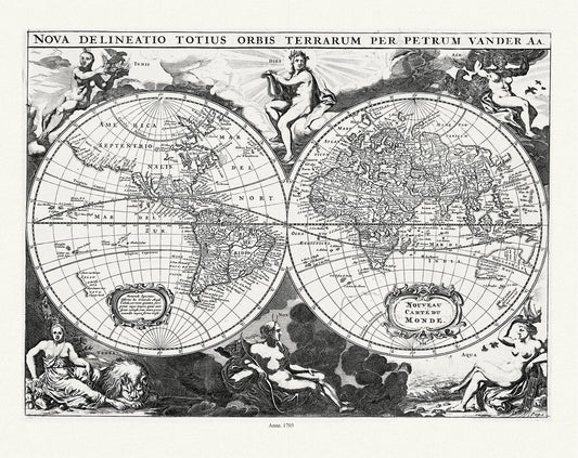
Aa, (Pieter va der, ), Nova Delineatio Totius Orbis Terrarum, 1703, Map on heavy cotton canvas, 22x27in. approx.
Regular price $45.00 CADRegular price -
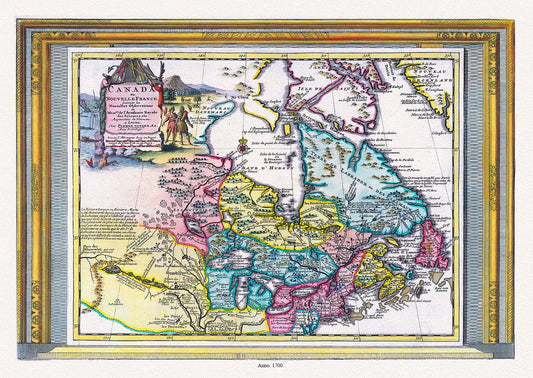
Aa, Canada ou Nouvelle France Suivant les Nouvelles Observations, 1700, map on heavy cotton canvas, 20 x 25" approx.
Regular price $45.00 CADRegular price -
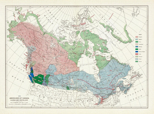
Aborigines of Canada, Alaska and Greenland, issued 1915, Map on heavy cotton canvas, 22x27" approx.
Regular price $45.00 CADRegular price -
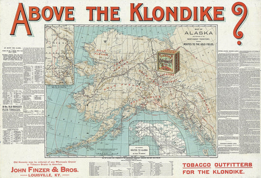
Above the Klondike Map of Alaska and Portions of the Northwest Territory, 1898, Map on heavy canvas, 22x27" approx.
Regular price $45.00 CADRegular price -
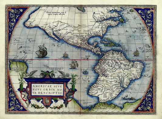
Abraham Ortelius, Theatrum Orbis Terrarum-Americae sive novi orbis, nova descriptio, Anno. 1570 Ver. III ,Map on cotton canvas, 22x27in
Regular price $45.00 CADRegular price -
Abraham Ortelius, Theatrum Orbis Terrarum-Americae sive novi orbis, nova descriptio, Anno. 1570 Ver. III, 50 x 70 cm, 20 x 25" approx.
Regular price $45.00 CADRegular price -
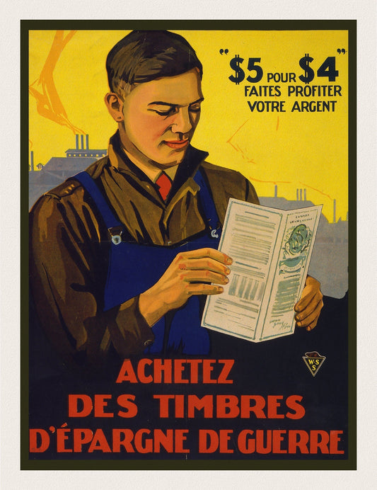
Achetez des timbres d'épargne de guerre, 1915, vintage war poster on durable cotton canvas, 50 x 70 cm, 20 x 25" approx.
Regular price $45.00 CADRegular price