-
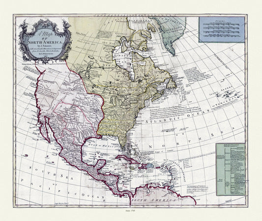
A map of North America, 1765, on heavy cotton canvas, 22x27" approx.
Regular price $45.00 CADRegular price -
A map of part of the continent of North America, to the Pacific and between latitude 35 and 52 North, 1830, map on canvas, 22x27"
Regular price $45.00 CADRegular price -
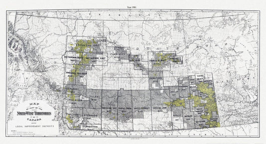
A Map of part of the North-West Territories of Canada, showing local improvement districts, 1901
Regular price $45.00 CADRegular price -
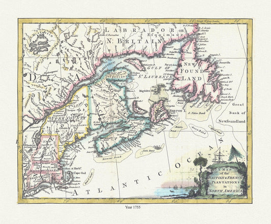
A map of the British & French plantations in North America, 1755
Regular price $45.00 CADRegular price -
A map of the British & French plantations in North America, 1755, map on durable cotton canvas, 50 x 70 cm, 20 x 25" approx.
Regular price $45.00 CADRegular price -
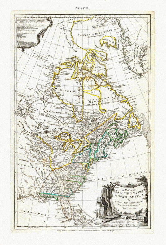
A Map of The British Empire in North America, 1776, Jefferys auth., map on durable cotton canvas, 50 x 70 cm, 20 x 25" approx.
Regular price $45.00 CADRegular price -
A Map of The British Empire in North America, 1776, on heavy cotton canvas, 22x27" approx.
Regular price $45.00 CADRegular price -
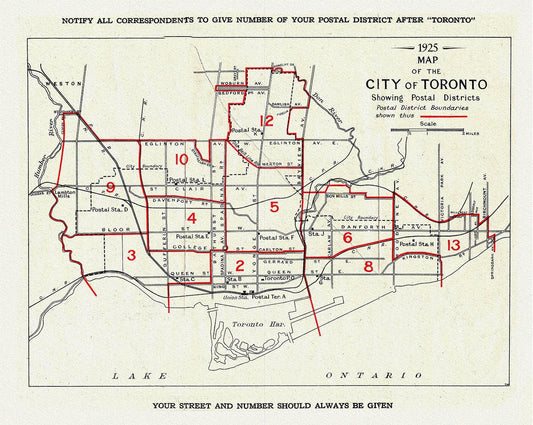
A Map of the City of Toronto Showing Postal Districts, 1925, map on heavy cotton canvas, 22x27" approx.
Regular price $45.00 CADRegular price -
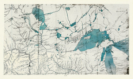
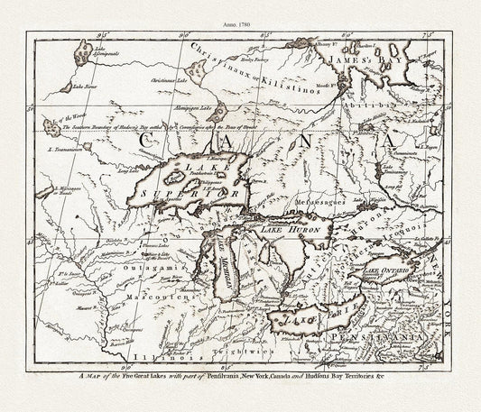
A Map of the Five Great Lakes with part of Pensilvania, New York, Canada, and Hudsons Bay Territories &c., 1780, on cotton canvas, 22x27"
Regular price $45.00 CADRegular price -
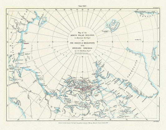
A Map of the north polar regions to illustrate the paper on the origin & migrations of the Greenland Esquimaux,1865
Regular price $45.00 CADRegular price -
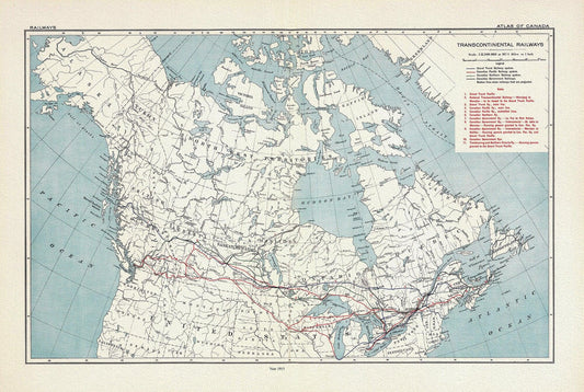
A Map of Transcontinental Railways, 1915, on heavy cotton canvas, 20x27" approx.
Regular price $45.00 CADRegular price -
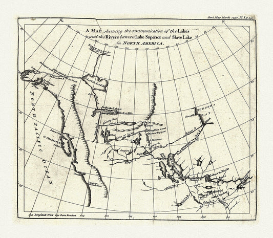
A map shewing the communication of the lakes and rivers between Lake Superior and Slave Lake in N. America, 1790, on canvas, 22x27" approx.
Regular price $45.00 CADRegular price -
A map shewing the communication of the lakes and the rivers between Lake Superior and Slave Lake in North America, 1785 on canvas, 22x27"
Regular price $45.00 CADRegular price -
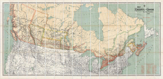
A Map Shewing the Railways of Canada, 1886, map on heavy cotton canvas, 50 x 70cm, 20 x 25" approx.
Regular price $45.00 CADRegular price -
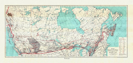
A Mineral Map of Canada, 1911, on heavy cotton canvas, 16x27" approx.
Regular price $45.00 CADRegular price -
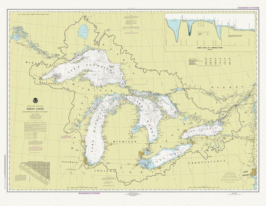
A Nautical Chart of The Great Lakes, 2016 Chart of The Great Lakes, 2016, map on heavy cotton canvas, 50x70cm (20 x 25") approx.
Regular price $45.00 CADRegular price -
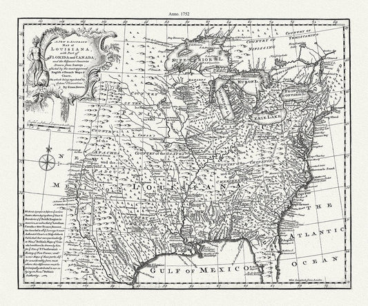
A new & accurate map of Louisiana, with part of Florida and Canada, and the adjacent countries, 1752, Bowen auth. canvas, 20 x 25" approx.
Regular price $45.00 CADRegular price -
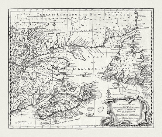
A new & accurate map of Newfoundland, Cape Breton, St. John and Anticosta, with Nova Scotia, Canada, 1752 , on canvas, 20 x 25" approx.
Regular price $45.00 CADRegular price -
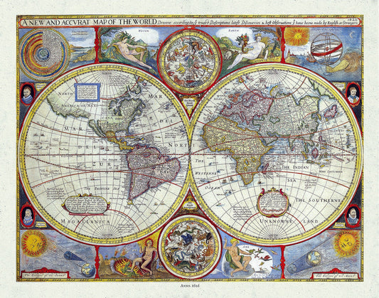
A New and Accurate Map of the World, 1626, Speed auth., map on durable cotton canvas, 50 x 70 cm, 20 x 25" approx.
Regular price $45.00 CADRegular price -
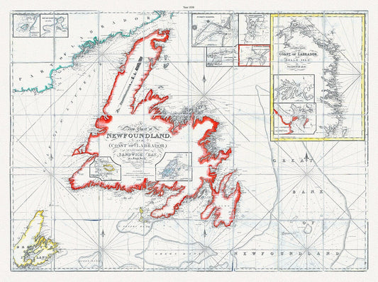
A new chart of Newfoundland, and coast of Labrador extending to Sandwich Bay, Blachford ,1838 , cotton canvas, 45 x 65 cm, 18 x 24" approx.
Regular price $45.00 CADRegular price -
A new chart of Newfoundland, and coast of Labrador extending to Sandwich Bay, Blachford auth.,1838
Regular price $45.00 CADRegular price -
A new chart of the coast of New England, Nova Scotia, and the islands of St. John, Cape Breton, Sable, the banks of St. Peters, 1784, Keulen auth.
Regular price $45.00 CADRegular price -
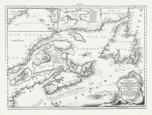
A new chart of the coast of New England, Nova Scotia, New France or Canada, with the islands of Newfoundland., Cape Breton, .Jefferys, 1746
Regular price $45.00 CADRegular price -
A new chart of the coast of New England, Nova Scotia, New France or Canada, with the islands of Newfoundland., Cape Breton, St. John's &c.Jefferys, 1746
Regular price $45.00 CADRegular price