-
Africa: 1676, Speed authore
Regular price $45.00 CADRegular price -
Africa: A New map of Africk, Wells auth., 1700
Regular price $45.00 CADRegular price -
Africa: Afrique selon les Relations les plus Nouvelles.1689. Nolin et al. auths.
Regular price $45.00 CADRegular price -
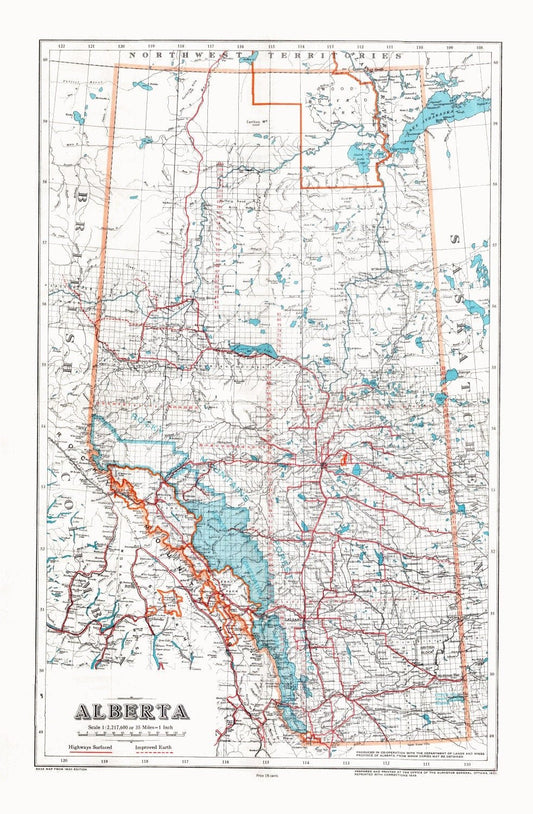
Alberta, 1948 , map on heavy cotton canvas, 22x27" approx.
Regular price $45.00 CADRegular price -
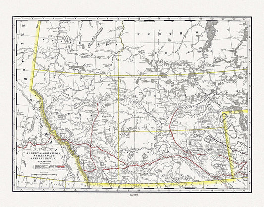
Alberta, Assiniboia, Athabasca & Saskatchewan, North West Territories, 1898 , map on heavy cotton canvas, 45 x 65 cm, 18 x 24" approx.
Regular price $45.00 CADRegular price -
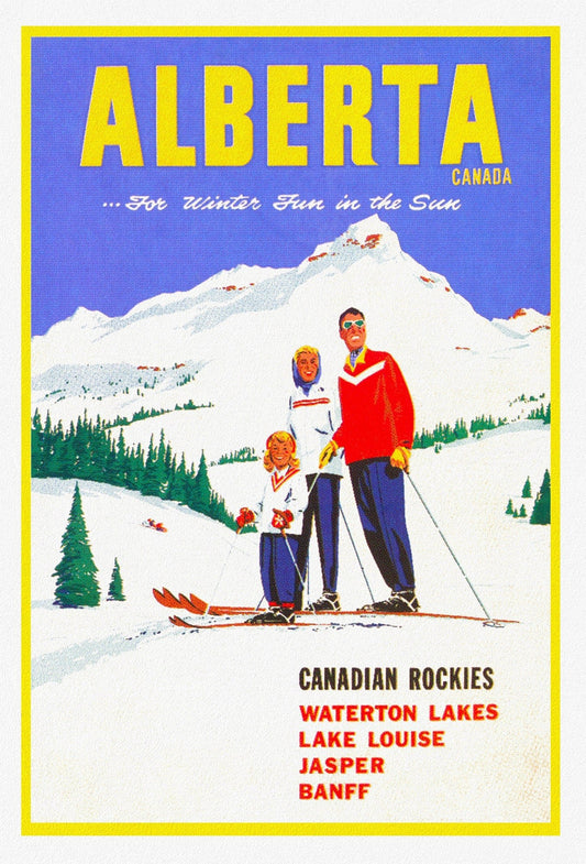
Alberta, Canadian Rockies , travel poster on heavy cotton canvas, 20x25" approx.
Regular price $45.00 CADRegular price -
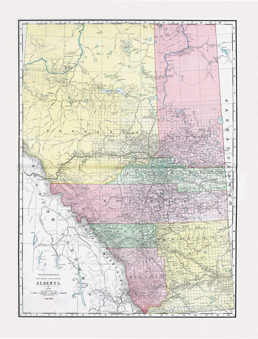
Alberta, Rand McNally and Company, 1912, map on heavy cotton canvas, 20x27" approx.
Regular price $45.00 CADRegular price -
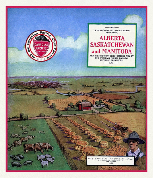
Alberta, Sask.& Alberta by Canadian Pacific , vintage travel poster on heavy cotton canvas, 50 x 70 cm, 20 x 25" approx.
Regular price $45.00 CADRegular price -
Alexander,New England, Canada, Nova Scotia, Newfoundland-1625 Ver. B
Regular price $45.00 CADRegular price -
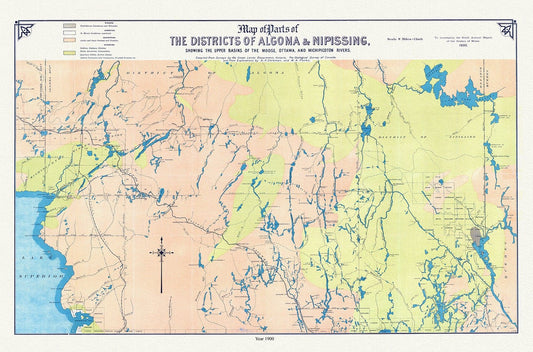
Algoma and Nipissing Districts, a geological map, 1900 , map on heavy cotton canvas, 45 x 65 cm, 18 x 24" approx.
Regular price $45.00 CADRegular price -
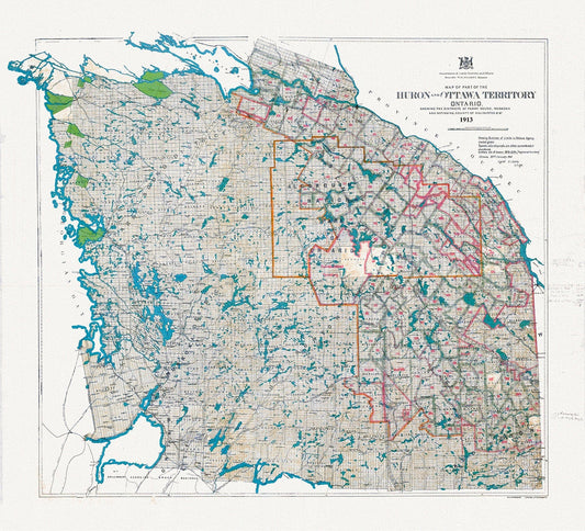
Algonquin Park Area, Part of the Huron and Ottawa Territories, 1913 , map on heavy cotton canvas, 45 x 65 cm, 18 x 24" approx.
Regular price $45.00 CADRegular price -
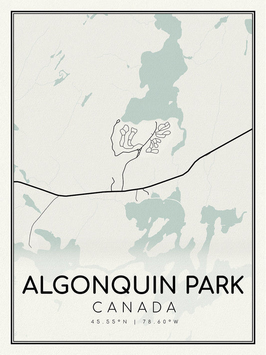
Algonquin Park, A Modern Map on heavy cotton canvas, 45 x 65 cm, 18 x 24" approx.
Regular price $45.00 CADRegular price -
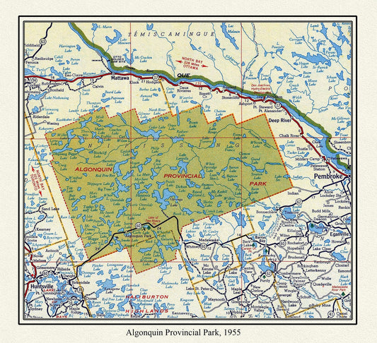
Algonquin Provincial Park, 1955 , map on heavy cotton canvas, 22x27" approx.
Regular price $45.00 CADRegular price -
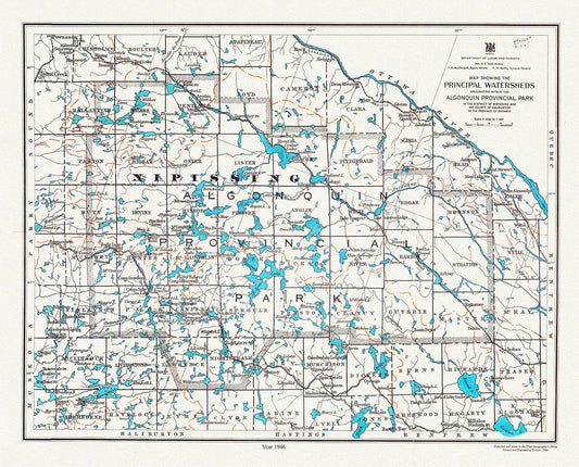
Algonquin Provincial Park, Principal Watersheds, 1946 , map on heavy cotton canvas, 45 x 65 cm, 18 x 24" approx.
Regular price $45.00 CADRegular price -
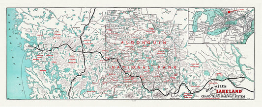
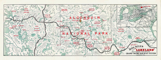
Algonquin-Haliburton: Grand Trunk Railway, Historic Algonquin Park Map, 1906, map on heavy cotton canvas, 22x27" approx.
Regular price $45.00 CADRegular price -
Algonquin: Grand Trunk Railway, Historic Algonquin Park Map, 1905, map on heavy cotton canvas, 22x27" approx.
Regular price $45.00 CADRegular price -
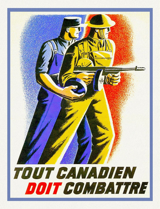
All Canadians Must Fight, 1941, war poster on durable cotton canvas, 50 x 70 cm, 20 x 25" approx.
Regular price $45.00 CADRegular price -
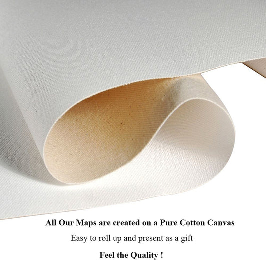
All Our Maps are Created on a pure cotton canvas!....Feel the texture and heft of our durable Maps!
Regular price $45.00 CADRegular price -
All Our Maps have a Matte Transparent Clear Protective Coating. Often there is No Need for Heavy, Fragile Glaring Glass
Regular price $45.00 CADRegular price -
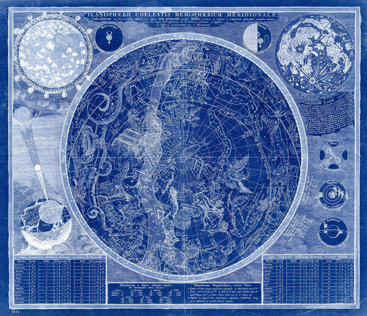
Allard, Planisphaerii coelestis hemisphaerium meridionale calculatum ad finem, pro aevo XVIII praesente, Cyanotype, 1700, canvas 22x27"
Regular price $45.00 CADRegular price -
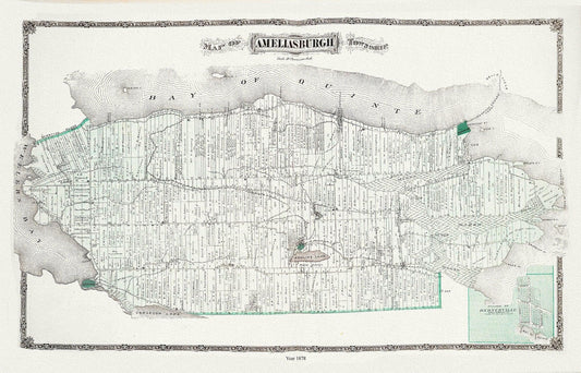
Ameliasburgh Township, Ont., 1878 , map on durable cotton canvas, 50 x 70 cm, 20 x 25" approx.
Regular price $45.00 CADRegular price -
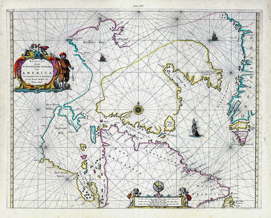
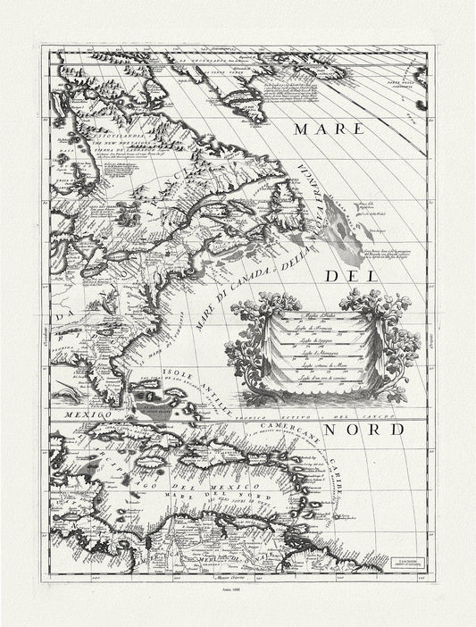
America Nort, 1667, Goos auth., map on heavy cotton canvas, 50 x 70cm, 20 x 25" approx.
Regular price $45.00 CADRegular price -
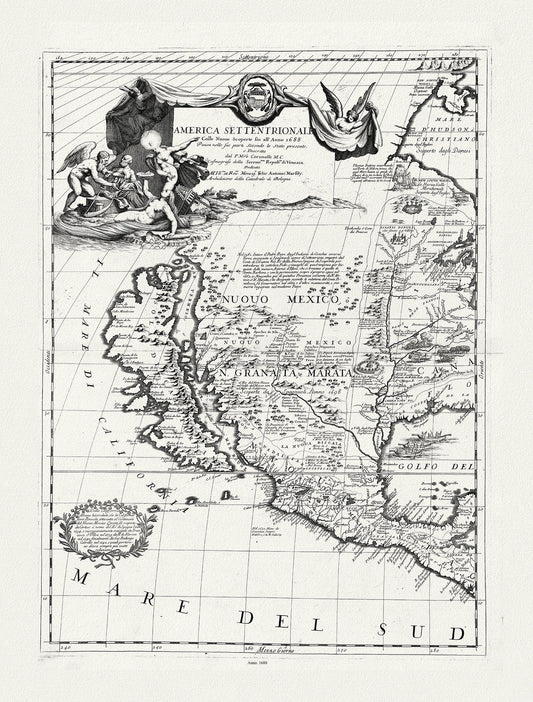
America Settentrionale colle nuoue scoperte fin al'anno 1688, diuisa nelle sue parti secundo lo stato.1688.Coronelli, canvas, 20 x 25"
Regular price $45.00 CADRegular price -
America Settentrionale le colle nuoue scoperte fin al'anno 1688, diuisa nelle sue parti secundo lo stato.1688.Coronelli, canvas, 20 x 25"
Regular price $45.00 CADRegular price