

The Map Chest
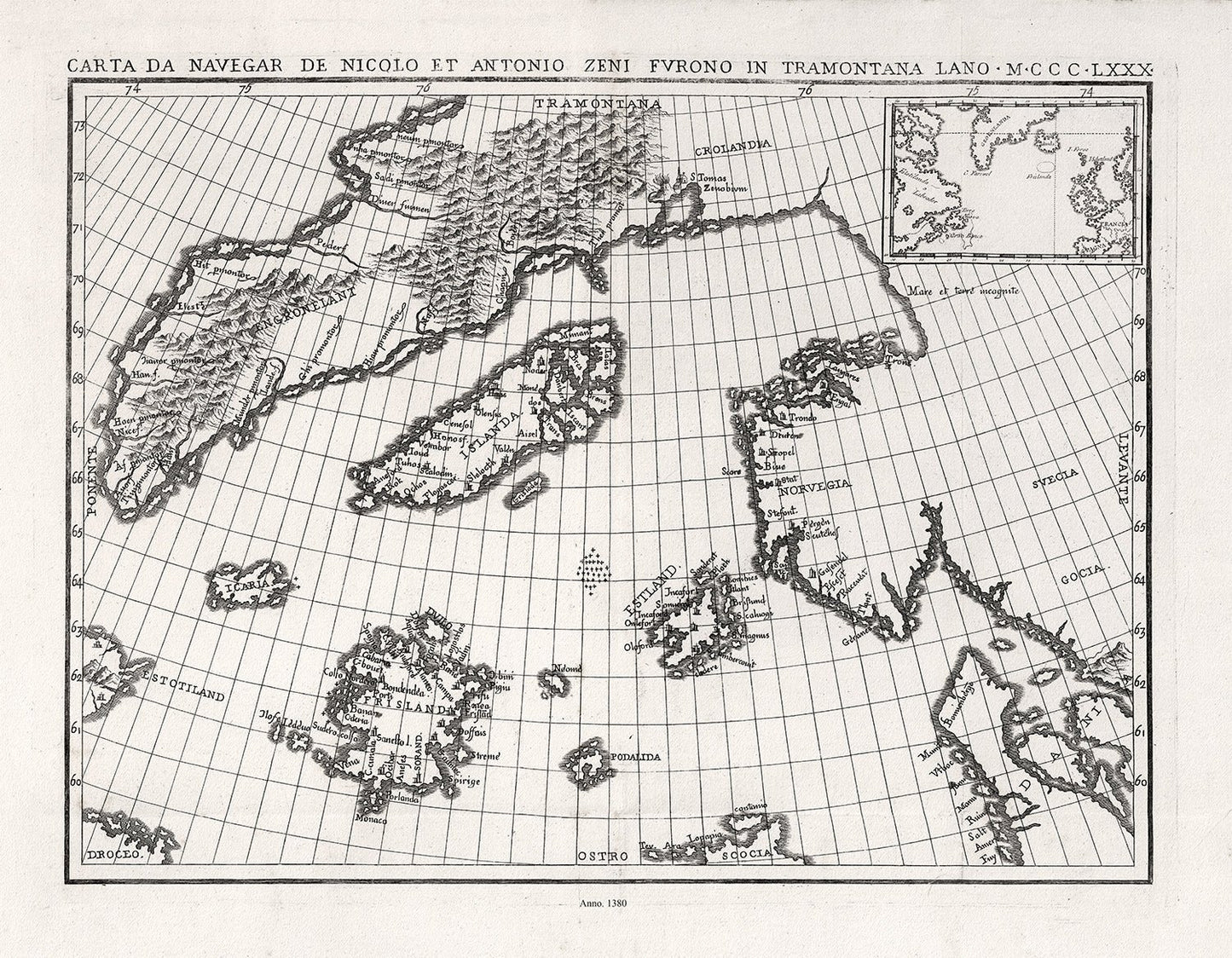
Atlantic Ocean: Zurla, Carta Da Navegar De Nicolo et Antonio Zeni Fvrono In Tramontana Lano M.CCC.LXXX(1380)
Atlantic Ocean: Zurla, Carta Da Navegar De Nicolo et Antonio Zeni Fvrono In Tramontana Lano M.CCC.LXXX(1380)
Couldn't load pickup availability
Share
The Zeno map purports to illustrate the voyages of the author's ancestor and his brother at the end of the 14th century, first appeared in Venice in the year 1558 as a part of a small book that contained accounts of voyages in the North Atlantic and westward to the shores of America. It is, however, a fictitious map based upon Olaus Magnus's Carta marina, along with other 16th century maps, and was probably created to give Venice, the author's native city, the credit for discovering America more than a century ahead of Columbus. Estotiland (said to be inhabited by people of European lineage, but having its own language; it is perhaps Labrador) and Drogeo (perhaps Newfoundland) on this map appear to represent the eastern coast of America. Frisland, originally referred to Iceland, but was added along with Iceland on this map. It appeared on subsequent maps for the next hundred years. It may refer to the Faroe Islands. The meridians are marked.
-
Shipping
It usually takes 1 to 2 weeks to complete your map....and another 1-2 weeks for postal delivery
-
Returns
We do Accept returns in the case of Material Defects