Skip to content
  • Home
  • Catalog
  • Contact
Log in
    The Map Chest
    • Home
    • Catalog
    • Contact
    Log in Cart

    Item added to your cart

    View my cart

    Filter:

    Availability
    0 selected Reset
    Availability
    Price
    The highest price is $300.00 Reset
    $
    $
    Remove all

    404 products

    Filter and sort Filter

    Filter and sort

    Filter

    404 products

    Availability
    Clear
    Price

    The highest price is $300.00

    $
    $
    Clear
    Remove all
    Remove all

    404 products

    • Map of Central Canada Showing Transportation and Commercial Development, 1927, map on durable cotton canvas, 50 x 70 cm, 20 x 25" approx.

      Map of Central Canada Showing Transportation and Commercial Development, 1927, map on durable cotton canvas, 50 x 70 cm, 20 x 25" approx.

      Map of Central Canada Showing Transportation and Commercial Development, 1927, map on durable cotton canvas, 50 x 70 cm, 20 x 25" approx.

      Regular price $45.00 CAD
      Regular price Sale price $45.00 CAD
      Unit price /  per 
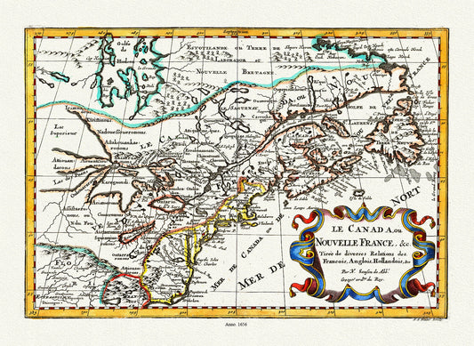
    • Le Canada ou Nouvelle France, 1656 Ver. II, Map on heavy cotton canvas, 1656,22x27" approx.

      Le Canada ou Nouvelle France, 1656 Ver. II, Map on heavy cotton canvas, 1656,22x27" approx.

      Le Canada ou Nouvelle France, 1656 Ver. II, Map on heavy cotton canvas, 1656,22x27" approx.

      Regular price $45.00 CAD
      Regular price Sale price $45.00 CAD
      Unit price /  per 
    • Grand Trunk Railway Company of Canada, 1885, map on heavy cotton canvas, 22x27" approx.

      Grand Trunk Railway Company of Canada, 1885, map on heavy cotton canvas, 22x27" approx.

      Grand Trunk Railway Company of Canada, 1885, map on heavy cotton canvas, 22x27" approx.

      Regular price $45.00 CAD
      Regular price Sale price $45.00 CAD
      Unit price /  per 
    • Geological map of Canada and Newfoundland, 1875 , map on heavy cotton canvas, 45 x 65 cm, 18 x 24" approx.

      Geological map of Canada and Newfoundland, 1875 , map on heavy cotton canvas, 45 x 65 cm, 18 x 24" approx.

      Geological map of Canada and Newfoundland, 1875 , map on heavy cotton canvas, 45 x 65 cm, 18 x 24" approx.

      Regular price $45.00 CAD
      Regular price Sale price $45.00 CAD
      Unit price /  per 
    • E Map of the United Counties of Leeds and Grenville, Canada West.1861, map on durable cotton canvas, 50 x 70 cm, 20 x 25" approx.

      E Map of the United Counties of Leeds and Grenville, Canada West.1861, map on durable cotton canvas, 50 x 70 cm, 20 x 25" approx.

      E Map of the United Counties of Leeds and Grenville, Canada West.1861, map on durable cotton canvas, 50 x 70 cm, 20 x 25" approx.

      Regular price $45.00 CAD
      Regular price Sale price $45.00 CAD
      Unit price /  per 
    • J.W. Clement Co., Canada, 1943 Ver. S, map on heavy cotton canvas, 20 x 25" approx.

      J.W. Clement Co., Canada, 1943 Ver. S, map on heavy cotton canvas, 20 x 25" approx.

      J.W. Clement Co., Canada, 1943 Ver. S, map on heavy cotton canvas, 20 x 25" approx.

      Regular price $45.00 CAD
      Regular price Sale price $45.00 CAD
      Unit price /  per 
    • Jaillot, Le Canada ou Partie De La Nouvelle France Dans l'Amerique Septentrionale, 1696 , map on heavy cotton canvas, 22x27" approx.

      Jaillot, Le Canada ou Partie De La Nouvelle France Dans l'Amerique Septentrionale, 1696 , map on heavy cotton canvas, 22x27" approx.

      Jaillot, Le Canada ou Partie De La Nouvelle France Dans l'Amerique Septentrionale, 1696 , map on heavy cotton canvas, 22x27" approx.

      Regular price $45.00 CAD
      Regular price Sale price $45.00 CAD
      Unit price /  per 
    • Map of the provinces of Canada, New Brunswick, Nova Scotia, Newfoundland and Prince Edward Island, a set of 6 highly detailed maps on canvas

      Map of the provinces of Canada, New Brunswick, Nova Scotia, Newfoundland and Prince Edward Island, a set of 6 highly detailed maps on canvas

      Map of the provinces of Canada, New Brunswick, Nova Scotia, Newfoundland and Prince Edward Island, a set of 6 highly detailed maps on canvas

      Regular price $300.00 CAD
      Regular price Sale price $300.00 CAD
      Unit price /  per 
    • Map showing Mounted Police stations in North-Western Canada, 1904, map on heavy cotton canvas, 22x27" approx.

      Map showing Mounted Police stations in North-Western Canada, 1904, map on heavy cotton canvas, 22x27" approx.

      Map showing Mounted Police stations in North-Western Canada, 1904, map on heavy cotton canvas, 22x27" approx.

      Regular price $45.00 CAD
      Regular price Sale price $45.00 CAD
      Unit price /  per 
    • Lower Canada. 1857, map on durable cotton canvas, 50 x 70 cm, 20 x 25" approx.

      Lower Canada. 1857, map on durable cotton canvas, 50 x 70 cm, 20 x 25" approx.

      Lower Canada. 1857, map on durable cotton canvas, 50 x 70 cm, 20 x 25" approx.

      Regular price $45.00 CAD
      Regular price Sale price $45.00 CAD
      Unit price /  per 
    • Map Of Canada East, In Counties, 1860 , map on durable cotton canvas, 50 x 70 cm, 20 x 25" approx.

      Map Of Canada East, In Counties, 1860 , map on durable cotton canvas, 50 x 70 cm, 20 x 25" approx.

      Map Of Canada East, In Counties, 1860 , map on durable cotton canvas, 50 x 70 cm, 20 x 25" approx.

      Regular price $45.00 CAD
      Regular price Sale price $45.00 CAD
      Unit price /  per 
    • Greenland and Canada, Tabula Groenlandica, Le Peyere auth., 1674  , map on durable cotton canvas, 50 x 70 cm, 20 x 25" approx.

      Greenland and Canada, Tabula Groenlandica, Le Peyere auth., 1674 , map on durable cotton canvas, 50 x 70 cm, 20 x 25" approx.

      Greenland and Canada, Tabula Groenlandica, Le Peyere auth., 1674 , map on durable cotton canvas, 50 x 70 cm, 20 x 25" approx.

      Regular price $45.00 CAD
      Regular price Sale price $45.00 CAD
      Unit price /  per 
    • Greenland and Canada, Le Peyrere auth., 1679  , map on durable cotton canvas, 50 x 70 cm, 20 x 25" approx.

      Greenland and Canada, Le Peyrere auth., 1679 , map on durable cotton canvas, 50 x 70 cm, 20 x 25" approx.

      Greenland and Canada, Le Peyrere auth., 1679 , map on durable cotton canvas, 50 x 70 cm, 20 x 25" approx.

      Regular price $45.00 CAD
      Regular price Sale price $45.00 CAD
      Unit price /  per 
    • Dominion of Canada, shewing  principal products, also railway & water routes, 1878, Smith auth. map on canvas, 50 x 70 cm, 20 x 25" approx.

      Dominion of Canada, shewing principal products, also railway & water routes, 1878, Smith auth. map on canvas, 50 x 70 cm, 20 x 25" approx.

      Dominion of Canada, shewing principal products, also railway & water routes, 1878, Smith auth. map on canvas, 50 x 70 cm, 20 x 25" approx.

      Regular price $45.00 CAD
      Regular price Sale price $45.00 CAD
      Unit price /  per 
    • E La Nouvelle France où Canada,Bellin,1764 Ver. I,II, map on durable cotton canvas, 50 x 70 cm, 20 x 25" approx.

      E La Nouvelle France où Canada,Bellin,1764 Ver. I,II, map on durable cotton canvas, 50 x 70 cm, 20 x 25" approx.

      E La Nouvelle France où Canada,Bellin,1764 Ver. I,II, map on durable cotton canvas, 50 x 70 cm, 20 x 25" approx.

      Regular price $45.00 CAD
      Regular price Sale price $45.00 CAD
      Unit price /  per 
    • Delisle, Le Canada, 1708, map on durable cotton canvas, 50 x 70 cm, 20 x 25" approx.

      Delisle, Le Canada, 1708, map on durable cotton canvas, 50 x 70 cm, 20 x 25" approx.

      Delisle, Le Canada, 1708, map on durable cotton canvas, 50 x 70 cm, 20 x 25" approx.

      Regular price $45.00 CAD
      Regular price Sale price $45.00 CAD
      Unit price /  per 
    • Map of the province of Upper Canada and the adjacent territories in North America, 1826 , map on heavy cotton canvas, 22x27" approx.

      Map of the province of Upper Canada and the adjacent territories in North America, 1826 , map on heavy cotton canvas, 22x27" approx.

      Map of the province of Upper Canada and the adjacent territories in North America, 1826 , map on heavy cotton canvas, 22x27" approx.

      Regular price $45.00 CAD
      Regular price Sale price $45.00 CAD
      Unit price /  per 
    • International boundary between the U.S. and Canada through the St. Lawrence River and Great Lakes, 1951 , map on canvas, 50x70cm approx.

      International boundary between the U.S. and Canada through the St. Lawrence River and Great Lakes, 1951 , map on canvas, 50x70cm approx.

      International boundary between the U.S. and Canada through the St. Lawrence River and Great Lakes, 1951 , map on canvas, 50x70cm approx.

      Regular price $45.00 CAD
      Regular price Sale price $45.00 CAD
      Unit price /  per 
    • Jacques Nicolas Bellin, Le Canada, 1745, map on heavy cotton canvas, 50x70cm (20 x 25") approx.

      Jacques Nicolas Bellin, Le Canada, 1745, map on heavy cotton canvas, 50x70cm (20 x 25") approx.

      Jacques Nicolas Bellin, Le Canada, 1745, map on heavy cotton canvas, 50x70cm (20 x 25") approx.

      Regular price $45.00 CAD
      Regular price Sale price $45.00 CAD
      Unit price /  per 
    • Enjoy Summer in Canada, Canadian National Railway, travel poster on heavy cotton canvas, 45 x 65 cm, 18 x 24" approx.

      Enjoy Summer in Canada, Canadian National Railway, travel poster on heavy cotton canvas, 45 x 65 cm, 18 x 24" approx.

      Enjoy Summer in Canada, Canadian National Railway, travel poster on heavy cotton canvas, 45 x 65 cm, 18 x 24" approx.

      Regular price $45.00 CAD
      Regular price Sale price $45.00 CAD
      Unit price /  per 
    • Lower Canada, 1815, Faden auth., map on heavy cotton canvas, 50x70cm (20 x 25") approx.

      Lower Canada, 1815, Faden auth., map on heavy cotton canvas, 50x70cm (20 x 25") approx.

      Lower Canada, 1815, Faden auth., map on heavy cotton canvas, 50x70cm (20 x 25") approx.

      Regular price $45.00 CAD
      Regular price Sale price $45.00 CAD
      Unit price /  per 
    • Dominion of Canada. Eastern Sheet. 1878, map on heavy cotton canvas, 50x70cm (20 x 25") approx.

      Dominion of Canada. Eastern Sheet. 1878, map on heavy cotton canvas, 50x70cm (20 x 25") approx.

      Dominion of Canada. Eastern Sheet. 1878, map on heavy cotton canvas, 50x70cm (20 x 25") approx.

      Regular price $45.00 CAD
      Regular price Sale price $45.00 CAD
      Unit price /  per 
    • Lower Canada, 1855, Mitchell auth., map on heavy cotton canvas, 50 x 70cm, 20 x 25" approx.

      Lower Canada, 1855, Mitchell auth., map on heavy cotton canvas, 50 x 70cm, 20 x 25" approx.

      Lower Canada, 1855, Mitchell auth., map on heavy cotton canvas, 50 x 70cm, 20 x 25" approx.

      Regular price $45.00 CAD
      Regular price Sale price $45.00 CAD
      Unit price /  per 
    • Fleming, Plan of the City of Toronto, Canada West, 1857, map on heavy cotton canvas, 22x27" approx.

      Fleming, Plan of the City of Toronto, Canada West, 1857, map on heavy cotton canvas, 22x27" approx.

      Fleming, Plan of the City of Toronto, Canada West, 1857, map on heavy cotton canvas, 22x27" approx.

      Regular price $45.00 CAD
      Regular price Sale price $45.00 CAD
      Unit price /  per 
    • 1
    • …
    • 6
    • 7
    • 8
    • 9
    • 10
    • …
    • 17
    • Choosing a selection results in a full page refresh.
    • Opens in a new window.