-
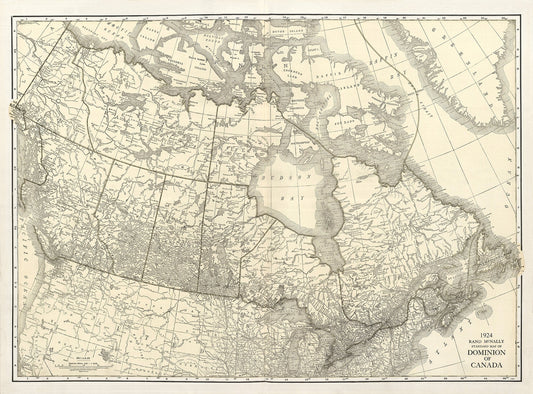
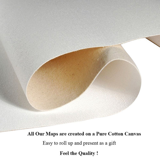
Rand McNally & Company, Commercial Atlas, Canada, 1924 Ver. I , map on heavy cotton canvas, 20 x 25" approx.
Regular price $45.00 CADRegular price -
Royal Rifles of Canada, Canada WW I Poster, on heavy cotton canvas, 22x27" approx.
Regular price $45.00 CADRegular price -
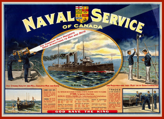
Naval service of Canada. Only strong, healthy and well educated men and boys are required, 1915, on heavy cotton canvas, 22x27in. approx.
Regular price $45.00 CADRegular price -
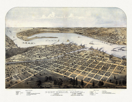
View of the City of Port Huron, Sarnia & Gratiot, Michigan, Point Edwards, Lambton Co., Canada West, 1867, canvas, 22x27"
Regular price $45.00 CADRegular price -
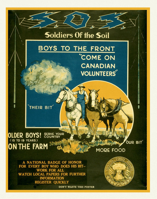
S.O.S. Soldiers of the Soil, Boys to the Front, 1914, Canada War Poster, on heavy cotton canvas, 22x27" approx.
Regular price $40.00 CADRegular price -
Plan of the Straits of St. Mary, and Michilimakinac shewing the two westernmost settlements of Canada, 1750, 50 x 70 cm, 20 x 25" approx.
Regular price $45.00 CADRegular price -
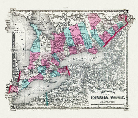
Schonberg's Map of Canada West, 1867 , map on heavy cotton canvas, 22x27" approx.
Regular price $45.00 CADRegular price -
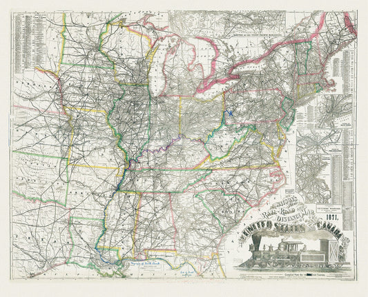
Watson's new rail-road and distance map of the United States and Canada, 1871, map on heavy cotton canvas, 22x27" approx
Regular price $45.00 CADRegular price -
Parlane, See Canada's Parks this Summer, 1935, supplement to Toronto Star, poster on cotton canvas, 22x27" approx.
Regular price $45.00 CADRegular price -
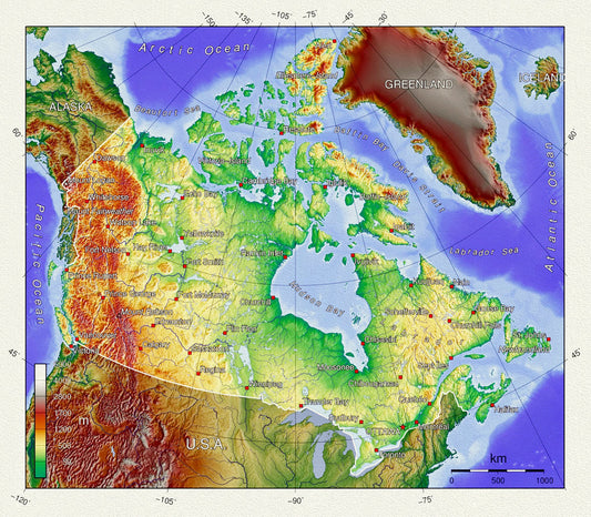
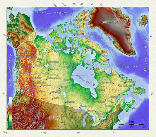
Topographical Map of Canada, on heavy cotton canvas, 20 x 25" approx.
Regular price $45.00 CADRegular price -
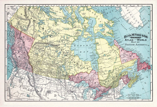
Rand, McNally & Co., British America (Canada), 1892, , map on heavy cotton canvas, 20 x 25" approx.
Regular price $45.00 CADRegular price -
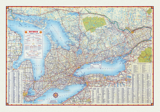
Shell Oil Company of Canada, Road Map of Ontario, 1955, map on heavy cotton canvas, 22x27" approx.
Regular price $45.00 CADRegular price -
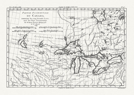
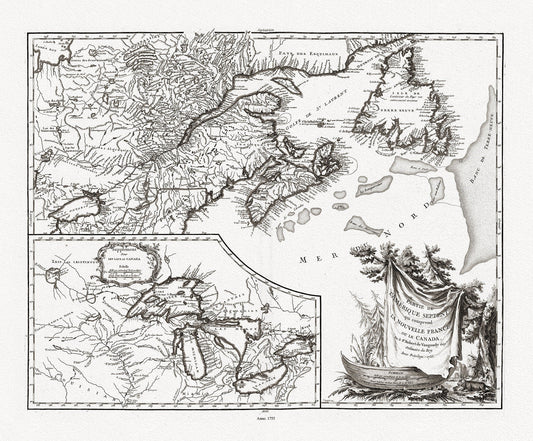
Raynall et Bonne, Partie Occidentale Du Canada, 1780, map on heavy cotton canvas, 50 x 70cm, 20 x 27" approx.
Regular price $45.00 CADRegular price -
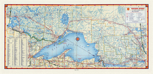
Shell Oil of Canada, Northern Ontario, 1959, Map on canvas, 16 x 27" approx.
Regular price $45.00 CADRegular price -
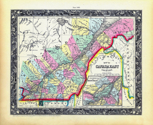
Quebec: Mitchell, Map Of Canada East In Counties, 1860 , map on heavy cotton canvas, 22x27" approx.
Regular price $45.00 CADRegular price -
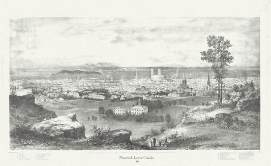
Montreal, Lower Canada, 1855, Whitfield auth., vintage print reprinted on durable cotton canvas, 50 x 70 cm, 20 x 25" approx.
Regular price $45.00 CADRegular price -
Map showing the route of the Chicago and Canada Southern Railway and its connecting lines, Colton auth., 1872 on canvas, 20 x 25" approx
Regular price $45.00 CADRegular price -
Topographical Map of Canada, vintage map reprinted on durable cotton canvas, 50 x 70 cm, 20 x 25" approx.
Regular price $45.00 CADRegular price -
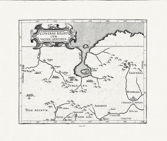
Wytfliet, Corneille, Conibas regio cum vicinis gentibus, (Central Canada), 1597, map on heavy cotton canvas, 22x27" approx.
Regular price $45.00 CADRegular price -
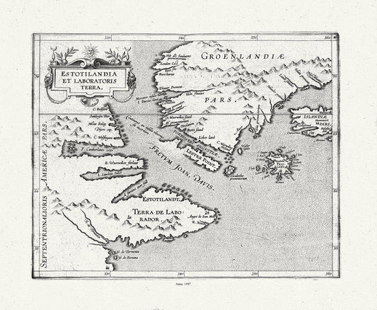
Wytfliet, Corneille, Estotilandia et Laboratoris Terra, ( East Coast Canada), 1597, map on heavy cotton canvas, 22x27" approx.
Regular price $45.00 CADRegular price -
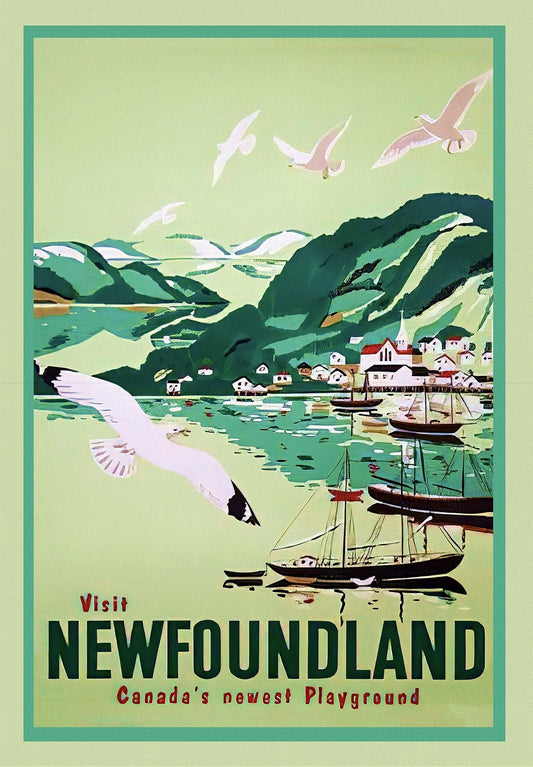
Visit Newfoundland Canada, 1965, Travel Poster on heavy cotton canvas, 22x27" approx.
Regular price $45.00 CADRegular price -
Rand, McNally & Co., British America (Canada), 1892, map on heavy cotton canvas, 22x27" approx.
Regular price $45.00 CADRegular price -
Vaugondy (Robert de, Gilles, 1688-1766), Nouvelle France ou le Canada, 1755 , map on heavy cotton canvas, 22x27" approx.
Regular price $45.00 CADRegular price -
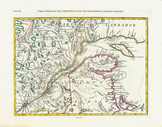
Mitchell, Rayanal et Zatta,Parte Orientale del Canada, Nuova Scozia Settentrionale, e Parte di Labrador, 1778, on canvas, 22x27"
Regular price $45.00 CADRegular price