-
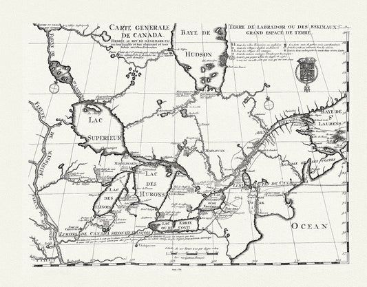
Carte generale de Canada, Lahotan auth., 1706, map on heavy cotton canvas, 50 x 70 cm, 20 x 25" approx.
Regular price $45.00 CADRegular price -
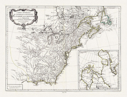
Carte générale du Canada, de la Louisiane, de la Floride, de la Caroline, de la Virginie, de la Nouvelle Angleterre, 1776, 25x27" approx.
Regular price $55.00 CADRegular price -
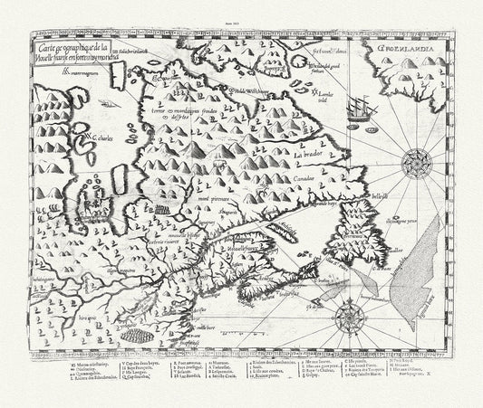
Carte geographique de la Nouelle franse en son vray moricha, Champlain auth., 1613, map on heavy cotton canvas, 50 x 70 cm, 20 x 25" approx.
Regular price $45.00 CADRegular price -
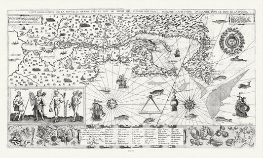
Carte geographiqve de la Nouvelle France, St Tongois cappitaine ordinaire pour le roy , Champlain.auth., 1612,,canvas, 20 x 25" approx.
Regular price $45.00 CADRegular price -
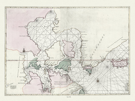
Carte particulière de l'Amerique septentrionale ou sont compris le destroit de Davids, le destroit de Hudson, Mortier auth.,1700, 20x25"
Regular price $45.00 CADRegular price -
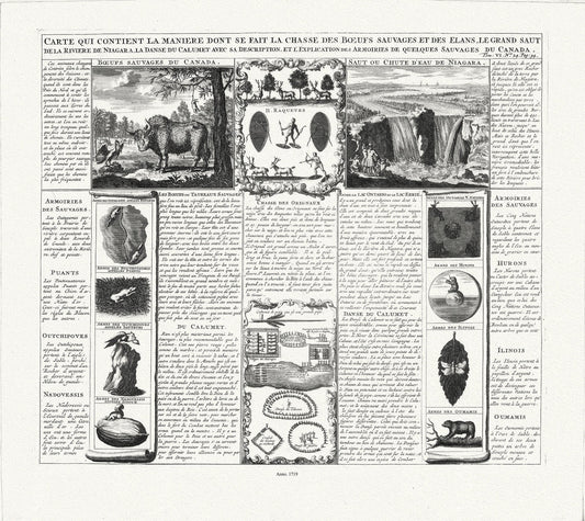
Carte qui contient la maniere dont se fait la chasse des boeufs sauvages, 1719
Regular price $45.00 CADRegular price -
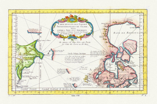
Carte reduite des parties septentrionales du globe, generale des voyages, 1758, Bellin auth., map on heavy cotton canvas,20 x 25" approx.
Regular price $45.00 CADRegular price -
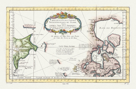
Carte reduite des parties septentrionales du globe, situees entre l'Asie et l'Amerique ,1758 , map on heavy cotton canvas, 20 x 25" approx.
Regular price $45.00 CADRegular price -
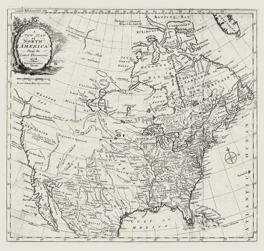
Carver, A new map of North America, from the latest discoveries, 1778, map on durable cotton canvas, 50 x 70 cm, 20 x 25" approx.
Regular price $45.00 CADRegular price -
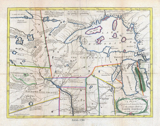
Carver, Interior, North America, 1781, map on heavy cotton canvas, 50x70cm (20 x 25") approx.
Regular price $45.00 CADRegular price -
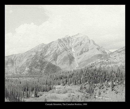
Cascade Mountain, The Canadian Rockies, 1900, Vintage Photograph on canvas, 20 x 24" approx
Regular price $45.00 CADRegular price -
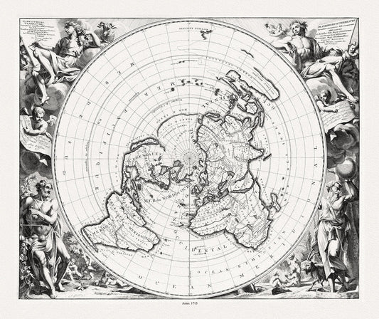
Cassinni & Aa, Planisphere Terrestre, suivant les nouvelles observations des astronomes, 1713, printed on to heavy cotton canvas, 22x27in.
Regular price $45.00 CADRegular price -
Celestial: Circular Planesphere Plate 26, 1729, Flamsteed auth.
Regular price $45.00 CADRegular price -
Celestial: Astronomia Comparativa, 1742, Doppelmayr auth.
Regular price $45.00 CADRegular price -
Celestial: Basis Geographiae Recentioris Astronomia, 1742, Doppelmayr auth.
Regular price $45.00 CADRegular price -
Celestial: Cellarius, Harmoni Macrocosmica XI, 1660
Regular price $45.00 CADRegular price -
Celestial: Coronelli, Celestial Universe-AB, 1693,
Regular price $45.00 CADRegular price -
Celestial: Ferguson, Collection of nine images including astronomical instruments, celestial charts, and a world map, 1769
Regular price $45.00 CADRegular price -
Celestial: Ferguson-Collection of nine images including astronomical instruments, celestial charts, and a world map,1769 Cyanotype
Regular price $45.00 CADRegular price -
Celestial: Hemisphaerium Coeli Australe, 1742, Doppelmayr auth.
Regular price $45.00 CADRegular price -
Celestial: Hemispharium Coeli Boreale, 1742, Doppelmayr auth.
Regular price $45.00 CADRegular price -
Celestial: Positions of the Globe,1800, Delamarche auth., Cyanotype
Regular price $45.00 CADRegular price -
Celestial: Theoria Planetarium Primariorum, 1742, Doppelmayr auth.
Regular price $45.00 CADRegular price -
Celestial: Amillary Sphere, 1800, Delamarche auth.
Regular price $45.00 CADRegular price