-
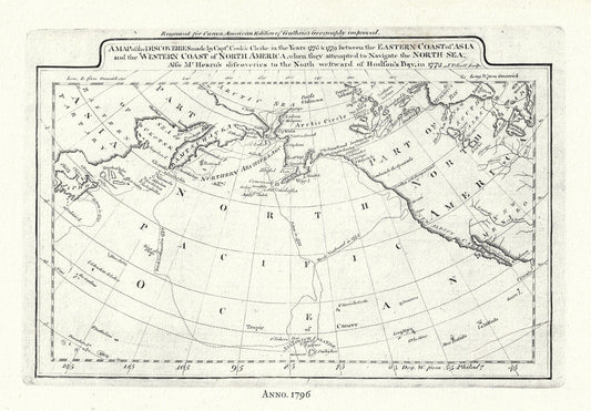
Captain Cook's Voyages in the Pacific Northwest, map on heavy cotton canvas, 50 x 70cm, 20 x 25" approx.
Regular price $45.00 CADRegular price -
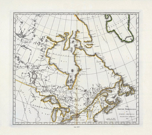
Carey, British Possessions in North America, 1818, map on heavy cotton canvas, 20 x 25" approx.
Regular price $45.00 CADRegular price -
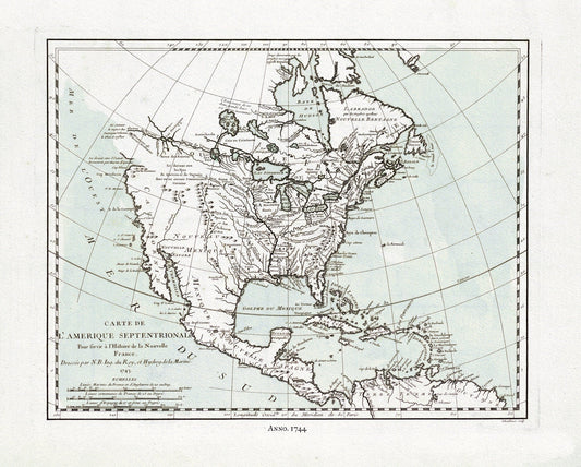
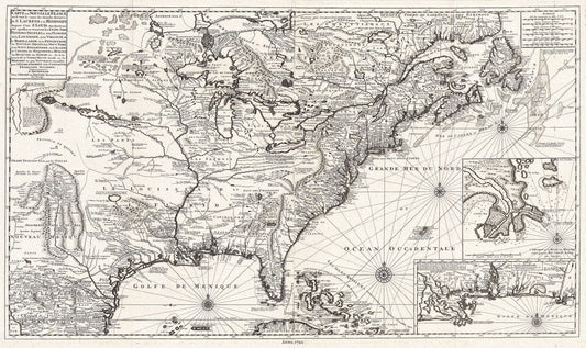
Carte de L'Amerique Septentrionale, 1744 Ver. II, map on heavy cotton canvas, 22x27" approx.
Regular price $45.00 CADRegular price -
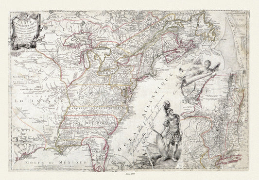
Carte de l'Amérique Septle. pour servir à l'intelligence de la guerre entre les Anglois et les insurgents, 1777, canvas 25x27" approx.
Regular price $55.00 CADRegular price -
Carte de l'Amérique Septle. pour servir à l'intelligence de la guerre entre les Anglois et les insurgents, 1777, heavy cotton canvas, 22x27"
Regular price $45.00 CADRegular price -
Carte de l'Amérique Septle. pour servir à l'intelligence de la guerre entre les Anglois et les insurgents, 1777,canvas,22x27" approx.
Regular price $45.00 CADRegular price -
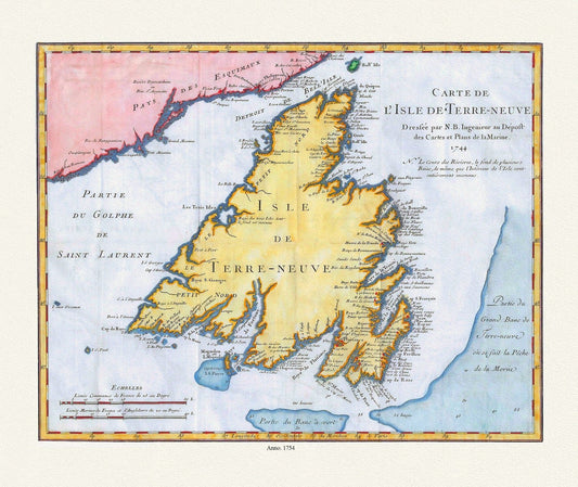
Carte de l'Isle de Terre-Neuve, Bellin auth.,1744 , map on heavy cotton canvas, 50 x 70 cm, 20 x 25" approx.
Regular price $45.00 CADRegular price -
Carte de l'Isle de Terre-Neuve, Bellin auth.,1744 Ver.III
Regular price $45.00 CADRegular price -
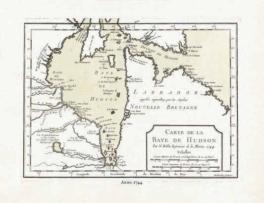
Carte de la Bye de Hudson, Bellin auth., 1744, map on heavy cotton canvas, 50 x 70 cm, 20 x 25" approx.
Regular price $45.00 CADRegular price -
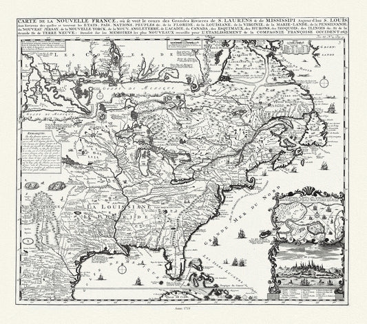
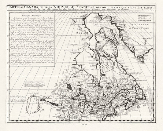
Carte de la Nouvelle France où se voit le cours des Grandes Rivieres de S. Laurens & de Mississipi, 1719 , on canvas, 20 x 25" approx.
Regular price $45.00 CADRegular price -
Carte de la Nouvelle France, 1720, Van Keulen, map on heavy cotton canvas, 50 x 70cm, 20 x 25" approx.
Regular price $45.00 CADRegular price -
Carte de la Nouvelle France, Champlain (1632) et Thoreau (1850), map on heavy cotton canvas, 50 x 70 cm, 20 x 25" approx.
Regular price $45.00 CADRegular price -
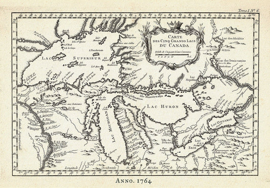
Carte des Cinq Grand Lacs du Canada, Bellin auth.,1764 Ver. II, map on durable cotton canvas, 50 x 70 cm, 20 x 25" approx.
Regular price $45.00 CADRegular price -
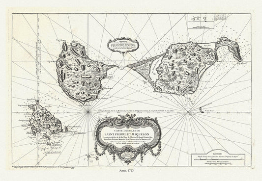
Carte des les Saint Pierre et Miquelon, 1763, Bellin auth. , map on durable cotton canvas, 50 x 70 cm, 20 x 25" approx.
Regular price $45.00 CADRegular price -
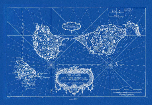
Carte des les Saint Pierre et Miquelon, 1763, Bellin auth., Cyanotype, map on durable cotton canvas, 50 x 70 cm, 20 x 25" approx.
Regular price $45.00 CADRegular price -
Carte des Pays situes a l'Ouest du Canada, Long auth.,1791, travel poster on durable cotton canvas, 50 x 70 cm, 20 x 25" approx.
Regular price $45.00 CADRegular price -
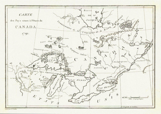
Carte des Pays situes a l'Ouest du Canada, Stephen H. Long auth.,1791, map on durable cotton canvas, 50 x 70 cm, 20 x 25" approx.
Regular price $45.00 CADRegular price -
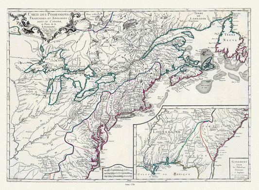
Carte des possessions françoises et angloises dans le Canada, et partie de la Louisiane, 1756,Lonchamps auth., canvas, 22x27" approx.
Regular price $45.00 CADRegular price -
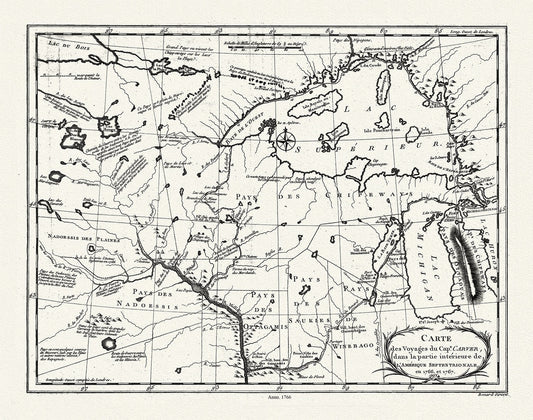
Carte des voyages du Cape. Carver, dans la partie intérieure de l'Amérique septentrionale en 1766, et 1767., 50 x 70 cm, 20 x 25" approx.
Regular price $45.00 CADRegular price -
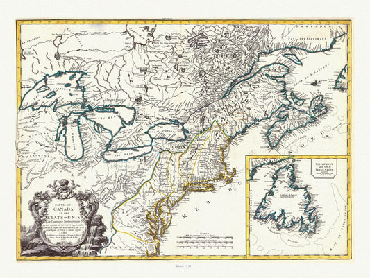
Carte du Canada et des Etats Unis de l'Amérique Septentrionale, 1778, Vaugondy auth, map on durable canvas, 50 x 70 cm, 20 x 25" approx.
Regular price $45.00 CADRegular price -
Carte du Canada ou de la Nouvelle France, 1719, Map on heavy cotton canvas, 22x27" approx.
Regular price $45.00 CADRegular price -
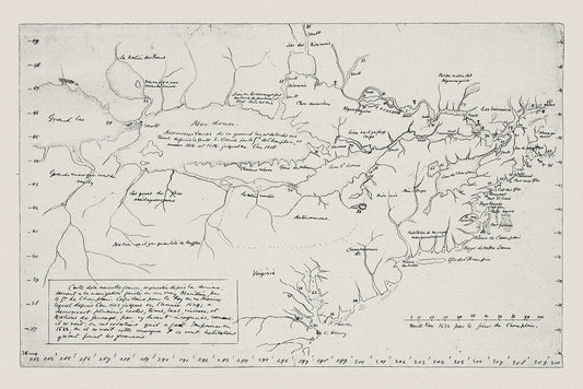
Carte du cours du fleuve de St. Laurent depuis son embouchure jusqu'au dessus de Quebec,1757 Bellin auth
Regular price $45.00 CADRegular price -
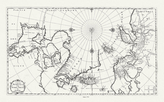
Carte du nord est & du nord west du Pole, 1735, Bernard auth., map on heavy cotton canvas, 50 x 70 cm, 20 x 25" approx.
Regular price $45.00 CADRegular price -
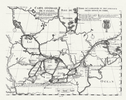
Carte Générale de Canada, Lahontan auth.,1703, map on durable cotton canvas, 50 x 70 cm, 20 x 25" approx.
Regular price $45.00 CADRegular price