-
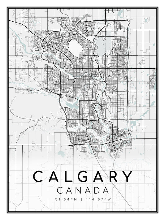
Calgary, Alberta, map on heavy cotton canvas, 45 x 65 cm, 18 x 24" approx.
Regular price $45.00 CADRegular price -
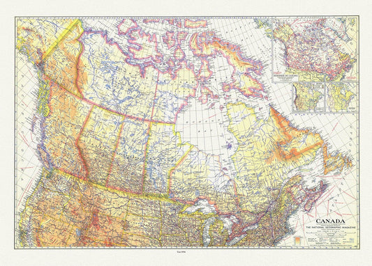
Canada , National Geographic, 1936, vintage map reprinted on durable cotton canvas, 50 x 70 cm or 20x25" approx.
Regular price $45.00 CADRegular price -
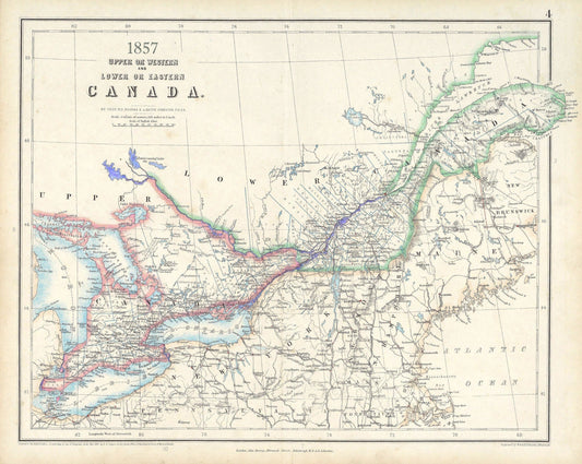
Canada ,Central,1857, Johnston auth., map on durable cotton canvas, 50 x 70 cm, 20 x 25" approx.
Regular price $45.00 CADRegular price -
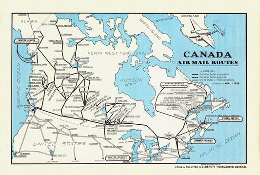
Canada Air Mail Routes,1939, on heavy cotton canvas, 22x27" approx.
Regular price $45.00 CADRegular price -
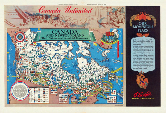
Canada and Newfoundland, Their natural and industrial resources, MacLean's Magazine, 1945, map on heavy cotton canvas, 22x27" approx.
Regular price $45.00 CADRegular price -
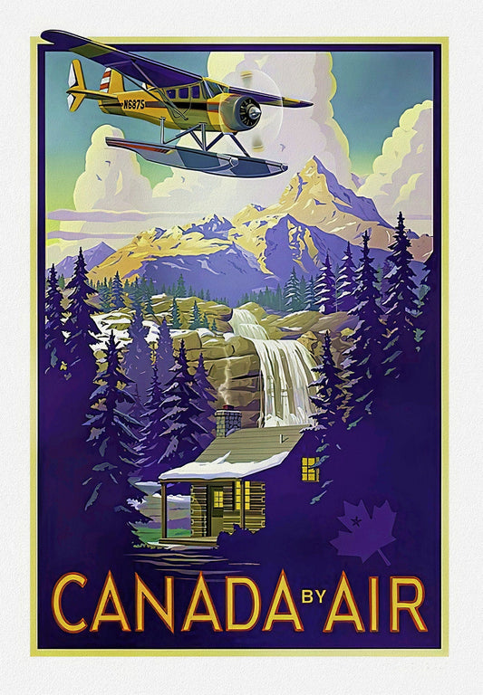
Canada by Air, Travel Poster on heavy cotton canvas, 22x27" approx.
Regular price $45.00 CADRegular price -
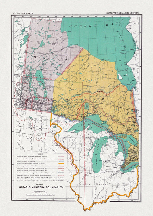
Canada Department of the Interior et Chalifour, Ontario & Manitoba boundary, 1915, map on heavy cotton canvas, 22x27" approx.
Regular price $45.00 CADRegular price -
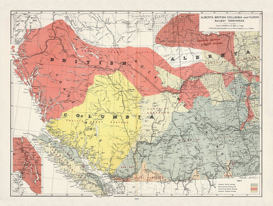
Canada Department of the Interior, Alberta, British Columbia and Yukon Railway Territories, 1915, on heavy cotton canvas, 22x27" approx.
Regular price $45.00 CADRegular price -
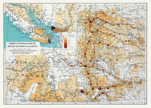
Canada Department of the Interior, Density of population 1911, British Columbia and Alberta, 1915, on heavy cotton canvas, 22x27" approx.
Regular price $45.00 CADRegular price -
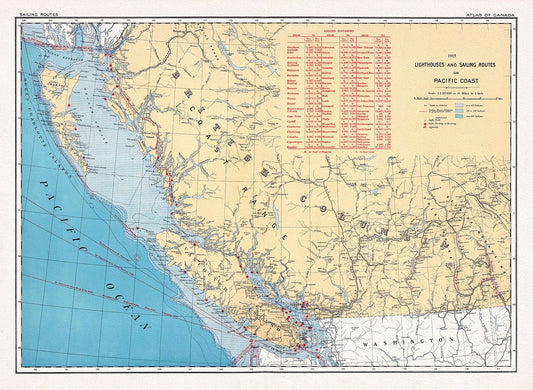
Canada Department of the Interior, Lighthouses and sailing routes on Pacific Coast, 1915, map on heavy cotton canvas, 22x27" approx.
Regular price $45.00 CADRegular price -
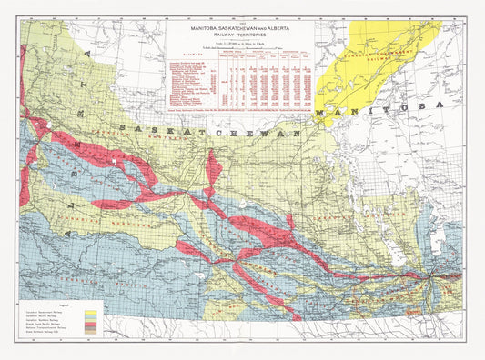
Canada Department of the Interior, Manitoba, Saskatchewan and Alberta railway territories, 1915, map on heavy cotton canvas, 22x27" approx.
Regular price $45.00 CADRegular price -
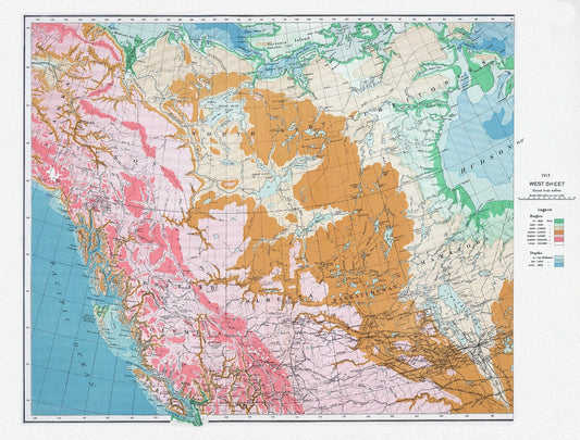
Canada Department of the Interior, West sheet, Physical map of the Dominion of Canada, 1915 , map on heavy cotton canvas, 22x27" approx.
Regular price $45.00 CADRegular price -
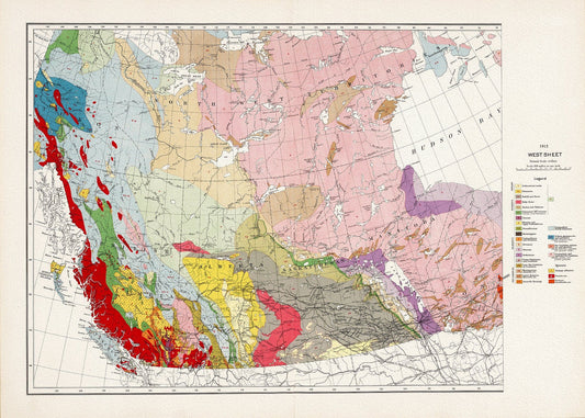
Canada Department of the Interior, West sheet. Geological Map of the Dominion of Canada, 1915, map on heavy cotton canvas, 22x27" approx.
Regular price $45.00 CADRegular price -
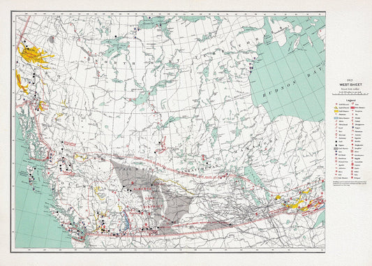
Canada Department of the Interior, West sheet. Mineral map of the Dominion of Canada, 1915, map on heavy cotton canvas, 22x27" approx.
Regular price $45.00 CADRegular price -
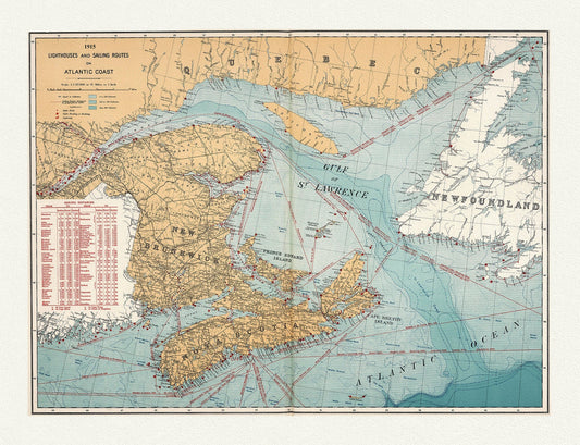
Canada Department of the Interior: Lighthouses and sailing routes on Atlantic coast, 1915 , map on heavy cotton canvas, 20 x 25" approx.
Regular price $45.00 CADRegular price -
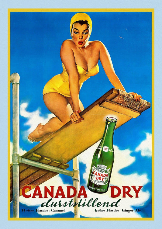
Canada Dry, poster on heavy cotton canvas, 50 x 70 cm, 20 x 25" approx.
Regular price $45.00 CADRegular price -
Canada First Peoples:
Regular price $45.00 CADRegular price -
Canada First Peoples: Aboriginal population, 1951
Regular price $45.00 CADRegular price -
Canada First Peoples: Plan of Captain Carvers Travels in the interior Parts of North America, 1781
Regular price $45.00 CADRegular price -
Canada First Peoples: A map of Canada showing the locations of Indian bands with linguistic affiliations,1965
Regular price $45.00 CADRegular price -
Canada First Peoples: A Map of the Country of the Five Nations, belonging to the Province of New York; and of the Lakes near,1747
Regular price $45.00 CADRegular price -
Canada First Peoples: A map of the Seneca villages and the Jesuit and French contacts 1615-1708
Regular price $45.00 CADRegular price -
Canada First Peoples: A Mappe of Colonel Römers Voyage to ye 5 Indian nations going from New Yorck to Albany thence west to ye 3 Macquas Castle, 1700
Regular price $45.00 CADRegular price -
Canada First Peoples: Aborigines of Canada, Alaska and Greenland, 1906
Regular price $45.00 CADRegular price