-
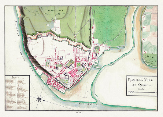
Plan de la ville de Québec, 1750 , map on heavy cotton canvas, 20 x 25" approx.
Regular price $45.00 CADRegular price -
Plan des cotes de Terre-Neuve VII, 1784, Cook et Lane auths. map on durable cotton canvas, 50 x 70 cm, 20 x 25" approx.
Regular price $45.00 CADRegular price -
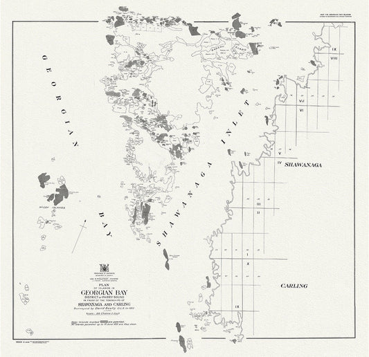
Plan of islands in Georgian Bay district of Parry Sound, in front of the townships of Shawanaga and Carling, 1931
Regular price $45.00 CADRegular price -
Plan of part of the province of Manitoba showing the water powers on the Winnipeg River, 1908 , map on canvas, 50 x 70 cm, 20 x 25" approx.
Regular price $45.00 CADRegular price -
Plan of part of the province of Manitoba showing the water powers on the Winnipeg River,1908, map , 50 x 70 cm, 20 x 25" approx.
Regular price $45.00 CADRegular price -
Plan of Picton, Prince Edward County, Ontario, 1880, map on heavy cotton canvas, 45 x 65 cm, 18 x 24" approx.
Regular price $45.00 CADRegular price -
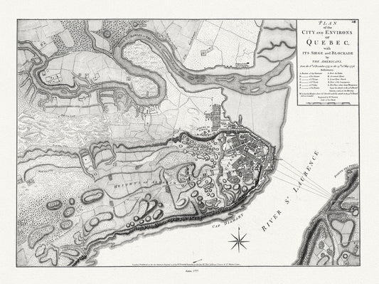
Plan of the city and environs of Quebec with its siege and blockade by the Americans, from 1775 to 1776 Ver. I, 22x27" canvas
Regular price $45.00 CADRegular price -
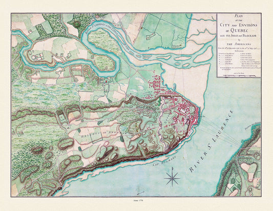
Plan of the city and environs of Quebec, with its siege and blockade by the Americans from 1775-1776,, map on cotton canvas, 20x27" approx.
Regular price $45.00 CADRegular price -
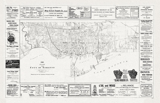
Plan of the City of Toronto, 1903, map on heavy cotton canvas, 22x27" approx.
Regular price $45.00 CADRegular price -
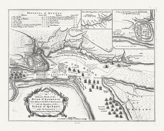
Plan of the River St. Laurence, from Sillery Montmorenci Falls etc...., 1760, map on heavy cotton canvas, 20x27" approx.
Regular price $45.00 CADRegular price -
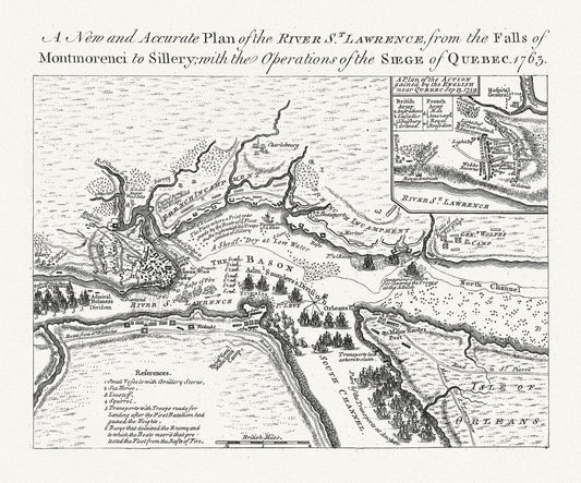
Plan of the river St. Laurence, the falls of Montmorency to Sillery., with the siege of Quebec, 1763, map on cotton canvas, 20x27" approx
Regular price $45.00 CADRegular price -
Plan of the Straits of St. Mary, and Michilimakinac shewing the two westernmost settlements of Canada, 1750, 50 x 70 cm, 20 x 25" approx.
Regular price $45.00 CADRegular price -
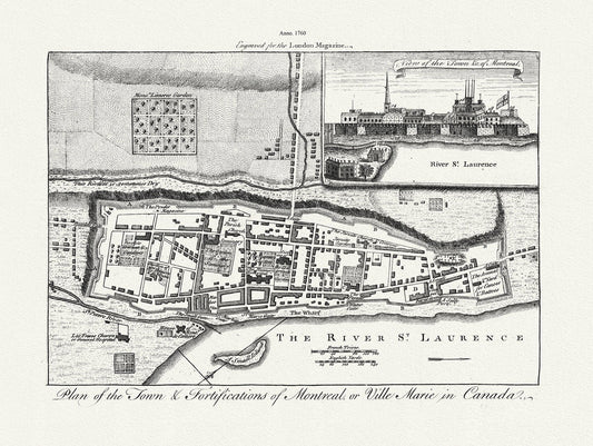
Plan of the town & fortifications of Montreal, or Ville Marie in Canada, 1760, map on heavy cotton canvas, 22x27" approx.
Regular price $45.00 CADRegular price -
Plancio Pietro, Orbis Terrarum, 1534 Ver. D, Map on heavy cotton canvas, 22x27in. approx.
Regular price $45.00 CADRegular price -
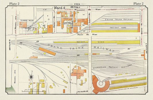
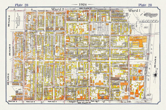
Plate 02, Toronto Downtown, Railway Lands, 1924, map on heavy cotton canvas, 20 x 30" or 50 x 75cm. approx.
Regular price $45.00 CADRegular price -
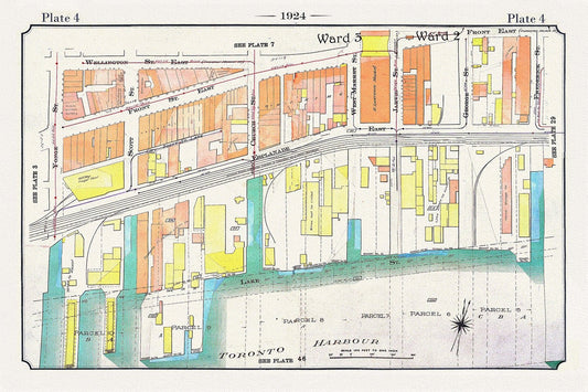
Plate 04, Toronto, Downtown Waterfront, Harbour East, 1924
Regular price $45.00 CADRegular price -
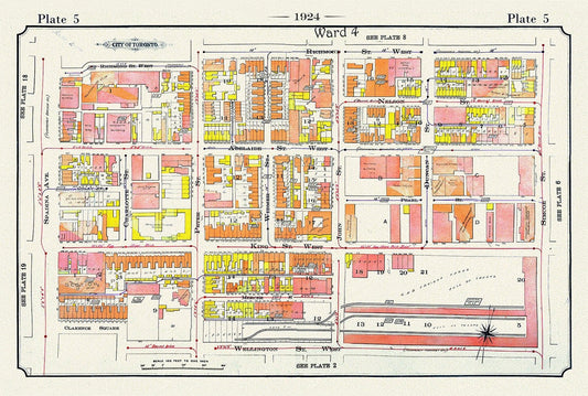
Plate 05, Toronto Downtown West, King St. to Spadina, 1924, map on heavy cotton canvas, 20 x 30" or 50 x 75cm. approx.
Regular price $45.00 CADRegular price -
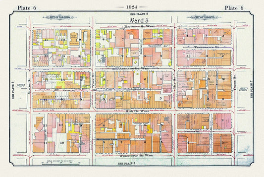
Plate 06, Toronto Downtown West, Simcoe St., 1924
Regular price $45.00 CADRegular price -
Plate 07, Toronto Downtown East, Cabbagetown, 1924, map on heavy cotton canvas, 20 x 30" or 50 x 75cm. approx.
Regular price $45.00 CADRegular price -
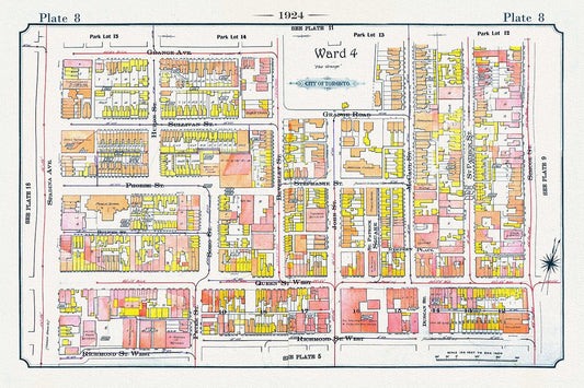
Plate 08, Toronto Downtown, Queen St. West to Spadina, 1924, map on heavy cotton canvas, 20 x 30" or 50 x 75cm. approx.
Regular price $45.00 CADRegular price -
Plate 10 Toronto Downtown East of Yonge, South of Dundas St., 1923, Map on heavy cotton canvas, 18x27in. approx.
Regular price $45.00 CADRegular price -
Plate 10, Toronto Downtown East,, Mutual St., 1910 , map on heavy cotton canvas, 20 x 30" approx.
Regular price $45.00 CADRegular price -
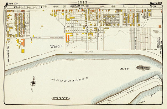
Plate 103, Toronto East, The Beach, Ashbridges Bay, 1913, map on heavy cotton canvas, 20 x 30" or 50 x 75cm. approx.
Regular price $45.00 CADRegular price -
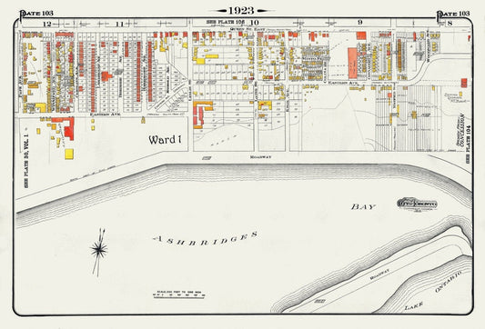
Plate 103, Toronto East, Waterfront, Ashbridges Bay, 1923, Map on heavy cotton canvas, 18x27in. approx.
Regular price $45.00 CADRegular price