-
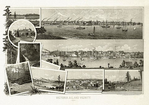
Panoramic Map of Victoria, B.C. and vicinity,1884, on heavy cotton canvas, 22x27" approx.
Regular price $45.00 CADRegular price -
Parlane, See Canada's Parks this Summer, 1935, supplement to Toronto Star, poster on cotton canvas, 22x27" approx.
Regular price $45.00 CADRegular price -
Part of a Map of the British Empire in America, Popple auth., 1733E, map on heavy cotton canvas, 50 x 70 cm, 20 x 25" approx.
Regular price $45.00 CADRegular price -
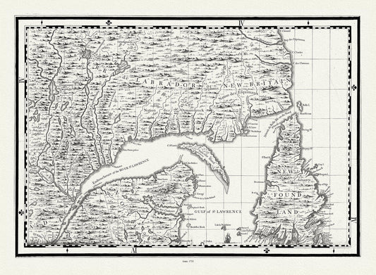
Part of North America,containing Canada, the north parts of New England and New York, with Nova Scotia and Newfoundland,1777, canvas, 20x25"
Regular price $45.00 CADRegular price -
Part of the coast of N.W. America , with tracks of His Majesty's sloop Discovery and armed tender Chatham, 1798, canvas map, 20x25" approx.
Regular price $45.00 CADRegular price -
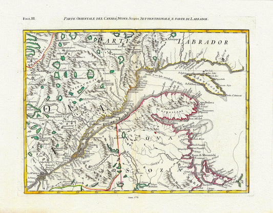
Parte Orientale del Canada, Nuova Scozia Settentrionale, e Parte di Labrador, 1778, Map on heavy cotton canvas, 22x27" Approx.
Regular price $45.00 CADRegular price -
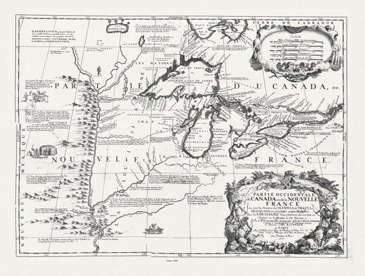
Partie occidentale du Canada ou de la Nouvelle France ou sont les Nations des Ilinois, avec la Louisiane, Coronelli, 1688, canvas 20 x 25"
Regular price $45.00 CADRegular price -
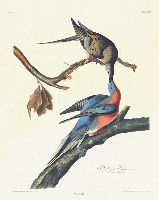
Passenger pigeon. plate 62, 1835, Audobon auth., vintage print on durable cotton canvas, 50 x 70 cm, 20 x 25" approx.
Regular price $45.00 CADRegular price -
Patten, A trader's map of the Ohio country before 1753, map on heavy cotton canvas, 22x27" approx.
Regular price $45.00 CADRegular price -
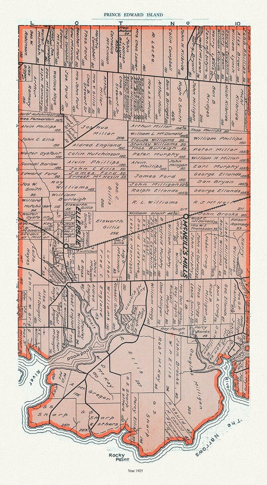
PEI: Map 12, Prince County, Prince Edward Island, 1925 , vintage map reprinted on durable cotton canvas, 50 x 70 cm or 20x25" approx.
Regular price $45.00 CADRegular price -
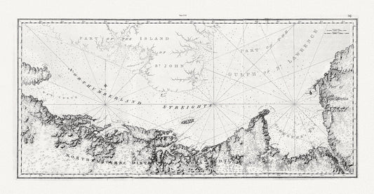
PEI: North East Coast of Nova Scotia and Northumberland Strait, Des Barres auth., 1755, on cotton canvas, 50 x 70 cm or 20x25" approx.
Regular price $45.00 CADRegular price -
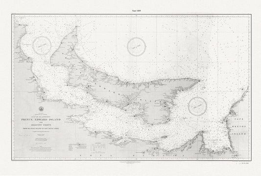
PEI: Prince Edward Island and adjacent coasts, from Sea Wolf Island to Escuminac Point, 1889, Nautical chart on canvas 20x25" approx.
Regular price $45.00 CADRegular price -
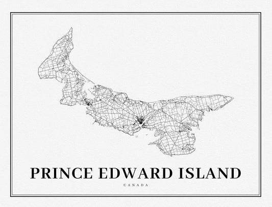
PEI: Prince Edward Island, A Modern Map
Regular price $45.00 CADRegular price -
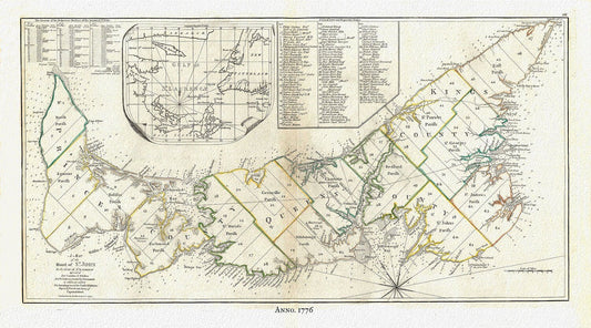
PEI:Gulf of St. Lawrence, Prince Edward Island, Jefferys auth.,1776 , map reprinted on durable cotton canvas, 50 x 70 cm or 20x25" approx.
Regular price $45.00 CADRegular price -
PEI; Map of the City of Charlottetown, Meacham et Allen auths.,1880 , vintage map on durable cotton canvas, 50 x 70 cm or 20x25" approx.
Regular price $45.00 CADRegular price -
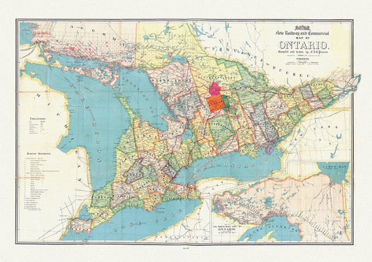
Penson, A New Railway and Commercial Map of Ontario,1887 Ver. II , map on heavy cotton canvas, 50 x 70 cm, 20 x 25" approx.
Regular price $45.00 CADRegular price -
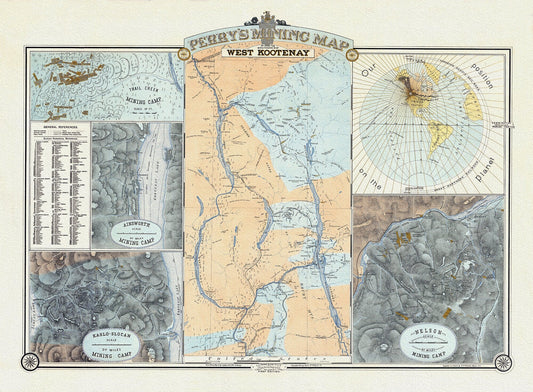
Perry's Mining Map of the Southern District of West Kootenay, 1893, Map on heavy cotton canvas, 22x27" approx.
Regular price $45.00 CADRegular price -
Peter Pond, fur trader & explorer, 1785, map on durable cotton canvas, 50 x 70 cm, 20 x 25" approx.
Regular price $45.00 CADRegular price -
Peterborough County, Township Map. 1875, map on heavy cotton canvas, 50 x 70cm, 20 x 27" approx.
Regular price $40.00 CADRegular price -
Peterborough, Ont. Topographic Map sheet 031D08, 1933 , map on durable cotton canvas, 50 x 70 cm, 20 x 25" approx.
Regular price $45.00 CADRegular price -
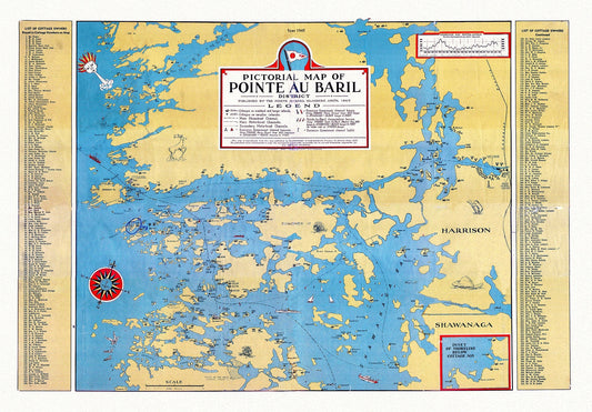
Pictorial map of Pointe au Baril District, 1945, , map on heavy cotton canvas, 22x27" approx.
Regular price $45.00 CADRegular price -
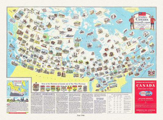
Pictorial map of the dominion of Canada with Newfoundland and Labrador Scenic, historic, recreationa, economic resources, 1946, Turner auth.
Regular price $45.00 CADRegular price -
Pierre-Jean Mariette, Carte de l'Amerique, 1646
Regular price $45.00 CADRegular price -
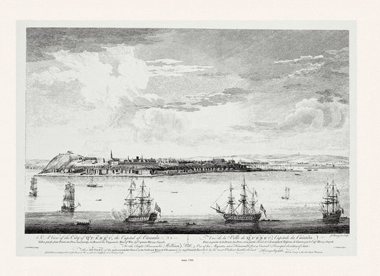
Pitt, Vue de la ville du Québec, capitale du Canada, 1760, map on heavy cotton canvas, 20x27" approx.
Regular price $45.00 CADRegular price