-
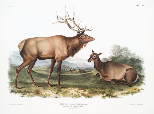
J.J. Audobon, North American Elk (Cervus Canadensis) from the viviparous quadrupeds of North America (1845) , 50 x 70 cm, 20 x 25" approx.
Regular price $45.00 CADRegular price -
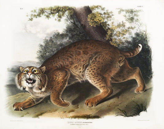
J.J. Audobon, North American wild cat (Lynx rufus) from the viviparous quadrupeds of North America (1845) , 50 x 70 cm, 20 x 25" approx.
Regular price $45.00 CADRegular price -
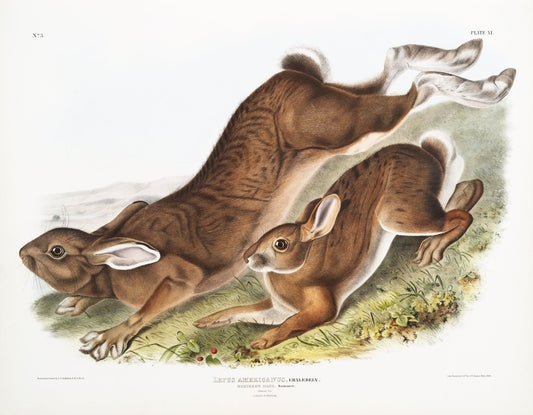
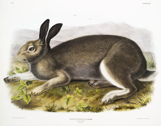
J.J. Audobon, Northern Hare (Lepus Americanus) from the viviparous quadrupeds of North America (1845) ,canvas, 50 x 70 cm, 20 x 25" approx.
Regular price $45.00 CADRegular price -
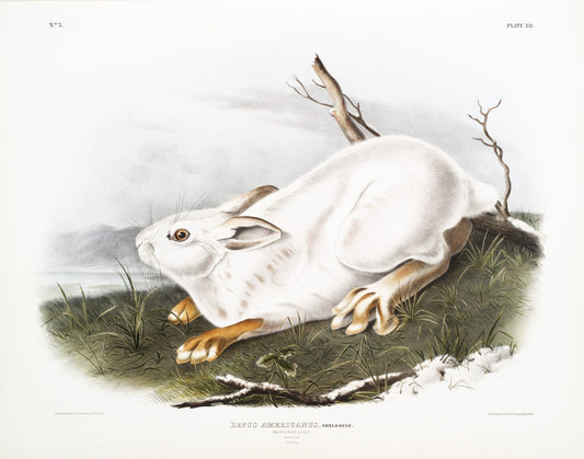
J.J. Audobon, Northern Hare in winter (Lepus Americanus) from the viviparous quadrupeds of North America (1845) , 20 x 25" approx.
Regular price $45.00 CADRegular price -
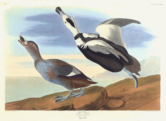
J.J. Audobon, Pied Duck. Fuligula Labradora. 1835, bird print on durable cotton canvas, 19x27inches(50x70cm) approx.
Regular price $45.00 CADRegular price -
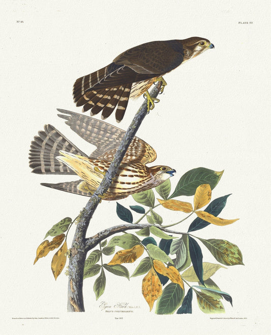
J.J. Audobon, Pigeon hawk. Male, 1. F, 2. Falco columbarius. c.2 v.1 plate 92, 1835 , vintage print on canvas, 50 x 70 cm, 20 x 25" approx.
Regular price $45.00 CADRegular price -
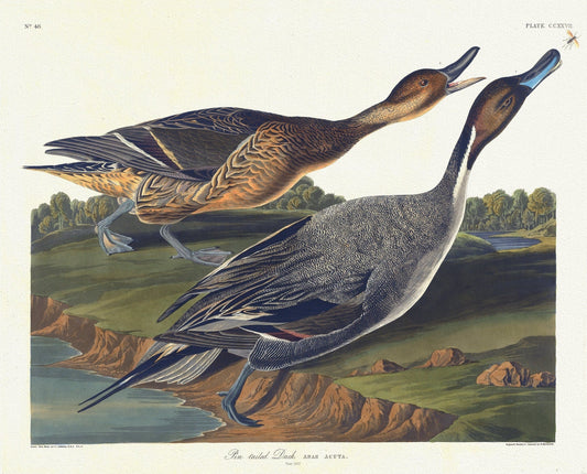
J.J. Audobon, Pin tailed duck. Anas acuta. c.1 v.3 plate 227, 1835, vintage nature print on canvas, 50 x 70 cm, 20 x 25" approx.
Regular price $45.00 CADRegular price -
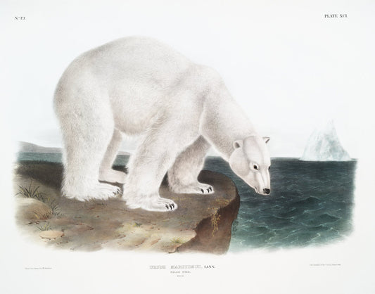
J.J. Audobon, Polar Bear (Ursus maritimus) from the viviparous quadrupeds of North America (1845) , on canvas, 50 x 70 cm, 20 x 25" approx.
Regular price $45.00 CADRegular price -
J.J. Audobon, Polar Hare (Lepus glacialis) from the viviparous quadrupeds of North America (1845), on canvas, 50 x 70 cm, 20 x 25" approx.
Regular price $45.00 CADRegular price -
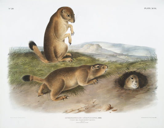
J.J. Audobon, Prairie Dog or Prairie marmot squirrel (Spermophilus ludovicianus) from the viviparous quadrupeds of North America (1845)
Regular price $45.00 CADRegular price -
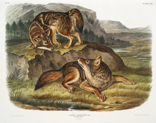
J.J. Audobon, Prairie Wolf (Canis latrans) from the viviparous quadrupeds of North America (1845), on canvas, 50 x 70 cm, 20 x 25" approx.
Regular price $45.00 CADRegular price -
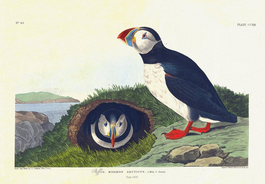
J.J. Audobon, Puffin. Mormon arcticus. 1. Male. 2. Female. c.1 v.3 plate 213, 1835, vintage print on canvas, 50 x 70 cm, 20 x 25" approx.
Regular price $45.00 CADRegular price -
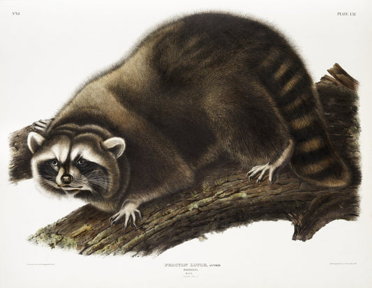
J.J. Audobon, Raccoon (Procyon lotor) from the viviparous quadrupeds of North America (1845) , on canvas, 50 x 70 cm, 20 x 25" approx.
Regular price $45.00 CADRegular price -
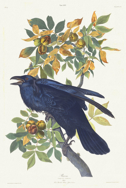
J.J. Audobon, Raven .Corvus corax. Male.. c.1 v.2 plate 101, 1835 , print on canvas, 50 x 70 cm, 20 x 25" approx.
Regular price $45.00 CADRegular price -
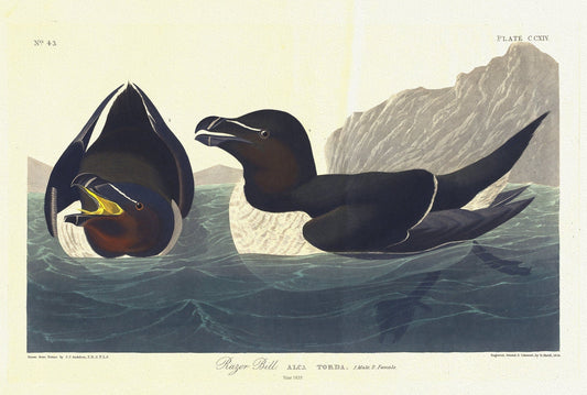
J.J. Audobon, Razor bill. Alca torda. 1. Male. 2. Female. c.1 v.3 plate 214, 1835, vintage print on canvas, 50 x 70 cm, 20 x 25" approx.
Regular price $45.00 CADRegular price -
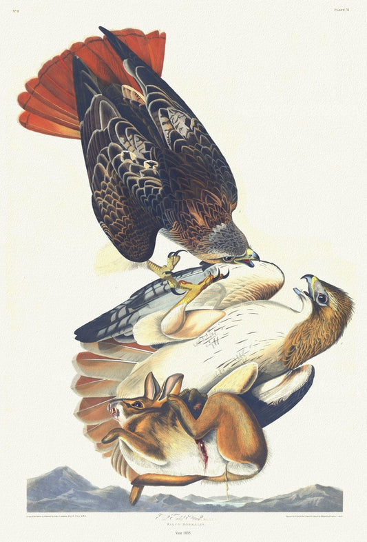
J.J. Audobon, Red tailed hawk. Male, 1. F, 2. Falco borealis. c.2 v.1 plate 51, 1835
Regular price $45.00 CADRegular price -
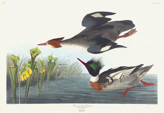
J.J. Audobon, Red-breasted merganser. Mergus serrator, c.1 v.4 plate 401, 1835, print on canvas, 50 x 70 cm, 20 x 25" approx.
Regular price $45.00 CADRegular price -
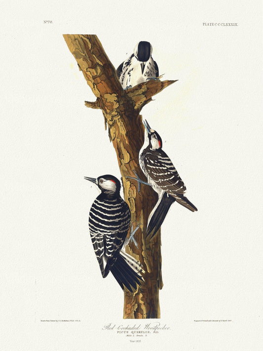
J.J. Audobon, Red-cockaded woodpecker Picus querulus, c.1 v.4 plate 389, 1835, vintage nature print on canvas, 50 x 70 cm, 20 x 25" approx.
Regular price $45.00 CADRegular price -
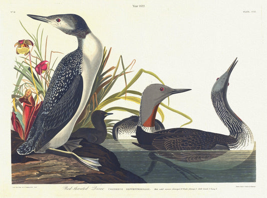
J.J. Audobon, Red-throated diver.Colymbus septentrionalis. 4. c.1 v.3 plate 202, 1835 , print on canvas, 50 x 70 cm, 20 x 25" approx.
Regular price $45.00 CADRegular price -
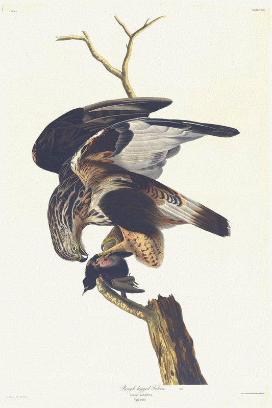
J.J. Audobon, Rough-legged falcon Falco lagopus. Male. c.1 v.2 plate 166, 1835 , print on canvas, 50 x 70 cm, 20 x 25" approx.
Regular price $45.00 CADRegular price -
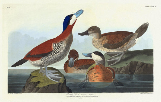
J.J. Audobon, Ruddy duck Fuligula rubida. Male adult ,Female adult, c.1 v.4 plate 343, 1835, print on canvas, 50 x 70 cm, 20 x 25" approx.
Regular price $45.00 CADRegular price -
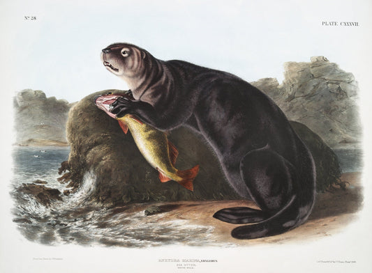
J.J. Audobon, Sea Otter (Enhydra marina) from the viviparous quadrupeds of North America (1845) , on canvas, 50 x 70 cm, 20 x 25" approx.
Regular price $45.00 CADRegular price -
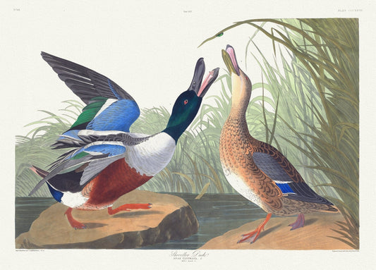
J.J. Audobon, Shoveller duck .Anas clypeata, L. Male, 1. Female, 2. c.1 v.4 plate 327, 1835 , print on canvas, 50 x 70 cm, 20 x 25" approx.
Regular price $45.00 CADRegular price -
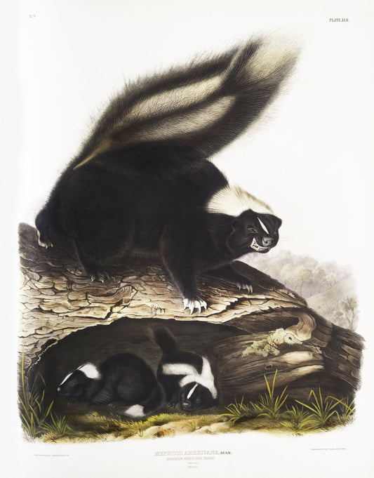
J.J. Audobon, Skunk (Mephitis Americana) from the viviparous quadrupeds of North America (1845), print, 50 x 70 cm, 20 x 25" approx.
Regular price $45.00 CADRegular price