-
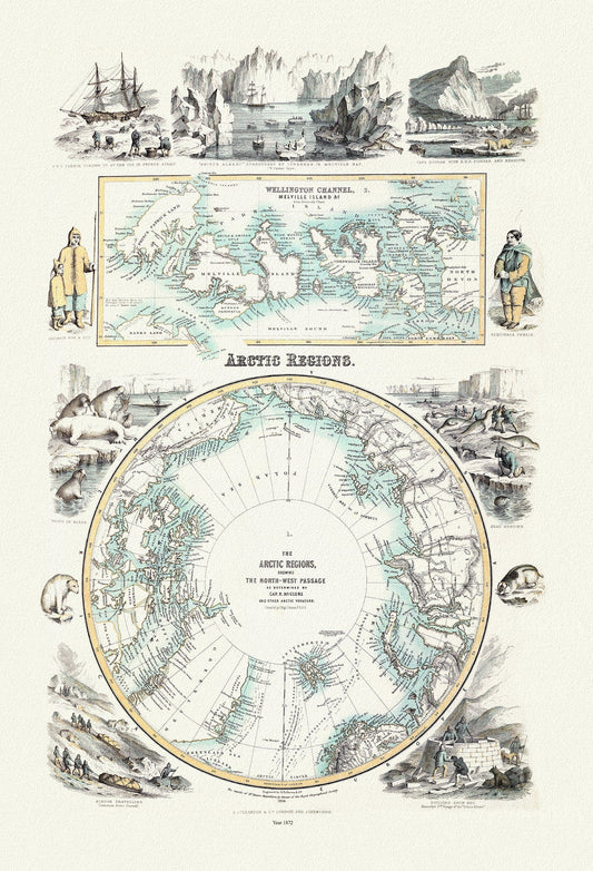
Fullarton, Arctic Regions, 1872, map on heavy cotton canvas, 22x27" approx.
Regular price $45.00 CADRegular price -
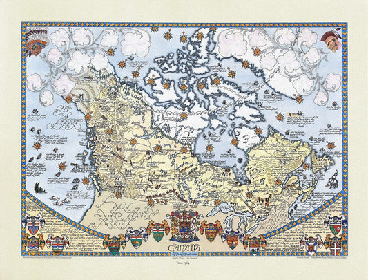
Furse, Canada, 1964 , map on durable cotton canvas, 50 x 70 cm or 20x25" approx.
Regular price $45.00 CADRegular price -
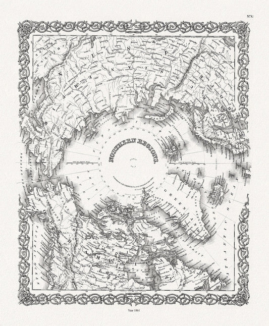
G.W. Colton, Northern Regions, 1861, Map printed on to heavy cotton canvas, 22x27in. approx.
Regular price $45.00 CADRegular price -
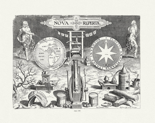
Galle et Straet, Map of Western Hemisphere, 1590, map on durable cotton canvas, 50 x 70 cm, 20 x 25" approx.
Regular price $45.00 CADRegular price -
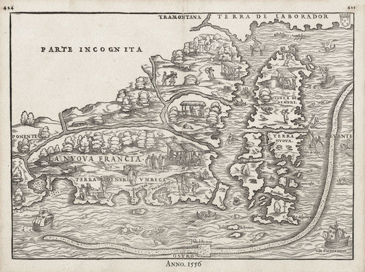
Gastaldi, La Nuova Francia, 1556, map on heavy cotton canvas, 50 x 70cm, 20 x 27" approx.
Regular price $45.00 CADRegular price -
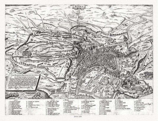
Gastaldi, Rome, Italy, 1561, map on heavy cotton canvas, 22x27" approx.
Regular price $45.00 CADRegular price -
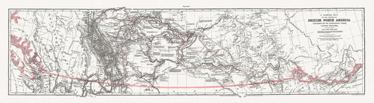
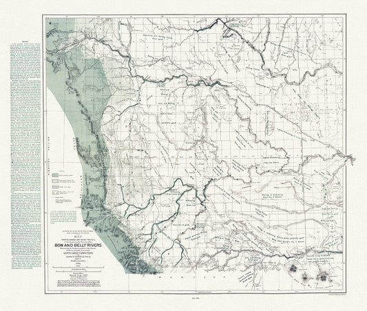
General Map of the Routes in North America Explored by Captain Palliser, during the years 1857, 1858, 1859,& 1860 ' on canvas 18 x 24" about
Regular price $45.00 CADRegular price -
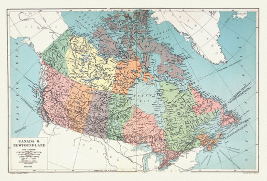

Geographia Map Company, Canada and Newfoundland, 1935 , map on heavy cotton canvas, 20 x 25" approx.
Regular price $45.00 CADRegular price -
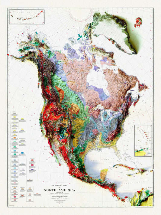
Geologic Map of North America, 1911 , map on heavy cotton canvas, 20 x 25" approx.
Regular price $45.00 CADRegular price -
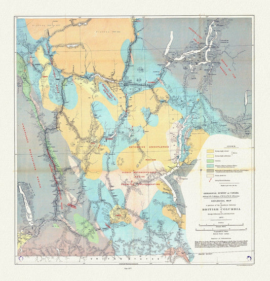
Geological map of a portion of the Southern Interior of British Columbia, George Dawson ,1877, map on cotton canvas, 20 x 25" approx.
Regular price $45.00 CADRegular price -
Geological map of Canada and Newfoundland, 1875
Regular price $45.00 CADRegular price -
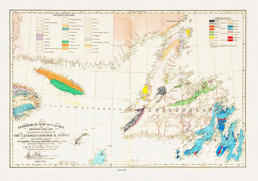
Geological map of Canada and Newfoundland, 1875 , map on heavy cotton canvas, 45 x 65 cm, 18 x 24" approx.
Regular price $45.00 CADRegular price -
Geological Map of Newfoundland, 1921
Regular price $45.00 CADRegular price -
Geological Map of Newfoundland, 1921 Ver. BWI
Regular price $45.00 CADRegular price -
Geological Map of Northern Alberta, Assiniboia and Saskatchewan, Northwest Territory, Tyrrell , 1887, map on cotton canvas, 20x27" approx.
Regular price $45.00 CADRegular price -
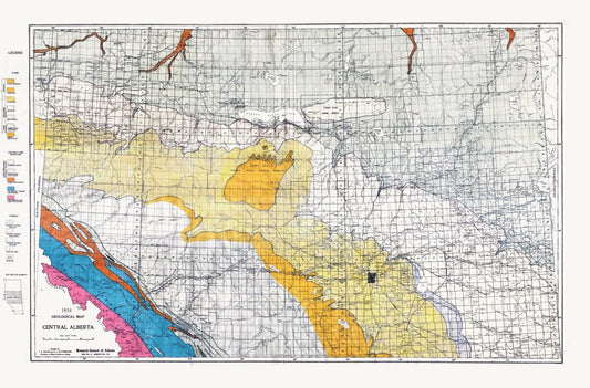
Geological Map, Central Alberta, 1934, , map on heavy cotton canvas, 22x27" approx.
Regular price $45.00 CADRegular price -
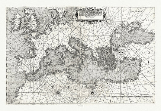
Giacomo Gastaldi, Europe & Mediterranean, 1572 , map on heavy cotton canvas, 22x27" approx.
Regular price $45.00 CADRegular price -
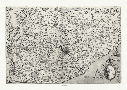
Giacomo Gastaldi,Territorio di Roma, Italy, 1575, map on heavy cotton canvas, 22x27" approx.
Regular price $45.00 CADRegular price -
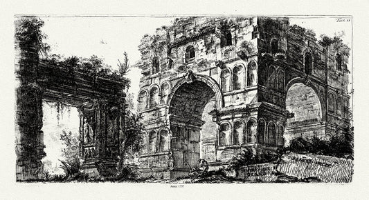
Giovanni Battista Piranesi, Tempio di Diana, 1764, map on heavy cotton canvas, 18x27" approx.
Regular price $45.00 CADRegular price -
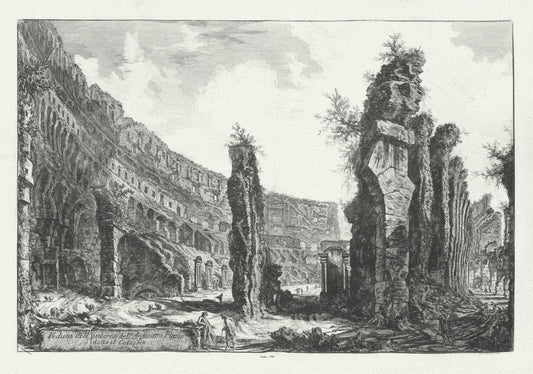
Giovanni Battista Piranesi, Vedute di Roma, Interior View of the Colosseum, c. 1760
Regular price $45.00 CADRegular price -
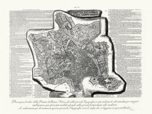
Giovanni Battista Piranesi, Vedute di Roma, Map Of Rome, Part. 1, 1748, map on heavy cotton canvas, 22x27" approx.
Regular price $45.00 CADRegular price -
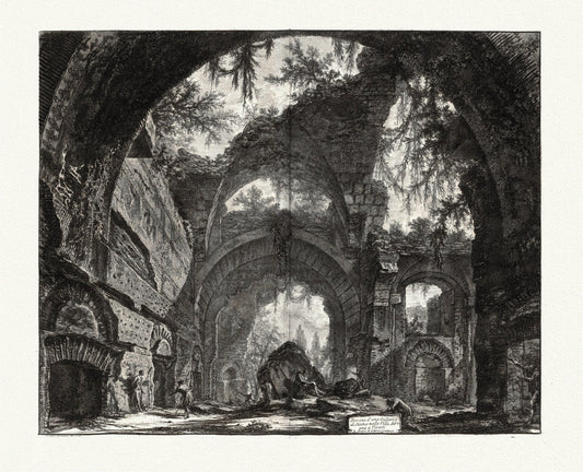
Giovanni Battista Piranesi, Vedute di Roma, Remains of a Praetorian Fort at Hadrian's Villa, c. 1760, map on cotton canvas, 22x27" approx.
Regular price $45.00 CADRegular price -
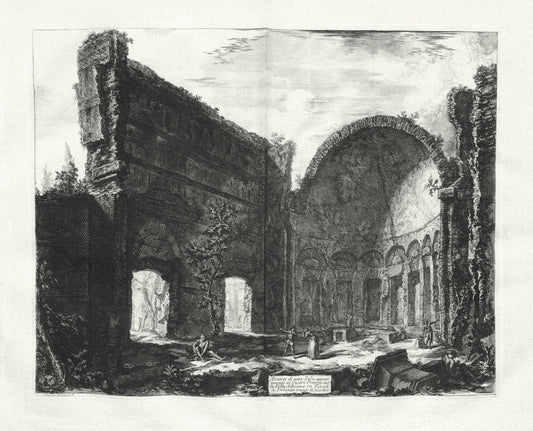
Giovanni Battista Piranesi, Vedute di Roma, Ruins of a Sculpture Gallery at Hadrian's Villa at Tivoli, 1760, cotton canvas, 22x27" approx.
Regular price $45.00 CADRegular price -
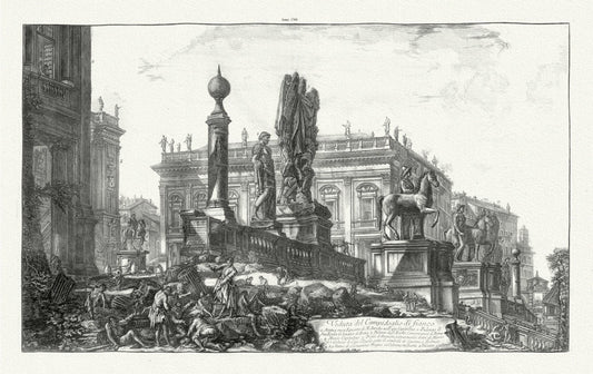
Giovanni Battista Piranesi, Vedute di Roma, Side View of the Capitoline Hill, c. 1760 , heavy cotton canvas, 22x27" approx.
Regular price $45.00 CADRegular price