-
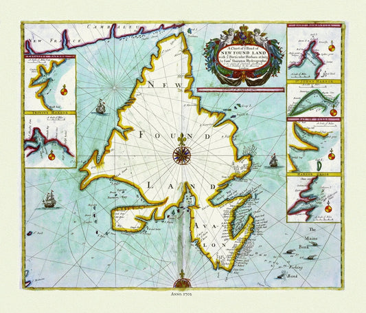
Thornton, A chart NEW FOUND LAND with particular harbors , 1702 , Approx. 20x24", on heavy canvas
Regular price $45.00 CADRegular price -
Thornton, A chart of NEW FOUND LAND with particular harbors atl arge, 1702 Ver. 1
Regular price $45.00 CADRegular price -
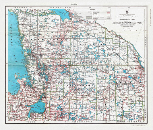
Topographic Map showing the Algonquin Provincial Park and surrounding country in the Province of Ontario, 1946, cotton canvas, 22x27"
Regular price $45.00 CADRegular price -
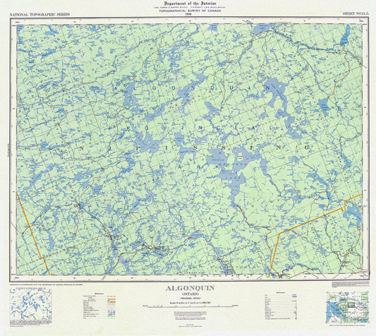
Topographical Map of Algonquin, 1934 , map on heavy cotton canvas, 22x27" approx.
Regular price $45.00 CADRegular price -
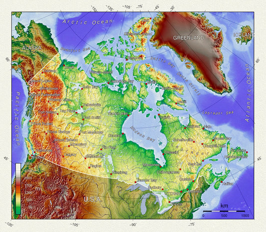
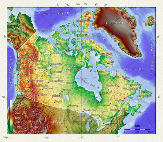
Topographical Map of Canada, on heavy cotton canvas, 20 x 25" approx.
Regular price $45.00 CADRegular price -
Topographical Map of Canada, vintage map reprinted on durable cotton canvas, 50 x 70 cm, 20 x 25" approx.
Regular price $45.00 CADRegular price -
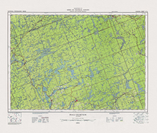
Topographical Map of Haliburton, Ontario, 1951, on heavy cotton canvas, 22x27" approx.
Regular price $45.00 CADRegular price -
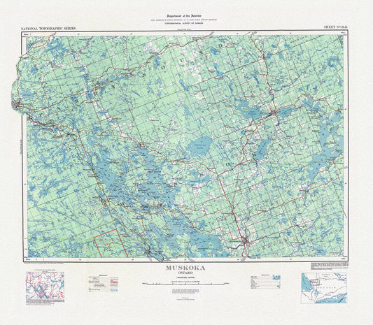
Topographical Map of Muskoka, Ontario, 1929, on heavy cotton canvas, 22x27" approx.
Regular price $45.00 CADRegular price -
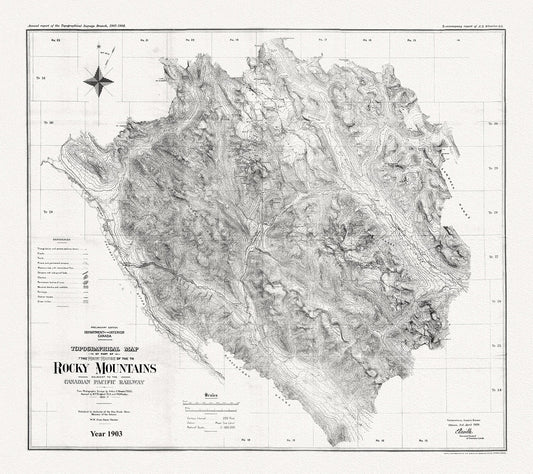
Topographical map of part of the main range of the Rocky Mountains adjacent to the Canadian Pacific Railway, 1903, Canvas 20 x 25" approx.
Regular price $45.00 CADRegular price -
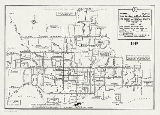
Toronto Bus Routes, 1949 , map on heavy cotton canvas, 22x27" approx.
Regular price $45.00 CADRegular price -
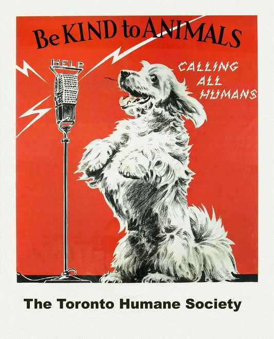
Toronto Humane Society, Be Kind to Animals Ver. I , vintage poster on heavy cotton canvas, 20x25" approx.
Regular price $45.00 CADRegular price -
Toronto Humane Society, Be Kind to Animals Ver. III , vintage poster on heavy cotton canvas, 20x25" approx.
Regular price $45.00 CADRegular price -
Toronto Humane Society, Be Kind to Animals, vintage poster on heavy cotton canvas, 50 x 70cm, 20 x 25" approx.
Regular price $45.00 CADRegular price -
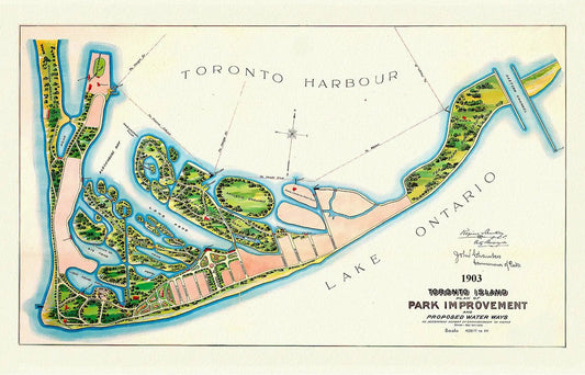
Toronto Island, Plan of Park Improvement, 1903
Regular price $45.00 CADRegular price -
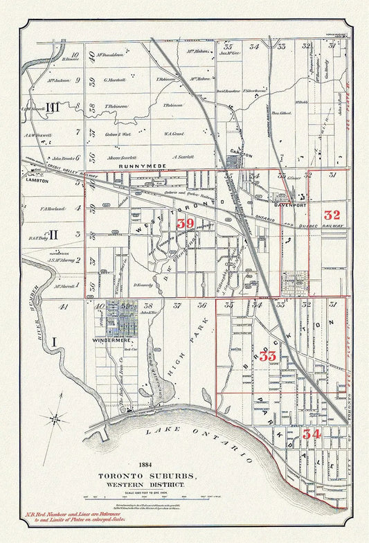
Toronto Suburbs, Western District, 1884, map on heavy cotton canvas, 20 x 30" or 50 x 75cm. approx.
Regular price $45.00 CADRegular price -
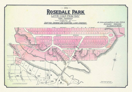
Toronto Uptown, Rosedale, 1884 , map on heavy cotton canvas, 20 x 30" approx.
Regular price $45.00 CADRegular price -
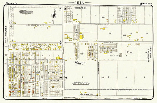
Toronto, 1913-112-East-Danforth-Leslie North, map on heavy cotton canvas, 50 x 70cm, 20 x 25" approx.
Regular price $45.00 CADRegular price -
Toronto, A Modern Map Ver. II, on heavy cotton canvas, 45 x 65 cm, 18 x 24" approx.
Regular price $45.00 CADRegular price -
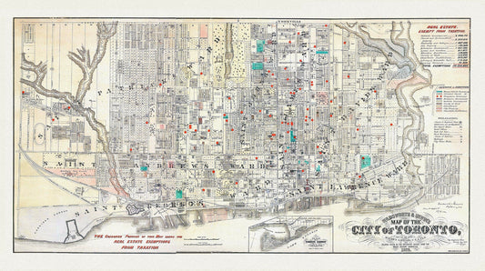
Toronto, Areas Exempt from Real Estate Taxation, 1878, map on heavy cotton canvas, 22x27" approx.
Regular price $45.00 CADRegular price -
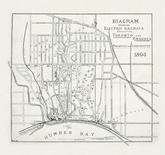
Toronto: Diagram showing electric railways connecting Toronto and Swansea projected and constructed, 1894, map on canvas, 20 x 25" approx
Regular price $45.00 CADRegular price -
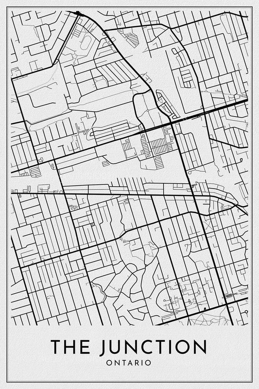
Toronto: The Junction, Toronto, A Modern Map, on durable canvas 50 x 70 cm, 20 x 25" approx.
Regular price $45.00 CADRegular price -
Toronto: Chalifour et Canada Department of the Interior, 1915 , map on heavy cotton canvas, 22x27" approx.
Regular price $45.00 CADRegular price -
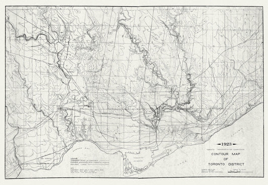
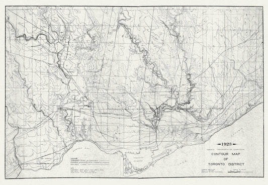
Toronto: Contour Map , 1923 , map on heavy cotton canvas, 22x27" approx.
Regular price $45.00 CADRegular price -
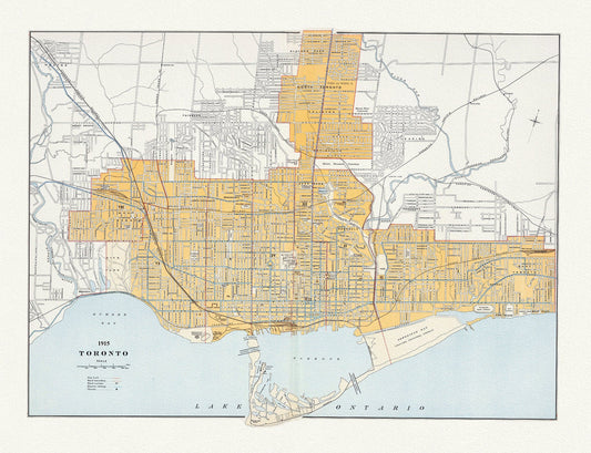
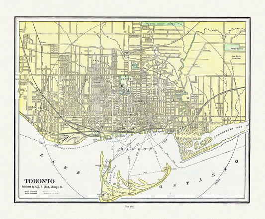
Toronto: Cram et Murray, 1901 , map on heavy cotton canvas, 22x27" approx.
Regular price $45.00 CADRegular price